Afternoon Update

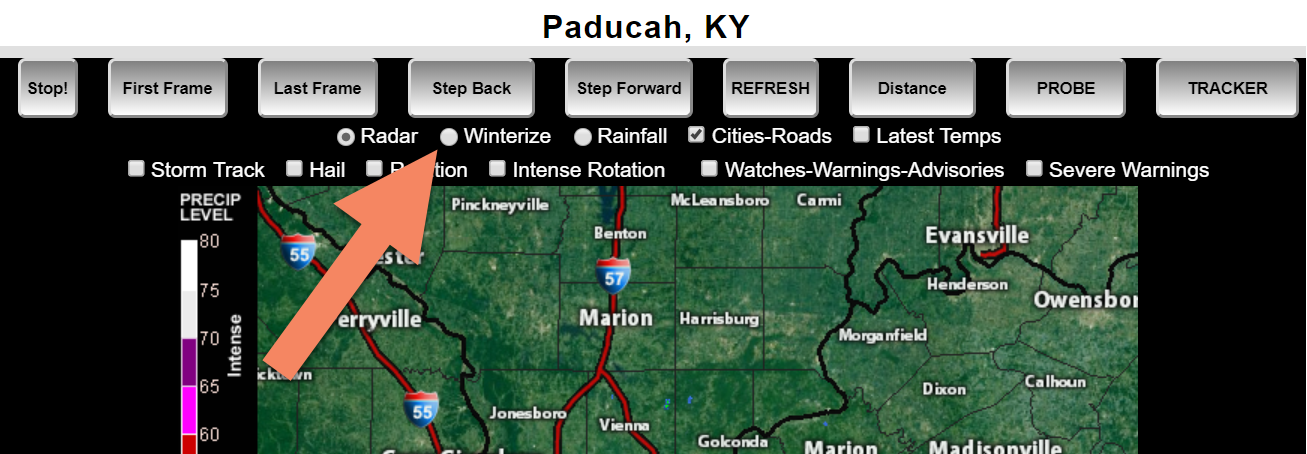
Click here for your interactive local city-view radars & regional radars.
During winter weather be sure and click the winterize button above each city-view radar. This will show you the precipitation type.
Scroll down for previous update, graphics, and comments, as well.

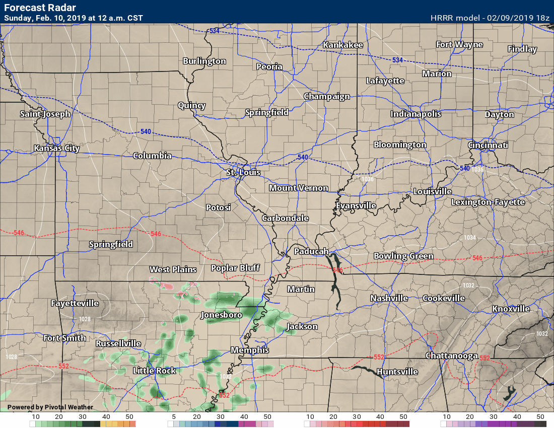
Let’s take a look at the latest Hrrr future-cast radar.
Timestamp upper left.
Green is rain. Blue is snow. Pink is a wintry mix.
Keep in mind, the precip may begin as sleet and snow before quickly changing over to freezing rain and eventually rain.
Use caution tomorrow morning. The first step could be icy. Freezing rain also may occur during church services.
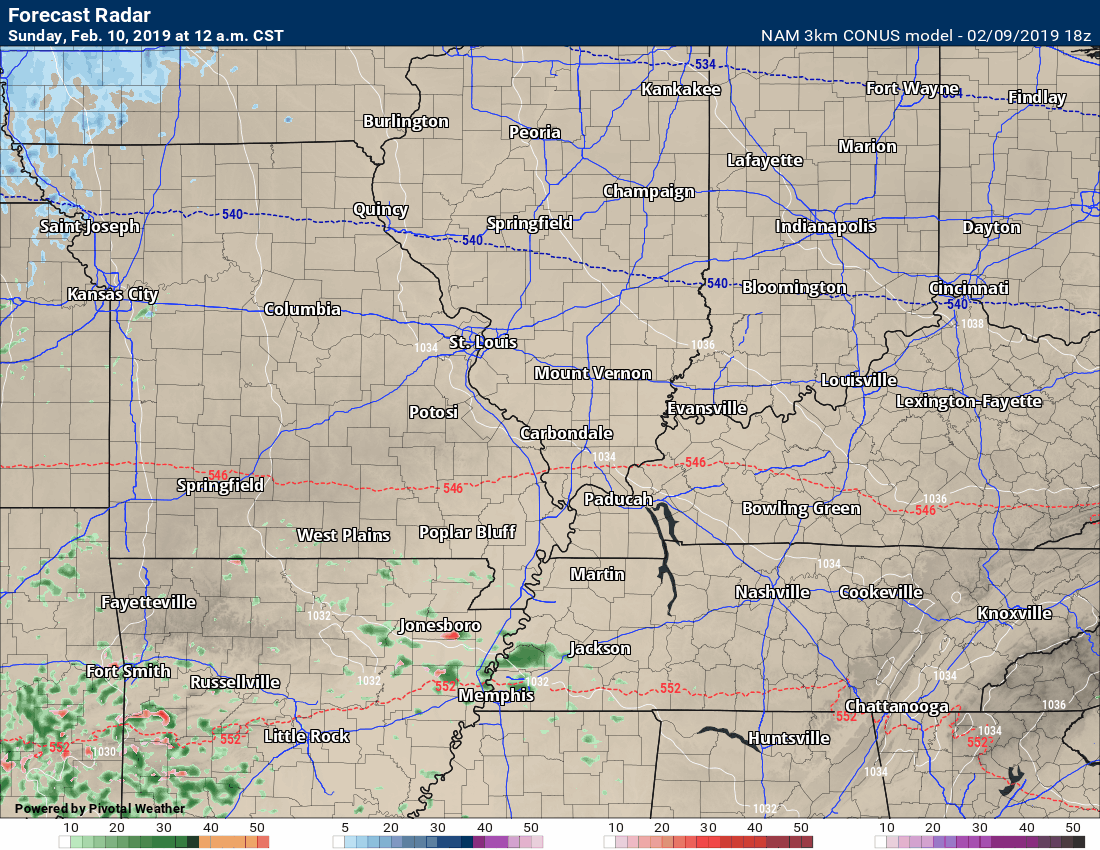
3K NAM
This is the afternoon run
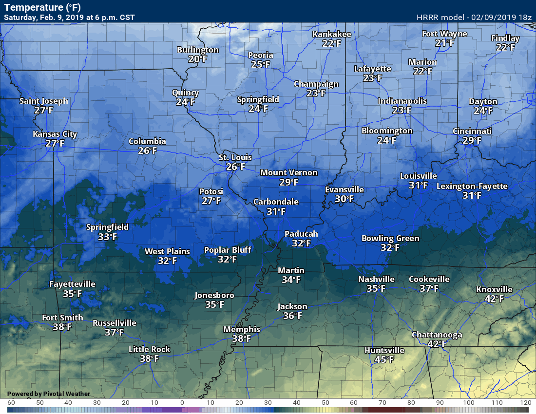
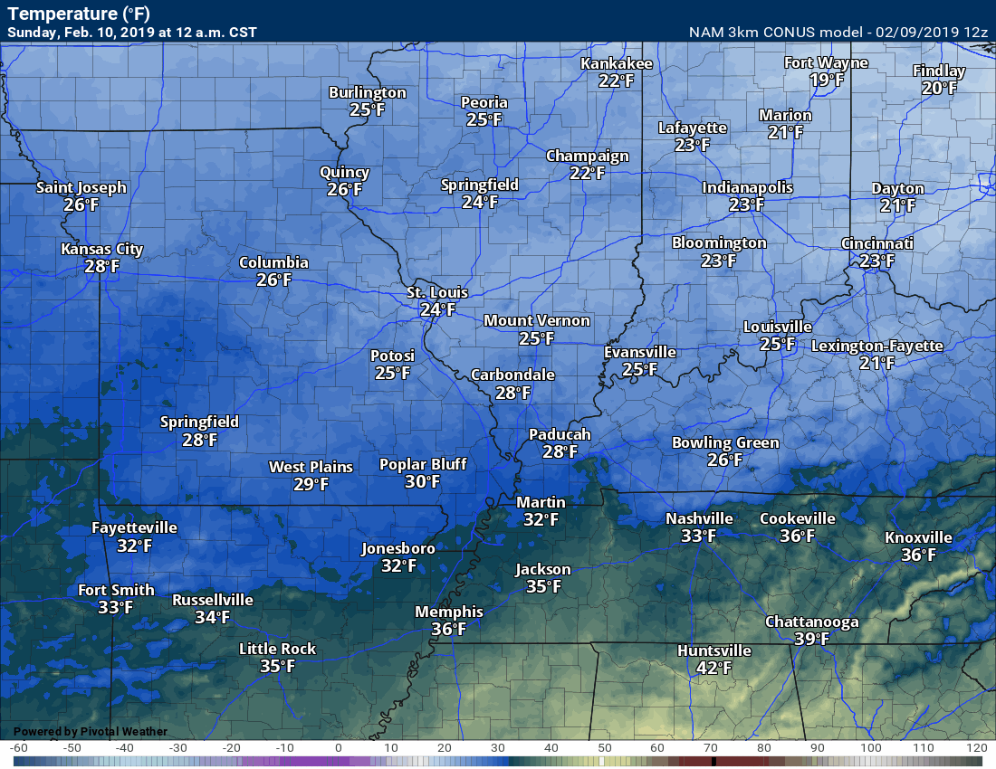
Hour by hour temps.
Model’s forecast. Won’t be exact but you do get the general idea on how temperatures should rebound as the warm front lifts northward.
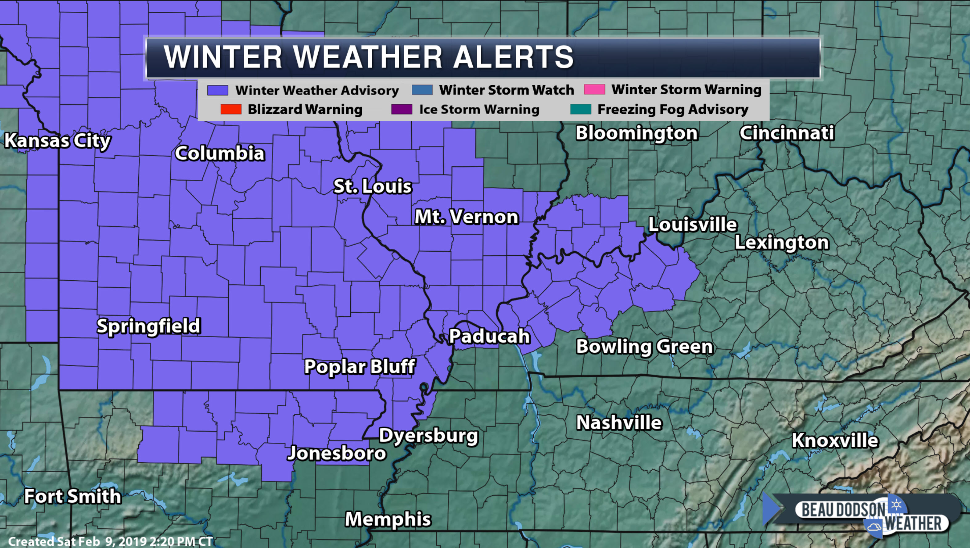
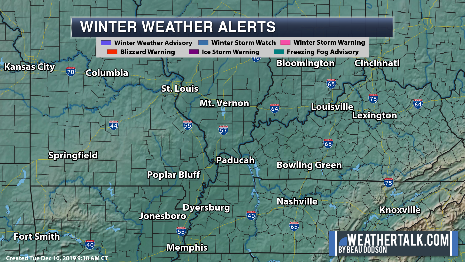
Additional counties have been added to the winter weather advisory.
If you are not included in the winter weather advisory then monitor conditions, as well.
There could still be a period of a wintry mix at the onset of precipitation late tonight/tomorrow morning.
Click here for an updated map (this map will not show the green zone).
https://imagery.weathertalk.com/prx/WinterAlerts.png
Plan on widespread rain Sunday afternoon into Monday night.
Don’t forget that river flooding will continue well after the rain ends. Many rivers will exceed flood stage.
A flood watch blankets the region from Sunday night into Monday night.
Additional counties may be added.
Avoid flooded roadways.
Here is the initial outline of the watch. Bootheel and west Tennessee counties will also be included in the threat of flooding.
Again, more counties may be officially added.
I already have MO/TN in flood concerns, as well.
This is the NWS outline.
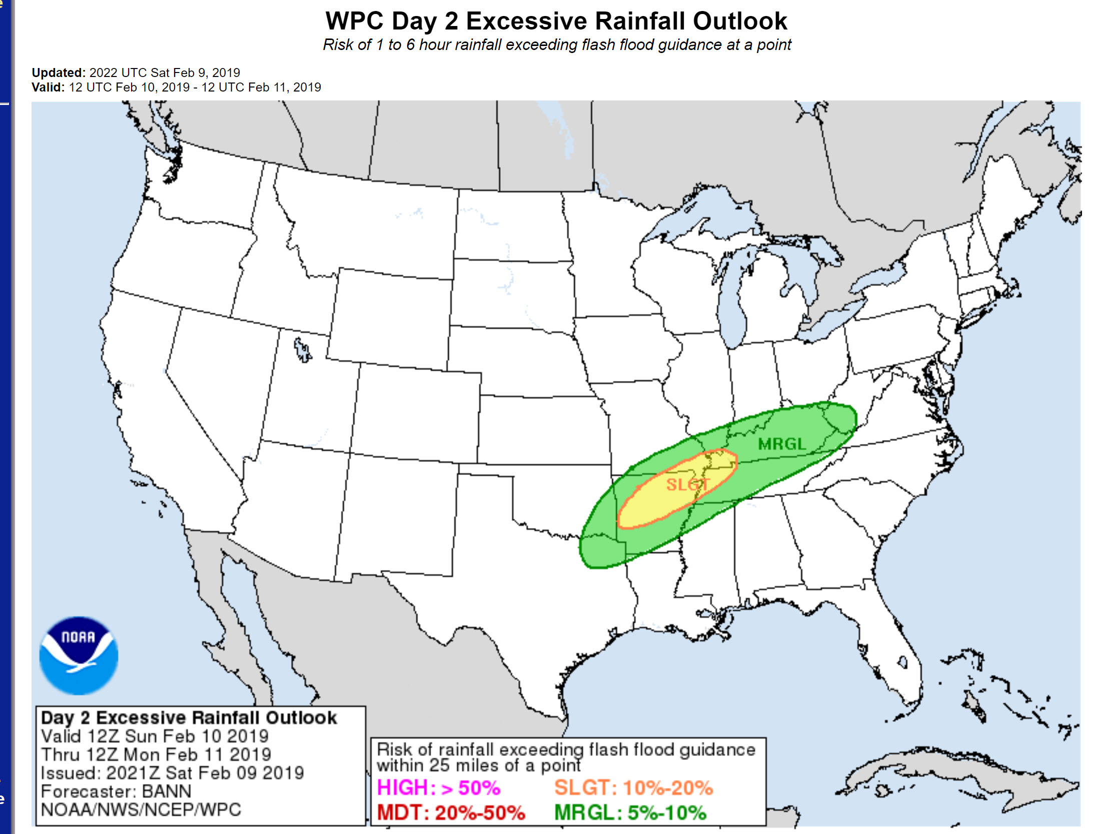
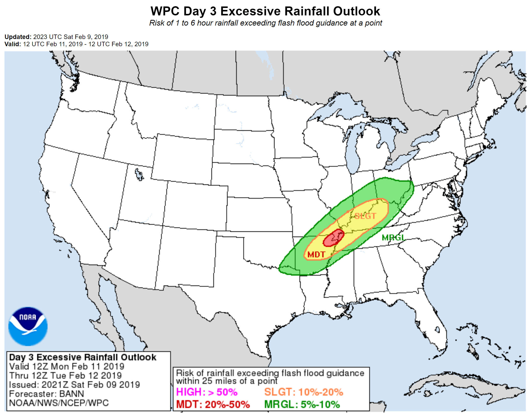
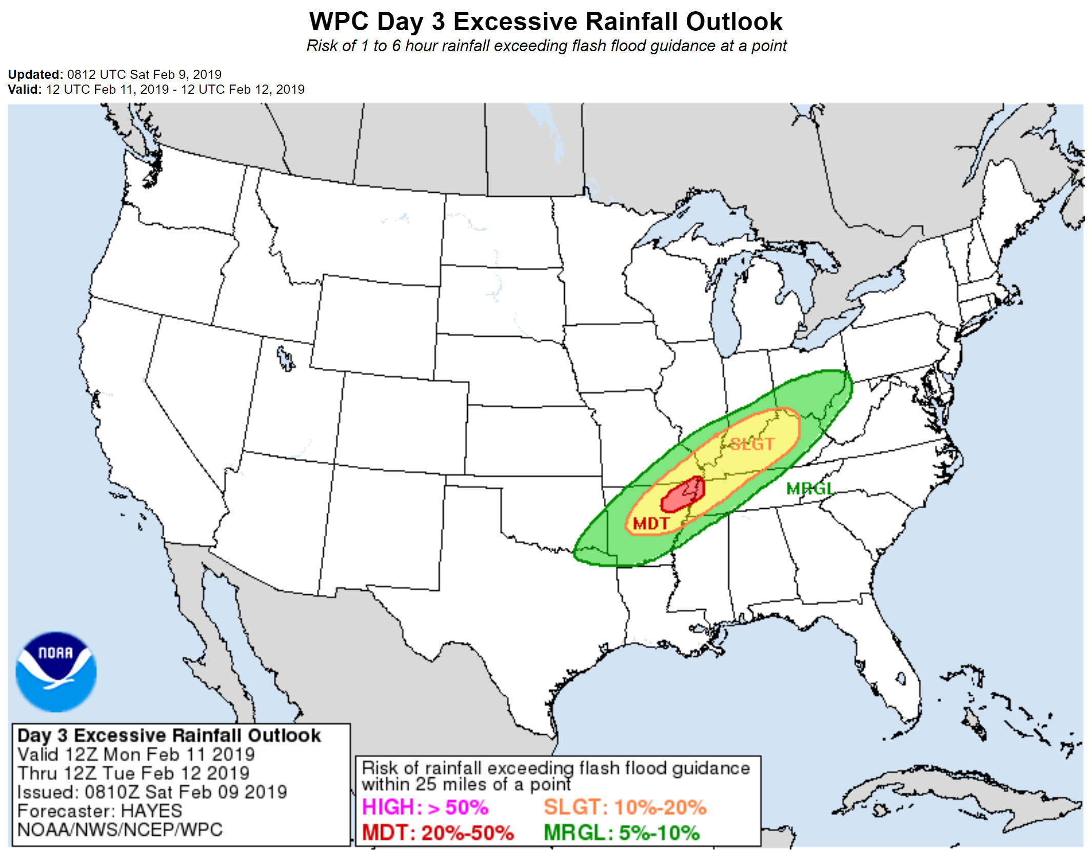
There is a marginal to slight risk and a marginal to moderate risk of flash flooding tomorrow and Monday.
Day two text
Day three text
Click here for the text outlook
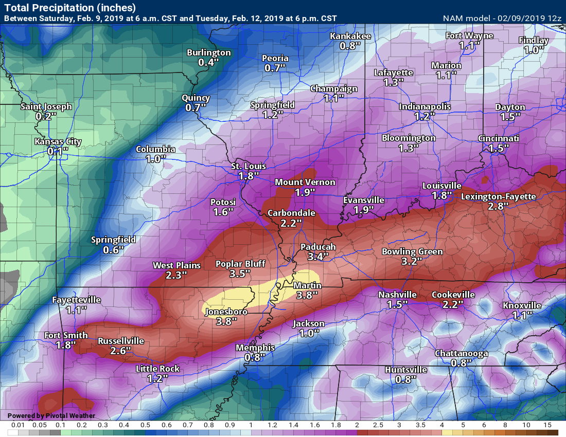
NAM rainfall totals. Do not get hung up on numbers.
Look more at just how widespread this rain event is.
A widespread one to three-inch rain event. Pockets of three to four+ inches will occur.
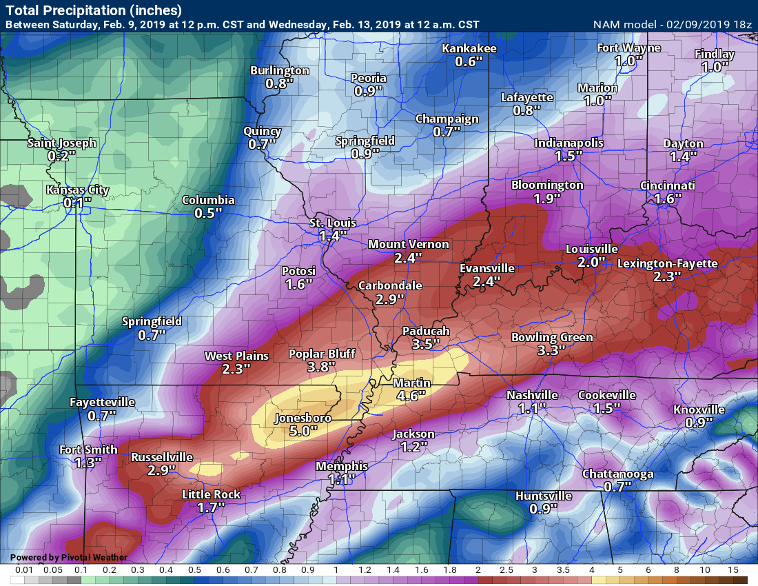
Additional rain is possible by Thursday and Friday.
This is an active pattern and it will continue.
Previous outlook below. Scroll down.
.
.

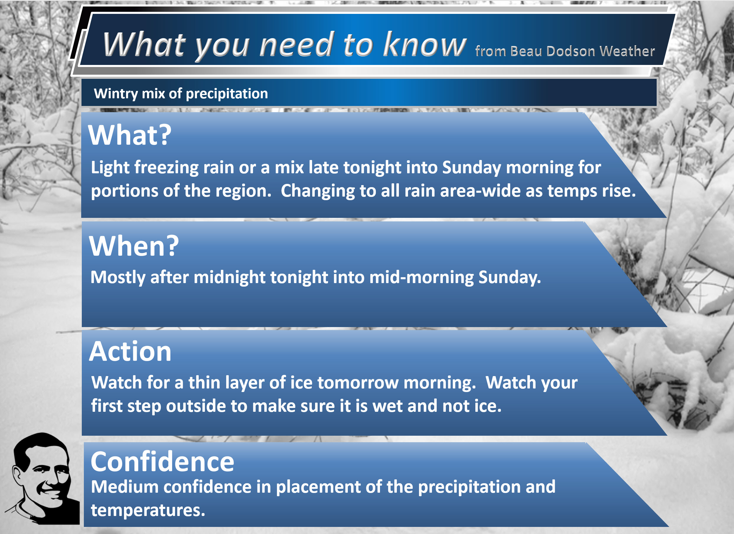
We have two concerns over the next three days.
The first concern will be a wintry mix that will develop late tonight (likely after 11 PM across southeast MO and then moving northeast from there) and especially during Sunday morning.
This wintry mix may not impact all of my forecast counties. The risk is higher as you travel west and north/northwest.
Light totals. This is not a storm that will cause any problems with power lines or tree limbs.
Complete focus is simply on icy surfaces.
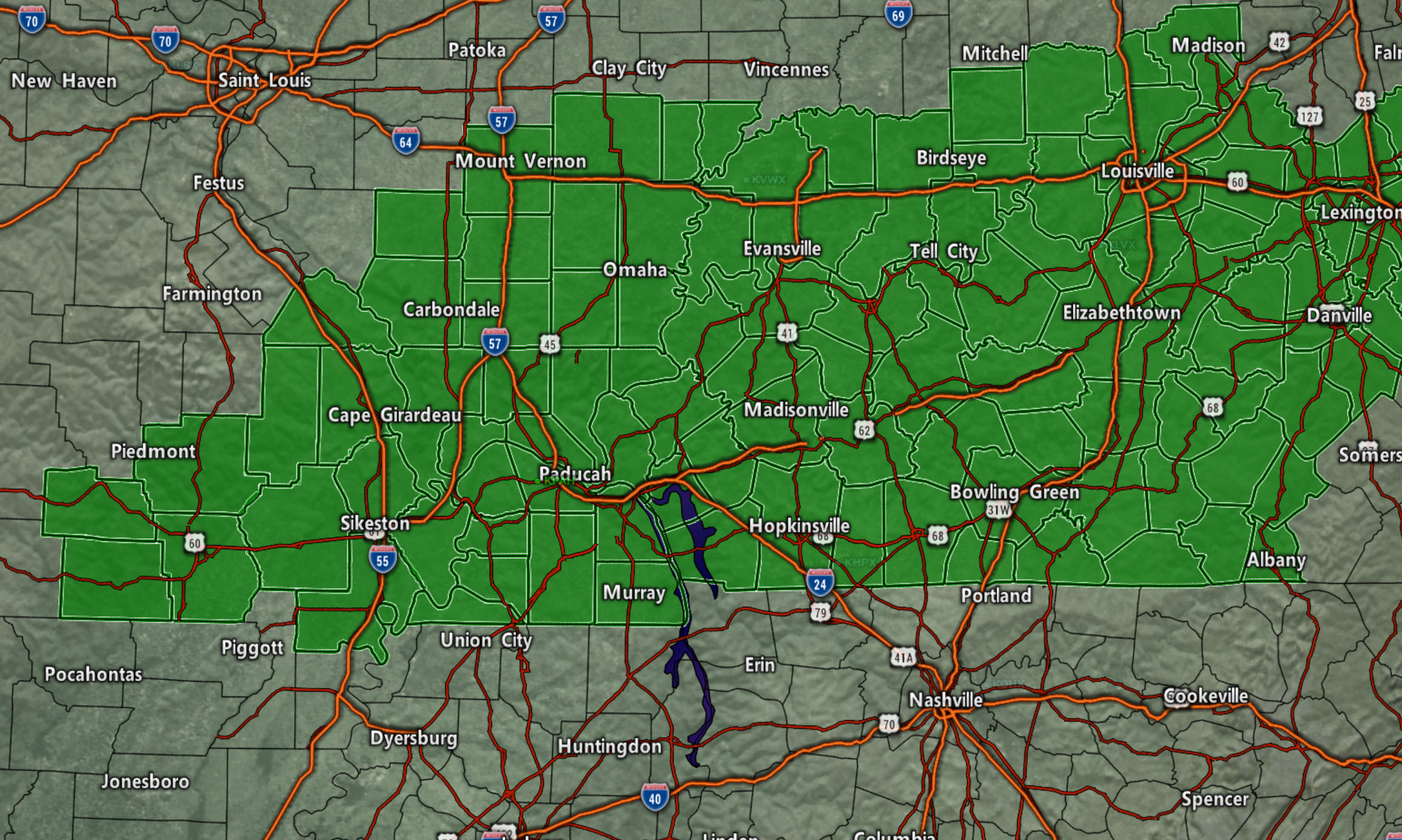
For now, these are the counties in the winter weather advisory for freezing rain and sleet (purple zone). This may need to be adjusted if the onset timing changes or temperatures change.
The counties in green should monitor updates. They are currently not in an advisory.
Click here for an updated map (this map will not show the green zone).
https://imagery.weathertalk.com/prx/WinterAlerts.png
.
Click to enlarge images and animations on this post.

It is important to remember that surfaces are cold. If rain falls then it will freeze upon contact. This could occur even with temperatures somewhat above freezing (it takes surfaces a bit longer to warm).
We are not forecasting a heavy ice storm. We are forecasting enough of a wintry mix to make roads, parking lots, and other surfaces icy for a few hours Sunday morning.
Again, this may not impact everyone. There remain some questions about what time the precipitation arrives vs what time temperatures rise enough above freezing to change everything over to rain.
The biggest concern may be during morning church services. Someone slipping and falling could break a wrist or injure themselves in other ways.
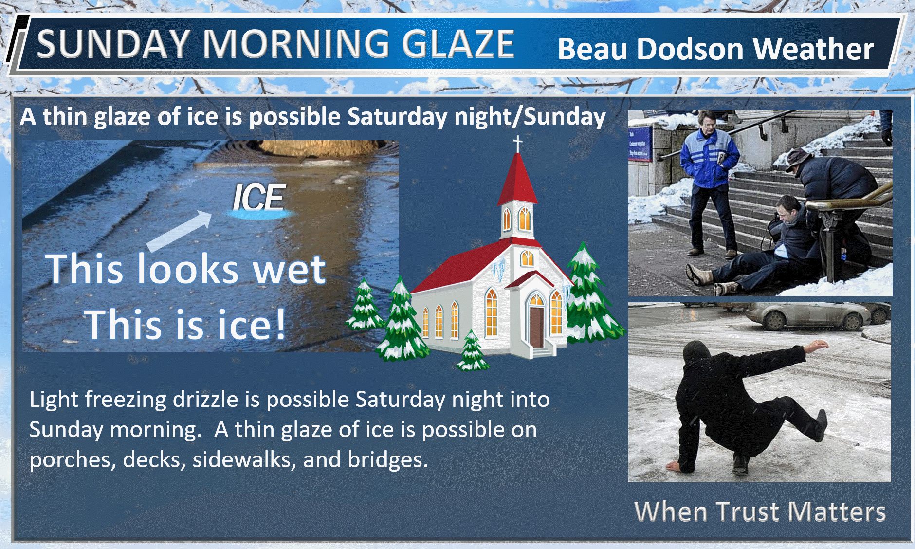
Historically, our deadliest winter storm events tend to be light freezing rain situations. This is because people believe the roads are simply wet and it is actually a thin layer of clear ice. Cars and ice do not go together.

Temperatures will rise above freezing area-wide as we move through the morning and afternoon hours.
If you have travel plans late tonight and especially on Sunday morning then monitor radars and road conditions.
Remember, that first step could be icy. Be prepared for patios, decks, driveways, and other surfaces to possibly be coated with a thin layer of ice.
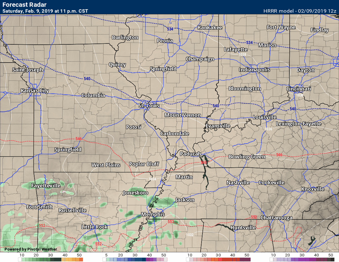
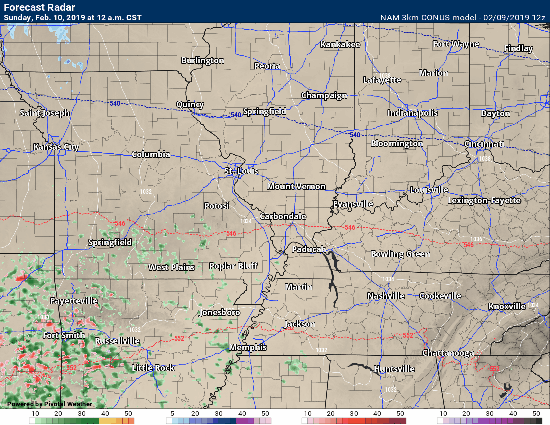
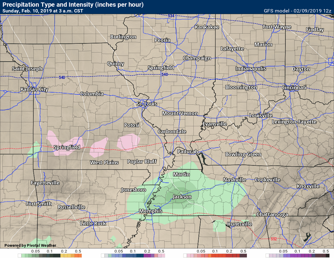
Let me show you a few computer model animations.
These are the future-cast radar animations.
Time-stamp upper left.
Hrrr model first. NAM model second.
Green is rain. Blue is snow. Red/pink/purple is a wintry mix.
Notice that we change to all rain tomorrow morning into the afternoon.
The concern is before that happens. A light wintry mix may make some surfaces icy. Again, some areas may not have to deal with any ice.
Focus on impact and not amount. Some icy surfaces for some of my forecast counties.
NAM model
Click to enlarge
Focus on impact and not amount. Some icy surfaces for some of my forecast counties.
You can see the wave of freezing rain or mix push southwest to northeast across the region.
Temperature animation
Hrrr
Time-stamp upper left.
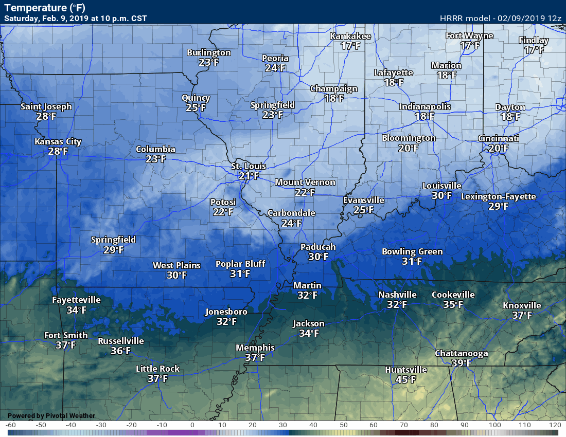
NAM model
Precipitation Totals
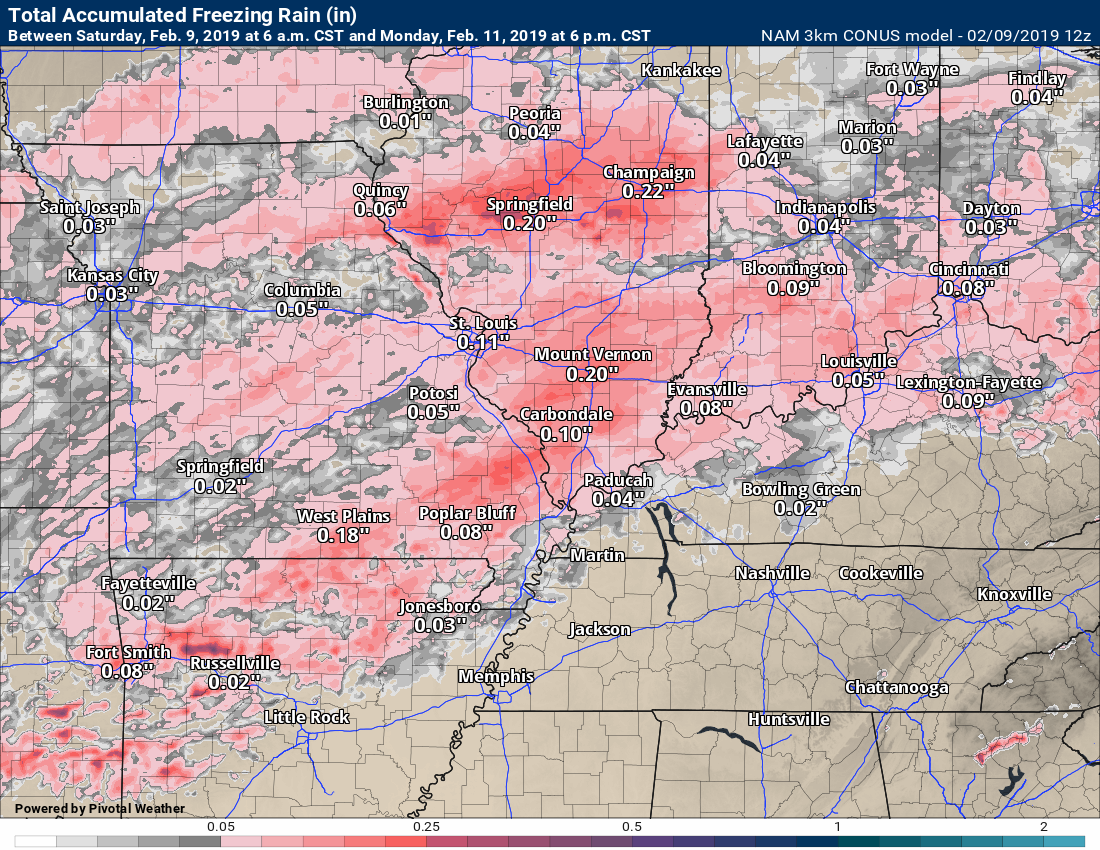
Hrrr model. Freezing rain.
Cut this in half.
Focus on impact and not amount. Some icy surfaces for some of my forecast counties.
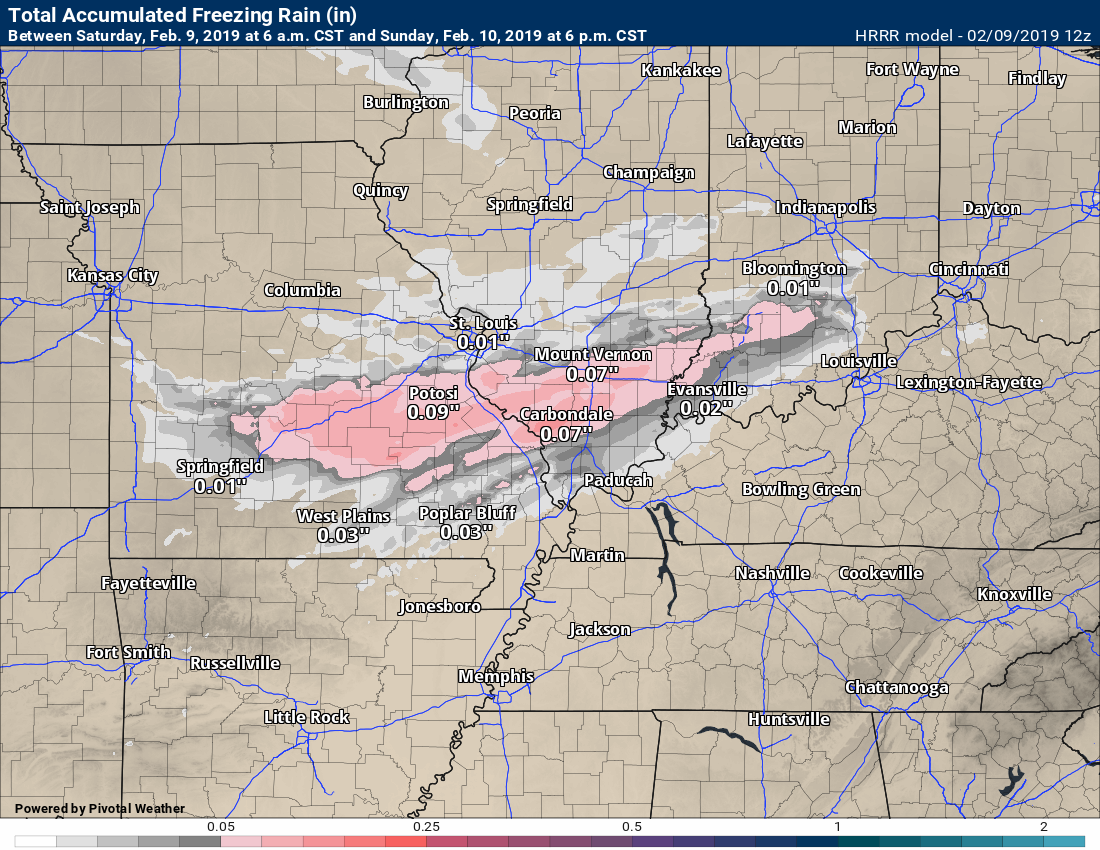
NAM model freezing rain.
Cut this in half.
NAM has the freezing rain area a bit wider than the Hrrr model.
Different models. Different opinions.
Flooding
The next big story is another widespread moderate to a heavy rain event. This is going to push flood waters even higher.
Rain totals of one to three inches will be common with pockets of greater than three inches.
Some type of flash flood or flood watch may need to be re-issued for this event, as well.
Future-cast radar from the GFS model. I stopped the animation at 6 am on Tuesday. Most of the rain falls before that time.
Green is rain. Yellow is moderate rain. Blue is snow. Pink is a wintry mix.

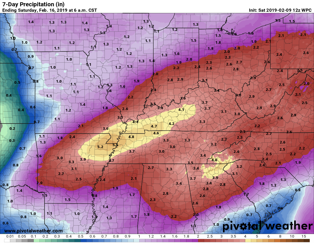
WPC forecast totals (NOAA)
GFS model. Rainfall totals. This is what the GFS model expects.
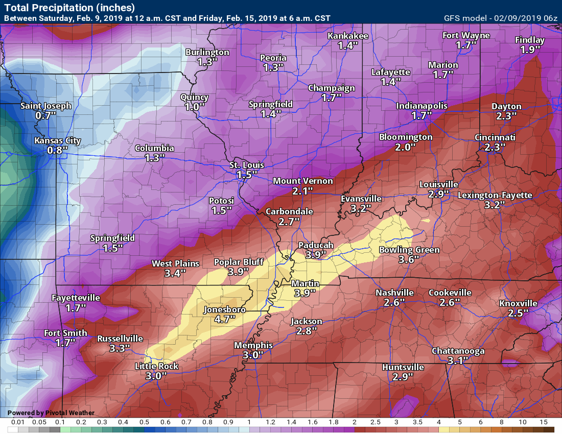
NAM model
We have been placed in a marginal to a slight risk of flash flooding by the WPC. This covers Sunday and Sunday night.

We have been placed in a marginal to moderate risk of flash flooding for Monday and Monday night.
.
Monitor updates.
.

WeatherTalk monthly operating costs can top $2000.00. Your $5 subscription helps pay for those costs. I work for you.
The $5 will allow you to register up to seven phones!
For $5 a month you can receive the following. You may choose to receive these via your WeatherTalk app or regular text messaging.
Severe weather app/text alerts from my keyboard to your app/cell phone. These are hand typed messages from me to you. During tornado outbreaks, you will receive numerous app/text messages telling you exactly where the tornado is located.
- Daily forecast app/texts from my computer to your app/cell phone.
- Social media links sent directly to your app/cell phone. When I update the blog, videos, or Facebook you will receive the link.
- AWARE emails. These emails keep you well ahead of the storm. They give you several days of lead time before significant weather events.
- Direct access to Beau via text and email. Your very own personal meteorologist. I work for you!
- Missouri and Ohio Valley centered video updates
- Long-range weather videos
- Week one, two, three and four temperature and precipitation outlooks.
Monthly outlooks. - Your subscription also will help support several local charities.
Would you like to subscribe? Subscribe at www.beaudodsonweather.com
Typical progression on a severe weather day for subscribers.


I encourage subscribers to use the app vs regular text messaging. We have found text messaging to be delayed during severe weather. The app typically will receive the messages instantly. I recommend people have three to four methods of receiving their severe weather information.
Remember, my app and text alerts are hand typed and not computer generated. You are being given my personal attention during significant weather events.

Subscribers, do you need a forecast for an outdoor event?

Did you know that you can find me on Twitter?

Click here for your interactive local city-view radars & regional radars.
During winter weather be sure and click the winterize button above each city-view radar. This will show you the precipitation type.


Here are the latest local river stage forecast numbers Click Here.
Here are the latest lake stage forecast numbers for Kentucky Lake and Lake Barkley Click Here.
![]()
.
![]()

A new weather podcast is now available! Weather Geeks (which you might remember is on The Weather Channel each Sunday)
To learn more visit their website. Click here.
![]()

WeatherBrains Episode 681
First joining us tonight is Leslie Chapman-Henderson, CEO of FLASH (Federal Alliance for Safe Homes), to congratulate our very own James Spann on winning the 2019 National Weather Person of the Year award. Leslie, thanks for joining us!
Tonight’s Guest WeatherBrain is a retired National Weather Service WCM for Little Rock, Arkansas. After many years of service, he retired in 2015. John Robinson, welcome to the show!
Also joining us as Guest Panelist is is the Field Meteorologist and Executive Weather Producer for KOCO 5 First Alert Weather. Mike Armstrong, welcome!
Discussions in this weekly podcast include topics like:
- James wins WeatherPerson of the Weather 2019
- American Airlines Flight 1420 crash of 1999
- 1999 Arkansas tornado outbreak
- Correlations between tornado fatalities and socioeconomic status?
- The Astronomy Report from Tony Rice
- and more!
Find me on Facebook!

Find me on Twitter!

Did you know that a portion of your monthly subscription helps support local charity projects?
You can learn more about those projects by visiting the Shadow Angel Foundation website and the Beau Dodson News website.


We offer interactive local city live radars and regional radars. If a radar does not update then try another one. If a radar does not appear to be refreshing then hit Ctrl F5. You may also try restarting your browser.
The local city view radars also have clickable warnings.
During the winter months, you can track snow and ice by clicking the winterize button on the local city view interactive radars.
You may email me at beaudodson@usawx.com
Find me on Facebook!
Find me on Twitter!
Did you know that a portion of your monthly subscription helps support local charity projects?
You can learn more about those projects by visiting the Shadow Angel Foundation website and the Beau Dodson News website.
I encourage subscribers to use the app vs regular text messaging. We have found text messaging to be delayed during severe weather. The app typically will receive the messages instantly. I recommend people have three to four methods of receiving their severe weather information.
Remember, my app and text alerts are hand typed and not computer generated. You are being given personal attention during significant weather events.
