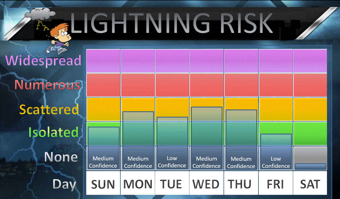
1. Above normal temperatures to continue into the upcoming weekend. They are going to last awhile.
2. Widely scattered thunderstorms possible today into Thursday. Some areas will again miss out on the rain
Sunday and Sunday night
Another warm day for the region. Expect highs mainly in the 85 to 90 degree range. There will be a few clouds and thunderstorms in the mix. That might shave a couple of degrees off the thermometer (for a few of you).
Check radar link in the comment section to track the storms.
It will be warm again tonight. If we clear out then patchy fog would be possible (esp in areas that receive a little rain today).
Monday through Friday
Widely scattered thunderstorm chances will be with us through the period. Temperatures will continue to be above normal with highs in the middle to upper 80’s through the week.
Overnight lows will range from the middle 60’s to around 70 degrees. Well above average.
No sign of a major cool down, yet.
Enjoy your Sunday


.
You must have a Weather Talk subscription ($3 a month) to view the videos.
Videos are posted on the www.weathertalk.com website. Once there, click the Beau Video-Cast tab. Long Range Video Update
If you believe you missed a video then you can also click the LIVE FEED link on the Weather Talk website. You will find the most recent and previous seven days worth of links on that page.
I can app/text you the videos, as well. Make sure you have text option FOUR turned on. That would be the Weather Extra text option. Sign up for the app/text messages, videos, and more at www.beaudodsonweather.com
.

.
This forecast update covers southern Illinois, southeast Missouri, western Kentucky. and extreme northwest Tennessee.
.
September 16, 2017
Saturday Night Forecast Details:
Forecast: Mostly clear. Patchy fog possible. Becoming partly cloudy over southeast Missouri and southwest Illinois.
Temperatures: MO ~ 64 to 68 IL ~ 64 to 68 KY ~ 64 to 68 TN ~ 64 to 68
What impacts are anticipated from the weather? Lower visibility if fog forms
My confidence in the forecast verifying: High
Is severe weather expected? No
The NWS defines severe weather as 58 mph winds or great, 1″ hail or larger, and/or tornadoes
What is the chance of precipitation? MO ~ 10% IL ~ 0% KY ~ 0% TN ~ 0%
Coverage of precipitation: None
Should I cancel my outdoor plans? No
.
September 17, 2017
Sunday Forecast Details
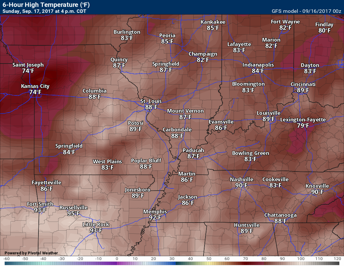
Forecast: Patchy morning fog. Partly to mostly sunny. A few afternoon cumulus clouds with a 20% to 30% of a thunderstorm for southeast Missouri and southwest Illinois. Isolated storms possible, elsewhere, but probabilities diminish as you move further and further east. Warm and a bit more humid.
Temperatures: MO ~ 85 to 90 IL ~ 85 to 90 KY ~ 85 to 90 TN ~ 85 to 90
Winds: South winds at 4 to 8 mph
What impacts are anticipated from the weather? A few areas could have wet roadways and lightning (mainly over SE MO/SW IL)
My confidence in the forecast verifying: Medium
Is severe weather expected? No
The NWS defines severe weather as 58 mph winds or great, 1″ hail or larger, and/or tornadoes
What is the chance of precipitation? MO ~ 30% IL ~ 30% KY ~ 20% TN ~ 15%
Coverage of precipitation: Much of the region will remain dry. Scattered storms for southeast Missouri and southwest Illinois. Lesser chances elsewhere.
Should I cancel my outdoor plans? No, but perhaps check radars.
.
Sunday Night Forecast Details:
Forecast: A few clouds. A 20% of an evening thunderstorm. Patchy fog possible.
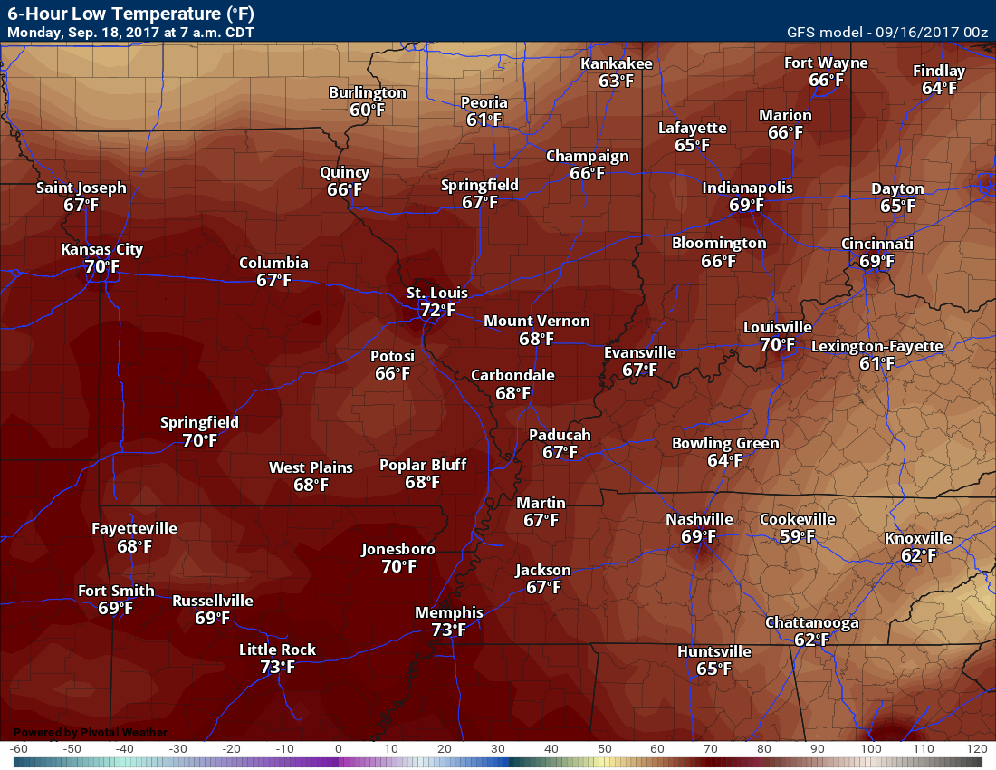
Temperatures: MO ~ 65 to 70 IL ~ 65 to 70 KY ~ 65 to 70 TN ~ 65 to 70
What impacts are anticipated from the weather? Isolated wet roads and lightning.
My confidence in the forecast verifying: High
Is severe weather expected? No
The NWS defines severe weather as 58 mph winds or great, 1″ hail or larger, and/or tornadoes
What is the chance of precipitation? MO ~ 20% IL ~ 20% KY ~ 20% TN ~ 20%
Coverage of precipitation: Isolated.
Should I cancel my outdoor plans? No, but check radar for a few thunderstorms.
.
September 18, 2017
Monday Forecast Details
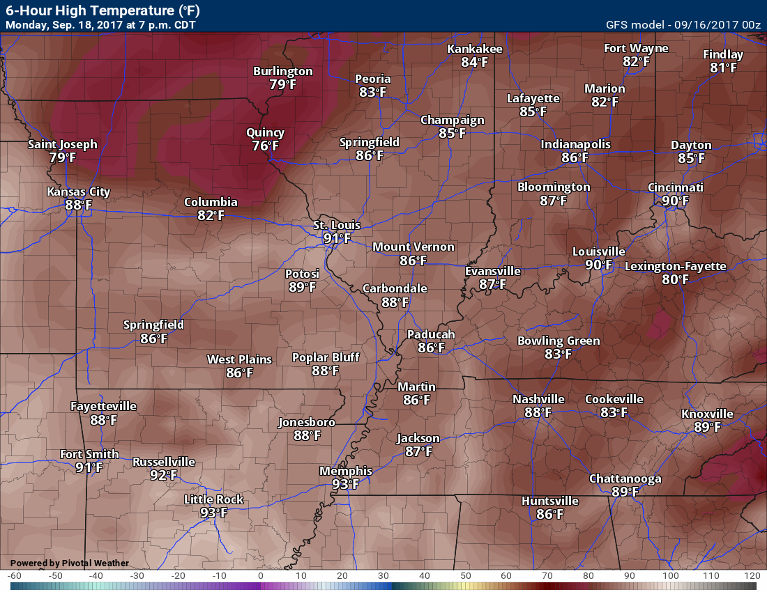
Forecast: Partly sunny. Warm and humid. A chance of a few thunderstorms.
Temperatures: MO ~ 85 to 88 IL ~ 85 to 88 KY ~ 85 to 88 TN ~ 85 to 88
Winds: Southwest winds at 5 to 10 mph
What impacts are anticipated from the weather? Wet roadways. Lightning.
My confidence in the forecast verifying: Medium
Is severe weather expected? No
The NWS defines severe weather as 58 mph winds or great, 1″ hail or larger, and/or tornadoes
What is the chance of precipitation? MO ~ 30% IL ~ 30% KY ~ 30% TN ~ 30%
Coverage of precipitation: Scattered
Should I cancel my outdoor plans? No, but monitor updates
.
Monday Night Forecast Details:
Forecast: Partly cloudy. A slight chance of a thunderstorm.
Temperatures: MO ~ 65 to 70 IL ~ 65 to 70 KY ~ 65 to 70 TN ~ 65 to 70
What impacts are anticipated from the weather? Wet roadways. Lightning
My confidence in the forecast verifying: Medium
Is severe weather expected? No
The NWS defines severe weather as 58 mph winds or great, 1″ hail or larger, and/or tornadoes
What is the chance of precipitation? MO ~ 20% IL ~ 20% KY ~ 20% TN ~ 20%
Coverage of precipitation: Isolated
Should I cancel my outdoor plans? No, but monitor updates
.
September 19, 2017
Tuesday Forecast Details
Forecast: Partly sunny. Warm and humid. A thunderstorm possible.
Temperatures: MO ~ 85 to 88 IL ~ 85 to 88 KY ~ 85 to 88 TN ~ 85 to 88
Winds: Calm to south winds at 5 to 10 mph
What impacts are anticipated from the weather? A chance of wet roadways and lightning.
My confidence in the forecast verifying: Low
Is severe weather expected? No
The NWS defines severe weather as 58 mph winds or great, 1″ hail or larger, and/or tornadoes
What is the chance of precipitation? MO ~ 30% IL ~ 30% KY ~ 20% TN ~ 20%
Coverage of precipitation: Isolated
Should I cancel my outdoor plans? No, but monitor updates
.
Tuesday Night Forecast Details:
Forecast: Partly cloudy. Warm. A slight chance of a thunderstorm.
Temperatures: MO ~ 65 to 70 IL ~ 65 to 70 KY ~ 65 to 70 TN ~ 65 to 70
What impacts are anticipated from the weather? Wet roadways. Lightning
My confidence in the forecast verifying: Low
Is severe weather expected? No
The NWS defines severe weather as 58 mph winds or great, 1″ hail or larger, and/or tornadoes
What is the chance of precipitation? MO ~ 20% IL ~ 20% KY ~ 20% TN ~ 20%
Coverage of precipitation: None to isolated
Should I cancel my outdoor plans? No, but monitor updates
.
September 20, 2017
Wednesday Forecast Details
Forecast: Partly sunny. Warm and humid. A chance of a thunderstorm.
Temperatures: MO ~ 85 to 88 IL ~ 85 to 88 KY ~ 85 to 88 TN ~ 85 to 88
Winds: South winds at 5 to 10 mph
What impacts are anticipated from the weather? A chance of wet roadways and lightning.
My confidence in the forecast verifying: Low
Is severe weather expected? No
The NWS defines severe weather as 58 mph winds or great, 1″ hail or larger, and/or tornadoes
What is the chance of precipitation? MO ~ 30% IL ~ 30% KY ~ 30% TN ~ 30%
Coverage of precipitation: Scattered
Should I cancel my outdoor plans? No, but monitor updates
.
Wednesday Night Forecast Details:
Forecast: Mostly cloudy. Warm. A chance of a thunderstorm.
Temperatures: MO ~ 65 to 70 IL ~ 65 to 70 KY ~ 65 to 70 TN ~ 65 to 70
What impacts are anticipated from the weather? Wet roadways. Lightning
My confidence in the forecast verifying: Low
Is severe weather expected? No
The NWS defines severe weather as 58 mph winds or great, 1″ hail or larger, and/or tornadoes
What is the chance of precipitation? MO ~ 30% IL ~ 30% KY ~ 30% TN ~ 30%
Coverage of precipitation: Scattered
Should I cancel my outdoor plans? No, but monitor updates
.
September 21, 2017
Thursday Forecast Details
Forecast: Partly sunny. Warm and humid. A chance of a thunderstorm.
Temperatures: MO ~ 85 to 88 IL ~ 85 to 88 KY ~ 85 to 88 TN ~ 85 to 88
Winds: South winds at 5 to 10 mph
What impacts are anticipated from the weather? A chance of wet roadways and lightning.
My confidence in the forecast verifying: Low
Is severe weather expected? No
The NWS defines severe weather as 58 mph winds or great, 1″ hail or larger, and/or tornadoes
What is the chance of precipitation? MO ~ 30% IL ~ 30% KY ~ 30% TN ~ 30%
Coverage of precipitation: Scattered
Should I cancel my outdoor plans? No, but monitor updates
.
Thursday Night Forecast Details:
Forecast: Mostly cloudy. Warm. A chance of a thunderstorm.
Temperatures: MO ~ 65 to 70 IL ~ 65 to 70 KY ~ 65 to 70 TN ~ 65 to 70
What impacts are anticipated from the weather? Wet roadways. Lightning
My confidence in the forecast verifying: Low
Is severe weather expected? No
The NWS defines severe weather as 58 mph winds or great, 1″ hail or larger, and/or tornadoes
What is the chance of precipitation? MO ~ 30% IL ~ 30% KY ~ 30% TN ~ 30%
Coverage of precipitation: Scattered
Should I cancel my outdoor plans? No, but monitor updates
.

Don’t forget to check out the Southern Illinois Weather Observatory web-site for weather maps, tower cams, scanner feeds, radars, and much more! Click here
.

A severe thunderstorm is defined as a storm that produces quarter size hail or larger, 58 mph winds or greater, and/or a tornado. That is the official National Weather Service definition of a severe thunderstorm
Saturday night through Wednesday: Severe weather is not anticipated.
.
Lightning is possible Sunday through Thursday. See the day by day details at the top of this post.
Lightning risk

Overview
Are there any weather concerns
- A warm forecast ahead of us
- Some chances for showers and thunderstorms
Short range
Confidence level in the short range forecast is high
Beau Dodson Weather in your community!
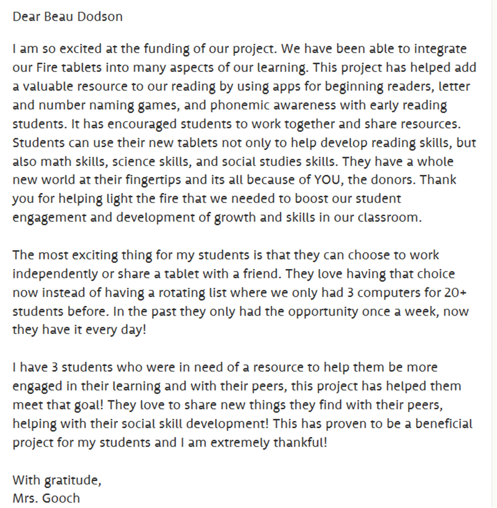
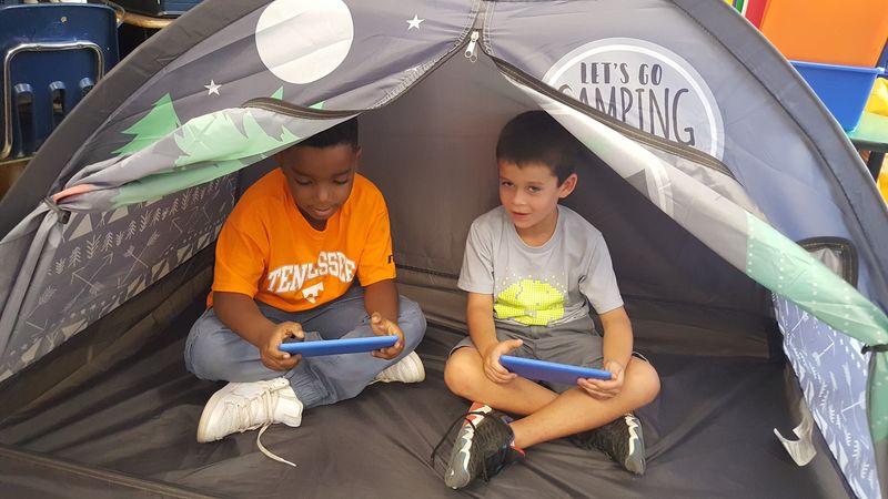
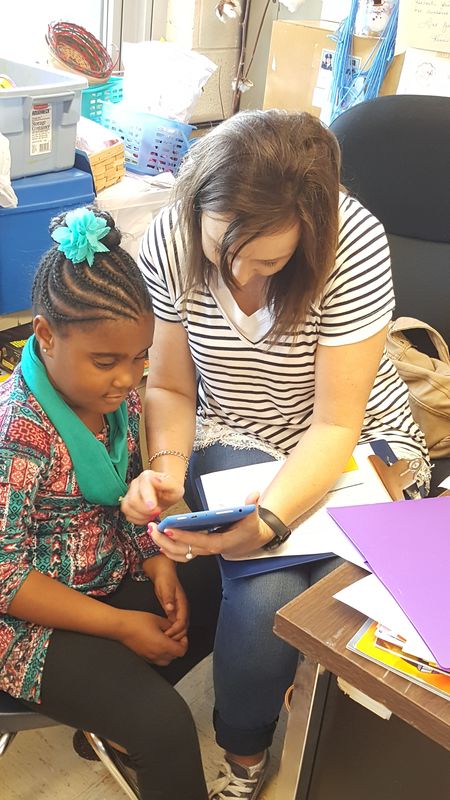
We recently finished sponsoring a project for Hickman, Kentucky Elementary Middle School. We were one of fourteen sponsors for this project. The project was buying Chromebooks (computer tablets).
The teacher sent us a thank you letter.
Thank you to all of the Weather Talk subscribers.
Now, back to the weather.
Our nice weather will continue. By nice, I mean warm. I know some of you wanted warmer weather. I also know many of you are ready to slide into fall. Patience. All in good time!
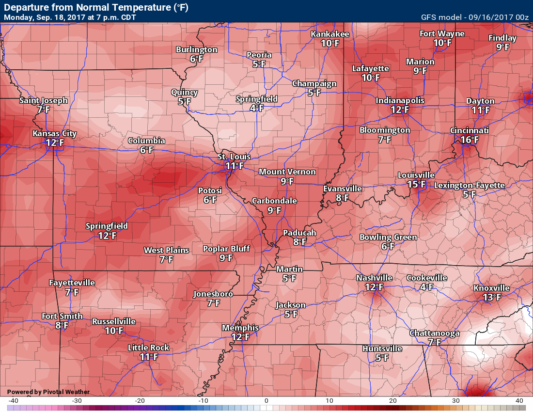
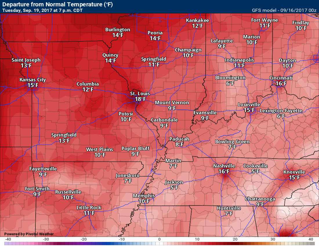
Temperatures will remain above normal for the foreseeable future. Expect daily high temperatures in the middle to upper 80’s. Normal high temperatures are around 80 to 84 degrees.
Temperature anomaly forecast maps. How many degrees above normal will temperatures be?
Sunday

Monday
Tuesday
Rain chances will start to creep back into the forecast. A few isolated storms can’t be ruled out late Sunday afternoon and night. The main concern would be over southeast Missouri and southwest Illinois.
Elsewhere, chances decrease as you move further and further east.
Scattered thunderstorms are possible on Monday and Monday evening. Lower chances Tuesday into Tuesday night. Thunderstorm chances will rise just a tad on Wednesday and Thursday.
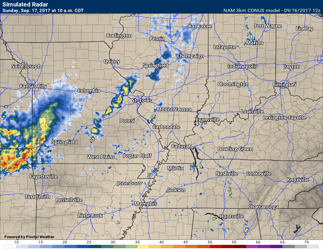
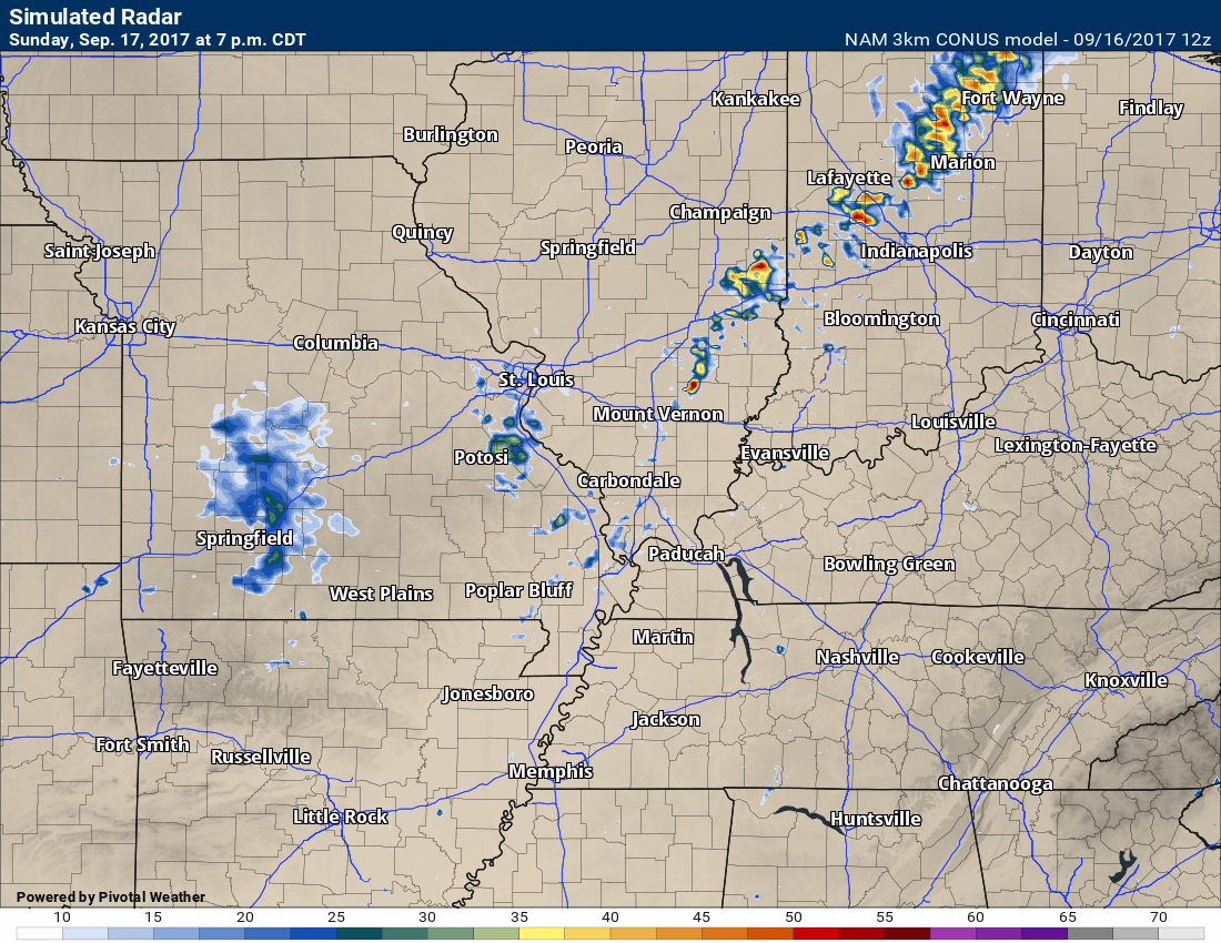
Future-cast radar from the NAM 3K model shows isolated to scattered showers and thunderstorms over the coming days. Many areas may remain dry (unfortunately).
10 AM Sunday radar. The NAM shows a few storms over southeast Missouri and maybe southwest Illinois.
Sunday 7 PM future-cast radar. A few isolated thunderstorms showing up on the NAM model guidance.
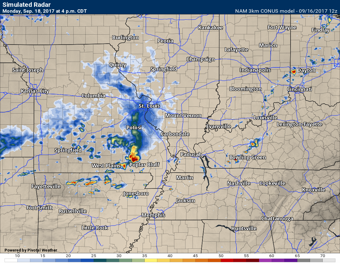
Monday at 4 PM. Future-cast radar from the NAM 3K model guidance.
The NAM pops a few thunderstorms, in our local area, on Monday.
Here is the Monday evening future-cast radar from the NAM 3K model guidance. Again, a few showers and thunderstorms possible. Many areas may remain dry.
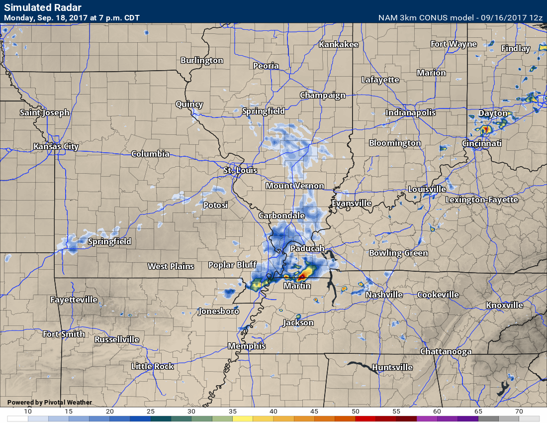
At this time, severe weather appears unlikely. Lightning will be the main concern. A few heavy downpours, as well.
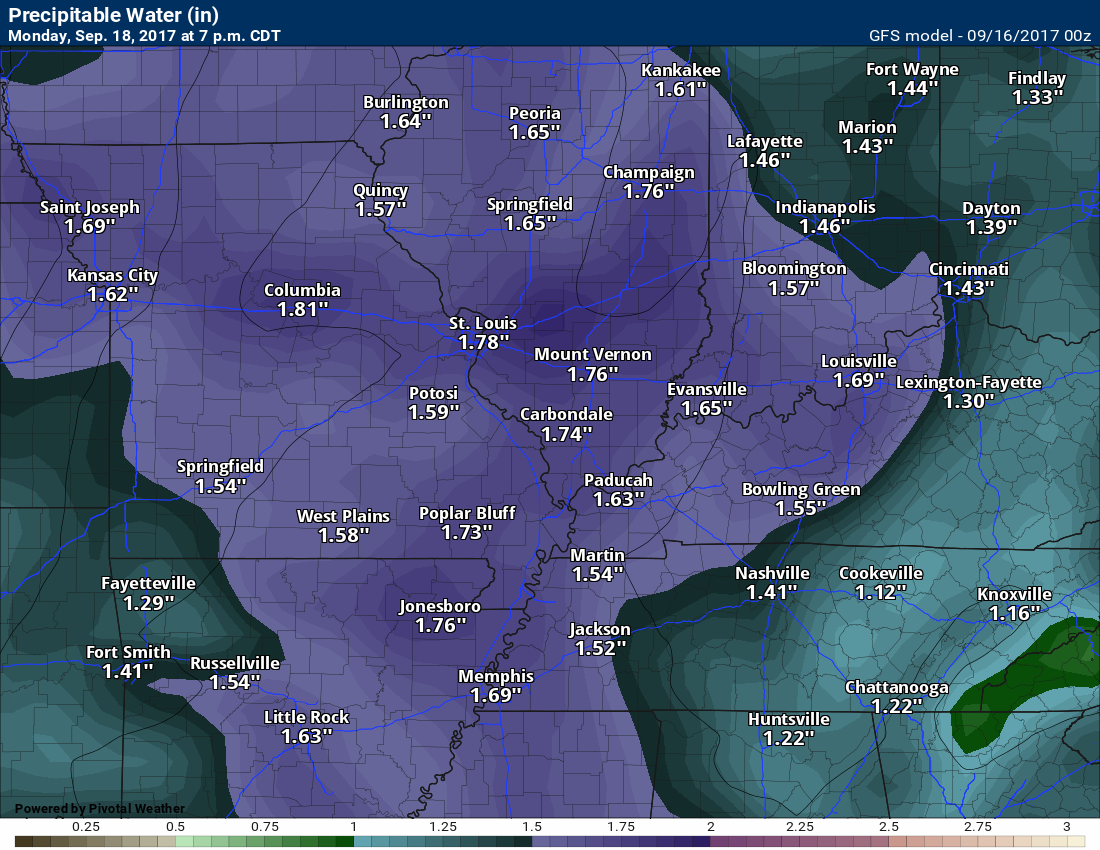
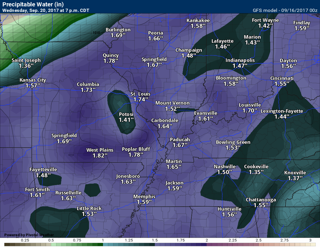
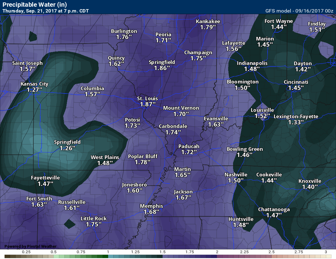
Precipitable water values (PWAT) will be on the rise over the coming days. What are PWAT’s?
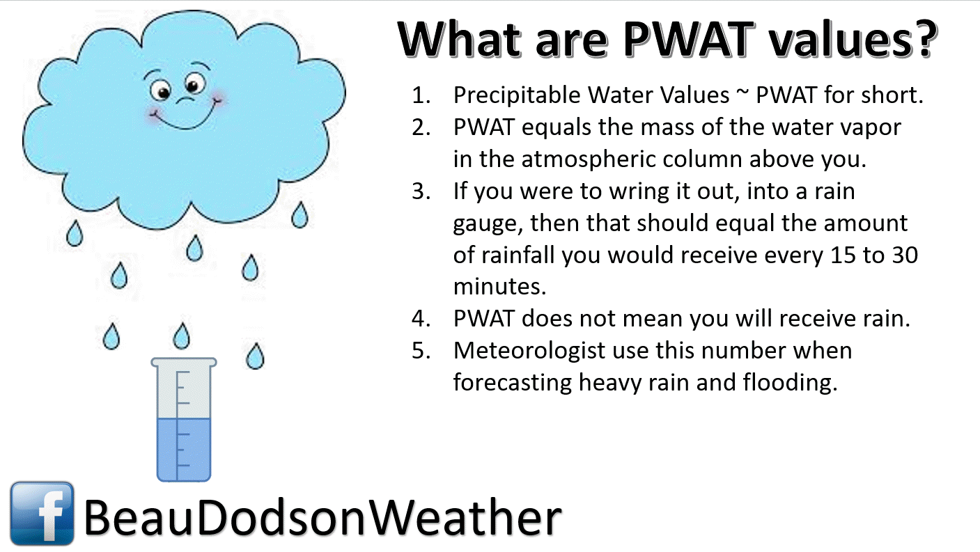
PWAT values will be WELL above seasonal norms. If we do have thunderstorms, then they could produce some downpours.
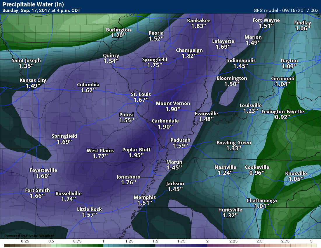
Sunday PWAT values
Monday PWAT values
Tuesday PWAT values

Wednesday PWAT values
Thursday PWAT values
TEMPERATURE FORECAST
Click images to enlarge
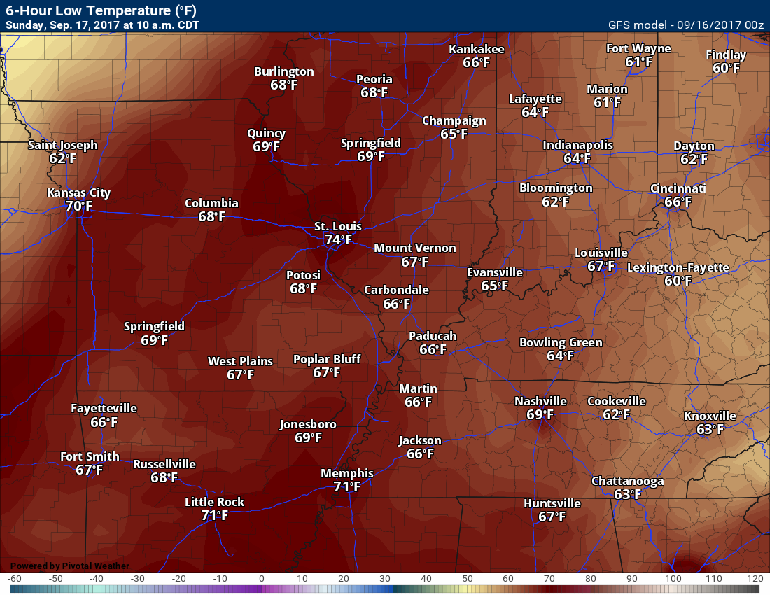
Saturday night low temperatures
Sunday high temperatures
Sunday night low temperatures
Monday high temperatures
Monday night low temperatures

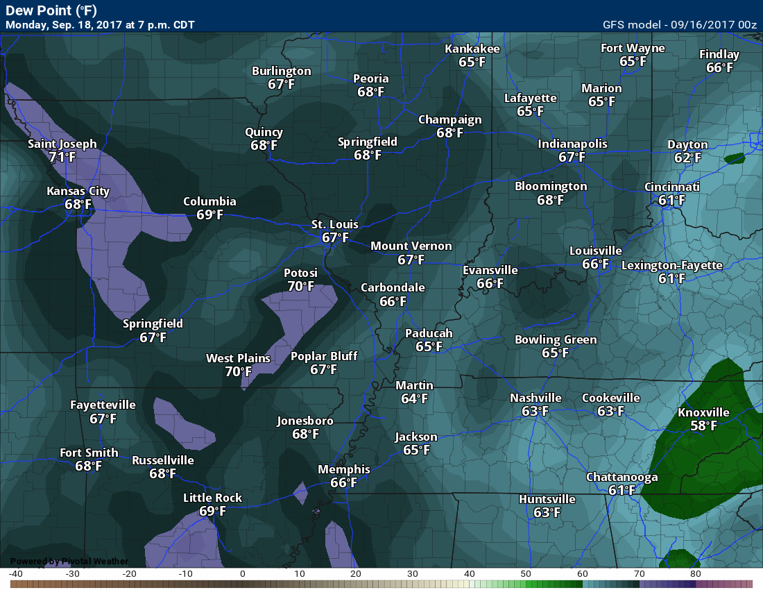
Dew point scale

Click images to enlarge
Dew points for Sunday

Dew points for Monday
Dew points for Tuesday

Dew points for Wednesday

Long range
Warm weather will continue into next weekend. A few showers and thunderstorms are possible on Wednesday and Thursday. Not sure about Friday, just yet.
A cold front may enter the picture around Sunday night/Monday of next week. That front could trigger some showers and thunderstorms. Still quite a bit of time to monitor.
I continue to watch Invest 96L in the Atlantic. It could impact the islands, but is still a considerable distance away from hitting land. It could strengthen into a tropical storm and eventually a hurricane.
Are you subscribing to the Weather Talk texts and videos?
We now have premiere videos for the short and long range forecasts! Make sure you have text option four turned on (green).
Sign up at www.beaudodsonweather.com
We also have an Apple and Android app (scroll down to bottom of the page for more information)

Were you aware that I have hired some help for long range videos? Short range videos, as well. An amazing team of meteorologists.
Click the link below to read more
http://cms.weathertalk.com/meet-the-team/
Weather Talk subscribers now have some of the best short and long range weather videos produced across the eastern United States.
.


We have regional radars and local city radars – if a radar does not update then try another one. Occasional browsers need their cache cleared. You may also try restarting your browser. That usually fixes the problem. Occasionally we do have a radar go down. That is why I have duplicates. Thus, if one fails then try another one.
During the winter you can track snow and ice by clicking the winterize button on the local city view interactive radars.
If you have any problems then please send me an email beaudodson@usawx.com
Interactive Weather Radar Page. Choose the city nearest your location: Click this link
National interactive radar: Click this link.
Local interactive city radars include St Louis, Mt Vernon, Evansville, Poplar Bluff, Cape Girardeau, Marion, Paducah, Hopkinsville, Memphis, Nashville, Dyersburg, and all of eastern Kentucky. These are interactive radars. Local city radars – click here
The Beau Dodson Weather APP is ready for Apple and Android users. The purpose of this app is for me to deliver your app/text messages instantly. ATT and Verizon have not always been reliable when it comes to speed. The app allows instant delivery.
Some of you have asked if you can receive the texts on your phone and the app. The answer to that is, yes. The Android app will automatically allow that to happen. On the Apple app, however, you will need to go into your app and click settings. Make sure the green tab is OFF. Off means you will still receive the texts to your phone and the app. If you have any questions, then email me at beaudodson@usawx.com
The app is for text subscribers.
The direct download, for the Apple app, can be viewed here
https://itunes.apple.com/us/app/id1190136514
If you have not signed up for the texting service then you may do so at www.beaudodsonweather.com

The Android app is also ready.
Remember, the app’s are for www.weathertalk.com subscribers. The app allows your to receive the text messages faster than ATT and Verizon.
Here is the download link for the Android version Click Here

——————————————————–
If you have not signed up for the texts messages, then please do. Link www.beaudodsonweather.com
Your support helps with the following:

and


Who do you trust for your weather information and who holds them accountable?
I have studied weather in our region since the late 1970’s. I have 39 years of experience in observing our regions weather patterns. My degree is in Broadcast Meteorology and a Bachelor’s of Science.
My resume includes:
Member of the American Meteorological Society.
NOAA Weather-Ready Nation Ambassador.
Meteorologist for McCracken County Emergency Management. I served from 2005 through 2015.
Meteorologist for McCracken County Rescue. 2015 through current
I own and operate the Southern Illinois Weather Observatory.
I am the chief meteorologist for Weather Talk LLC. I am the owner of Weather Talk LLC.
I am also a business owner in western Kentucky.
Recipient of the Mark Trail Award, WPSD Six Who Make A Difference Award, Kentucky Colonel, and the Caesar J. Fiamma” Award from the American Red Cross.
In 2005 I helped open the largest American Cross shelter in U.S. history in Houston, Texas. I was deployed to help after Hurricane Katrina and Hurricane Rita. I was a shelter manager of one of the Houston, Texas shelter divisions.
In 2009 I was presented with the Kentucky Office of Highway Safety Award.
Recognized by the Kentucky House of Representatives for my service to the State of Kentucky leading up to several winter storms and severe weather outbreaks.
If you click on the image below you can read the Kentucky House of Representatives Resolution.

I am also President of the Shadow Angel Foundation which serves portions of western Kentucky and southern Illinois.
There is a lot of noise on the internet. A lot of weather maps are posted without explanation. Over time you should learn who to trust for your weather information.
My forecast philosophy is simple and straight forward.
- Communicate in simple terms
- To be as accurate as possible within a reasonable time frame before an event
- Interact with you on Twitter, Facebook, email, texts, and this blog
- Minimize the “hype” that you might see on some television stations or through other weather sources
- Push you towards utilizing wall-to-wall LOCAL TV coverage during severe weather events
Many of the graphics on this page are from www.weatherbell.com
WeatherBell is a great resource for weather model guidance.


You can sign up for my AWARE email by clicking here I typically send out AWARE emails before severe weather, winter storms, or other active weather situations. I do not email watches or warnings. The emails are a basic “heads up” concerning incoming weather conditions