

.
You must have a Weather Talk subscription ($3 a month) to view the videos.
Videos are posted on the www.weathertalk.com website. Once there, click the Beau Video-Cast tab. Long Range Video Update
If you believe you missed a video then you can also click the LIVE FEED link on the Weather Talk website. You will find the most recent and previous seven days worth of links on that page.
I can app/text you the videos, as well. Make sure you have text option FOUR turned on. That would be the Weather Extra text option. Sign up for the app/text messages, videos, and more at www.beaudodsonweather.com
.

.
This forecast update covers southern Illinois, southeast Missouri, western Kentucky. and extreme northwest Tennessee.
.
September 10, 2017
Sunday Night Forecast Details:
Forecast: Mostly clear. Cool temperatures. Patchy fog.
Temperatures: MO ~ 48 to 54 IL ~ 48 to 54 KY ~ 50 to 54 TN ~ 50 to 54
Winds: Northeast at 5 mph
What impacts are anticipated from the weather? None
My confidence in the forecast verifying: High
Is severe weather expected? No
The NWS defines severe weather as 58 mph winds or great, 1″ hail or larger, and/or tornadoes
What is the chance of precipitation? MO ~ 0% IL ~ 0% KY ~ 0% TN ~ 0%
Coverage of precipitation: None
Should I cancel my outdoor plans? No
.
September 11, 2017
Monday Forecast Details
Forecast: Partly to mostly sunny. Pleasant temperatures. Some increase in clouds during the afternoon from southeast to northwest.
Temperatures: MO ~ 75 to 80 IL ~ 75 to 80 KY ~ 75 to 80 TN ~ 75 to 80
Winds: Light and variable winds. Winds mostly north and northeast at 5 to 10 mph early increasing to 7 to 14 mph afternoon. Higher gusts possible late.
What impacts are anticipated from the weather? Most likely none
My confidence in the forecast verifying: High
Is severe weather expected? No
The NWS defines severe weather as 58 mph winds or great, 1″ hail or larger, and/or tornadoes
What is the chance of precipitation? MO ~ 0% IL ~ 0% KY ~ 10% TN ~ 10%
Coverage of precipitation: Most likely none
Should I cancel my outdoor plans? No
.
Monday Night Forecast Details:
Forecast: Increasing clouds late. Gusty winds developing. Rain developing over the Kentucky/Tennessee border counties. If rain develops it would move from the southeast towards the northwest. It will rotate into the area. Opposite of how precipitation normally moves in our region. This will be the remnants of Irma. Rain should spread towards southeast Missouri and southern Illinois. Some question as to how far northwest the rain will push. Best rain chances will be late at night.
Temperatures: MO ~ 54 to 58 IL ~ 54 to 58 KY ~ 54 to 58 TN ~ 54 to 58
Winds: North and northwest winds increasing to 15 to 30 mph. Higher gusts possible.
What impacts are anticipated from the weather? Wet roadways. Gusty winds developing.
My confidence in the forecast verifying: Medium.
Is severe weather expected? Unlikely
The NWS defines severe weather as 58 mph winds or great, 1″ hail or larger, and/or tornadoes
What is the chance of precipitation? MO ~ 50% IL ~ 50% KY ~ 70% TN ~ 70% (the higher rain chances arrive late at night)
Coverage of precipitation: Increasing coverage from the southeast
Should I cancel my outdoor plans? No
.
September 12, 2017
Tuesday Forecast Details
Forecast: Rain likely. Locally heavy downpours. Gusty winds. Cool.
Temperatures: MO ~ 66 to 72 IL ~ 66 to 72 KY ~ 66 to 72 TN ~ 66 to 72
Winds: North and northeast winds at 15 to 30 mph with gusts to 40 mph possible.
What impacts are anticipated from the weather? Wet roadways. Gusty winds possible.
My confidence in the forecast verifying: Medium
Is severe weather expected? Unlikely, but monitor updates.
The NWS defines severe weather as 58 mph winds or great, 1″ hail or larger, and/or tornadoes
What is the chance of precipitation? MO ~ 60% IL ~ 60% KY ~ 80% TN ~ 90%
Coverage of precipitation: Numerous showers likely
Should I cancel my outdoor plans? Have a plan B
.
Tuesday Night Forecast Details:
Forecast: Mostly cloudy. Scattered rain showers.
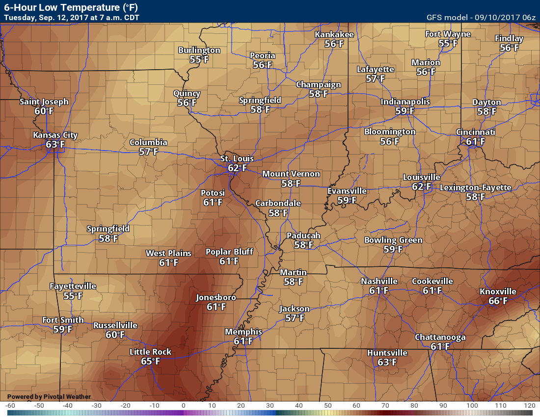
Temperatures: MO ~ 56 to 62 IL ~ 56 to 62 KY ~ 56 to 62 TN ~ 56 to 62
Winds: Northeast winds at 10 to 20 mph. Gusty winds possible.
What impacts are anticipated from the weather? Wet roadways. Gusty winds.
My confidence in the forecast verifying: Medium
Is severe weather expected? Unlikely, but monitor updates
The NWS defines severe weather as 58 mph winds or great, 1″ hail or larger, and/or tornadoes
What is the chance of precipitation? MO ~ 50% IL ~ 50% KY ~ 60% TN ~ 70%
Coverage of precipitation: Scattered to numerous
Should I cancel my outdoor plans? Have a plan B
.
September 13, 2017
Wednesday Forecast Details
Forecast: Mostly cloudy. Some remaining showers possible. Cool. If Irma departs faster then temperatures will be a bit higher than forecasted.
Temperatures: MO ~ 68 to 74 IL ~ 68 to 74 KY ~ 68 to 74 TN ~ 68 to 74
Winds: Southeast winds at 8 to 16 mph. Gusty winds possible.
What impacts are anticipated from the weather? Wet roadways. Gusty winds possible.
My confidence in the forecast verifying: Medium
Is severe weather expected? Unlikely
The NWS defines severe weather as 58 mph winds or great, 1″ hail or larger, and/or tornadoes
What is the chance of precipitation? MO ~ 40% IL ~ 40% KY ~ 50% TN ~ 50%
Coverage of precipitation: Scattered to perhaps numerous showers
Should I cancel my outdoor plans? Have a plan B
.
Wednesday Night Forecast Details:
Forecast: Some clouds. A chance for scattered showers. Rain should be ending.
Temperatures: MO ~ 55 to 60 IL ~ 55 to 60 KY ~ 55 to 60 TN ~ 55 to 60
Winds: Variable at 6 to 12 mph
What impacts are anticipated from the weather? Perhaps wet roadways
My confidence in the forecast verifying: Medium
Is severe weather expected? No
The NWS defines severe weather as 58 mph winds or great, 1″ hail or larger, and/or tornadoes
What is the chance of precipitation? MO ~ 30% IL ~ 30% KY ~ 40% TN ~ 40%
Coverage of precipitation: Scattered
Should I cancel my outdoor plans? No, but monitor updates
.
September 14, 2017
Thursday Forecast Details
Forecast: A mix of sun and clouds. Mild.
Temperatures: MO ~ 74 to 78 IL ~ 74 to 78 KY ~ 74 to 78 TN ~ 74 to 78
Winds: Variable winds becoming northwest at 5 to 10 mph
What impacts are anticipated from the weather? Most likely none.
My confidence in the forecast verifying: Medium
Is severe weather expected? No
The NWS defines severe weather as 58 mph winds or great, 1″ hail or larger, and/or tornadoes
What is the chance of precipitation? MO ~ 0% IL ~ 0% KY ~ 0% TN ~ 0%
Coverage of precipitation: None anticipated
Should I cancel my outdoor plans? No
.
Thursday Night Forecast Details:
Forecast: Mostly clear.
Temperatures: MO ~ 55 to 60 IL ~ 55 to 60 KY ~ 55 to 60 TN ~ 55 to 60
Winds: Variable at 4 to 8 mph
What impacts are anticipated from the weather? None
My confidence in the forecast verifying: Medium
Is severe weather expected? No
The NWS defines severe weather as 58 mph winds or great, 1″ hail or larger, and/or tornadoes
What is the chance of precipitation? MO ~ 0% IL ~ 0% KY ~ 0% TN ~ 0%
Coverage of precipitation: None
Should I cancel my outdoor plans? No
.
September 15, 2017
Friday Forecast Details
Forecast: Mostly sunny. Mild.
Temperatures: MO ~ 78 to 84 IL ~ 78 to 84 KY ~ 78 to 84 TN ~ 78 to 84
Winds: South winds at 5 to 10 mph
What impacts are anticipated from the weather? Most likely none.
My confidence in the forecast verifying: Medium
Is severe weather expected? No
The NWS defines severe weather as 58 mph winds or great, 1″ hail or larger, and/or tornadoes
What is the chance of precipitation? MO ~ 0% IL ~ 0% KY ~ 0% TN ~ 0%
Coverage of precipitation: None anticipated
Should I cancel my outdoor plans? No
.
Friday Night Forecast Details:
Forecast: Mostly clear.
Temperatures: MO ~ 56 to 62 IL ~ 56 to 62 KY ~ 56 to 62 TN ~ 56 to 62
Winds: Variable winds at 5 mph
What impacts are anticipated from the weather? None
My confidence in the forecast verifying: Medium
Is severe weather expected? No
The NWS defines severe weather as 58 mph winds or great, 1″ hail or larger, and/or tornadoes
What is the chance of precipitation? MO ~ 0% IL ~ 0% KY ~ 0% TN ~ 0%
Coverage of precipitation: None
Should I cancel my outdoor plans? No
.

Don’t forget to check out the Southern Illinois Weather Observatory web-site for weather maps, tower cams, scanner feeds, radars, and much more! Click here
.

A severe thunderstorm is defined as a storm that produces quarter size hail or larger, 58 mph winds or greater, and/or a tornado. That is the official National Weather Service definition of a severe thunderstorm
Sunday night through Monday night: Severe weather is not anticipated.
Tuesday through Wednesday night: The remnants of Hurricane Irma will push into our region. At this time, the tornado threat appears low. With that said, monitor updates. Occasionally dying tropical systems can produce brief tornadoes in our region. Locally heavy rain is possible with Irma, but widespread heavy rain or flash flooding is not anticipated. Most of the area needs rain.
Southcentral Kentucky experienced heavy rain from Harvey. Those areas could have some water issues if heavy rain develops. Monitor updates.
.

Overview
Are there any weather concerns
- Irma will begin to spread rain into our region late Monday and Tuesday
- Below normal temperatures to continue
Short range
Confidence level in the short range forecast is medium
Our nice weather is about to end. Most of us need rain, so I am not going to complain.
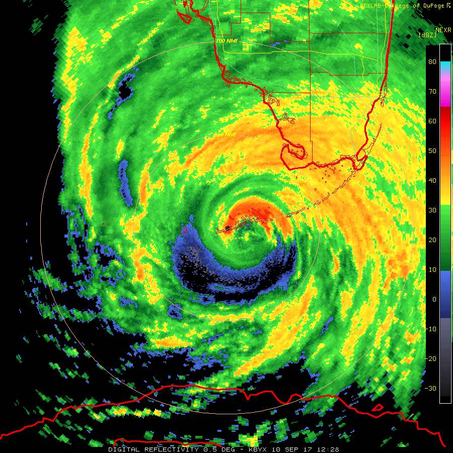
Hurricane Irma moved ashore, as a category four hurricane, on Sunday morning. Winds over 120 mph whipped the islands. A large storm surge caused severe damage. As I type this, the system is spreading northward through Florida.
Here was a radar view of the land falling hurricane (taken at 9 am on Sunday)
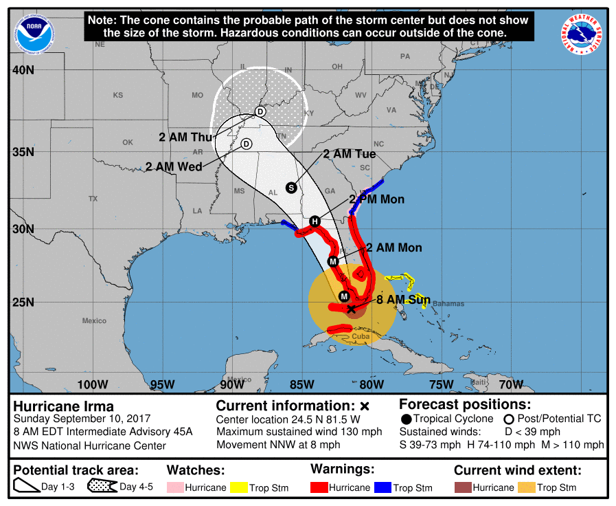
Irma will spread northward over the next 12 to 24 hours. It will then start to turn a bit more to the northwest. The National Hurricane Center’s official track forecast brings Irma into our region on Tuesday.
The D represents a depression. Depression is the weakest form of the tropical system. Depression is followed by tropical storm and that is followed by hurricane. Depression is the lowest end point of a dying tropical system.
Gusty winds will be a concern as the system pulls through our region.
The impact from the remnants won’t be all that impressive. Gusty winds will occur and some downpours. What is not anticipated is widespread tornado activity or flash flooding. We believe that Irma will weaken considerably on Monday night into Tuesday night.
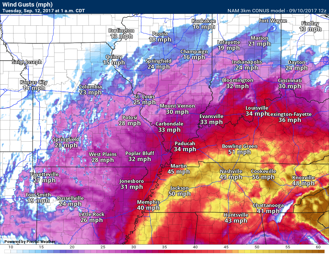
Winds gusts could reach 40 mph. Not sure we see higher than that. This is one part of the forecast that I will be monitoring.
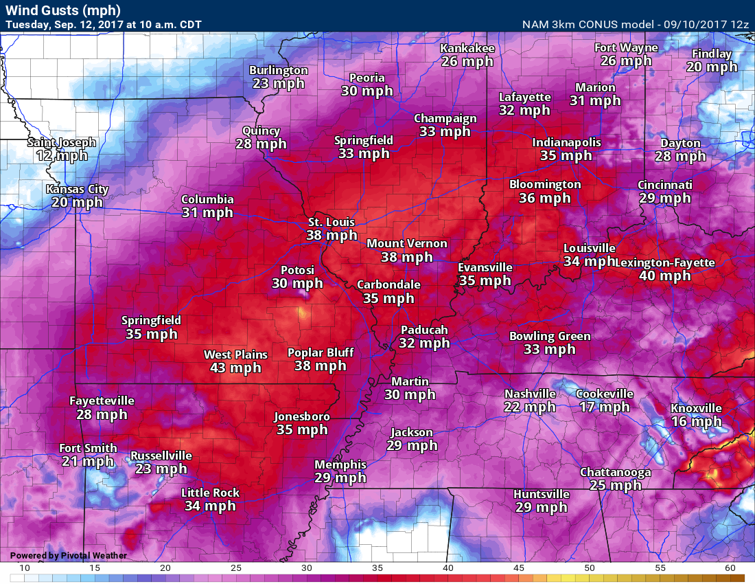
Here is the high resolution NAM guidance. This is for late Monday night and Tuesday. Winds could reach or gust above 40 mph.
1 AM Tuesday wind gust map
4 AM on Tuesday

7 AM Tuesday wind gust map

Tuesday 10 AM wind gust forecast map
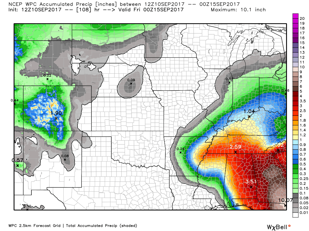
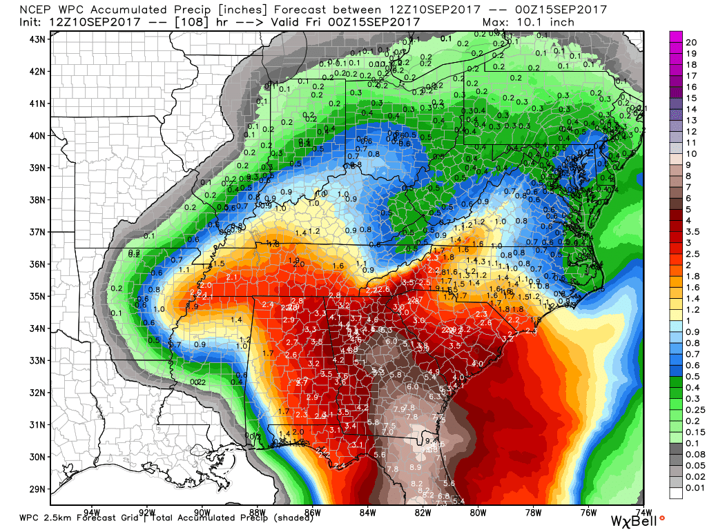
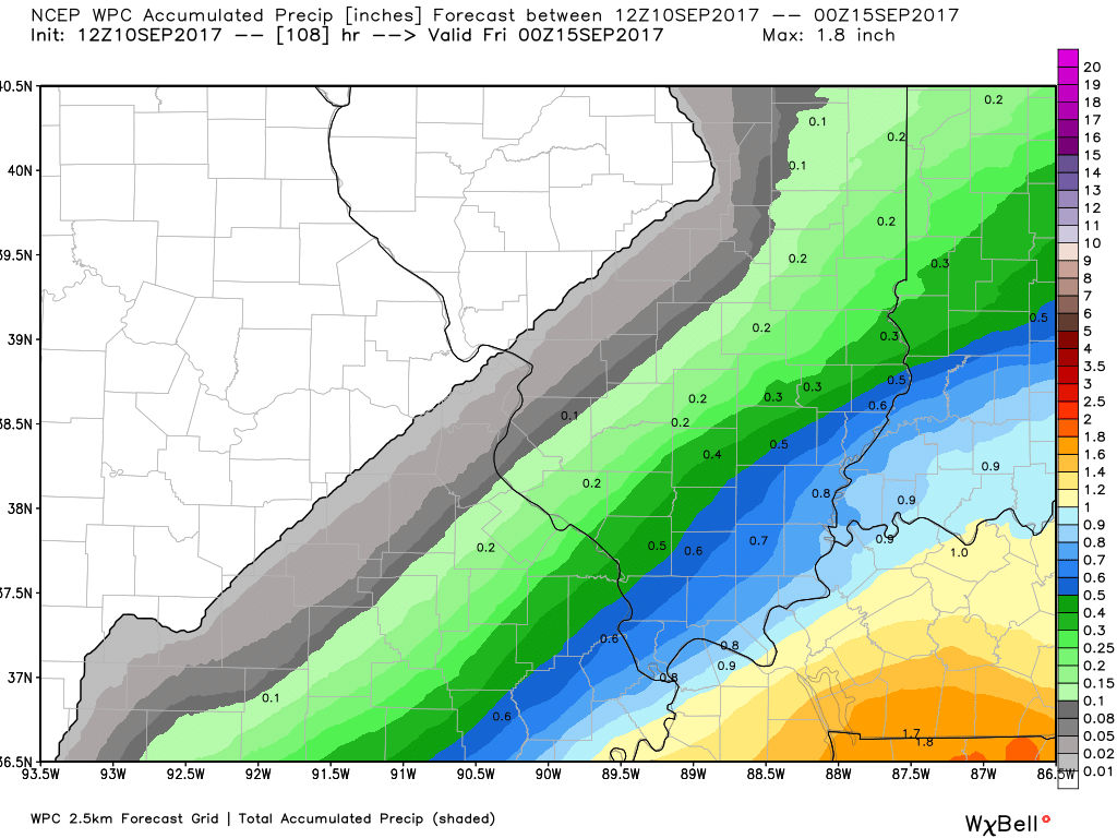
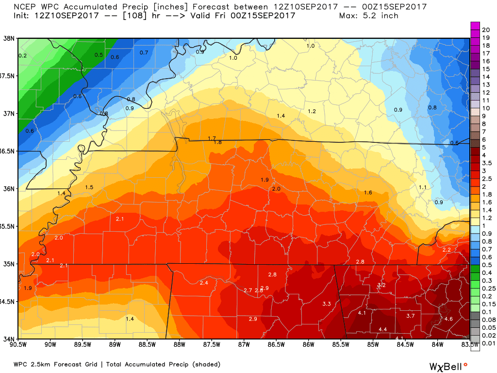
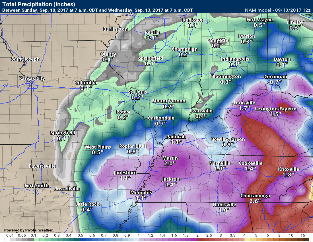
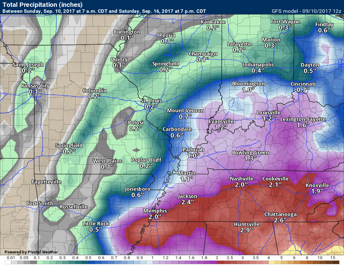
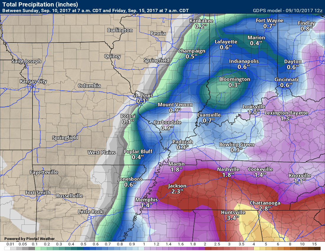
Rainfall totals will vary. The heavier totals will occur near the center of the dying hurricane. We certainly could see some one to two-inch amounts in my forecast counties. The best chance of those would be over south central Kentucky into northwest Tennessee. How far north and west the heavier rain spreads is still a bit questionable.
Here is the official rainfall forecast from the WPC
Regional
Zoomed in. Click to enlarge.
Zoomed even more
Let’s look at some rainfall totals from the models
High-resolution NAM guidance

NAM model guidance through Wednesday (most of the rain will fall on Monday night/Tuesday/Tuesday evening)
Rainfall totals anticipated (model’s opinion)
GFS model guidance rainfall totals from Irma
Canadian model guidance rainfall totals from Irma
Here is the GFS model guidance. This is how it sees Irma unfolding. The time stamp is the top left of the animation.
Canadian model holds the rain off until Tuesday morning. Some disagreement on the exact timing of the rain.
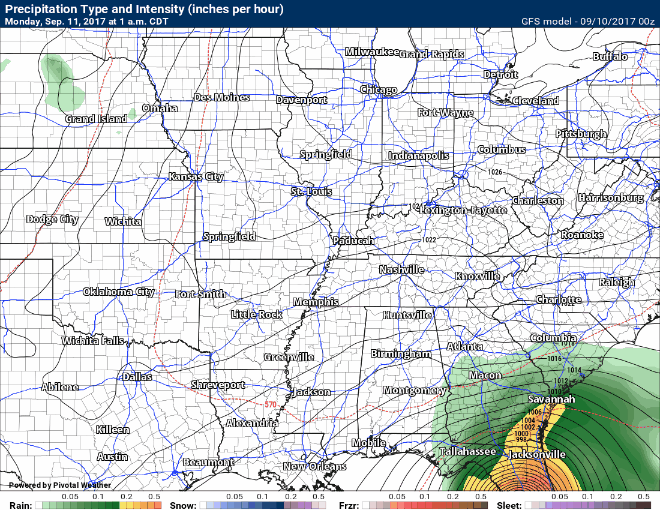
The NAM model, on the other hand, attempts to bring rain into our region on Monday afternoon. This seems a bit fast, but I can’t rule it out.
1 PM Monday. This is the high-resolution 3K NAM model. It brings rain in faster.

Here is the 7 PM Monday future-cast radar map. What radar might look like on Monday evening. Again, the NAM is a bit faster than some other guidance packages.

Occasionally, land-falling hurricanes can produce tornadoes in our region. At this time, that appears unlikely.
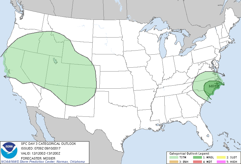
The SPC has not outlined our region for severe weather. I will continue to monitor trends (in case something changes). The SPC will update these maps several times between now and the arrival time of the remnants of Irma.
Monday severe weather outlook from the Storm Prediction Center
Tuesday severe weather outlook from the SPC
Severe threat is noted along the East Coast as Irma moves north/northwest.
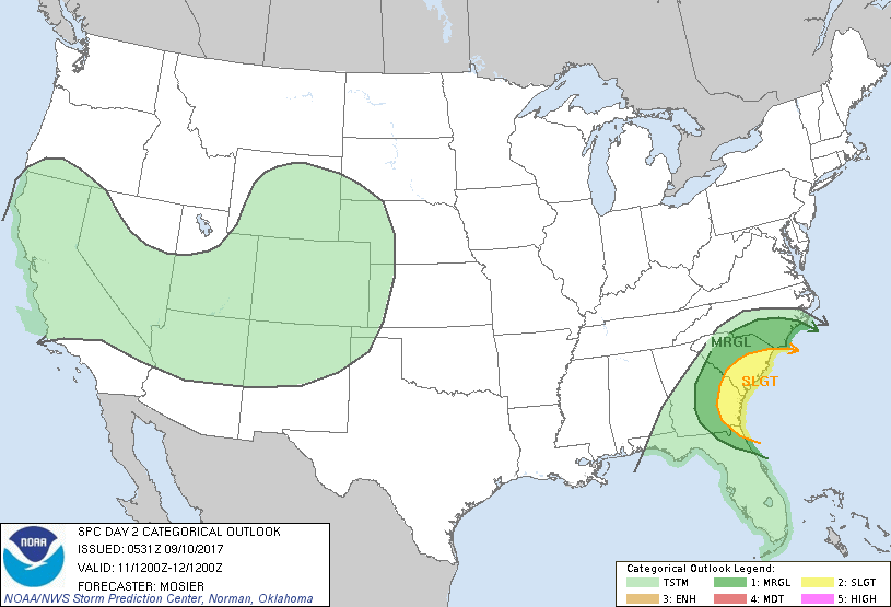
No concerns for our region (the map below is the Tuesday outlook)
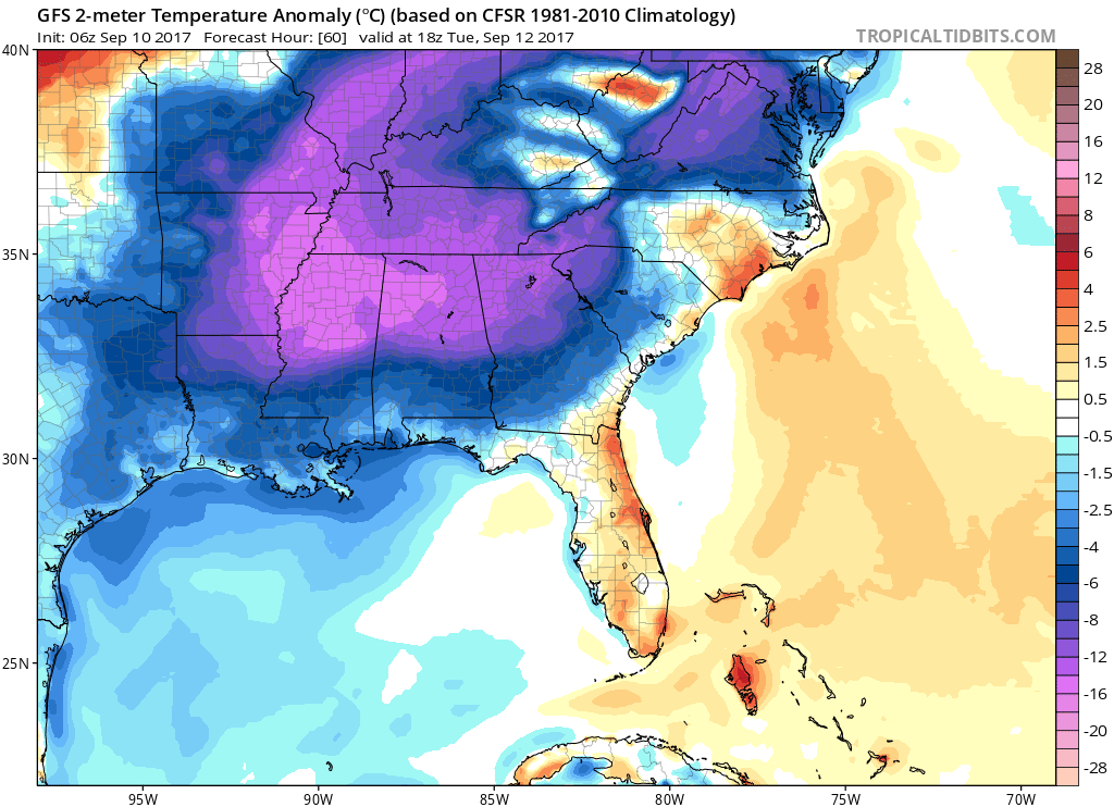
TEMPERATURE FORECAST
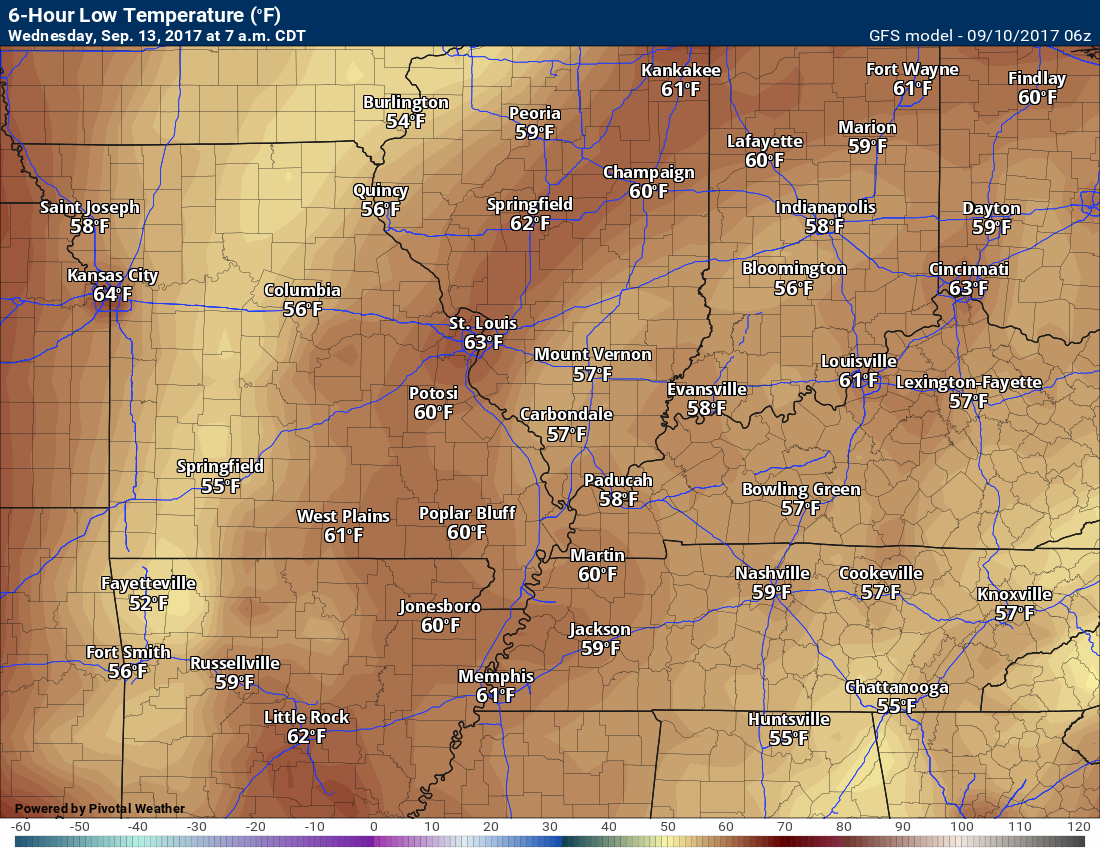
Temperatures will be well below normal as Irma approaches our region. Thick clouds and rain will be the cause.
Temperature anomaly forecast for Tuesday. Normal high temperatures are 85 degrees and normal low temperatures are 60 degrees.
Click map to enlarge
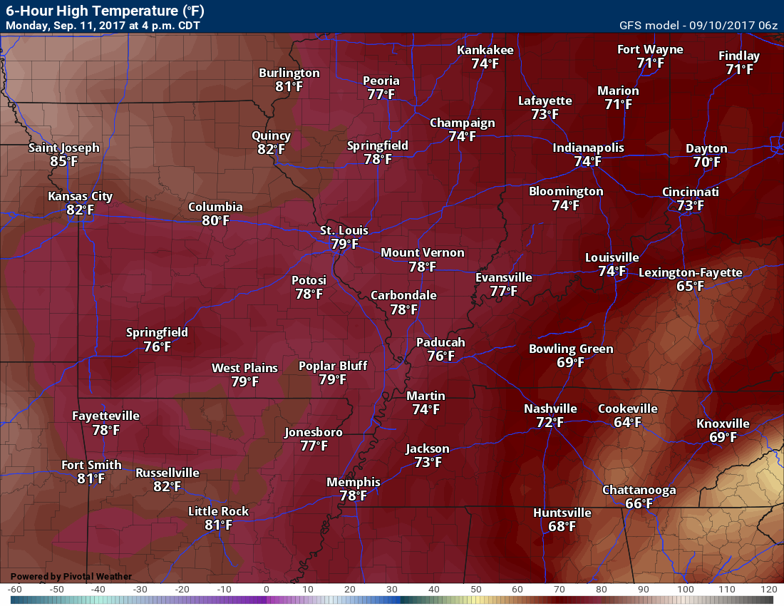
Click images to enlarge
Low temperatures for Sunday night (below)

High temperatures for Monday (below)
Low temperatures for Monday night (below)
High temperatures for Tuesday

Low temperatures for Tuesday night
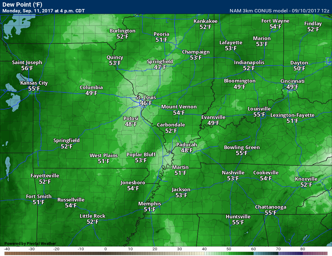
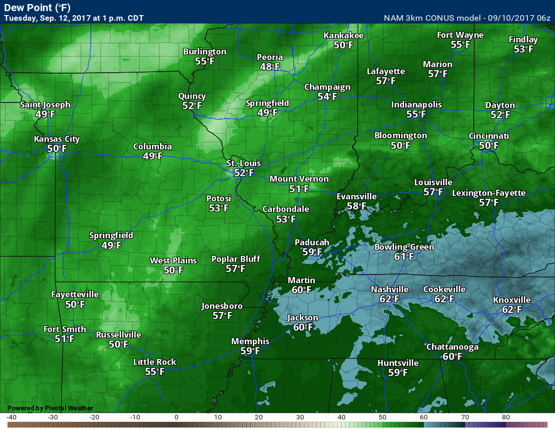
Dew point scale

Dew points for Monday
Dew points for Tuesday
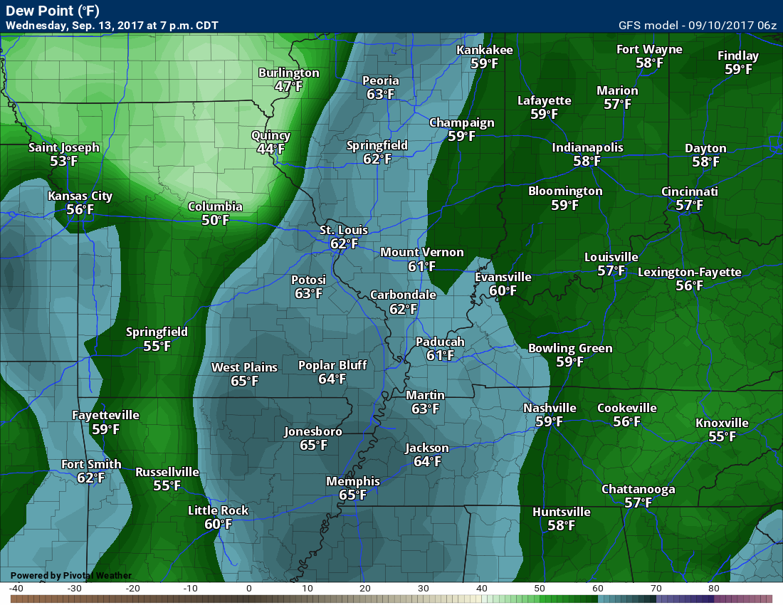
Dew points for Wednesday
Dew point for Thursday

Long range
The confidence level is low to medium for the long range forecast.
I am monitoring September 17th/18th for a cold front. Long way out and confidence is low.
Temperatures should push to near normal by late in the week into the weekend.
Are you subscribing to the Weather Talk texts and videos?
We now have premiere videos for the short and long range forecasts! Make sure you have text option four turned on (green).
Sign up at www.beaudodsonweather.com
We also have an Apple and Android app (scroll down to bottom of the page for more information)

Were you aware that I have hired some help for long range videos? Short range videos, as well. An amazing team of meteorologists.
Click the link below to read more
http://cms.weathertalk.com/meet-the-team/
Weather Talk subscribers now have some of the best short and long range weather videos produced across the eastern United States.
.


We have regional radars and local city radars – if a radar does not update then try another one. Occasional browsers need their cache cleared. You may also try restarting your browser. That usually fixes the problem. Occasionally we do have a radar go down. That is why I have duplicates. Thus, if one fails then try another one.
During the winter you can track snow and ice by clicking the winterize button on the local city view interactive radars.
If you have any problems then please send me an email beaudodson@usawx.com
Interactive Weather Radar Page. Choose the city nearest your location: Click this link
National interactive radar: Click this link.
Local interactive city radars include St Louis, Mt Vernon, Evansville, Poplar Bluff, Cape Girardeau, Marion, Paducah, Hopkinsville, Memphis, Nashville, Dyersburg, and all of eastern Kentucky. These are interactive radars. Local city radars – click here
The Beau Dodson Weather APP is ready for Apple and Android users. The purpose of this app is for me to deliver your app/text messages instantly. ATT and Verizon have not always been reliable when it comes to speed. The app allows instant delivery.
Some of you have asked if you can receive the texts on your phone and the app. The answer to that is, yes. The Android app will automatically allow that to happen. On the Apple app, however, you will need to go into your app and click settings. Make sure the green tab is OFF. Off means you will still receive the texts to your phone and the app. If you have any questions, then email me at beaudodson@usawx.com
The app is for text subscribers.
The direct download, for the Apple app, can be viewed here
https://itunes.apple.com/us/app/id1190136514
If you have not signed up for the texting service then you may do so at www.beaudodsonweather.com

The Android app is also ready.
Remember, the app’s are for www.weathertalk.com subscribers. The app allows your to receive the text messages faster than ATT and Verizon.
Here is the download link for the Android version Click Here

——————————————————–
If you have not signed up for the texts messages, then please do. Link www.beaudodsonweather.com
Your support helps with the following:

and


Who do you trust for your weather information and who holds them accountable?
I have studied weather in our region since the late 1970’s. I have 39 years of experience in observing our regions weather patterns. My degree is in Broadcast Meteorology and a Bachelor’s of Science.
My resume includes:
Member of the American Meteorological Society.
NOAA Weather-Ready Nation Ambassador.
Meteorologist for McCracken County Emergency Management. I served from 2005 through 2015.
Meteorologist for McCracken County Rescue. 2015 through current
I own and operate the Southern Illinois Weather Observatory.
I am the chief meteorologist for Weather Talk LLC. I am the owner of Weather Talk LLC.
I am also a business owner in western Kentucky.
Recipient of the Mark Trail Award, WPSD Six Who Make A Difference Award, Kentucky Colonel, and the Caesar J. Fiamma” Award from the American Red Cross.
In 2005 I helped open the largest American Cross shelter in U.S. history in Houston, Texas. I was deployed to help after Hurricane Katrina and Hurricane Rita. I was a shelter manager of one of the Houston, Texas shelter divisions.
In 2009 I was presented with the Kentucky Office of Highway Safety Award.
Recognized by the Kentucky House of Representatives for my service to the State of Kentucky leading up to several winter storms and severe weather outbreaks.
If you click on the image below you can read the Kentucky House of Representatives Resolution.

I am also President of the Shadow Angel Foundation which serves portions of western Kentucky and southern Illinois.
There is a lot of noise on the internet. A lot of weather maps are posted without explanation. Over time you should learn who to trust for your weather information.
My forecast philosophy is simple and straight forward.
- Communicate in simple terms
- To be as accurate as possible within a reasonable time frame before an event
- Interact with you on Twitter, Facebook, email, texts, and this blog
- Minimize the “hype” that you might see on some television stations or through other weather sources
- Push you towards utilizing wall-to-wall LOCAL TV coverage during severe weather events
Many of the graphics on this page are from www.weatherbell.com
WeatherBell is a great resource for weather model guidance.


You can sign up for my AWARE email by clicking here I typically send out AWARE emails before severe weather, winter storms, or other active weather situations. I do not email watches or warnings. The emails are a basic “heads up” concerning incoming weather conditions