I will be utilizing the texting service today for tornadoes and other severe weather. Make sure you have turned on WeatherOne. This is text option one. It is the most important text. If tornadoes occur, then you will receive frequent texts for your county.
Don’t forget to download and use the app. The app receives the text messages instantly. ATT and Verizon can take longer to send them out. Minutes count when tornadoes are occurring.
You can sign up for those app/text messages at www.beaudodsonweather.com Remember, it is $3 a month and that helps cover all the costs of this day.
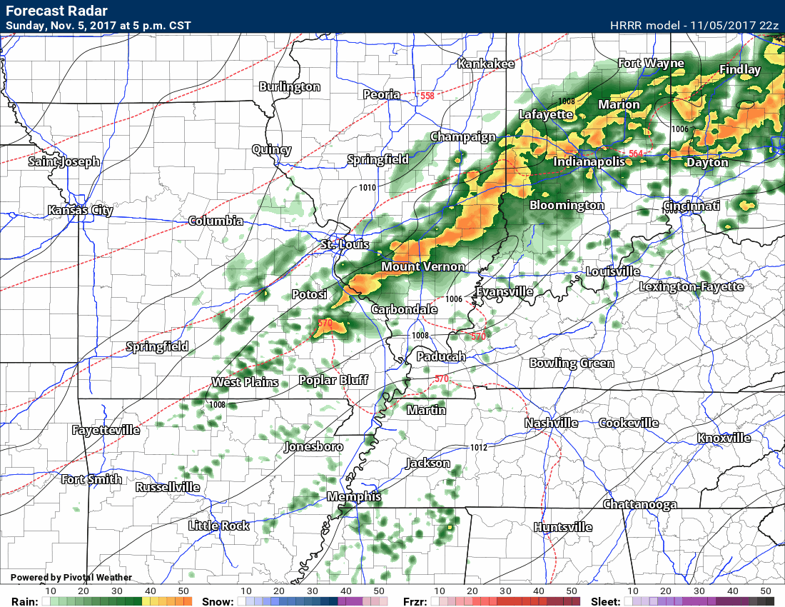
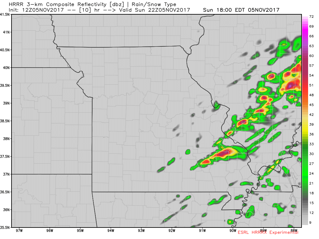
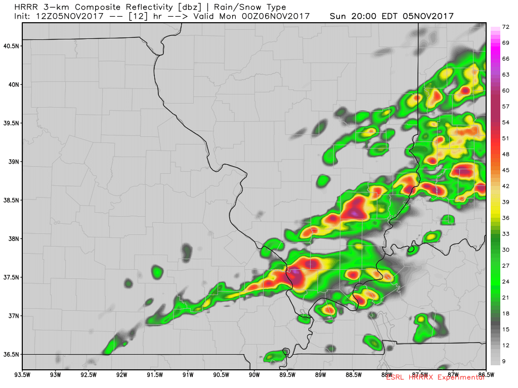
7 PM
Storms continue to line out. That is a good sign. We could still have damaging wind and some hail. Tornado risk is low, but not zero. Monitor updates.
Update on Facebook
https://www.facebook.com/beaudodsonweather/posts/1850996374929862
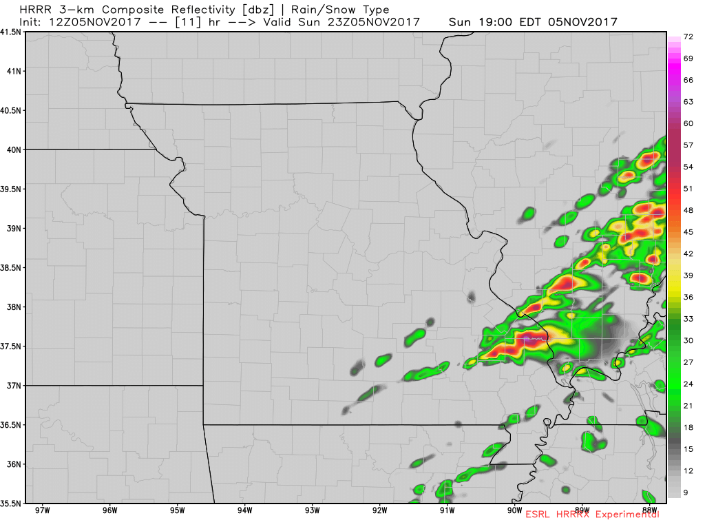
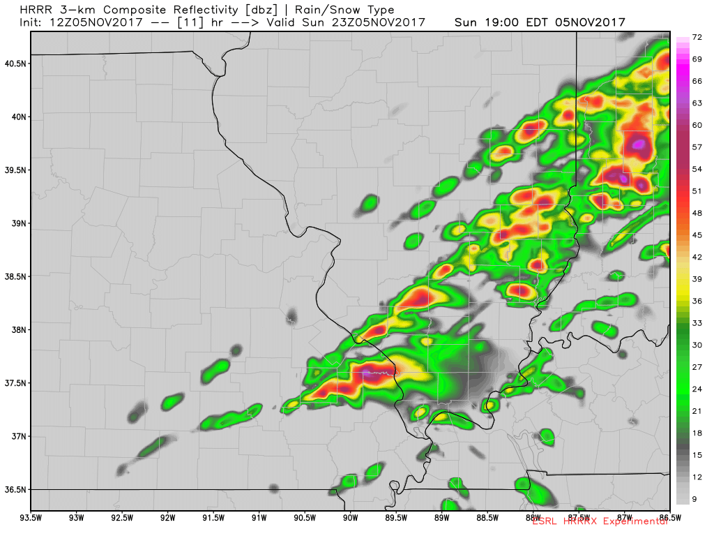
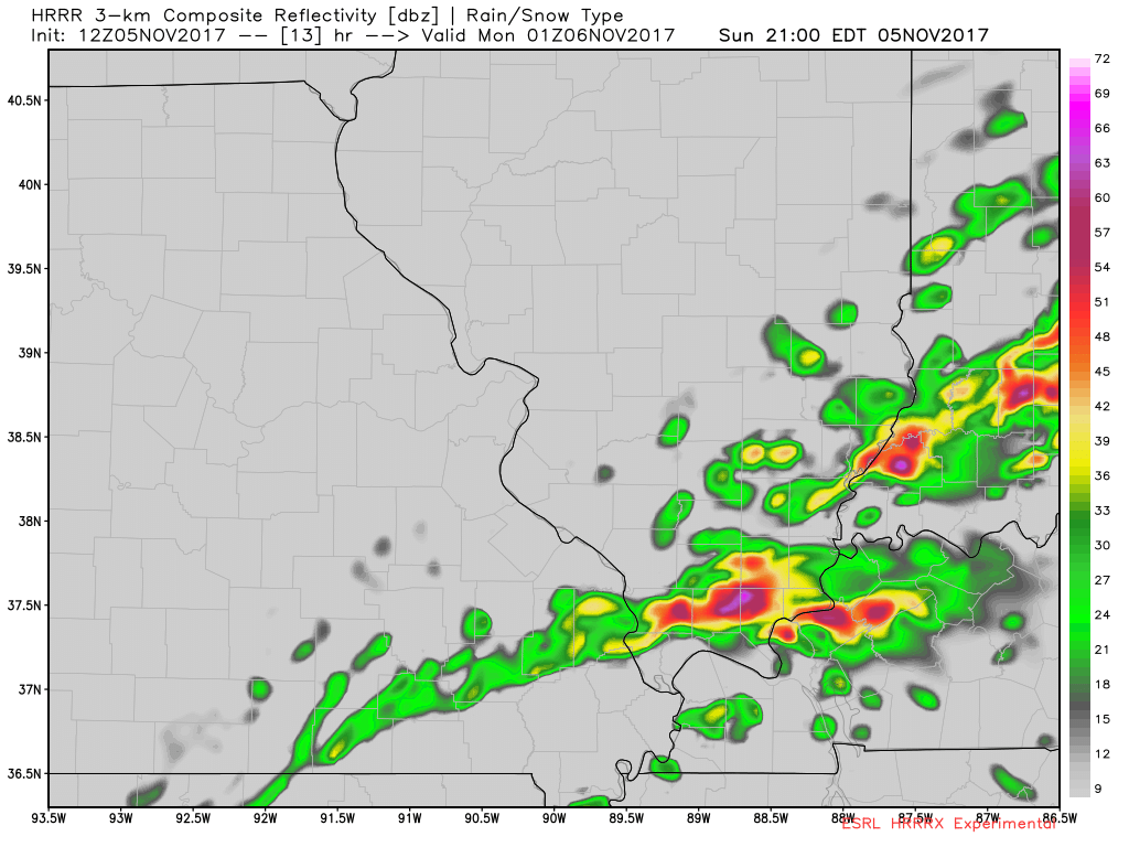
6 PM
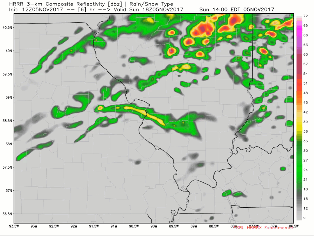
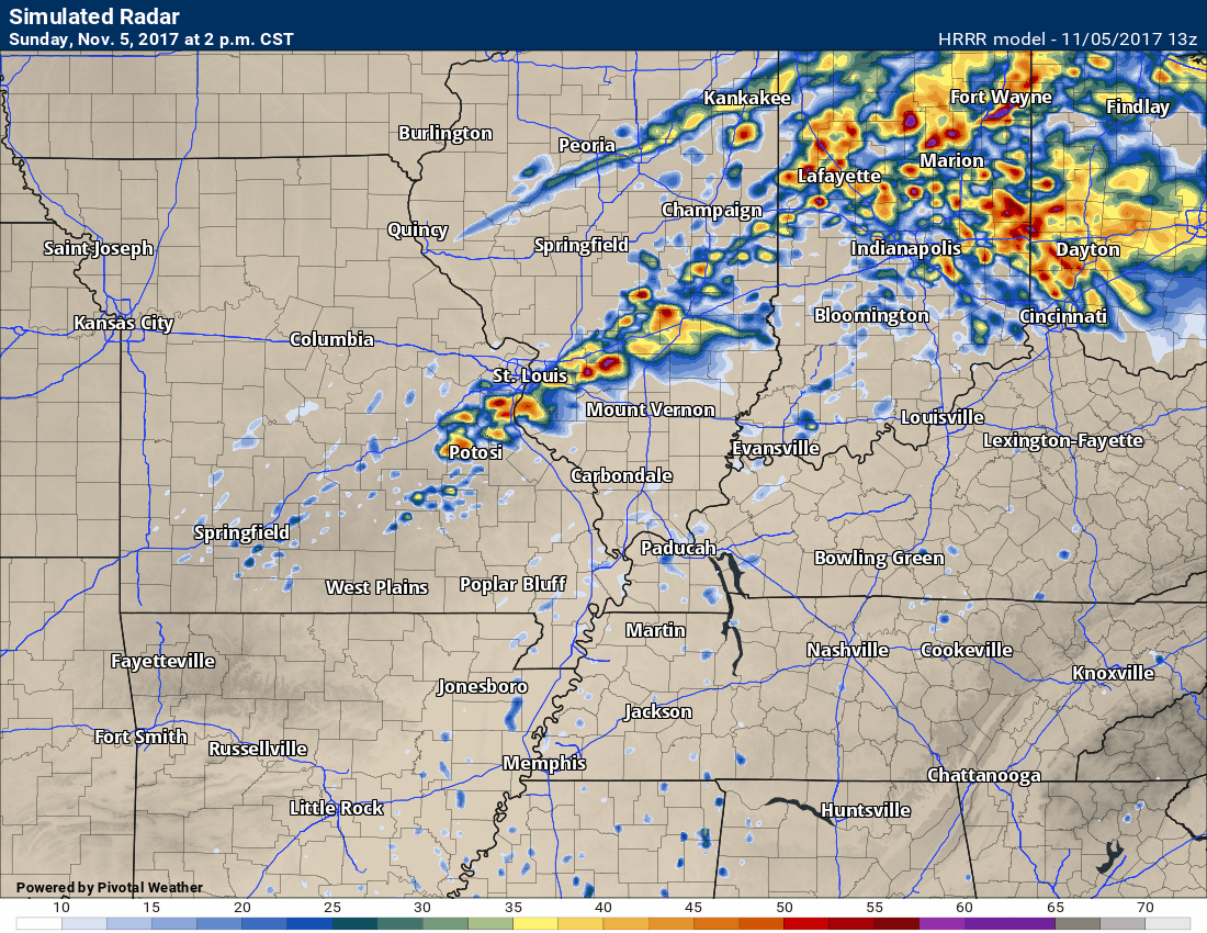
Future-cast radar
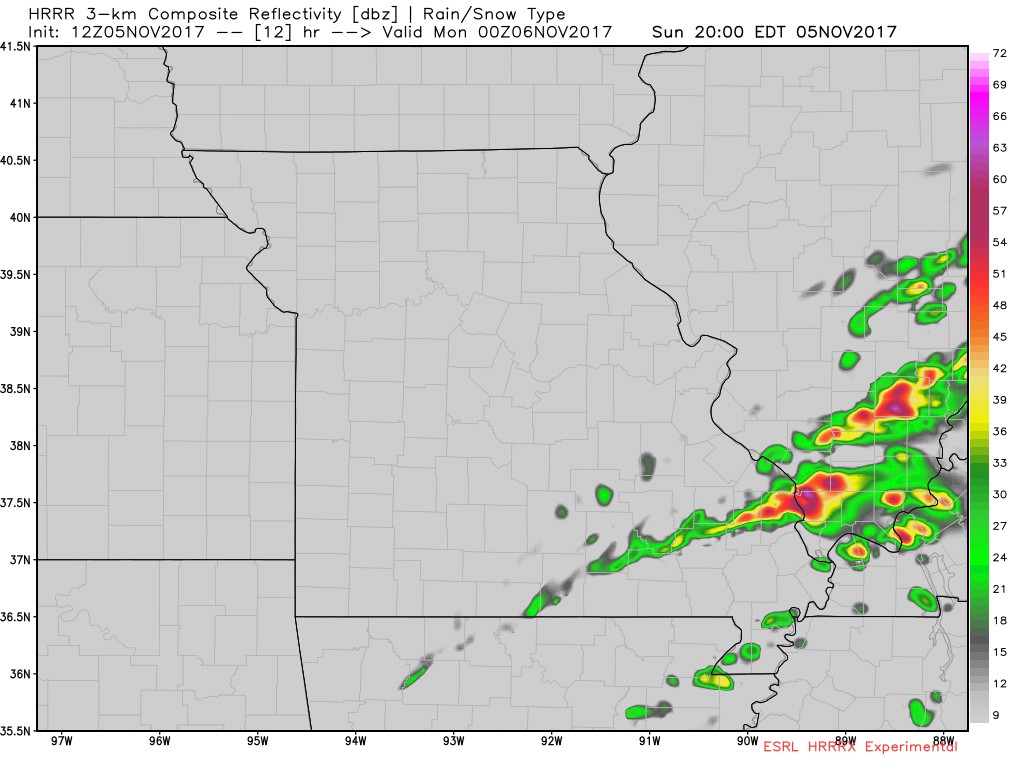
3 PM
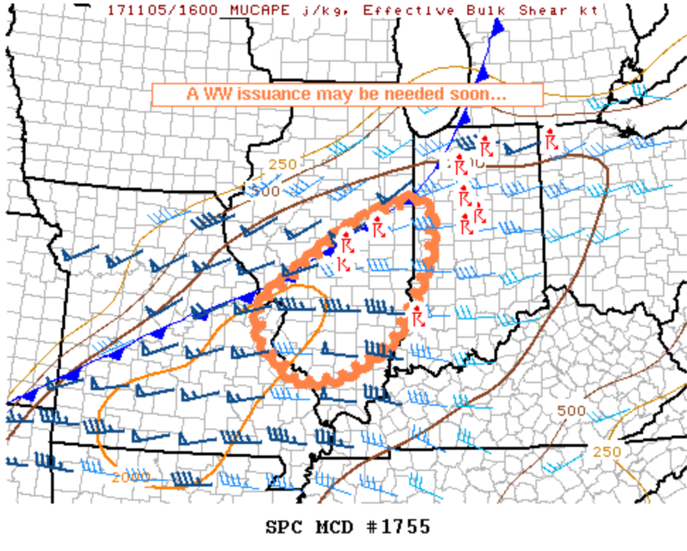
A tornado watch may be issued shortly for much of the area
http://www.spc.noaa.gov/products/md/2017/md1755.html
12 PM update
A tornado watch will soon be issued for portions of southern Illinois. Some Missouri counties may also be added.
Latest information can be viewed here – Click Here
11:15 AM
I am anticipating a tornado or severe thunderstorm watch to be issued by mid-afternoon. It will likely cover a decent chunk of our local area.
Remember, a watch means to monitor updates. A warning means to see shelter.
10:55 AM update
Future-cast radar loop from the Hrrrx model. This takes us from this afternoon into tonight.
The time is in Zulu. The time stamp on the right side is eastern time. 22z would be 4 pm. 00z would be 6 pm. 02z would be 8 pm.
Click to enlarge the animation.
10:30 AM update
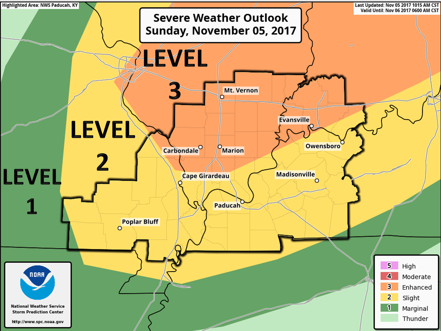
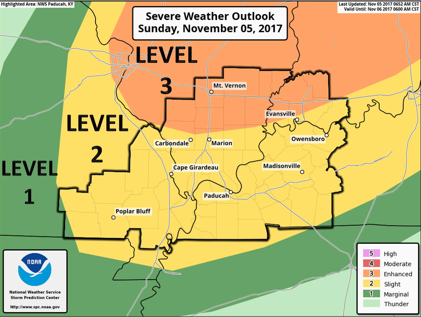
Latest SPC outlook. They continue to shift things further south and west. Don’t get too caught up in the colors. Weather does not follow our colors.
Future-cast radar. This is model guidance. Model’s aren’t gospel. This is what radar could look like later this afternoon.
4 pm
5 pm
6 pm
Eastern view
4 pm

5 pm
6 pm
7 pm
8 pm
9 pm
9 AM UPDATE
SPC shifted their greater risk zone further south and west. This was expected.
9 AM UPDATE
Facebook discussion on today’s storms.
https://wtalk.co/A3KEHNDJ
Here is the latest Hrrr model guidance. This is the future-cast radar. This shows you what radar MIGHT look like later today.
November 5, 2017
Update number one. This updated expires at 2 PM.
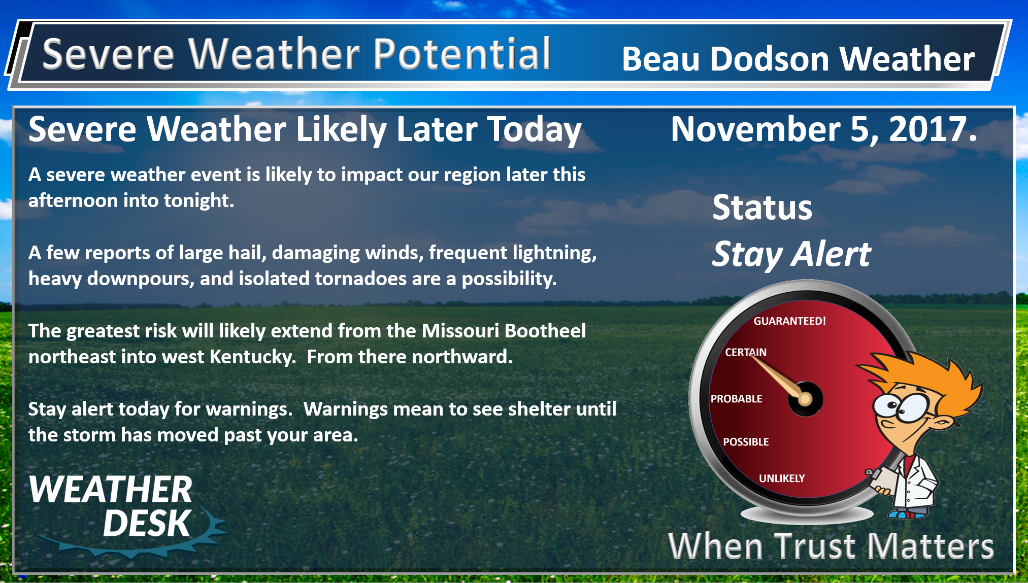
Severe Storms Likely Later Today and Tonight.
I will be utilizing the texting service today for tornadoes and other severe weather. Make sure you have turned on WeatherOne. This is text option one. It is the most important text. If tornadoes occur, then you will receive frequent texts for your county.
Don’t forget to download and use the app. The app receives the text messages instantly. ATT and Verizon can take longer to send them out. Minutes count when tornadoes are occurring.
You can sign up for those app/text messages at www.beaudodsonweather.com Remember, it is $3 a month and that helps cover all the costs of this day.
The entire forecast discussion will be centered on storm chances today and tonight.
If you were with me yesterday you might have read that I thought the Storm Prediction Center severe weather outlook was incorrect. It needed to be moved south and west. They did that earlier this morning.
A strong cold front is going to move into the region later today. Warm and moist air blankets our region. Dew points are more like summer than autumn.
Gusty southerly winds will reach 25 to 35 mph speeds. Some gusts above 35 likely. These are gradient winds because of pressure changes in the atmosphere. A strong low level just also blankets the region.
Thunderstorms will become most numerous after 3 or 4 pm today. There should be a few storms before then, but odds favor later in the day vs earlier for the greater coverage.
Storms that form early will move from the southwest towards the northeast. Storms that form later will move northwest to southeast. Storm movement will be greater than 50 mph. Fast moving storms.
A band of severe storms will likely form from Farmington, MO towards Mt Vernon, IL between 3 and 4 pm. Give or take. The line will then push south and east.
Keep in mind, storms may form ahead of this line, as well.
The line would approach Cape Girardeau to Marion, IL and northeast of there between 4 PM and 6 PM. Again, give or take and subject to adjustments.
The main concern today will be large hail and damaging winds. Isolated tornadoes can not be ruled out.
This is a classic November severe weather setup.
I do expect tornado watches to be issued for our region later this afternoon into tonight. I do expect quite a few warnings to be issued.
A watch means to keep an eye on the weather. A warning means to seek shelter.
It is not possible to tell you what your county will receive. The best I can do is tell you the potential of the atmosphere. The details are worked out once storms form and are moving into your area.


We offer regional radars and local city radars – if a radar does not update then try another one. Occasional browsers need their cache cleared. You may also try restarting your browser. This will usually fix any problems.
During the winter you can track snow and ice by clicking the winterize button on the local city view interactive radars.
You may email me at beaudodson@usawx.com
Interactive Weather Radar Page. Choose the city nearest your location: Click this link
National interactive radar: Click this link.
Are you subscribing to Weather Talk app/text messages and videos? This is what helps support all of the data you see each day.
We now offer premium videos for the short and long-range forecasts! These videos are produced by a team of long-range forecast experts. They are brought to you as bonus information. Activate text option four in order to receive these on your app or via text.
Subscribe at www.beaudodsonweather.com
We offer an Apple and Android app (scroll to the bottom of this page for more information).
Your $3 a month helps cover the following monthly costs. These are my out of pocket expenses.
We offer an Apple and Android app (scroll to the bottom of this page for more information).
.
The Beau Dodson Weather APP is ready for Apple and Android users. The app provides a faster way for you to receive my text messages. ATT and Verizon are not always reliable when it comes to speed.
Some of you have asked if you can receive the texts on your phone and the app. The answer to that is, yes. The Android app will automatically allow that to happen. On the Apple app, however, you will need to open your app and click the settings button. Make sure the green tab is OFF. Off means you will still receive the texts to your phone and the app. If you have any questions, then email me at beaudodson@usawx.com
The app is for text subscribers.
The direct download, for the Apple app, can be viewed here
https://itunes.apple.com/us/app/id1190136514
Here is the download link for the Android version Click Here
If you have not signed up for the texting service then you may do so at www.beaudodsonweather.com


——————————————————–
Your support helps with the following:

and

.

Whom do you trust for your weather information?
I have studied weather, in our region, since the late 1970’s. I have 40 years of experience in observing our regions weather patterns. My degree is in Broadcast Meteorology and a Bachelor’s of Science.
My resume includes:
Member of the American Meteorological Society.
NOAA Weather-Ready Nation Ambassador.
Meteorologist for McCracken County Emergency Management. I served from 2005 through 2015.
Meteorologist for McCracken County Rescue. 2015 through current
I own and operate the Southern Illinois Weather Observatory.
I am the chief meteorologist for Weather Talk LLC.
I am also a business owner in western Kentucky.
Recipient of the Mark Trail Award, WPSD Six Who Make A Difference Award, Kentucky Colonel, and the Caesar J. Fiamma” Award from the American Red Cross.
In 2005, I helped open the largest American Cross shelter in U.S. history. This was in Houston, Texas. I was deployed to help with the aftermath of Hurricane Katrina and Hurricane Rita. I was a shelter manager of one of the Houston, Texas shelter divisions.
In 2009 I was presented with the Kentucky Office of Highway Safety Award.
Recognized by the Kentucky House of Representatives for my service to the State of Kentucky leading up to several winter storms and severe weather outbreaks.
If you click on the image below you can read the Kentucky House of Representatives Resolution.

I am President of the Shadow Angel Foundation which serves portions of western Kentucky and southern Illinois.
There is a lot of noise on the internet. A lot of weather maps are posted without explanation. You need a trusted source for information.
My forecast philosophy is simple and straight forward.
- Communicate in simple terms
- To be as accurate as possible within a reasonable time frame before an event
- Interact with you on Twitter, Facebook, email, texts, and this blog
- Minimize the “hype” that you might see through other weather sources
- Push you towards utilizing wall-to-wall LOCAL TV coverage during severe weather events

Sign up for my AWARE email by clicking here.
I typically send AWARE emails before severe weather, winter storms, or other active weather situations. I do not email watches or warnings. The emails are a basic “heads up” concerning incoming weather conditions