November 4, 2018
Remember, severe weather forecasts often times comes down to six to twelve hours before the event. Thus, checking back is important.
My current thoughts on Monday’s severe weather risk.
Medium confidence.
There are questions above the placement of the area of low pressure. Any adjustments in its track will have an impact on our severe weather concerns.
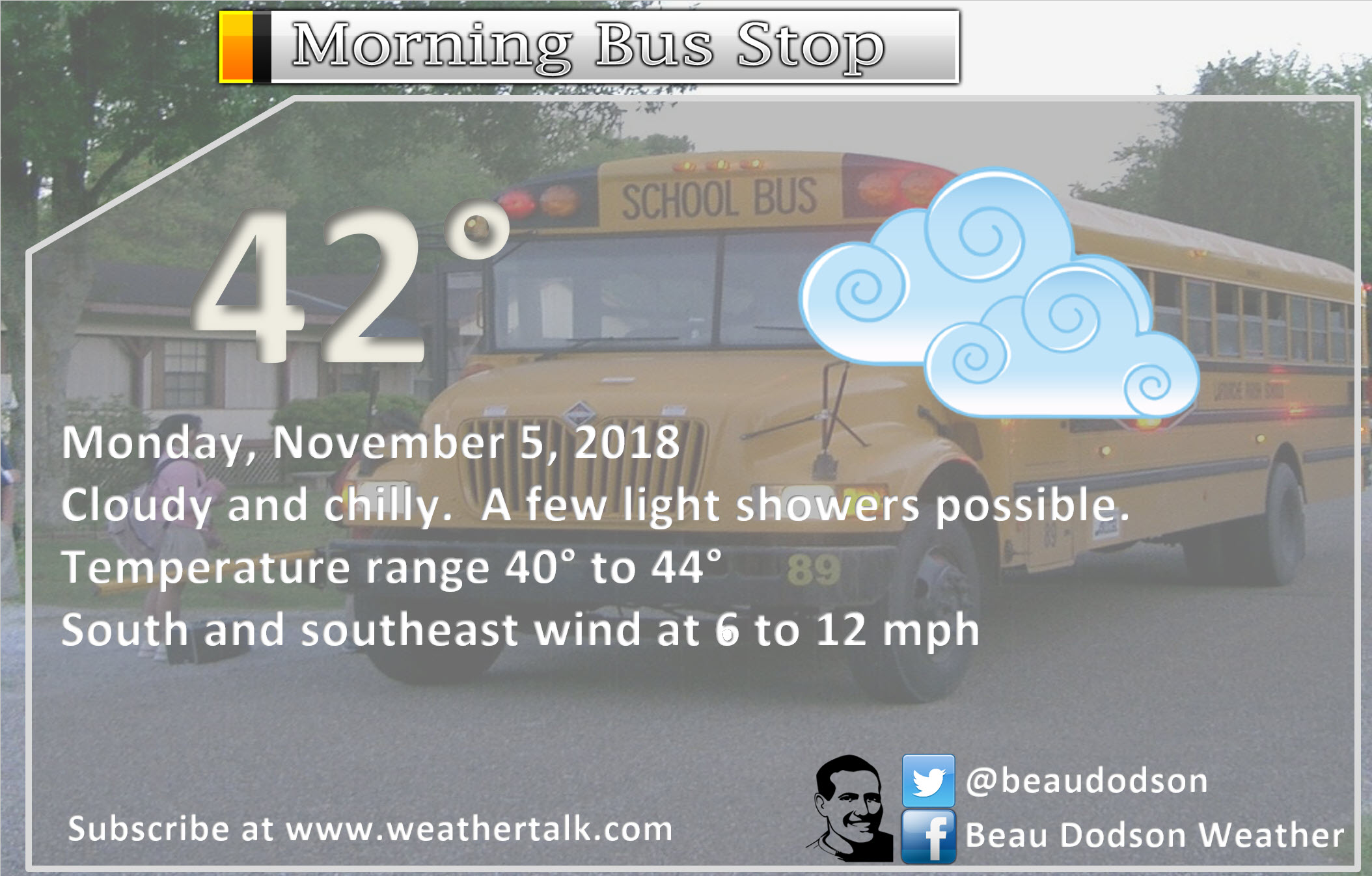
1. Mostly dry Monday morning.
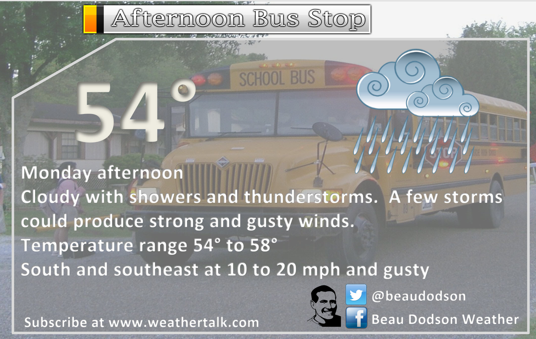
2. Widespread showers and some thunderstorms developing during Monday afternoon into the evening hours.
3. Rain ends west to east Monday night.
4. Strong winds will be possible with any thunderstorms that form.
5. Strong and gusty winds along the cold front, as well.
A few of the thunderstorms could be intense. This is especially true across portions of Kentucky and Tennessee.
Severe weather is not uncommon during the autumn months. As a matter of fact, many of our deadly tornadoes occur during late October and November.
Currently, the Storm Prediction Center/NOAA has placed a large chunk of our region in a level three out of five risk of severe storms and tornadoes during Monday afternoon and night.
One is the lowest risk on their scale. Five is the highest risk on their scale.
Based on most data, I am having a difficult time understanding the reasoning of the risk for a significant portion of our region.
There is a lack of higher dew points. There is little or no CAPE (CAPE is basically energy for thunderstorms to tap into).
If CAPE does develop then my concerns would increase for a larger portion of the region. For now, I continue to monitor trends.
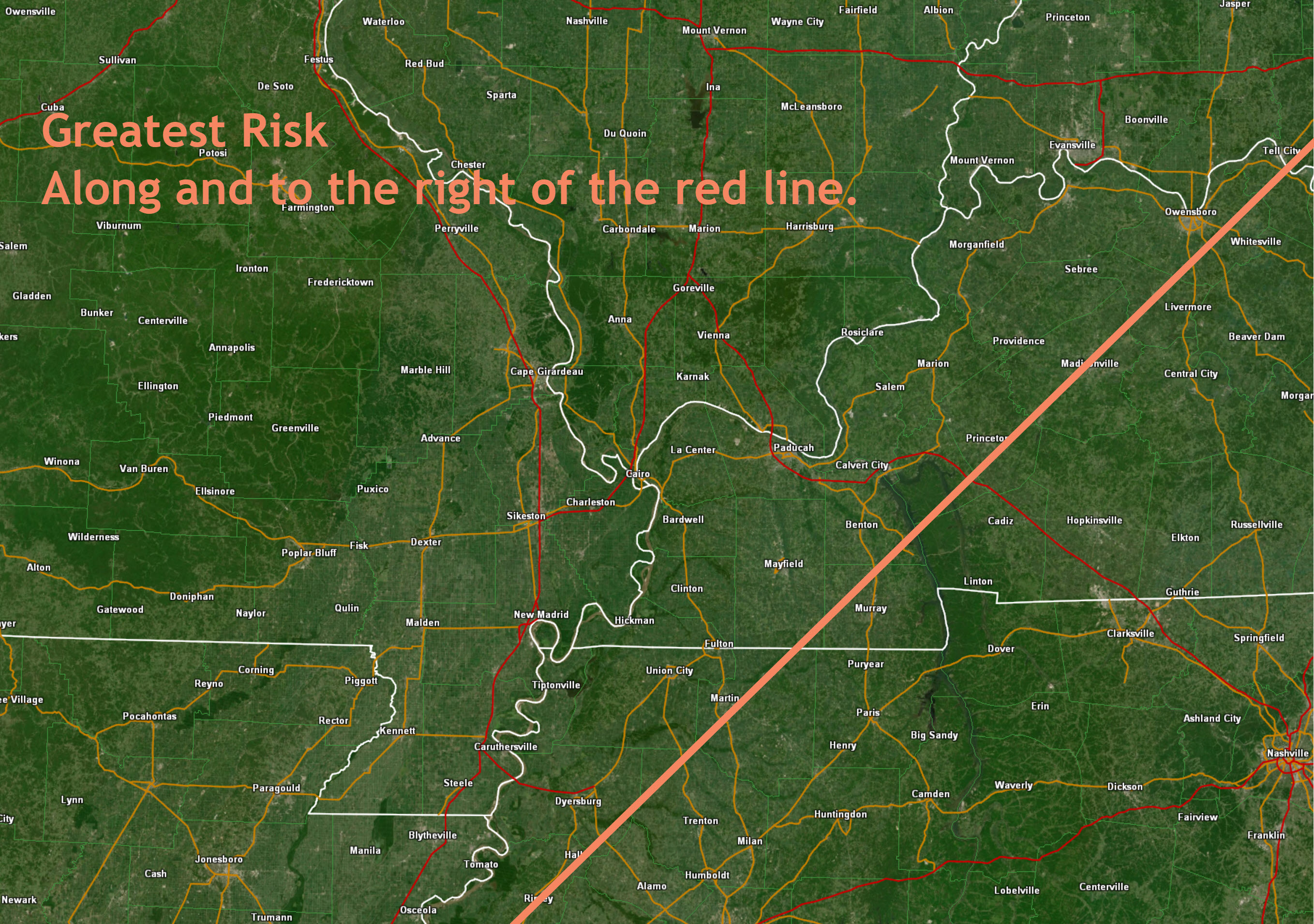
I currently have the greatest risk of severe weather along and east of a line from Madisonville, Kentucky to Murray, Kentucky and then southwest towards Memphis, Tennessee.
West of that line is questionable (a least for verified severe weather). Severe weather would be thunderstorms producing 58 mph winds and tornadoes.
If the area of low pressure tracks further northwest, then more of our region would be impacted by severe thunderstorms. Monitor updates.
Typically, it isn’t until 12 to 18 hours before an event that the forecast is solidified. This event will be no different.
Small changes in the track of the system can have big impacts to our sensible weather.
Tornadoes are certainly possible in areas with CAPE.
Wind shear (turning of wind with height) will be high. Wind shear is one ingredient when considering severe weather.
There will be no lack of shear Monday afternoon and evening.
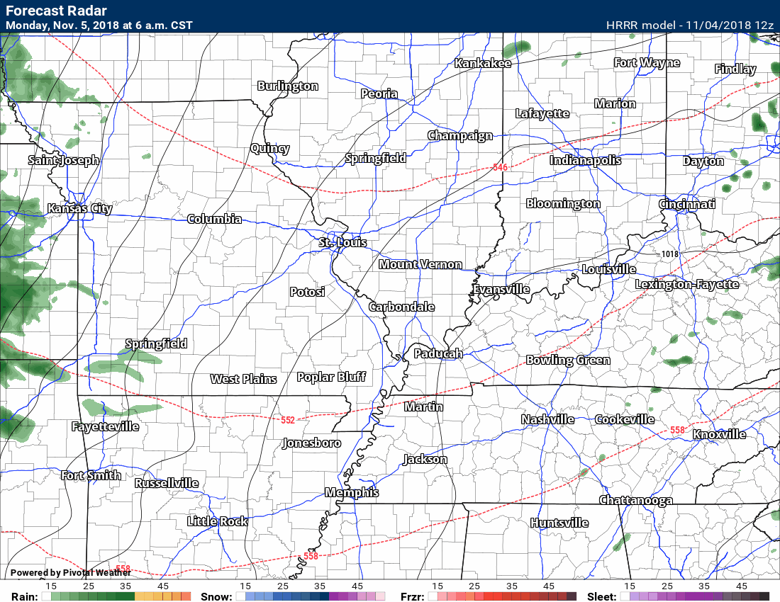
Here is the Hrrr model guidance future-cast radar. This is showing you Monday afternoon and evening.
The time-stamp is located in the upper left portion of the graphic.
Here is where the greatest risk will likely be.
Keep in mind, that does not mean there won’t be activity to the left of the line.