Welcome to 2019
Short holiday update. I wanted to update the Wednesday into Friday time-frame.
I have updated the daily forecast only.
A fresh new update will be posted tomorrow.
I have been tracking two winter storm systems. One Wednesday night and one on Thursday night/Friday.
For now, this is looking more and more like an all rain event.
I can’t completely rule out a wintry mix but the trends have been warmer.
As always, winter systems are tricky to forecast, at best.
Monitor updates moving forward.
Happy new year!
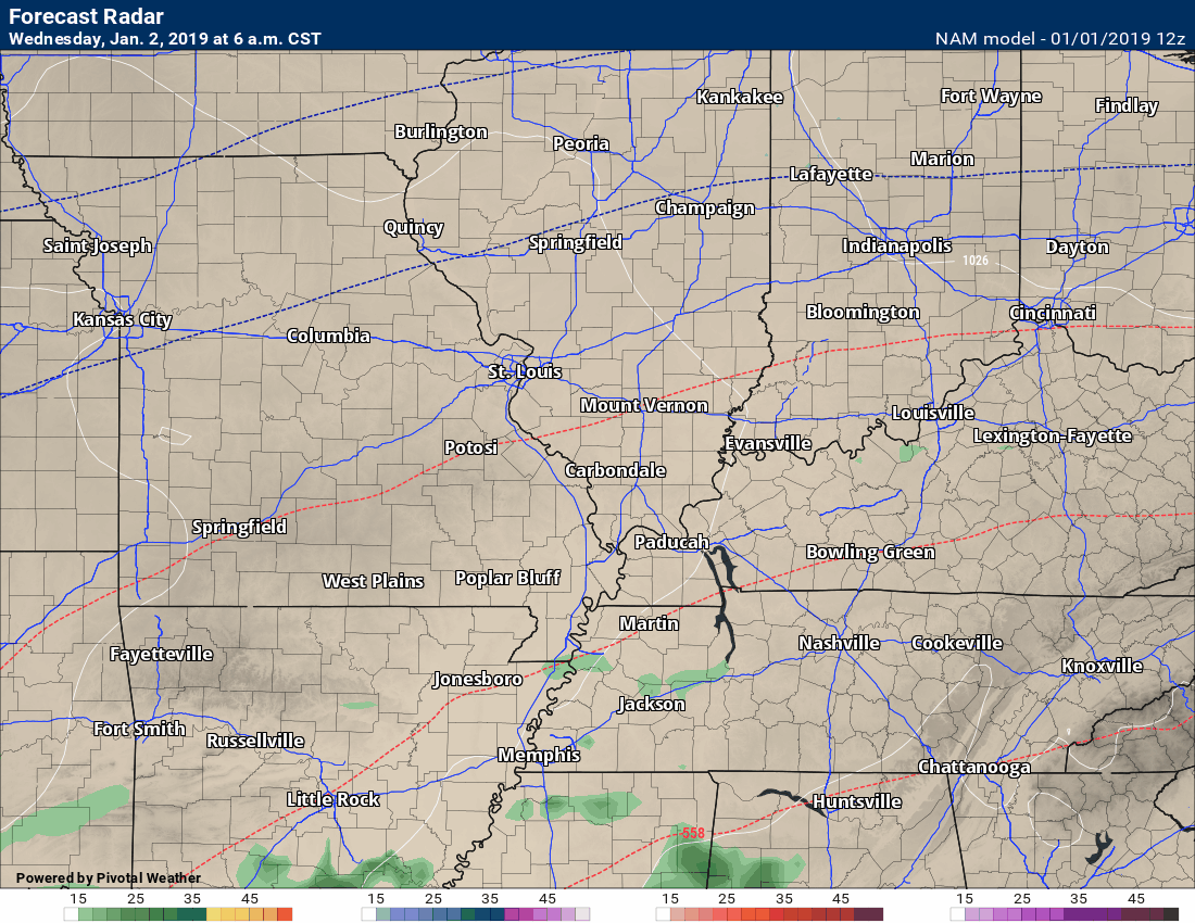
NAM future-cast radar shows you a couple of precipitation events. One Wednesday/Wednesday night and another one develops Thursday night/Friday.
January 1, 2018
Tuesday Forecast: A mix of sun and clouds. More clouds than sun. Patchy drizzle.
My confidence in the forecast verifying: High (80% confidence in the forecast)
Temperature range: MO ~ 36 to 44 IL ~ 36 to 44 KY ~ 40 to 45 TN ~ 40 to 45
Wind direction and speed: North and northwest at 6 to 12 mph with gusts to 15 mph
Wind chill (feels like) temperature forecast: 25 to 35
What is the chance/probability of precipitation? MO ~ 20% IL ~ 20% KY ~ 20% TN ~ 0%
Coverage of precipitation: None
Is flash flooding anticipated? No
Is accumulating snow or ice anticipated? No
Is non-accumulating snow or ice anticipated? No
Are icy road conditions anticipated? No
Is severe weather expected? No
The NWS officially defines severe weather as 58 mph wind or great, 1″ hail or larger, and/or tornadoes
Will lightning be possible? No
What impacts are anticipated from the weather? None
Should I cancel my outdoor plans? No
Will the weather impact my outdoor plans? None
UV Index: 2 to 3 Low
Sunrise: 7:10 AM
Tuesday Night Forecast Details:
Forecast: Mostly cloudy. Cool. Patchy drizzle.
My confidence in the forecast verifying: High (80% confidence in the forecast)
Temperature range: MO ~ 26 to 32 IL ~ 264 to 32 KY ~ 30 to 35 TN ~ 30 to 35
Wind direction and speed: North at 5 to 10 mph
Wind chill (feels like) temperature forecast: 20 to 30
What is the chance/probability of precipitation? MO ~ 20% IL ~ 20% KY ~ 20% TN ~ 0%
Coverage of precipitation: Patchy drizzle
Is flash flooding anticipated? No
Is accumulating snow or ice anticipated? No
Is non-accumulating snow or ice anticipated? No
Are icy road conditions anticipated? Most likely no. Monitor bridges late tonight if drizzle continues.
Is severe weather expected? No
The NWS officially defines severe weather as 58 mph wind or great, 1″ hail or larger, and/or tornadoes
Will lightning be possible? No
What impacts are anticipated from the weather? Most likely none. Monitor drizzle overnight. Cold services could freeze if the drizzle continues.
Should I cancel my outdoor plans? No
Will the weather impact my outdoor plans? No
Sunset: 4:48 PM
Moonrise: 2:56 AM Waning Crescent
Moonset: 1:53 PM
January 2, 2018
Wednesday Forecast: Increasing clouds. Cool. A southern system may clip our local area.
My confidence in the forecast verifying: Medium (50% confidence in the forecast)
Temperature range: MO ~ 38 to 42 IL ~ 38 to 42 KY ~ 38 to 44 TN ~ 40 to 45
Wind direction and speed: West and northwest at 6 to 12 mph
Wind chill (feels like) temperature forecast: 25 to 35
What is the chance/probability of precipitation? MO ~ 20% IL ~ 0% KY ~ 20% TN ~ 30%
Coverage of precipitation: Scattered (southern counties)
Is flash flooding anticipated? No
Is accumulating snow or ice anticipated? No
Is non-accumulating snow or ice anticipated? No
Are icy road conditions anticipated? No
Is severe weather expected? No
The NWS officially defines severe weather as 58 mph wind or great, 1″ hail or larger, and/or tornadoes
Will lightning be possible? No
What impacts are anticipated from the weather? None to a few wet roadways in NW TN
Should I cancel my outdoor plans? No
Will the weather impact my outdoor plans? For most areas, no. Monitoring our southern counties as a system may clip us.
UV Index: 2 to 3 Low
Sunrise: 7:10 AM
Wednesday Night Forecast Details:
Forecast: Cloudy. A shower possible over NW Tennessee.
My confidence in the forecast verifying: Medium (60% confidence in the forecast)
Temperature range: MO ~ 26 to 34 IL ~ 26 to 34 KY ~ 30 to 34 TN ~ 32 to 34
Wind direction and speed: West at 6 to 12 mph
Wind chill (feels like) temperature forecast: 20 to 30
What is the chance/probability of precipitation? MO ~ 10% IL ~ 0% KY ~ 20% TN ~ 30%
Coverage of precipitation: Isolated in northwest TN
Is flash flooding anticipated? No
Is accumulating snow or ice anticipated? No
Is non-accumulating snow or ice anticipated? No
Are icy road conditions anticipated? No
Is severe weather expected? No
The NWS officially defines severe weather as 58 mph wind or great, 1″ hail or larger, and/or tornadoes
Will lightning be possible? No
Should I cancel my outdoor plans? No
What impacts are anticipated from the weather? Perhaps some wet roadways in NW Tennessee. Most areas will remain dry.
Will the weather impact my outdoor plans? Most likely no
Sunset: 4:49 PM
Moonrise: 3:56 AM Waning Crescent
Moonset: 2:30 PM
January 3, 2018
Thursday Forecast: Intervals of clouds. Chilly.
My confidence in the forecast verifying: Medium (60% confidence in the forecast)
Temperature range: MO ~ 42 to 45 IL ~ 42 to 46 KY ~ 42 to 46 TN ~ 43 to 46
Wind direction and speed: East and northeast at 6 to 12 mph
Wind chill (feels like) temperature forecast:
What is the chance/probability of precipitation? MO ~ 0% IL ~ 0% KY ~ 0% TN ~ 10%
Coverage of precipitation: Most likely none but monitor updates.
Is flash flooding anticipated? No
Is accumulating snow or ice anticipated? No
Is non-accumulating snow or ice anticipated? No
Are icy road conditions anticipated? No
Is severe weather expected? No
The NWS officially defines severe weather as 58 mph wind or great, 1″ hail or larger, and/or tornadoes
Will lightning be possible? No
What impacts are anticipated from the weather? Most likely none
Should I cancel my outdoor plans? No
Will the weather impact my outdoor plans? No
UV Index: 2 Low
Sunrise: 7:10 AM
Thursday Night Forecast Details:
Forecast: Intervals of clouds. Chilly. A slight chance of rain showers late.
My confidence in the forecast verifying: Medium (40% confidence in the forecast)
Temperature range: MO ~ 30 to 35 IL ~ 30 to 35 KY ~ 32 to 36 TN ~ 33 to 36
Wind direction and speed: Northeast at 6 to 12 mph
Wind chill (feels like) temperature forecast: 15 to 25
What is the chance/probability of precipitation? MO ~ 20% IL ~ 20% KY ~ 20% TN ~ 20%
Coverage of precipitation: None to isolated
Is flash flooding anticipated? No
Is accumulating snow or ice anticipated? No
Is non-accumulating snow or ice anticipated? Monitor
Are icy road conditions anticipated? No
Is severe weather expected? No
The NWS officially defines severe weather as 58 mph wind or great, 1″ hail or larger, and/or tornadoes
Will lightning be possible? No
Should I cancel my outdoor plans? No
What impacts are anticipated from the weather? None to isolated wet roadways. Most areas will remain dry.
Will the weather impact my outdoor plans? No
Sunset: 4:49 PM
Moonrise: 4:56 AM Waning Crescent
Moonset: 3:11 PM
The key to Friday’s forecast will be how far south the low-pressure center tracks.
It has been trending further south. If it goes too far south then much of the area would remain dry.
Confidence in the forecast, for now, is rather low.
January 4, 2018
Friday Forecast: Cloudy with a few rain showers.
My confidence in the forecast verifying: LOW (30% confidence in the forecast)
Temperature range: MO ~ 42 to 46 IL ~ 43 to 46 KY ~ 43 to 46 TN ~ 44 to 46
Wind direction and speed: North and northeast at 10 to 20 mph
Wind chill (feels like) temperature forecast: 30 to 40
What is the chance/probability of precipitation? MO ~ 30% IL ~ 30% KY ~ 40% TN ~ 40%
Coverage of precipitation: Scattered
Is flash flooding anticipated? No
Is accumulating snow or ice anticipated? No
Is non-accumulating snow or ice anticipated? Unlikely
Are icy road conditions anticipated? No
Is severe weather expected? Monitor updates
The NWS officially defines severe weather as 58 mph wind or great, 1″ hail or larger, and/or tornadoes
Will lightning be possible? Monitor updates
What impacts are anticipated from the weather? Wet roadways.
Should I cancel my outdoor plans? No, but check radars and updates.
Will the weather impact my outdoor plans? Damp conditions are possible.
UV Index: 2 Low
Sunrise: 7:10 AM
Friday Night Forecast Details:
Forecast: Mostly cloudy. A few rain showers before midnight.
My confidence in the forecast verifying: Medium (40% confidence in the forecast)
Temperature range: MO ~ 28 to 32 IL ~ 28 to 32 KY ~ 28 to 32 TN ~ 30 to 34
Wind direction and speed: West and northwest at 7 to 14 mph
Wind chill (feels like) temperature forecast:
What is the chance/probability of precipitation? MO ~ 20% IL ~ 30% KY ~ 30% TN ~30%
Coverage of precipitation: Ending west to east
Is flash flooding anticipated? No
Is accumulating snow or ice anticipated? No
Is non-accumulating snow or ice anticipated? No
Are icy road conditions anticipated? No
Is severe weather expected? No
The NWS officially defines severe weather as 58 mph wind or great, 1″ hail or larger, and/or tornadoes
Will lightning be possible? No
Should I cancel my outdoor plans? No, but check radars
What impacts are anticipated from the weather? Maybe some wet roadways.
Will the weather impact my outdoor plans? Early in the night, there could be damp conditions.
Sunset: 4:50 PM
Moonrise: 5:53 AM Waning Crescent
Moonset: 3:55 PM
January 5, 2018
Saturday Forecast: Partly cloudy.
My confidence in the forecast verifying: Medium (60% confidence in the forecast)
Temperature range: MO ~ 50 to 54 IL ~ 50 to 54 KY ~ 50 to 54 TN ~ 52 to 54
Wind direction and speed: West and southwest at 5 to 10 mph
Wind chill (feels like) temperature forecast:
What is the chance/probability of precipitation? MO ~ 0% IL ~ 0% KY ~ 0% TN ~ 0%
Coverage of precipitation: None
Is flash flooding anticipated? No
Is accumulating snow or ice anticipated? No
Is non-accumulating snow or ice anticipated? No
Are icy road conditions anticipated? No
Is severe weather expected? No
The NWS officially defines severe weather as 58 mph wind or great, 1″ hail or larger, and/or tornadoes
Will lightning be possible? No
What impacts are anticipated from the weather? None
Should I cancel my outdoor plans? No
Will the weather impact my outdoor plans? None
UV Index: 3 Low
Sunrise: 7:10 AM
Saturday Night Forecast Details:
Forecast: Mostly clear.
My confidence in the forecast verifying: Medium (60% confidence in the forecast)
Temperature range: MO ~ 32 to 36 IL ~ 32 to 36 KY ~ 32 to 36 TN ~ 34 to 38
Wind direction and speed: Southwest at 5 mph
Wind chill (feels like) temperature forecast: 28 to 34
What is the chance/probability of precipitation? MO ~ 0% IL ~ 0% KY ~ 0% TN ~ 0%
Coverage of precipitation: None
Is flash flooding anticipated? No
Is accumulating snow or ice anticipated? No
Is non-accumulating snow or ice anticipated? No
Are icy road conditions anticipated? No
Is severe weather expected? No
The NWS officially defines severe weather as 58 mph wind or great, 1″ hail or larger, and/or tornadoes
Will lightning be possible? No
Should I cancel my outdoor plans? No
What impacts are anticipated from the weather? None
Will the weather impact my outdoor plans? No
Sunset: 4:51 PM
Moonrise: 6:45 AM Waning Crescent
Moonset: 4:43 PM
January 6, 2018
Sunday Forecast: Mostly sunny. A few clouds. Mild for January.
My confidence in the forecast verifying: Medium (40% confidence in the forecast)
Temperature range: MO ~ 52 to 54 IL ~ 52 to 54 KY ~ 52 to 54 TN ~ 52 to 54
Wind direction and speed: South at 6 to 12 mph
Wind chill (feels like) temperature forecast:
What is the chance/probability of precipitation? MO ~ 0% IL ~ 0% KY ~ 0% TN ~ 0%
Coverage of precipitation: None
Is flash flooding anticipated? No
Is accumulating snow or ice anticipated? No
Is non-accumulating snow or ice anticipated? No
Are icy road conditions anticipated? No
Is severe weather expected? No
The NWS officially defines severe weather as 58 mph wind or great, 1″ hail or larger, and/or tornadoes
Will lightning be possible? No
What impacts are anticipated from the weather? None
Should I cancel my outdoor plans? No
Will the weather impact my outdoor plans? None
UV Index: 3 Low
Sunrise: 7:10 AM
Sunday Night Forecast Details:
Forecast: Becoming cloudy. A slight chance of rain showers late at night.
My confidence in the forecast verifying: Medium (40% confidence in the forecast)
Temperature range: MO ~ 38 to 44 IL ~ 38 to 44 KY ~ 40 to 44 TN ~ 40 to 45
Wind direction and speed: South and southeast at 7 to 14 mph
Wind chill (feels like) temperature forecast:
What is the chance/probability of precipitation? MO ~ 20% IL ~ 20% KY ~ 20% TN ~ 20%
Coverage of precipitation: None to isolated late
Is flash flooding anticipated? No
Is accumulating snow or ice anticipated? No
Is non-accumulating snow or ice anticipated? No
Are icy road conditions anticipated? No
Is severe weather expected? No
The NWS officially defines severe weather as 58 mph wind or great, 1″ hail or larger, and/or tornadoes
Will lightning be possible? No
Should I cancel my outdoor plans? No
What impacts are anticipated from the weather? None to isolated wet roadways late
Will the weather impact my outdoor plans? No
Sunset: 4:52 PM
Moonrise: 7:35 AM New
Moonset: 5:33 PM
January 7, 2018
Monday Forecast: Mostly cloudy. Rain showers possible. Mild.
My confidence in the forecast verifying: Medium (40% confidence in the forecast)
Temperature range: MO ~ 53 to 56 IL ~ 53 to 56 KY ~ 54 to 58 TN ~ 54 to 58
Wind direction and speed: South at 6 to 12 mph with gusts to 20 mph
Wind chill (feels like) temperature forecast:
What is the chance/probability of precipitation? MO ~ 40% IL ~ 40% KY ~ 40% TN ~ 40%
Coverage of precipitation: Scattered
Is flash flooding anticipated? No
Is accumulating snow or ice anticipated? No
Is non-accumulating snow or ice anticipated? No
Are icy road conditions anticipated? No
Is severe weather expected? No
The NWS officially defines severe weather as 58 mph wind or great, 1″ hail or larger, and/or tornadoes
Will lightning be possible? No
What impacts are anticipated from the weather? Wet roadways
Should I cancel my outdoor plans? No, but monitor updates and radars
Will the weather impact my outdoor plans? There may be damp conditions.
UV Index: 1 to 2 Low
Sunrise: 7:10 AM
Monday Night Forecast Details:
Forecast: Cloudy. Rain showers possible.
My confidence in the forecast verifying: Medium (40% confidence in the forecast)
Temperature range: MO ~ 38 to 44 IL ~ 38 to 44 KY ~ 40 to 44 TN ~ 42 to 45
Wind direction and speed: Southwest becoming more westerly at 5 to 10 mph with gusts to 15 mph
Wind chill (feels like) temperature forecast:
What is the chance/probability of precipitation? MO ~ 40% IL ~ 40% KY ~ 40% TN ~ 40%
Coverage of precipitation: Scattered
Is flash flooding anticipated? No
Is accumulating snow or ice anticipated? No
Is non-accumulating snow or ice anticipated? No
Are icy road conditions anticipated? No
Is severe weather expected? No
The NWS officially defines severe weather as 58 mph wind or great, 1″ hail or larger, and/or tornadoes
Will lightning be possible? No
Should I cancel my outdoor plans? No
What impacts are anticipated from the weather? Wet roadways.
Will the weather impact my outdoor plans? Some damp conditions are possible early in the night. Monitor updates. The timing of the rain ending is still a question.
Sunset: 4:53 PM
Moonrise: 8:17 AM Waxing Crescent
Moonset: 6:29 PM
January 8, 2018
Tuesday Forecast: Partly sunny. Rain showers ending. The day may end up dry.
My confidence in the forecast verifying: Medium (40% confidence in the forecast)
Temperature range: MO ~ 48 to 54 IL ~ 48 to 54 KY ~ 50 to 54 TN ~ 52 to 55
Wind direction and speed: Northwest at 5 to 10 mph with gusts to 18 mph
Wind chill (feels like) temperature forecast:
What is the chance/probability of precipitation? MO ~ 10% IL ~ 10% KY ~ 20% TN ~ 20%
Coverage of precipitation: Ending
Is flash flooding anticipated? No
Is accumulating snow or ice anticipated? No
Is non-accumulating snow or ice anticipated? No
Are icy road conditions anticipated? No
Is severe weather expected? No
The NWS officially defines severe weather as 58 mph wind or great, 1″ hail or larger, and/or tornadoes
Will lightning be possible? No
What impacts are anticipated from the weather? Perhaps some remaining wet roadways
Should I cancel my outdoor plans? No, but check radars
Will the weather impact my outdoor plans? It may be damp
UV Index: 2 Low
Sunrise: 7:10 AM
Tuesday Night Forecast Details:
Forecast: Mostly clear. Patchy fog.
My confidence in the forecast verifying: Medium (40% confidence in the forecast)
Temperature range: MO ~ 36 to 44 IL ~ 36 to 44 KY ~ 36 to 44 TN ~ 36 to 44
Wind direction and speed: North and northwest at 4 to 8 mph
Wind chill (feels like) temperature forecast:
What is the chance/probability of precipitation? MO ~ 0% IL ~ 0% KY ~ 0% TN ~ 0%
Coverage of precipitation: None
Is flash flooding anticipated? No
Is accumulating snow or ice anticipated? No
Is non-accumulating snow or ice anticipated? No
Are icy road conditions anticipated? No
Is severe weather expected? No
The NWS officially defines severe weather as 58 mph wind or great, 1″ hail or larger, and/or tornadoes
Will lightning be possible? No
Should I cancel my outdoor plans? No
What impacts are anticipated from the weather? Monitor the chance of fog. Lower visibility if fog develops.
Will the weather impact my outdoor plans? No
Sunset: 4:54 PM
Moonrise: 8:56 AM Waxing Crescent
Moonset: 7:23 PM
January 9, 2018
Wednesday Forecast: Mostly sunny.
My confidence in the forecast verifying: Medium (40% confidence in the forecast)
Temperature range: MO ~ 48 to 54 IL ~ 48 to 54 KY ~ 48 to 54 TN ~ 48 to 54
Wind direction and speed:
Wind chill (feels like) temperature forecast:
What is the chance/probability of precipitation? MO ~ 0% IL ~ 0% KY ~ 0% TN ~ 0%
Coverage of precipitation: None
Is flash flooding anticipated? No
Is accumulating snow or ice anticipated? No
Is non-accumulating snow or ice anticipated? No
Are icy road conditions anticipated? No
Is severe weather expected? No
The NWS officially defines severe weather as 58 mph wind or great, 1″ hail or larger, and/or tornadoes
Will lightning be possible? No
What impacts are anticipated from the weather? None
Should I cancel my outdoor plans? No
Will the weather impact my outdoor plans? No
UV Index: 3 Low to medium
Sunrise: 7:10 AM
Wednesday Night Forecast Details:
Forecast: Mostly clear.
My confidence in the forecast verifying: Medium (40% confidence in the forecast)
Temperature range: MO ~ 36 to 44 IL ~ 36 to 44 KY ~ 36 to 44 TN ~ 36 to 44
Wind direction and speed: North and northwest at 4 to 8 mph
Wind chill (feels like) temperature forecast:
What is the chance/probability of precipitation? MO ~ 0% IL ~ 0% KY ~ 0% TN ~ 0%
Coverage of precipitation: None
Is flash flooding anticipated? No
Is accumulating snow or ice anticipated? No
Is non-accumulating snow or ice anticipated? No
Are icy road conditions anticipated? No
Is severe weather expected? No
The NWS officially defines severe weather as 58 mph wind or great, 1″ hail or larger, and/or tornadoes
Will lightning be possible? No
Should I cancel my outdoor plans? No
What impacts are anticipated from the weather? None
Will the weather impact my outdoor plans? No
Sunset: 4:55 PM
Moonrise: 9:31 AM Waxing Crescent
Moonset: 8:21 PM