Are you missing out? Want to help cover monthly operating costs?
WeatherTalk monthly operating costs can top $2000.00. Your $3 subscription helps pay for those costs. I work for you.
For $3 a month you can receive the following. You may choose to receive these via your WeatherTalk app or regular text messaging.
- Severe weather app/text alerts from my keyboard to your app/cell phone. These are hand typed by Beau. During tornado outbreaks, you will receive numerous app/text messages telling you exactly where the tornado is located.
- Daily forecast app/texts from my computer to your app/cell phone.
- Social media links sent directly to your app/cell phone. When I update the blog, videos, or Facebook you will receive the link.
- AWARE emails. These emails keep you well ahead of the storm. They give you several days of lead time before significant weather events.
- Direct access to Beau via text and email. Your very own personal meteorologist. I work for you!
- Missouri and Ohio Valley centered video updates
- Long-range weather videos
- Week one, two, three and four temperature and precipitation outlooks.
- Monthly outlooks.
- Your subscription also will help support several local charities.
Haven’t you subscribed? Subscribe at www.beaudodsonweather.com

Example of a recent severe weather alert. I issued this well before the official tornado warning. You would have had plenty of time for you and your family to seek shelter.


Your $3 per month also helps support these local charity projects.

I encourage subscribers to use the app vs regular text messaging. We have found text messaging to be delayed during severe weather. The app typically will receive the messages instantly. I recommend people have three to four methods of receiving their severe weather information.
Remember, my app and text alerts are hand typed and not computer generated. You are being given personal attention during significant weather events.


March 5, 2018
Monday Forecast Details
Forecast: Cloudy. Showers. Breezy. Showers diminishing west to east as we move into the afternoon and evening.
Temperatures: MO ~ 52 to 56 IL ~ 52 to 56 KY ~ 52 to 56 NW TN ~ 54 to 58
What is the chance of precipitation? MO ~ 70% IL ~ 80% KY ~ 80% TN ~ 80%
Coverage of precipitation: Numerous
Winds: Southeast and south at 10 to 20 mph and gusty
What impacts are anticipated from the weather? Wet roadways.
My confidence in the forecast verifying: High
Is severe weather expected? No
The NWS defines severe weather as 58 mph wind or great, 1″ hail or larger, and/or tornadoes
Should I cancel my outdoor plans? Have a plan B.
Monday Night Forecast Details:
Forecast: Cloudy. An evening shower possible. Some clearing overnight. Colder.
Temperatures: MO ~ 34 to 38 IL ~ 33 to 36 KY ~ 35 to 38 NW TN ~ 36 to 40
What is the chance of precipitation? MO ~ 20% IL ~ 30% KY ~ 40% TN ~ 40%
Coverage of precipitation: Scattered early
Winds: West at 4 to 8 mph with gusts to 12 mph
What impacts are anticipated from the weather? Wet roadways early
My confidence in the forecast verifying: High
Is severe weather expected? No
The NWS defines severe weather as 58 mph wind or great, 1″ hail or larger, and/or tornadoes
Should I cancel my outdoor plans? Monitor radars
March 6, 2018
Tuesday Forecast Details
Wind Alert. Strong and gusty winds today.
Forecast: Becoming windy. Sunny during the morning. Clouds increasing from the north during the afternoon. A 20% of a shower or thundershower late in the day. Temperatures may fall late in the day, especially over our northern counties (northern parts of southeast Missouri and northern portions of southern Illinois).
Temperatures: MO ~ 54 to 58 IL ~ 53 to 56 KY ~ 54 to 58 TN ~ 55 to 58
What is the chance of precipitation? MO ~ 20% IL ~ 20% KY ~ 10% TN ~ 0%
Coverage of precipitation: Most likely none. Perhaps some isolated showers late in the day over our northern counties.
Winds: West at 10 to 20 mph with gusts to 40 mph. Winds may be variable in direction at times.
What impacts are anticipated from the weather? Strong winds. Isolated lightning late in the day over our northern counties. Low confidence on the lightning portion of the forecast.
My confidence in the forecast verifying: Medium (low confidence on the precipitation chances).
Is severe weather expected? No
The NWS defines severe weather as 58 mph wind or great, 1″ hail or larger, and/or tornadoes
Should I cancel my outdoor plans? No
Tuesday Night Forecast Details:
Forecast: Some clouds. A chance of rain or snow showers. Windy.
Temperatures: MO ~ 33 to 36 IL ~ 33 to 36 KY ~ 33 to 36 TN ~ 34 to 36
What is the chance of precipitation? MO ~ 30% IL ~ 30% KY ~ 30% TN ~ 20%
Coverage of precipitation: Isolated to perhaps scattered.
Winds: West at 10 to 20 mph with gusts to 35 mph
What impacts are anticipated from the weather? Strong winds. Perhaps some wet roadways.
My confidence in the forecast verifying: Medium
Is severe weather expected? No
The NWS defines severe weather as 58 mph wind or great, 1″ hail or larger, and/or tornadoes
Should I cancel my outdoor plans? No
March 7, 2018
Wednesday Forecast Details
Forecast: Morning clouds. Becoming partly cloudy. Breezy, at times. A 20% of a snow flurry or rain shower possible before 10 AM.
Temperatures: MO ~ 42 to 45 IL ~ 42 to 45 KY ~ 42 to 46 TN ~ 42 to 46
What is the chance of precipitation? MO ~ 10% IL ~ 20% KY ~ 20% TN ~ 10%
Coverage of precipitation: Most likely none. Perhaps isolated before 10 AM.
Winds: Northwest winds at 10 to 20 mph and gusty.
What impacts are anticipated from the weather? Most likely none.
My confidence in the forecast verifying: High
Is severe weather expected? No
The NWS defines severe weather as 58 mph wind or great, 1″ hail or larger, and/or tornadoes
Should I cancel my outdoor plans? No
Wednesday Night Forecast Details:
Forecast: Clearing. Cold.
Temperatures: MO ~ 24 to 28 IL ~ 24 to 28 KY ~ 25 to 28 TN ~ 26 to 30
What is the chance of precipitation? MO ~ 0% IL ~ 0% KY ~ 0% TN ~ 0%
Coverage of precipitation: None
Winds: North and northwest winds at 6 to 12 mph with gusts to 16
What impacts are anticipated from the weather? None
My confidence in the forecast verifying: High
Is severe weather expected? No
The NWS defines severe weather as 58 mph wind or great, 1″ hail or larger, and/or tornadoes
Should I cancel my outdoor plans? No
March 8, 2018
Thursday Forecast Details
Forecast: Partly to mostly sunny. Continued chilly.
Temperatures: MO ~ 42 to 46 IL ~ 38 to 44 KY ~ 43 to 46 TN ~ 44 to 46
What is the chance of precipitation? MO ~ 0% IL ~ 0% KY ~ 0% TN ~ 0%
Coverage of precipitation: None
Winds: West and northwest winds at 6 to 12 mph and gusty.
What impacts are anticipated from the weather? None
My confidence in the forecast verifying: High
Is severe weather expected? No
The NWS defines severe weather as 58 mph wind or great, 1″ hail or larger, and/or tornadoes
Should I cancel my outdoor plans? No
Sunrise 6:15 AM
Thursday Night Forecast Details:
Forecast: Mostly clear early. Some increase in clouds late. A slight chance of snow showers after midnight.
Temperatures: MO ~ 24 to 28 IL ~ 24 to 28 KY ~ 25 to 30 TN ~ 25 to 30
What is the chance of precipitation? MO ~ 20% IL ~ 20% KY ~ 10% TN ~ 10%
Coverage of precipitation: None to isolated
Winds: North and northwest winds at 5 to 10 mph with gusts to 12
What impacts are anticipated from the weather? Most likely none
My confidence in the forecast verifying: Medium
Is severe weather expected? No
The NWS defines severe weather as 58 mph wind or great, 1″ hail or larger, and/or tornadoes
Should I cancel my outdoor plans? No
Sunset 5:55 PM
March 9, 2018
Friday Forecast Details
Forecast: A mix of sun and clouds. Becoming cloudy. Scattered showers possible. Shower chances may be greater over Missouri and Illinois vs Kentucky and Tennessee.
Temperatures: MO ~ 52 to 56 IL ~ 52 to 55 KY ~ 53 to 56 TN ~ 54 to 58
What is the chance of precipitation? MO ~ 40% IL ~ 40% KY ~ 30% TN ~ 20%
Coverage of precipitation: Scattered
Winds: South and southeast winds at 5 to 10 mph with gusts to 15 mph
What impacts are anticipated from the weather? Perhaps wet roadways
My confidence in the forecast verifying: Medium
Is severe weather expected? No
The NWS defines severe weather as 58 mph wind or great, 1″ hail or larger, and/or tornadoes
Should I cancel my outdoor plans? No, but monitor updates
Sunrise 6:14 AM
Friday Night Forecast Details:
Forecast: Mostly cloudy. Scattered showers possible.
Temperatures: MO ~ 40 to 45 IL ~ 40 to 45 KY ~ 42 to 44 TN ~ 44 to 46
What is the chance of precipitation? MO ~ 40% IL ~ 40% KY ~ 40% TN ~ 40%
Coverage of precipitation: Scattered
Winds: South and southwest winds at 6 to 12 mph
What impacts are anticipated from the weather? Wet roadways
My confidence in the forecast verifying: Medium
Is severe weather expected? No
The NWS defines severe weather as 58 mph wind or great, 1″ hail or larger, and/or tornadoes
Should I cancel my outdoor plans? Monitor updates
Sunset 5:56 PM
March 10, 2018
Saturday Forecast Details
Forecast: Cloudy. A few showers possible. A bit warmer.
Temperatures: MO ~ 54 to 58 IL ~ 54 to 56 KY ~ 55 to 60 TN ~ 56 to 60
What is the chance of precipitation? MO ~ 40% IL ~ 40% KY ~ 40% TN ~ 40%
Coverage of precipitation: Scattered
Winds: Variable winds at 6 to 12 mph
What impacts are anticipated from the weather? Wet roadways
My confidence in the forecast verifying: Medium
Is severe weather expected? No
The NWS defines severe weather as 58 mph wind or great, 1″ hail or larger, and/or tornadoes
Should I cancel my outdoor plans? Monitor updates.
Sunrise 6:12 AM
Saturday Night Forecast Details:
Clocks spring forward tonight!
Forecast: Mostly cloudy. Showers possible.
Temperatures: MO ~ 38 to 44 IL ~ 38 to 44 KY ~ 42 to 46 TN ~ 43 to 46
What is the chance of precipitation? MO ~ 40% IL ~ 40% KY ~ 40% TN ~ 40%
Coverage of precipitation: Scattered
Winds: East winds at 6 to 12 mph with gusts to 16 mph
What impacts are anticipated from the weather? Wet roadways
My confidence in the forecast verifying: Medium
Is severe weather expected? No
The NWS defines severe weather as 58 mph wind or great, 1″ hail or larger, and/or tornadoes
Should I cancel my outdoor plans? Monitor updates
Sunset 5:57 PM
March 11, 2018
Sunday Forecast Details
Forecast: Cloudy. A few showers again possible. Cool.
Temperatures: MO ~ 48 to 54 IL ~ 48 to 54 KY ~ 50 to 55 TN ~ 52 to 55
What is the chance of precipitation? MO ~ 30% IL ~ 30% KY ~ 30% TN ~ 30%
Coverage of precipitation: Scattered
Winds:
What impacts are anticipated from the weather? Wet roadways
My confidence in the forecast verifying: Medium
Is severe weather expected? No
The NWS defines severe weather as 58 mph wind or great, 1″ hail or larger, and/or tornadoes
Should I cancel my outdoor plans? Monitor updates.
Sunrise 7:09 AM
Sunday Night Forecast Details:
Forecast: Mostly cloudy. A snow or rain shower possible.
Temperatures: MO ~ 34 to 38 IL ~ 34 to 38 KY ~ 34 to 38 TN ~ 34 to 38
What is the chance of precipitation? MO ~ 30% IL ~ 30% KY ~ 30% TN ~ 30%
Coverage of precipitation: Scattered
Winds: North and northwest winds at 6 to 12 mph
What impacts are anticipated from the weather? Wet roadways
My confidence in the forecast verifying: LOW
Is severe weather expected? No
The NWS defines severe weather as 58 mph wind or great, 1″ hail or larger, and/or tornadoes
Should I cancel my outdoor plans? Monitor updates
Sunset 6:58 PM

Questions? Broken links? Other?
You may email me at beaudodson@usawx.com

The National Weather Service defines a severe thunderstorm as one that produces quarter size hail or larger, 58 mph winds or greater, and/or a tornado.
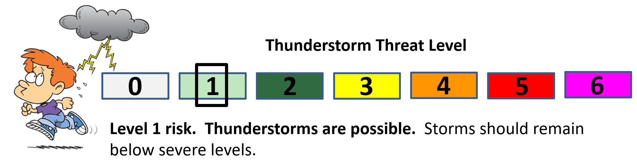
Today and tonight: Severe weather is not anticipated. There was some lightning last night, but it appears that is ending this morning and instability wanes.
Tomorrow through Friday afternoon: Severe weather is not anticipated
![]()
Interactive live weather radar page. Choose the city nearest your location. If one of the cities does not work then try a nearby one. Click here.
National map of weather watches and warnings. Click here.
Storm Prediction Center. Click here.
Weather Prediction Center. Click here.

Live lightning data: Click here.

Interactive GOES R satellite. Track clouds. Click here.

Here are the latest local river stage forecast numbers Click Here.
Here are the latest lake stage forecast numbers for Kentucky Lake and Lake Barkley Click Here.

The spring and preliminary summer outlooks have been posted for subscribers. Scroll down to see the outlook.
Not a subscriber? Learn more at this link.

WEATHER HIGHLIGHTS
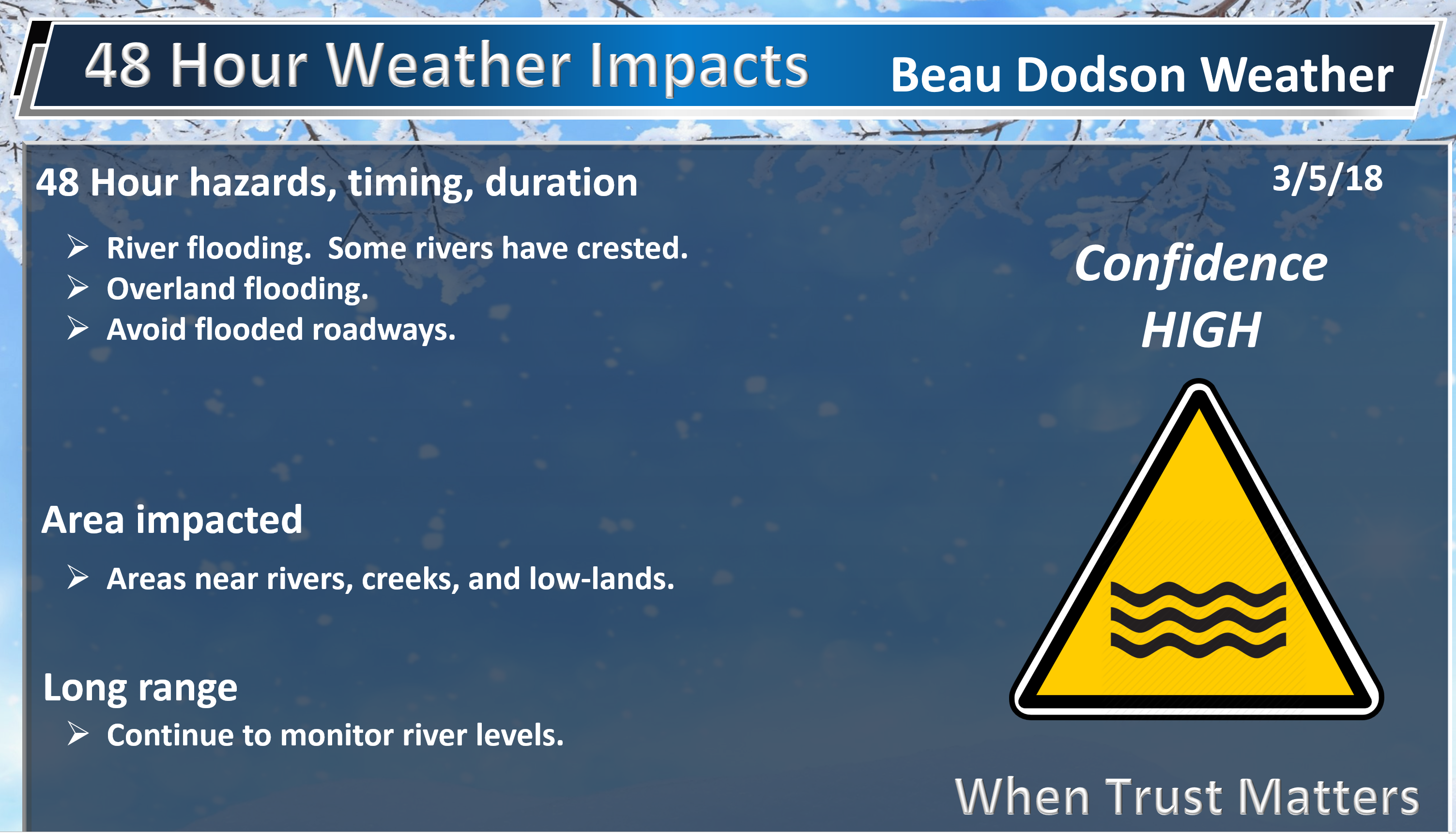
- Wet weather today.
- Flooding will continue to be an issue in many areas. Avoid flooded roadways.
- Another system dives into the region late Tuesday afternoon into Wednesday morning. Small precipitation chances and colder air.
- Rain chances may return as early as Friday and Saturday.
Highlights

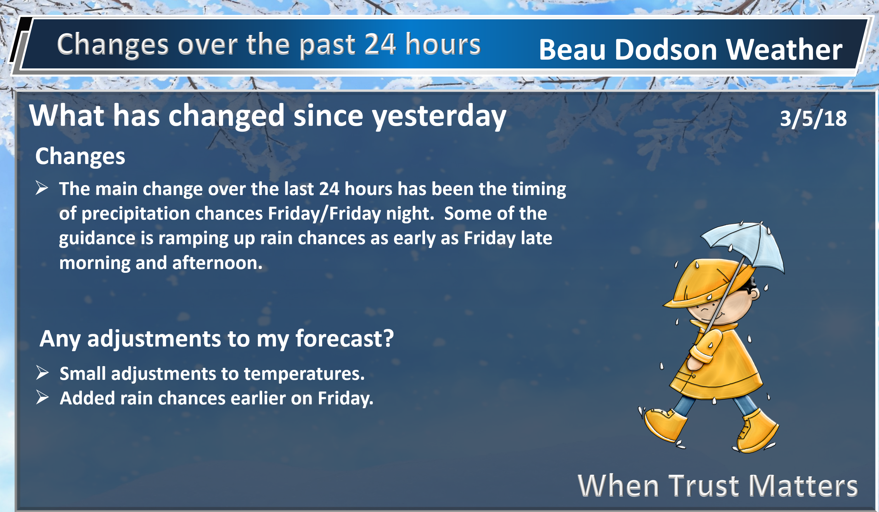
What has changed over the last 24 hours?
Weather Hazards.
Showers moved into the area last night. The showers increased in coverage from west to east. See the local city interactive radar links.
Interactive live weather radar page. Choose the city nearest your location. If one of the cities does not work then try a nearby one. Click here.
Those showers will remain with us today. Rain will subside, however, from west to east as we move into the afternoon and evening hours.
High temperatures today will be in the 50’s.
It appears the rain will have ended by early or mid-evening. Rain chances will end over southeast Missouri and southwest Illinois first. They will end over the Pennyrile area of western Kentucky last.
Dry weather will last into Tuesday morning.
A fast-moving gusty area of low pressure and associated cold front will push through the region Tuesday afternoon into Wednesday. This system won’t have a lot of moisture to work with. A few scattered rain or snow showers may develop to our north on Tuesday afternoon and push south and southeast.
I can’t completely rule out a thundershower. There is some instability.
Confidence in rain chances Tuesday afternoon and night are low.
The best chance of precipitation will likely be across northern portions of southeast Missouri and then into southern Illinois and northwest Kentucky.
Temperatures will be cold enough Tuesday night/Wednesday morning for a rain/snow or snow shower mix (if precipitation even occurs). Accumulation, at this time, is not anticipated.
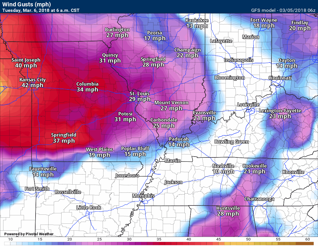
Another issue on Tuesday will be strong and gusty winds. Winds may gust to 35 to 40 mph.
Here is the GFS wind gust map for Tuesday into Wednesday. Timestamp upper left.
You may click the images to enlarge.
Precipitation chances end on Wednesday and that dry weather will last into Friday morning.
Let’s look at some temperatures.
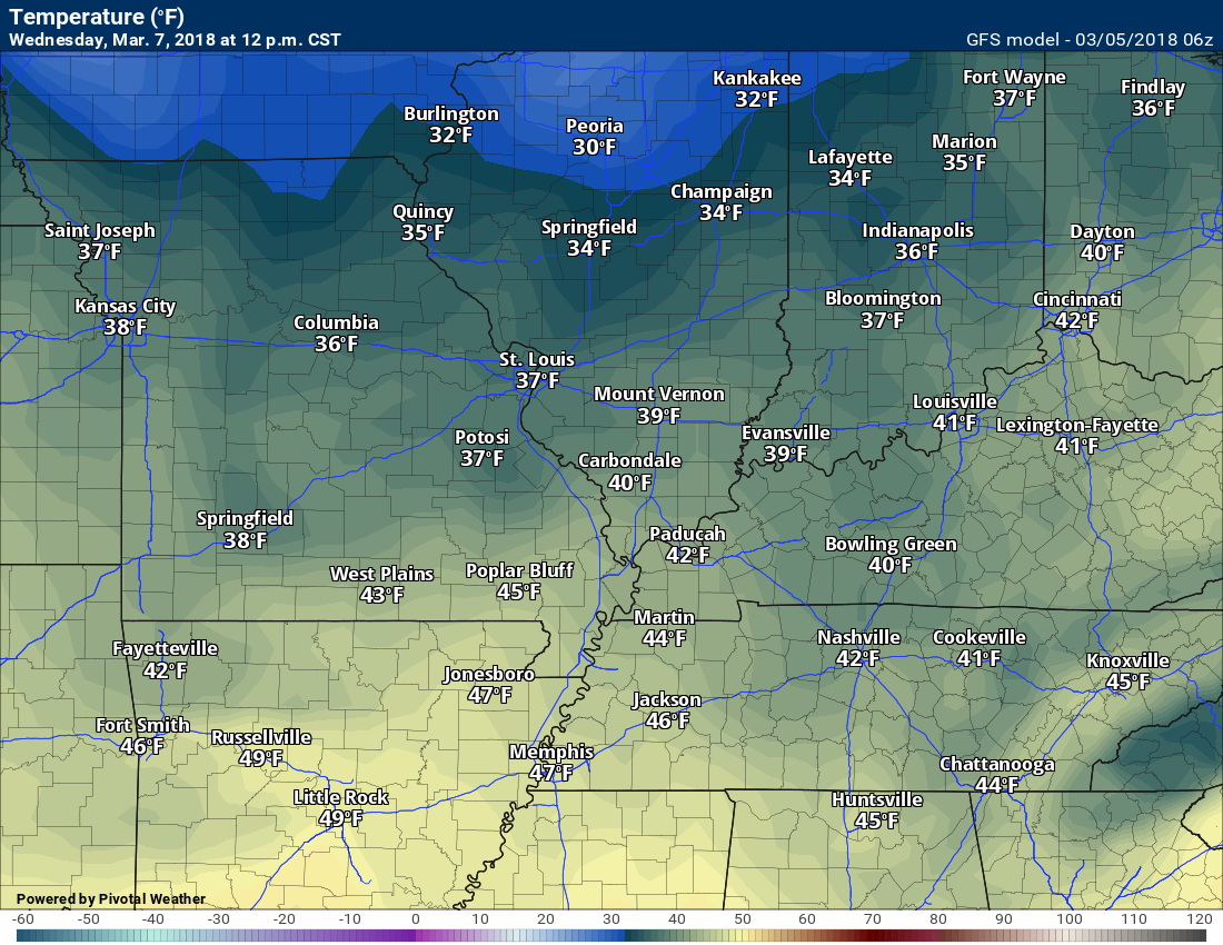
12 PM Wednesday
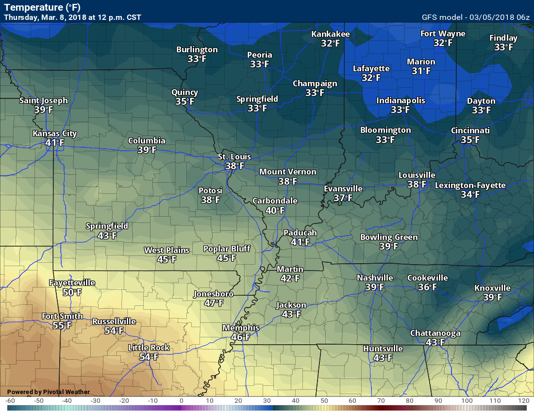
12 PM Thursday
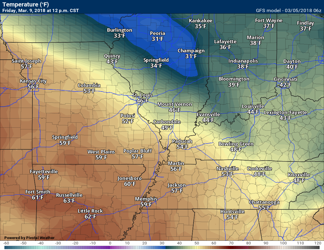
12 PM Friday
12 Saturday

Our next storm system arrives Friday into the weekend. Guidance has trended a tad wetter on Friday. This is because of the placement of a warm front across our region. Confidence on the placement of the warm front is low to medium. The best chance of precipitation will be near that front.
For now, it appears the front will be situated across southeast Missouri and southern Illinois.
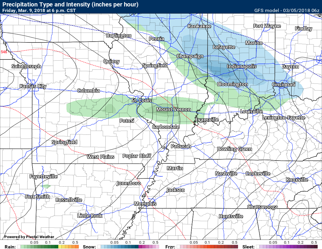
Here is the GFS depiction of rain Friday afternoon. Again, the exact placement of the rain will be highly dependent on the placement of the warm front.
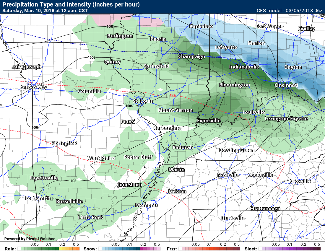
Here is the Saturday 12 AM precipitation map. I am not overly confident on rain probabilities Saturday (during the day). I will likely need to adjust those numbers as confidence increases in the overall forecast.
Rain chances will increase Friday night into Saturday night.
An interesting weather set-up on Sunday. An area of low pressure may skirt our region or pass to our south and southeast. This places us on the cold side of the area of low pressure. Some of the guidance develops snow in our local area. We will need to monitor this.
Here is the GFS precipitation type map. This is Sunday at 1 PM. Blue is snow. Green is rain. Tight isobars will mean strong and gusty winds.

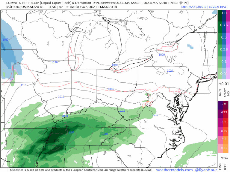
Here is the EC model guidance concerning the 2nd system. Green is rain. Blue is snow. Darker colors are heavier precipitation totals.
The EC is a significant winter storm event for portions of the Ohio Valley. Mostly to our east/northeast.
Long way to go concerning confidence on the Sunday event.
![]()

Subscribers you may view the latest week one, two, three, and four temperature and precipitation outlooks. Videos, as well. Click here to view today’s update.
Not a subscriber? Become one! Click here.
The week one, week two, and monthly outlooks are updated Monday through Friday. Subscribers videos are the same. During inclement weather, the videos are updated Monday through Sunday.
![]()

Weather Brains is a weekly podcast/video for those who love weather and want more!
Weather Brains episode number 632.
Previous episodes can be viewed by clicking here.
Today’s guest on Weather Brains is Gregory Mandt who has overall responsibility for the JPSS Program. In this role, Mandt oversees the development, acquisition, integration, installation, and acceptance of major system elements (spacecraft, instruments, launch services, and ground systems) for all four JPSS satellites, the first of which was successfully launched in November, 2017, and the NOAA-NASA Suomi NPP satellite.
Other discussions in this weekly podcast include topics like:
- Extremes: 90 at Titusville, FL, and -12 at Gothic, CO
- First tornado deaths in the USA late last week
- Relatively mild across much of Lower 48
- Astronomy Outlook with Tony Rice
- and more!

We offer interactive local city live radars and regional radars. If a radar does not update then try another one. If a radar does not appear to be refreshing then hit Ctrl F5. You may also try restarting your browser.
The local city view radars also have clickable warnings.
During the winter months, you can track snow and ice by clicking the winterize button on the local city view interactive radars.
You may email me at beaudodson@usawx.com
Find me on Facebook!

Find me on Twitter!

Did you know that a portion of your monthly subscription helps support local charity projects?
You can learn more about those projects by visiting the Shadow Angel Foundation website and the Beau Dodson News website.
