We have some great sponsors for the Weather Talk Blog. Please let our sponsors know that you appreciate their support for the Weather Talk Blog.
Milner and Orr Funeral Home and Cremation Services located in Paducah, Kentucky and three other western Kentucky towns – at Milner and Orr they believe in families helping families. You can find Milner and Orr on Facebook, as well.
![]()
.

For all of your families eye care needs. Visit their web-site here. Or, you can also visit their Facebook page.
.

Best at Enabling Body Shop Profitability since 1996. Located In Paducah Kentucky and Evansville Indiana; serving all customers in between. They provide Customer Service, along with all the tools necessary for body shops to remain educated and competitive. Click the logo above for their main web-site. You can find McClintock Preferred Finishes on Facebook, as well

Expressway Carwash and Express Lube are a locally owned and operated full service Carwash and Lube established in 1987. They have been proudly serving the community for 29 years now at their Park Avenue location and 20 years at their Southside location. They have been lucky enough to partner with Sidecar Deli in 2015, which allows them to provide their customers with not only quality service, but quality food as well. . If you haven’t already, be sure to make Expressway your one stop shop, with their carwash, lube and deli. For hours of operation and pricing visit www.expresswashlube.com or Expressway Carwash on Facebook.

TORNADO SHELTERS! Endrizzi’s Storm Shelters – For more information click here. Endrizzi Contracting and Landscaping can be found on Facebook, as well – click here
I have launched the new weather texting service! I could use your help. Be sure and sign up and fully support all of the weather data you see each day.
This is a monthly subscription service. Supporting this helps support everything else. The cost is $3 a month for one phone, $5 a month for three phones, and $10 a month for seven phones.
For more information visit BeauDodsonWeather.com
Or directly sign up at Weathertalk.com


This forecast update covers far southern Illinois, far southeast Missouri, and far western Kentucky. See the coverage map on the right side of the blog.
Remember that weather evolves. Check back frequently for updates, especially during active weather.


.
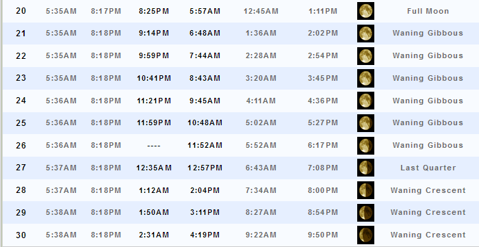
Moonrise will be at 12:35 a.m. and moonset will be at 12:57 a.m. Last Quarter.
Monday Night – Clearing overnight. An evening thunderstorm possible. Mainly over the far southern portion of the region. Storms ending.
What impact is expected? Heavy downpours, lightning, and gusty winds. Wet roadways.
Temperatures: Lows in the 68-74 degree range
Winds: Winds northwest/north/northeast at 5-10 mph. Gusts to 12 mph.
What is the chance for precipitation? 40% early (mainly far southern counties)
Coverage of precipitation: Scattered to numerous early in the evening over our southern counties.
Is severe weather expected? Isolated down burst winds possible.
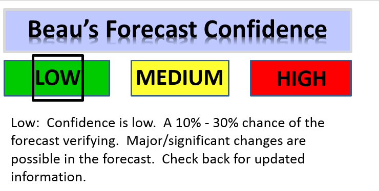
My confidence in this part of the forecast verifying: High
Should I cancel my outdoor plans? No, but check radars.
.
Tuesday – Partly to mostly sunny. A little bit cooler. Perhaps less humid. A 20% chance for a shower.
What impact is expected? Isolated wet roadways. Isolated lightning.
Temperatures: High temperatures in the 86-92 degree range. If the front is slower than anticipated then it could be a few degrees warmer on Tuesday.
Winds: North and northeast winds at 8-16 mph.
What is the chance for precipitation? 20%
Coverage of precipitation? Isolated
Is severe weather expected? No
My confidence in this part of the forecast verifying: High
Should I cancel my outdoor plans? No
Sunrise will be at 5:36 a.m. and sunset will be at 8:18 p.m.
UV index will be 9-10. Very high.
Moonrise will be at 1:12 a.m. and moonset will be at 2:04 p.m. Waning Crescent.
Tuesday Night – Mostly clear. Cooler. Less humid. Pleasant weather. Enjoy. Slight evening shower chance (<20%)
What impact is expected? Isolated wet roadways. Isolated lightning early in the evening.
Temperatures: Lows in the 60-65 degree range
Winds: Winds north and northeast at 5-10 mph. Gusts to 14 mph.
What is the chance for precipitation? <10%
Coverage of precipitation: Isolated.
Is severe weather expected? No
My confidence in this part of the forecast verifying: High
Should I cancel my outdoor plans? No
.
Wednesday – Mostly sunny. Cooler. Less humid. Pleasant day. Nicer air mass!
What impact is expected? None
Temperatures: High temperatures in the 76 to 84 degree range
Winds: North and northeast winds at 5-10 mph with gusts to 12 mph.
What is the chance for precipitation? <10%
Coverage of precipitation? None
Is severe weather expected? No
My confidence in this part of the forecast verifying: High
Should I cancel my outdoor plans? No
Sunrise will be at 5:38 a.m. and sunset will be at 8:18 p.m.
UV index will be 9-10. Very high.
Moonrise will be at 1:50 a.m. and moonset will be at 3:11 p.m. Waning Crescent.
Wednesday Night – Mostly clear. Cool. Pleasant night.
What impact is expected? None
Temperatures: Lows in the 56-62 degree range
Winds: Winds north and northeast/east at 5 mph.
What is the chance for precipitation? <10%
Coverage of precipitation: None
Is severe weather expected? No
My confidence in this part of the forecast verifying: High
Should I cancel my outdoor plans? No
.
Thursday – Partly sunny. Mild. A slight 20% chance for a shower.
What impact is expected? Most likely none.
Temperatures: High temperatures in the 82-86 degree range
Winds: North and northeast winds at 7-14 mph. Winds becoming east/southeast. Variable direction.
What is the chance for precipitation? <20%
Coverage of precipitation? Isolated to perhaps Scattered
Is severe weather expected? Unlikely
My confidence in this part of the forecast verifying: Low
Should I cancel my outdoor plans? No
Sunrise will be at 5:38 a.m. and sunset will be at 8:18 p.m.
UV index will be 8-10. Very high.
Moonrise will be at 2:31 a.m. and moonset will be at 4:19 p.m. Waning Crescent.
Thursday Night – A few clouds. Perhaps a scattered shower or thunderstorm.
What impact is expected? Maybe some wet roadways and lightning.
Temperatures: Lows in the 62-68 degree range
Winds: Winds variable or northeast at 4-8 mph.
What is the chance for precipitation? 30%
Coverage of precipitation: Isolated to scattered
Is severe weather expected? No
My confidence in this part of the forecast verifying: Low
Should I cancel my outdoor plans? No
.
Low confidence in the weekend forecast. These numbers may dramatically change. Some guidance shows heavy rain in our region from Friday into Tuesday. But, confidence is still too low to raise probabilities much higher. Monitor updated forecasts.
Friday – Partly cloudy. Mild. A thunderstorm possible.
What impact is expected? Wet roadways and lightning.
Temperatures: High temperatures in the 82-86 degree range
Winds: West and southwest winds at 5-10 mph
What is the chance for precipitation? 30%
Coverage of precipitation? Scattered
Is severe weather expected? No
My confidence in this part of the forecast verifying: Low
Should I cancel my outdoor plans? No, but monitor updates
Sunrise will be at 5:39 a.m. and sunset will be at 8:18 p.m.
UV index will be 7-9. High.
Moonrise will be at 3:16 a.m. and moonset will be at 5:26 p.m. Waning Crescent.
Friday Night – Partly cloudy. A low confidence forecast. Perhaps some scattered showers and thunderstorms.
What impact is expected? If storms develop then wet roadways and lightning.
Temperatures: Lows in the 64-66 degree range
Winds: Winds northwest and north at 5 mph.
What is the chance for precipitation? 30%
Coverage of precipitation: Perhaps scattered.
Is severe weather expected? No
My confidence in this part of the forecast verifying: Low
Should I cancel my outdoor plans? No, but monitor future updates
.
Saturday – Partly cloudy. Mild. A chance for showers and thunderstorms. Low confidence forecast.
What impact is expected? Maybe wet roadways and lightning.
Temperatures: High temperatures in the 82-88 degree range
Winds: Variable winds at 5-10 mph. Winds may turn out of the north or northeast.
What is the chance for precipitation? 40%
Coverage of precipitation? Perhaps scattered.
Is severe weather expected? No
My confidence in this part of the forecast verifying: Low
Should I cancel my outdoor plans? No, but monitor updates.
Sunrise will be at 5:39 a.m. and sunset will be at 8:18 p.m.
UV index will be 6-8. Moderate to high.
Moonrise will be at 4:06 a.m. and moonset will be at 6:30 p.m. Waning Crescent.
Saturday Night – Some clouds. Showers and thunderstorms again possible. Low confidence.
What impact is expected? Maybe some wet roadways and lightning.
Temperatures: Lows in the 62-66 degree range
Winds: Winds variable in direction at 5-10 mph.
What is the chance for precipitation? 40%
Coverage of precipitation: Scattered
Is severe weather expected? No
My confidence in this part of the forecast verifying: Low
Should I cancel my outdoor plans? No, but monitor updates.
.
Sunday – Partly cloudy. A shower or thunderstorm possible. Low confidence forecast.
What impact is expected? Maybe some wet roadways and lightning.
Temperatures: High temperatures in the 82 to 86 degree range
Winds: Variable winds at 5-10 mph
What is the chance for precipitation? 30%
Coverage of precipitation? Perhaps scattered
Is severe weather expected? No
My confidence in this part of the forecast verifying: Low
Should I cancel my outdoor plans? No, but monitor future updates.
Sunrise will be at 5:40 a.m. and sunset will be at 8:18 p.m.
UV index will be 7-8. Moderate to high.
Moonrise will be at 5:01 a.m. and moonset will be at 7:31 p.m. Waning Crescent.
Sunday Night – Partly cloudy. Again, a chance for scattered thunderstorms. But, low confidence.
What impact is expected? Maybe wet roadways and lightning.
Temperatures: Lows in the 62 to 68 degree range
Winds: Winds variable in direction at 4-8 mph.
What is the chance for precipitation? 30%
Coverage of precipitation: Perhaps scattered. Low confidence.
Is severe weather expected? No
My confidence in this part of the forecast verifying: Low
Should I cancel my outdoor plans? No, but monitor updates.
.
July 4th ~ Monday – Partly cloudy. A shower or storm possible. Low confidence on forecast verification.
What impact is expected? Maybe some wet roadways and lightning.
Temperatures: High temperatures in the 82 to 86 degree range
Winds: East and southeast winds at 5-10 mph
What is the chance for precipitation? 30%
Coverage of precipitation? Perhaps scattered
Is severe weather expected? No
My confidence in this part of the forecast verifying: Low
Should I cancel my outdoor plans? No, but monitor future updates.
Sunrise will be at 5:40 a.m. and sunset will be at 8:17 p.m.
UV index will be 7-8. Moderate to high.
Moonrise will be at 6:00 a.m. and moonset will be at 8:25 p.m. New moon.
Monday Night – Partly cloudy. Again, a chance for scattered thunderstorms. But, low confidence.
What impact is expected? Maybe wet roadways and lightning.
Temperatures: Lows in the 62 to 68 degree range
Winds: Winds southeast in direction at 4-8 mph.
What is the chance for precipitation? 30%
Coverage of precipitation: Perhaps scattered. Low confidence.
Is severe weather expected? No
My confidence in this part of the forecast verifying: Low
Should I cancel my outdoor plans? No, but monitor updates.
.
Tuesday – Partly cloudy. A shower or thunderstorm possible. Low confidence forecast.
What impact is expected? Maybe some wet roadways and lightning.
Temperatures: High temperatures in the 82 to 86 degree range
Winds: Southwest winds at 5-10 mph
What is the chance for precipitation? 30%
Coverage of precipitation? Perhaps scattered
Is severe weather expected? No
My confidence in this part of the forecast verifying: Low
Should I cancel my outdoor plans? No, but monitor future updates.
Sunrise will be at 5:41 a.m. and sunset will be at 8:18 p.m.
UV index will be 7-8. Moderate to high.
Moonrise will be at 7:01 a.m. and moonset will be at 9:14 p.m. Waxing Crescent.
Tuesday Night – Partly cloudy. Again, a chance for scattered thunderstorms. But, low confidence.
What impact is expected? Maybe wet roadways and lightning.
Temperatures: Lows in the 62 to 68 degree range
Winds: Winds southwest at 4-8 mph.
What is the chance for precipitation? 30%
Coverage of precipitation: Perhaps scattered. Low confidence.
Is severe weather expected? No
My confidence in this part of the forecast verifying: Low
Should I cancel my outdoor plans? No, but monitor updates.
More information on the UV index. Click here.
The weekend forecast is sponsored by Farmer and Company Real Estate.

Farmer & Company Real Estate is proud to represent buyers and sellers in both Southern Illinois and Western Kentucky. With 13 licensed brokers, we can provide years of experience to buyers & sellers of homes, land & farms and commercial & investment properties. We look forward to representing YOU! Follow us on Facebook, as well
The weekend forecast is sponsored by Farmer and Company Real Estate. Click here to visit their site.


Don’t forget to check out the Southern Illinois Weather Observatory web-site for weather maps, tower cams, scanner feeds, radars, and much more! Click here

An explanation of what is happening in the atmosphere over the coming days…
- Here comes the cooler air. Finally.
- Northwest flow will last awhile
- Precipitation chances?
- Latest drought numbers/dry weather numbers.
- Long range?
We experienced some thunderstorms over the weekend. A few of the storms produced wind damage. Down burst winds were the main cause for the damage. We talked about that possibility last week. Several reports of trees blown down. Wind gusts of 45-55 mph were reported in the most intense storms. Rainfall totals varied greatly across the region. Some locations picked up 1-3.7″ of rain. Other spots picked up no rain at all. Sound familiar? It should. We have been in this pattern for weeks. Rinse and repeat. Often times without the rinse.
Let me show you the SPI index map. This shows you how dry it has been over our region. The dark orange and red colors are dry conditions. Now, we did have some heavy rain on Sunday and Monday. That helped a little bit. This map will be updated over the next couple of days. It may reflect some of the recent rainfall. But, we still need more. Also, we don’t need two inches of rain in an hour. A lot of the water will run off when that happens. Especially true when the ground is hard/dry. We need a soaking rain. Hopefully we will pick up some more rain later this week.

Officially the drought monitor maps do not have us in abnormally dry conditions or drought. But, as many farmers are reporting, those drought maps don’t reflect reality.
It was also a hot weekend. Many areas were in the 90’s with heat index values above 100 degrees. The only real relief was when thunderstorms developed and then collapsed. This pushed numerous outflow boundaries across the region. Temperatures fell into the 70’s behind the boundaries. Those boundaries provided some much needed temperature relief.
The GREAT news is that northwest flow is going to push into the region over the coming days (already underway). Northwest flow means that the jet stream will dive south and southeast from Canada. This will deliver a much nicer air mass to our local area. Instead of temperatures in the 90’s we can expect mostly 80’s. And, it is possible that a couple of days could even have high temperatures in the upper 70’s. Won’t that be a nice change of pace.
The bad news is that rain chances, after Monday evening, will diminish for a few days. But, there are some indications that rain chances may increase later this week.
Typically northwest flow means active weather. Especially true during the summer months. What happens is that thunderstorms develop between the heat ridge and the trough. A ridge of high pressure is just what it sounds like. A ridge. Normally it means hot weather. A trough is a trough. A dipping of the jet stream. Examples here.
Ridge of high pressure in the southwest equals hot weather. A trough equals cooler weather. The arrows represent the jet stream. These ridges and troughs are typically transient. Meaning they move in and out of our region. Although, at times, they can be slow to move. Especially during the summer. The jet stream is at its weakest point during the summer months (at least over our region).

Precipitation normally occurs in a certain location within a trough. And, if you want an active pattern you can’t be too deep into the trough. You want to ride the ridge and the trough. There are some indications that a series of storms systems will produce locally heavy rain on Thursday into the weekend. But, placement of the heavier precipitation is uncertain. And, it is definitely not a lock for our local region. But, we also are not out of the running. Let’s keep some hope alive.
Speaking of much need rain, NOAA has completely dismissed the idea of substantial rain in our region. Here is the WPC/NOAA rainfall forecast for the next seven days. Now, this is just their opinion. One of many. Let’s see if NOAA keeps this forecast over the coming days. Not saying they will be wrong. But, not sure I buy this map as being the correct idea. With a train of disturbances moving through the northwest flow there should be a bit more rain than this. If the 500 mb maps are correct then our region is at least in the running for some rain chances. This map basically shows nothing at all for parts of southeast Missouri and southern Illinois. Again, I am a bit skeptical of this solution. And, I think they will change it.

Here is the NAM guidance. NAM is one of many models. It is showing a disturbance moving into our region on Thursday and Thursday night. Perhaps a thunderstorm complex will form over Nebraska and Iowa on Thursday. Then, it would move southeast. But, not sure how much of this holds together into our region. Typically these weaken. It is worth monitoring. And, I did mention at least a chance for some precipitation on Thursday and Thursday night.
Green and blue represents showers and thunderstorms. This is the 3 pm Thursday future-cast precipitation map from the NAM. Weatherbell.com graphics.

This next map is for Thursday evening.

Meteorologists look for upper level disturbances when forecasting rain and thunderstorms. Here is a map from wright-weather.com that shows two vort maxes. Think of vorts as rising air and energy. You can see one to our north and one well to our west on Thursday. The track of these vorts is going to be important to our local forecast. Ideally you want the vort max to move in from the southwest and west.

The GFS guidance (different model suite) also is showing a disturbance to our west and north on Thursday. Confidence on the exact placement is low. This will need to be monitored.

Here is the Friday GFS guidance map. It does have showers and storms in our area. Green represents rain. It even has a closed isobar over our area. An area of low pressure (the closed black line). Isobars are equal lines of pressure.
.
You will hear me talk about the heat ridge over the coming months. And, you will hear me mention northwest flow. Northwest flow delivers nicer temperatures to our region. Here is an example.
This first map is the 500 mb map (about 18,000′ aloft). Wind flow is from the northwest. I drew in some blue arrows to show you the wind flow. The heat ridge is well to our west/southwest. It is located over the southwest United States. This is the Wednesday afternoon weather map. We are on the north side of the blue arrows. The cooler side.

Now, here is the temperature anomaly (how much above or below normal will temperatures be) map for Wednesday evening. Notice the blue? Below normal temperatures. That is because of the jet stream diving in from the northwest. This delivers cooler air to our region. We are in a trough. Blue and green indicates below normal temperatures. Where is the red? Over the southwest United States. The hot air is under the heat ridge. The blue H on the graphic above.

Let me show you some more 500 mb maps for the upcoming week and weekend. Look for the northwest flow. When the arrows are diving down from the northwest into our region we are under the influence of a trough. Here is the Tuesday 500 mb map. Northwest flow arrives.

This next map is for Saturday, July 2nd. Northwest flow dominates our region.

This next map is for Sunday, July 3rd. Northwest flow continues. The ridge of high pressure is well to our south. Notice how we are straddling the two. That is where you want to be in order to pick up showers and thunderstorms. But, if the trough is too far south then we could miss out. This is still a question.

Let’s move ahead to July 6th. Next weeks 500 mb map from the GFS guidance. Hmm the big H is returning. That is the ridge of high pressure. Heat. Watch on the following maps how it builds back into the region. With full force, at that.

Let’s move forward to July 8th. This is the 500 mb chart from the GFS guidance. Uh oh. The big H is moving back towards our region. That would mean a return to hot and humid conditions. That is a ridge of high pressure.

Pulling forward to July 10th. Ouch. Let’s hope this is not right. A big heat ridge over the entire Central United States. That would mean hot and humid weather returning. It would also push the storm track well north of our region. Not good news. There is quite a bit of support for a heat wave somewhere after July 8th or 9th. And, it may continue for several days. A heat ridge, of this strength, could produce 95-105 degree weather over the Central United States.

CIPS analogs also indicate that we will head back into the heat at some point around July 7th, 8th, 9th and onward. Long way off for an exact date. But, we are not finished with the heat.
Here is the CIPS analog map centered on July 7th. The orange indicates above normal temperatures are favored.

Let’s take a look at some model guidance. In particular I want to show you some of the trends in the data. Trends are the direction a model is moving. Wetter, drier, cooler, warmer.
This is the GFS model. It is processed four times each day.
This is what it was showing on Sunday night (for the upcoming 10 days worth of rainfall). Heavy rain in our region later this week. At least that is what it was showing. Guidance and not gospel. Scale to this map is on the right. The red colors are 2″-4″ of rain.

Let me zoom in on the above map. Wow. The GFS really had some heavy rainfall totals for our region. The GFS guidance (and other guidance) is seeing the potential for a series of disturbances to move through the upper level northwest flow. Each one would deliver shower and thunderstorm chances. But, how far north of south is the question. Not a lot of confidence in the upcoming weekend forecast.

Now look at what happened in the early Monday morning run of the model. It shifted southward a bit. I like to watch trends in the data. Models are for guidance and not gospel. Meaning, you can’t make a forecast from a model. You can, however, use it to guide you in your thought process. Will the rain axis shift further south in the coming days? That is a question mark.

This is from Monday at 11 a.m. This is also the GFS guidance. Rainfall totals through the 5th of July. We are still in the running. Some shift back north on this run of the model.

Let me zoom in on that map. We can only hope.

The afternoon run of the GFS came up with these numbers. See a pattern developing? The models are all showing substantial rain somewhere in the region. Will it be us? Too soon to bank on that. But, I like our odds.

Let’s look at the Canadian model guidance. A different model suite. Interesting. The Canadian also has a heavy band of precipitation. But, it is even further south than the GFS. The EC guidance, which I can’t show you, is somewhere in the middle. What is important, however, is that there is a heavy rain band somewhere in the region. Models agree on that.

This graphic below is what the GFS was showing a few days ago. Notice how the newer maps (above maps) are showing the axis of heavy rain much further north and east. When guidance moves around a lot then you can’t trust the guidance. Wild swings n data mean the models are not doing well in processing what is going to happen. However, with that said, there is one main idea in all of the models. That idea is that there is the potential for some heavy rain somewhere in the Central United States later this week. Placement of the upper level features is key to what happens in our region. And, that will need to be worked out over the coming days.

The northwest flow will deliver much nicer air to our region over the coming days. We might even see some morning lows dipping into the 50’s. How about that!
Here is the NAM model guidance. Low temperatures for Wednesday and Thursday morning. Nice air. Low dew points. Low dew points will mean less air that you have to wear!

Thursday (the image below)

High temperatures will be much nicer, as well. The coming days will deliver a totally different feel than the past few weeks. Here are some of the high temperature maps.
These are the Wednesday through Saturday high temperature forecasts.


Let’s look at the GFS temperature anomaly maps. There are five day averaged temperatures for the upcoming two weeks.
We start out well below normal. The blue and green indicates below normal temperatures. And, I am confident this will verify. Image is from weatherbell.com Click image for a larger view.

This next map is the averages from July 2nd through July 7th. We start to heat up towards the end of this time line. The blue area is starting to shrink.

And, finally this next map is for July 5th through the 10th. We heat back up at some point after the 7th or 8th. Another heat wave? Maybe. Still some time to monitor. The red indicates above normal temperatures. If the heat ridge does build back into the region then we will return to heat and humidity. Uncomfortable heat and humidity.

I will be keeping a close eye on the Friday into Monday forecast. Holiday is upon us. I know many will have outdoor activities. Let’s not bank one way or another, just yet.
Low confidence on how this all plays out. The GFS ensembles show showers and thunderstorms possible in the region. Out of 21 boxes the majority show rain. These are ensemble maps. The same model run over and over again, but tweaked a little bit different each time it is process through the computer. The idea, on ensemble forecasting, is the more panels that agree the higher the confidence in the forecast numbers.
The yellow boxes show the runs that indicate a chance for showers and storms. Fourteen of the twenty-one ensembles show precipitation. Let’s keep an eye on it.


We have regional radars and local city radars – if a radar does not seem to be updating then try another one. Occasional browsers need their cache cleared. You may also try restarting your browser. That usually fixes the problem. Occasionally we do have a radar go down. That is why I have duplicates. Thus, if one fails then try another one.
If you have any problems then please send me an email beaudodson@usawx.com
WEATHER RADAR PAGE – Click here —
We also have a new national interactive radar – you can view that radar by clicking here.
Local interactive city radars include St Louis, Mt Vernon, Evansville, Poplar Bluff, Cape Girardeau, Marion, Paducah, Hopkinsville, Memphis, Nashville, Dyersburg, and all of eastern Kentucky – these are interactive radars. Local city radars – click here

Live Lightning Data – zoom and pan: Click here
Live Lightning Data with sound (click the sound button on the left side of the page): Click here

Can we expect severe thunderstorms over the next 24 to 48 hours? Remember that a severe thunderstorm is defined as a thunderstorm that produces 58 mph winds or higher, quarter size hail or larger, and/or a tornado.
.
Monday night: Perhaps some evening storms over our southern counties.
Tuesday-Thursday: Should be mostly dry. I will be monitoring Thursday afternoon and night. Maybe some storms approaching from the west and northwest.
Friday-Sunday: Monitor updates.
.

.
No major changes in this update
.

.
No major concerns once the storms end on Monday evening.

.
No
.

How much precipitation should we expect over the next few days?
.

Here are the current river stage forecasts. You can click your state and then the dot for your location. It will bring up the full forecast and hydrograph.
..

Here is the official 6-10 day and 8-14 day temperature and precipitation outlook. Check the date stamp at the top of each image (so you understand the time frame).
The forecast maps below are issued by the Weather Prediction Center (NOAA).


The latest 8-14 day temperature and precipitation outlook. Note the dates are at the top of the image. These maps DO NOT tell you how high or low temperatures or precipitation will be. They simply give you the probability as to whether temperatures or precipitation will be above or below normal.


Who do you trust for your weather information and who holds them accountable?
I have studied weather in our region since the late 1970’s. I have 37 years of experience in observing our regions weather patterns. My degree is in Broadcast Meteorology from Mississippi State University and an Associate of Science (AS). I am currently working on my Bachelor’s Degree in Geoscience.
My resume includes:
Member of the American Meteorological Society.
NOAA Weather-Ready Nation Ambassador.
Meteorologist for McCracken County Emergency Management. I served from 2005 through 2015.
I own and operate the Southern Illinois Weather Observatory.
Recipient of the Mark Trail Award, WPSD Six Who Make A Difference Award, Kentucky Colonel, and the Caesar J. Fiamma” Award from the American Red Cross.
In 2009 I was presented with the Kentucky Office of Highway Safety Award.
Recognized by the Kentucky House of Representatives for my service to the State of Kentucky leading up to several winter storms and severe weather outbreaks.
I am also President of the Shadow Angel Foundation which serves portions of western Kentucky and southern Illinois.
There is a lot of noise on the internet. A lot of weather maps are posted without explanation. Over time you should learn who to trust for your weather information.
My forecast philosophy is simple and straight forward.
- Communicate in simple terms
- To be as accurate as possible within a reasonable time frame before an event
- Interact with you on Twitter, Facebook, and the blog
- Minimize the “hype” that you might see on television or through other weather sources
- Push you towards utilizing wall-to-wall LOCAL TV coverage during severe weather events
I am a recipient of the Mark Trail Award, WPSD Six Who Make A Difference Award, Kentucky Colonel, and the Caesar J. Fiamma” Award from the American Red Cross. In 2009 I was presented with the Kentucky Office of Highway Safety Award. I was recognized by the Kentucky House of Representatives for my service to the State of Kentucky leading up to several winter storms and severe weather outbreaks.
If you click on the image below you can read the Kentucky House of Representatives Resolution.

Many of my graphics are from www.weatherbell.com – a great resource for weather data, model data, and more


You can sign up for my AWARE email by clicking here I typically send out AWARE emails before severe weather, winter storms, or other active weather situations. I do not email watches or warnings. The emails are a basic “heads up” concerning incoming weather conditions.