
.
January 23, 2018
Tuesday Forecast Details
Forecast: A mix of sun and clouds. Cooler. A slight chance of a snow flurry or sprinkle.
Temperatures: MO ~ 38 to 44 IL ~ 38 to 44 KY ~ 40 to 45
What is the chance of precipitation? MO ~ 10% IL ~ 10% KY ~ 10% TN ~ 10%
Coverage of precipitation: Most likely none
Wind chill values: 28 to 38
Accumulating snow or ice: No
Winds: West wind 7 to 14 mph with gusts to 16 mph. Higher gusts before 12 pm.
What impacts are anticipated from the weather? None
My confidence in the forecast verifying: High
Is severe weather expected? No
The NWS defines severe weather as 58 mph wind or great, 1″ hail or larger, and/or tornadoes
Should I cancel my outdoor plans? No
.
Tuesday Night Forecast Details:
Forecast: A few evening clouds, otherwise becoming mostly clear. Colder.
Temperatures: MO ~ 25 to 30 IL ~ 25 to 30 KY ~ 25 to 30
What is the chance of precipitation? MO ~ 0% IL ~ 0% KY ~ 0% TN ~ 0%
Coverage of precipitation: Most likely none
Wind chill values: 20 to 30
Accumulating snow or ice: No
Winds: West at 7 to 14 mph
What impacts are anticipated from the weather? None
My confidence in the forecast verifying: High
Is severe weather expected? No
The NWS defines severe weather as 58 mph wind or great, 1″ hail or larger, and/or tornadoes
Should I cancel my outdoor plans: No
.
January 24, 2018
Wednesday Forecast Details
Forecast: Mostly sunny
Temperatures: MO ~ 45 to 50 IL ~ 45 to 50 KY ~ 45 to 50
What is the chance of precipitation? MO ~ 0% IL ~ 0% KY ~ 0% TN ~ 0%
Coverage of precipitation: None
Wind chill values: N/A
Accumulating snow or ice: N0
Winds: West winds at 5 to 10 mph
What impacts are anticipated from the weather? None
My confidence in the forecast verifying: High
Is severe weather expected? No
The NWS defines severe weather as 58 mph wind or great, 1″ hail or larger, and/or tornadoes
Should I cancel my outdoor plans? No
.
Wednesday Night Forecast Details:
Forecast: Mostly clear.
Temperatures: MO ~ 25 to 30 IL ~ 25 to 30 KY ~ 25 to 30
What is the chance of precipitation? MO ~ 0% IL ~ 0% KY ~ 0% TN ~ 0%
Coverage of precipitation: None
Wind chill values: N/A
Accumulating snow or ice: No
Winds: South and southwest winds at 5 to 10 mph
What impacts are anticipated from the weather? None
My confidence in the forecast verifying: High
Is severe weather expected? No
The NWS defines severe weather as 58 mph wind or great, 1″ hail or larger, and/or tornadoes
Should I cancel my outdoor plans: No
.
January 25, 2018
Thursday Forecast Details
Forecast: Mostly sunny.
Temperatures: MO ~ 52 to 56 IL ~ 52 to 56 KY ~ 53 to 56
What is the chance of precipitation? MO ~ 0% IL ~ 0% KY ~ 0% TN ~ 0%
Coverage of precipitation: None
Wind chill values: N/A
Accumulating snow or ice: No
Winds: South and southwest at 7 to 14 mph
What impacts are anticipated from the weather? None
My confidence in the forecast verifying: High
Is severe weather expected? No
The NWS defines severe weather as 58 mph wind or great, 1″ hail or larger, and/or tornadoes
Should I cancel my outdoor plans? No
.
Thursday Night Forecast Details:
Forecast: Clear.
Temperatures: MO ~ 34 to 38 IL ~ 34 to 38 KY ~ 34 to 38
What is the chance of precipitation? MO ~ 0% IL ~ 0% KY ~ 0% TN ~ 0%
Coverage of precipitation: None
Wind chill values: N/A
Accumulating snow or ice: No
Winds: Southwest and west at 6 to 12 mph
What impacts are anticipated from the weather? None
My confidence in the forecast verifying: High
Is severe weather expected? No
The NWS defines severe weather as 58 mph wind or great, 1″ hail or larger, and/or tornadoes
Should I cancel my outdoor plans: No
.
January 26, 2018
Friday Forecast Details
Forecast: Partly to mostly sunny. Increasing clouds late in the day. Mild.
Temperatures: MO ~ 54 to 56 IL ~ 54 to 56 KY ~ 54 to 56
What is the chance of precipitation? MO ~ 10% IL ~ 10% KY ~ 10% TN ~ 10%
Coverage of precipitation: None
Wind chill values: N/A
Accumulating snow or ice: No
Winds: South and southwest at 7 to 14 mph
What impacts are anticipated from the weather? None
My confidence in the forecast verifying: Medium
Is severe weather expected? No
The NWS defines severe weather as 58 mph wind or great, 1″ hail or larger, and/or tornadoes
Should I cancel my outdoor plans? No
.
Friday Night Forecast Details:
Forecast: Cloudy. Showers possible.
Temperatures: MO ~ 44 to 48 IL ~ 44 to 48 KY ~ 44 to 48
What is the chance of precipitation? MO ~ 40% IL ~ 40% KY ~ 40% TN ~ 40%
Coverage of precipitation: Scattered
Wind chill values: N/A
Accumulating snow or ice: No
Winds: Southwest at 6 to 12 mph
What impacts are anticipated from the weather? Wet roadways
My confidence in the forecast verifying: Medium
Is severe weather expected? No
The NWS defines severe weather as 58 mph wind or great, 1″ hail or larger, and/or tornadoes
Should I cancel my outdoor plans: Monitor updates
.
January 27, 2018
Saturday Forecast Details
Forecast: Mostly cloudy. Showers possible.
Temperatures: MO ~ 52 to 56 IL ~ 52 to 56 KY ~ 52 to 56
What is the chance of precipitation? MO ~ 50% IL ~ 50% KY ~ 50% TN ~ 50%
Coverage of precipitation: Scattered
Wind chill values: N/A
Accumulating snow or ice: No
Winds: South and southwest at 7 to 14 mph
What impacts are anticipated from the weather? Wet roadways.
My confidence in the forecast verifying: Medium
Is severe weather expected? No
The NWS defines severe weather as 58 mph wind or great, 1″ hail or larger, and/or tornadoes
Should I cancel my outdoor plans? Monitor updates
.
Saturday Night Forecast Details:
Forecast: Cloudy. Showers possible. Slight chance of snow showers.
Temperatures: MO ~ 32 to 35 IL ~ 32 to 35 KY ~ 32 to 35
What is the chance of precipitation? MO ~ 40% IL ~ 40% KY ~ 40% TN ~ 40%
Coverage of precipitation: Scattered
Wind chill values: N/A
Accumulating snow or ice: Unlikley
Winds: West at 6 to 12 mph
What impacts are anticipated from the weather? Wet roadways
My confidence in the forecast verifying: Medium
Is severe weather expected? No
The NWS defines severe weather as 58 mph wind or great, 1″ hail or larger, and/or tornadoes
Should I cancel my outdoor plans: Monitor updates
.
January 28, 2018
Sunday Forecast Details
Forecast: Partly cloudy. Cooler.
Temperatures: MO ~ 44 to 48 IL ~ 44 to 48 KY ~ 44 to 48
What is the chance of precipitation? MO ~ 10% IL ~ 10% KY ~ 10% TN ~ 10%
Coverage of precipitation: Most likely none
Wind chill values: N/A
Accumulating snow or ice: No
Winds: West at 5 to 10 mph
What impacts are anticipated from the weather? None
My confidence in the forecast verifying: Medium
Is severe weather expected? No
The NWS defines severe weather as 58 mph wind or great, 1″ hail or larger, and/or tornadoes
Should I cancel my outdoor plans? No
.
Sunday Night Forecast Details:
Forecast: Mostly clear and chilly.
Temperatures: MO ~ 28 to 32 IL ~ 28 to 32 KY ~ 28 to 32
What is the chance of precipitation? MO ~ 0% IL ~ 0% KY ~ 0% TN ~ 0%
Coverage of precipitation: None
Wind chill values: N/A
Accumulating snow or ice: No
Winds: West at 5 to 10 mph
What impacts are anticipated from the weather? None
My confidence in the forecast verifying: Medium
Is severe weather expected? No
The NWS defines severe weather as 58 mph wind or great, 1″ hail or larger, and/or tornadoes
Should I cancel my outdoor plans: No
.

.
Tonight through Sunday: Snow is not anticipated. I will monitor Saturday night/Sunday for snow flurries as our next rain maker pulls away.
.

.
The National Weather Service definition of a severe thunderstorm is one that produces quarter size hail or larger, 58 mph winds or greater, and/or a tornado.
Tuesday through Sunday: Severe weather is not anticipated. Small chance of lightning Friday night and Saturday. Low confidence.
.

.
Interactive Weather Radar Page. Choose the city nearest your location: Click this link.
Short term outlook:
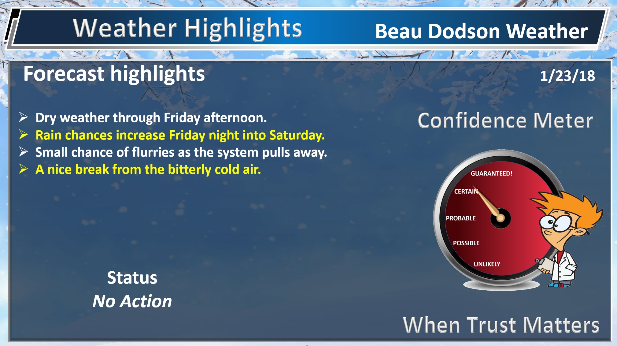
Today into Friday
Quiet weather will continue into Friday. No extreme temperature swings and no precipitation anticipated. This is a nice break from the weeks and weeks of cold we have experienced over the last two months.
A bit of a break for the weatherman (and all of you, as well).
We will have to deal with some clouds today. Gusty winds will subside as we move into the afternoon hours. Temperatures, because of cloud cover, will remain mostly in the 40’s.
Temperatures on Wednesday will rise into the 40’s, as well.
I am anticipating 50’s on Thursday, Friday, and perhaps Saturday. Back into the 40’s by Sunday (behind our next cold front).
Lows will dip into the upper 20’s tonight and Wednesday night. You can expect 30’s on Thursday night and 40’s on Friday night.
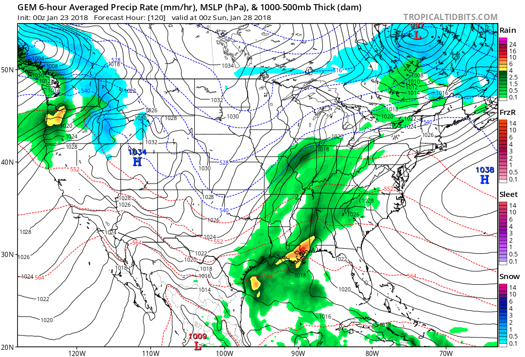
Our next rain chance will arrive on Friday night and Saturday. Models have mixed opinions on rainfall totals. For the time being, I am forecasting a light rain event. Rainfall totals of 0.10″ to 0.30″. I will monitor trends.
Here is the Canadian model showing you Saturday’s rain event. The GFS model shows rain, but not as much.
.
.
Much colder air is possible as we move into the first half of February. The pattern appears to be reloading. That will mean more cold and perhaps more wintry precipitation.
There is a strong signal that much of February may deliver below normal temperatures. See the long range video below.
.
Beau’s Winter Weather Outlook
.


We offer regional radars and local city radars – if a radar does not update then try another one. Occasional browsers need their cache cleared. You may also try restarting your browser. This will usually fix any problems.
During the winter you can track snow and ice by clicking the winterize button on the local city view interactive radars.
You may email me at beaudodson@usawx.com
Interactive Weather Radar Page. Choose the city nearest your location: Click this link
National interactive radar: Click this link.