
.
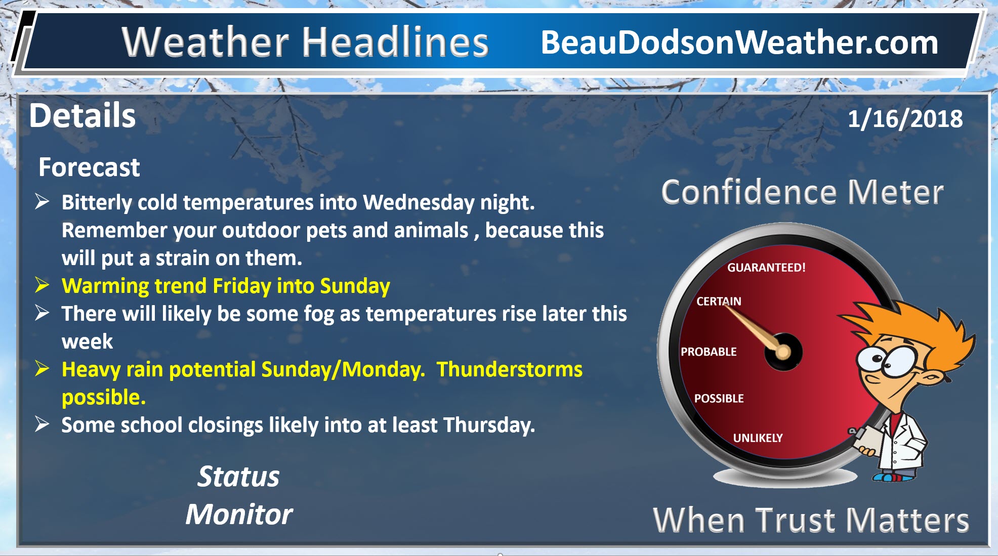
January 16, 2018
Tuesday Night Forecast Details:
Wind chill alert
Forecast: A few clouds. Clearing. A flurry possible. Bitterly cold. Some locations may dip below zero. Temperatures will vary depending on snow cover.
Temperatures: MO ~ -1 to 5 above IL ~ -4 to 5 above KY ~ -4 to 5 above
What is the chance of precipitation? MO ~ 10% IL ~ 10% KY ~ 10% TN ~ 10%
Coverage of precipitation: None
Wind chill values: -12 to 5 above
Accumulating snow or ice: No
Winds: Northwest at 5 to 10 mph
What impacts are anticipated from the weather? Icy roads from recent snow. Bitterly cold air. Low wind chill values.
My confidence in the forecast verifying: High
Is severe weather expected? No
The NWS defines severe weather as 58 mph wind or great, 1″ hail or larger, and/or tornadoes
Should I cancel my outdoor plans: Have a plan B
.
January 17, 2018
Wednesday Forecast Details
Wind chill alert for Wednesday morning
Forecast: Mostly sunny. Bitterly cold.
Temperatures: MO ~ 20 to 24 IL ~ 18 to 24 KY ~ 18 to 24
What is the chance of precipitation? MO ~ 0% IL ~ 0% KY ~ 0% TN ~ 0%
Coverage of precipitation: Most likely none
Wind chill values: 0 to 15
Accumulating snow or ice: No
Winds: Northwest at 10 to 15 mph
What impacts are anticipated from the weather? None.
My confidence in the forecast verifying: Medium
Is severe weather expected? No
The NWS defines severe weather as 58 mph wind or great, 1″ hail or larger, and/or tornadoes
Should I cancel my outdoor plans? No
.
Wednesday Night Forecast Details:
Forecast: Mostly clear. Bitterly cold.
Temperatures: MO ~ 6 to 12 IL ~ 6 to 12 KY ~ 5 to 10
What is the chance of precipitation? MO ~ 0% IL ~ 0% KY ~ 0% TN ~ 0%
Coverage of precipitation: None
Wind chill values: -5 to 10
Accumulating snow or ice: No
Winds: South and southwest at 5 to 10 mph
What impacts are anticipated from the weather? Low wind chill values.
My confidence in the forecast verifying: High
Is severe weather expected? No
The NWS defines severe weather as 58 mph wind or great, 1″ hail or larger, and/or tornadoes
Should I cancel my outdoor plans: No
.
January 18, 2018
Thursday Forecast Details
Forecast: Mostly sunny.
Temperatures: MO ~ 32 to 36 IL ~ 32 to 36 KY ~ 32 to 36
What is the chance of precipitation? MO ~ 0% IL ~ 0% KY ~ 0% TN ~ 0%
Coverage of precipitation: None
Wind chill values: 15 to 25
Accumulating snow or ice: No
Winds: South and southwest at 5 to 10 mph
What impacts are anticipated from the weather? None
My confidence in the forecast verifying: High
Is severe weather expected? No
The NWS defines severe weather as 58 mph wind or great, 1″ hail or larger, and/or tornadoes
Should I cancel my outdoor plans? No
.
Thursday Night Forecast Details:
Forecast: Mostly clear. Cold. Patchy fog.
Temperatures: MO ~ 18 to 24 IL ~ 18 to 24 KY ~ 18 to 24
What is the chance of precipitation? MO ~ 0% IL ~ 0% KY ~ 0% TN ~ 0%
Coverage of precipitation: None
Wind chill values: 15 to 20
Accumulating snow or ice: No
Winds: South and southwest at 5 to 10 mph
What impacts are anticipated from the weather? Perhaps patchy fog.
My confidence in the forecast verifying: High
Is severe weather expected? No
The NWS defines severe weather as 58 mph wind or great, 1″ hail or larger, and/or tornadoes
Should I cancel my outdoor plans: No
.
January 19, 2018
Friday Forecast Details
Forecast: Mostly sunny. Patchy fog possible. Not as cold.
Temperatures: MO ~ 38 to 44 IL ~ 38 to 44 KY ~ 38 to 44
What is the chance of precipitation? MO ~ 0% IL ~ 0% KY ~ 0% TN ~ 0%
Coverage of precipitation: None.
Wind chill values: 35 to 40
Accumulating snow or ice: No
Winds: South and southwest at 7 to 14 mph
What impacts are anticipated from the weather? Patchy fog.
My confidence in the forecast verifying: High
Is severe weather expected? No
The NWS defines severe weather as 58 mph wind or great, 1″ hail or larger, and/or tornadoes
Should I cancel my outdoor plans? No
.
Friday Night Forecast Details:
Forecast: A few clouds. Patchy fog possible. Small chance of drizzle. I will monitor this part of the forecast.
Temperatures: MO ~ 30 to 35 IL ~ 30 to 35 KY ~ 30 to 35
What is the chance of precipitation? MO ~ 5% IL ~ 5% KY ~ 5% TN ~ 5%
Coverage of precipitation: Most likely none. I can’t completely rule out some drizzle. I will need to monitor temperatures.
Wind chill values: 30 to 35
Accumulating snow or ice: Unlikely
Winds: South and southwest at 5 to 10 mph
What impacts are anticipated from the weather? Perhaps fog with low visibility. Maybe wet roadways. I will need to monitor the drizzle portion of the forecast.
My confidence in the forecast verifying: Medium
Is severe weather expected? No
The NWS defines severe weather as 58 mph wind or great, 1″ hail or larger, and/or tornadoes
Should I cancel my outdoor plans: No
.
January 20, 2018
Saturday Forecast Details
Forecast: Some fog. Cloudy. Patchy drizzle possible. Warmer.
Temperatures: MO ~ 46 to 52 IL ~ 45 to 50 KY ~ 46 to 52
What is the chance of precipitation? MO ~ 20% IL ~ 20% KY ~ 20% TN ~ 20%
Coverage of precipitation: Isolated
Wind chill values: N/A
Accumulating snow or ice: No
Winds: South and southwest at 10 to 20 mph
What impacts are anticipated from the weather? Maybe wet roadways
My confidence in the forecast verifying: Medium
Is severe weather expected? No
The NWS defines severe weather as 58 mph wind or great, 1″ hail or larger, and/or tornadoes
Should I cancel my outdoor plans? Monitor
.
Saturday Night Forecast Details:
Forecast: Cloudy. Fog possible. Patchy drizzle.
Temperatures: MO ~ 42 to 46 IL ~ 44 to 48 KY ~ 44 to 48
What is the chance of precipitation? MO ~ 20% IL ~ 20% KY ~ 20% TN ~ 20%
Coverage of precipitation: Isolated or patchy
Wind chill values: 40 to 45
Accumulating snow or ice: No
Winds: South and southwest at 8 to 16 mph
What impacts are anticipated from the weather? Wet roadways. Patchy fog.
My confidence in the forecast verifying: Medium
Is severe weather expected? No
The NWS defines severe weather as 58 mph wind or great, 1″ hail or larger, and/or tornadoes
Should I cancel my outdoor plans: Have a plan B
.
January 21, 2018
Sunday Forecast Details
Forecast: Cloudy. Patchy fog. Breezy. A few spotty showers. Most of the day should be dry. Mild.
Temperatures: MO ~ 54 to 56 IL ~ 52 to 56 KY ~ 52 to 56
What is the chance of precipitation? MO ~ 30% IL ~ 30% KY ~ 30% TN ~ 30%
Coverage of precipitation: Isolated to scattered
Wind chill values: N/A
Accumulating snow or ice: No
Winds: South and southwest at 10 to 15 mph with gusts to 30 mph
What impacts are anticipated from the weather? Wet roadways. If fog develops, then lower visibility possible
My confidence in the forecast verifying: Medium
Is severe weather expected? No
The NWS defines severe weather as 58 mph wind or great, 1″ hail or larger, and/or tornadoes
Should I cancel my outdoor plans? No, but check radars.
.
Sunday Night Forecast Details:
Forecast: Cloudy. Rain likely. Thunderstorms possible. Locally heavy rain possible. Gusty winds.
Temperatures: MO ~ 38 to 44 IL ~ 38 to 44 KY ~ 38 to 44
What is the chance of precipitation? MO ~ 80% IL ~ 80% KY ~ 80% TN ~ 80%
Coverage of precipitation: Becoming widespread.
Wind chill values: 34 to 40
Accumulating snow or ice: No
Winds: South wind at 10 to 20 mph with gusts to 35 mph
What impacts are anticipated from the weather? Wet roadways. Lightning.
My confidence in the forecast verifying: Medium
Is severe weather expected? Monitor updates
The NWS defines severe weather as 58 mph wind or great, 1″ hail or larger, and/or tornadoes
Should I cancel my outdoor plans: Have a plan B
.
January 22, 2018
Monday Forecast Details
Forecast: Mostly cloudy. Breezy. Showers possible before 2 PM. Rain should be ending west to east. A few downpours possible.
Temperatures: MO ~ 44 to 48 IL ~ 44 to 48 KY ~ 44 to 48
What is the chance of precipitation? MO ~ 60% IL ~ 60% KY ~ 60% TN ~ 60%
Coverage of precipitation: Scattered to perhaps widespread early in the morning
Wind chill values: N/A
Accumulating snow or ice: No
Winds: Winds becoming west and southwest at 14 to 25 mph and gusty.
What impacts are anticipated from the weather? Perhaps wet roadways. Perhaps lightning early in the morning.
My confidence in the forecast verifying: Medium
Is severe weather expected? Unlikely
The NWS defines severe weather as 58 mph wind or great, 1″ hail or larger, and/or tornadoes
Should I cancel my outdoor plans? No
.
Monday Night Forecast Details:
Forecast: Clearing. An evening shower possible, but most of the rain should be over.
Temperatures: MO ~ 38 to 44 IL ~ 38 to 44 KY ~ 38 to 44
What is the chance of precipitation? MO ~ 0% IL ~ 0% KY ~ 0% TN ~ 0%
Coverage of precipitation: None
Wind chill values: 30 to 35
Accumulating snow or ice: No
Winds: North at 5 to 10 mph
What impacts are anticipated from the weather? None.
My confidence in the forecast verifying: Medium
Is severe weather expected? No
The NWS defines severe weather as 58 mph wind or great, 1″ hail or larger, and/or tornadoes
Should I cancel my outdoor plans: No
.

.
Tonight through Wednesday night: Bitterly cold air and low wind chill values . No snow or ice anticipated. Roads will remain icy.
No snow or ice in the current forecast through Sunday.
.

.
The National Weather Service definition of a severe thunderstorm is one that produces quarter size hail or larger, 58 mph winds or greater, and/or a tornado.
Sunday and Sunday night: Thunderstorms will be possible. Lightning is possible. Wind fields aloft will be quite strong. If thunderstorms develop then they could produce gusty winds. Monitor updates
.

Forecast
Interactive Weather Radar Page. Choose the city nearest your location: Click this link
Please remember your outdoor pets. If it is cold for you it is cold for them.
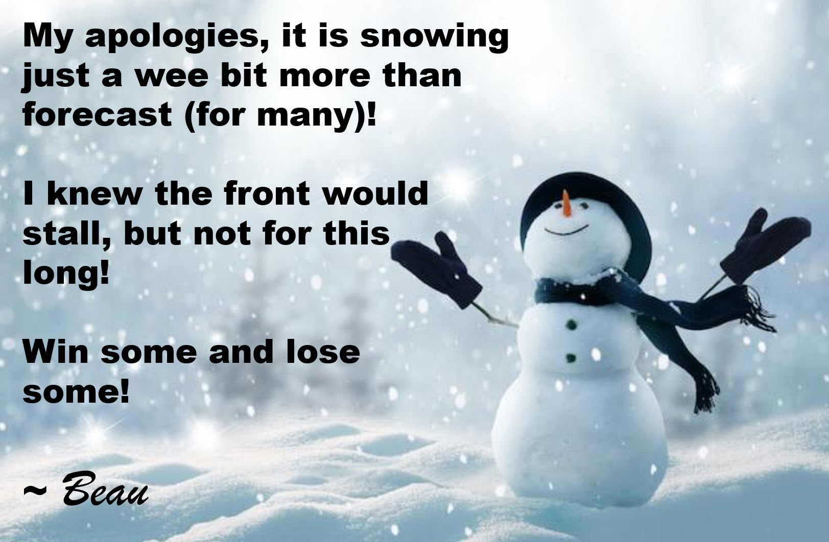
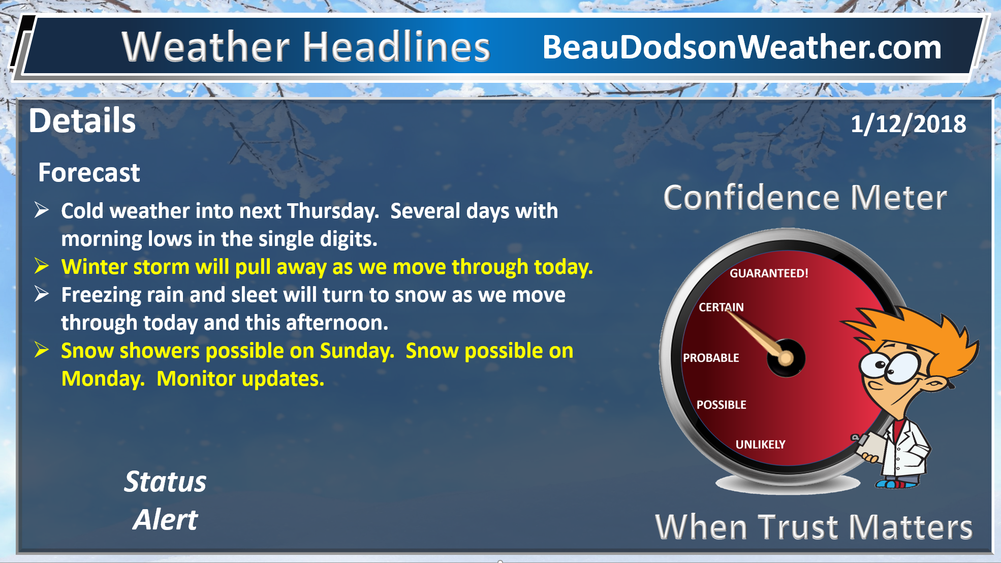
Wow, well some of you received a lot more snow than others.
My deepest apologies for getting the forecast totals wrong. I never dreamed the front would stall that long.
I posted this last night on social media! Nobody likes to miss the forecast more than the forecaster. Trust me!
.
.
Snowfall totals ranged from none to 12 inches! Quite the range.
The forecast was for some locations to receive very little in the way of snow. Others would receive one to three inches of snow with a few locations perhaps receiving four inches. The probabilities went down from there.
Many of you went for the gold.
Extreme southern Illinois, far southeast Missouri, and western Kentucky were the jackpot winners of the snow awards.
Extreme southern Illinois ranged from 3.5 to 7″. Extreme southeast Missouri had widespread 4 to 6 inches with pockets of 6 to 12 inches. Much of west Kentucky ended up with 3 to 6 inches and quite a few locations picked up 6 to 8 inches.
Northwest Tennessee also picked up periods of heavy snow. It took longer for them to start reporting accumulations. Temperatures there did warm a bit above freezing on Monday.
All in all, this was an over-achieving event (an understatement). My forecast probabilities stopped before eight inches.
I sent this out around 12:30 PM for extreme southern Illinois. I then ran a couple of errands. I ended up spending three hours in a ditch. I never could update everything else.
The problem was centered around a stalled front. I knew the front would stall. I did not know it would stall for the entire day and into half the night.
It did. The rest is history. Occasionally forecasts like this happen, but not very often (thankfully). It is certainly humbling to watch nature do what nature does.
It was one for the books. It is rare for a cold front to bring that much snow to the region. Normally our heavy snow events come from areas of low pressure that track into the region from the southwest. This one came into the region from the northwest.
A small disturbance slowed the progression of the front. This kept the snow falling for an extended period of time across portions of the region.
Those of you further north were wondering what all the fuss was about. You barely had enough snow to measure. Location, location, location.
Bitterly cold air temperatures and wind chills over the next 48 hours. Use care.
It will continue to be bitterly cold into Wednesday. Highs today will top out in the teens. Lows tonight mostly in the single digits. Highs on Wednesday will rise into the 20’s. Lows Wednesday night will range from 8 to 14.
The snow pack will help keep it colder.
Eventually, the winds will turn out of the south and southwest. We will likely have to deal with dense fog as we move deeper into the week. This is especially true as we start to warm a bit.
A strong cold front will sweep through the region on Sunday and Sunday night. This front will bring warmer air and rain. Thunderstorms are possible along and ahead of the front.
The amount of snow combined with heavy rain could be an issue. We will need to monitor trends in the guidance. Heavy rain over a deep snow pack can create water issues.
The risk of severe weather is an unknown. I will monitor trends. Wind fields will be strong. There is a question on instability.
The EC guidance brings the rain into the region Sunday night and Monday morning. This is a bit slower than previous runs.
For now, I have showers/storms in the forecast Sunday afternoon into Monday morning. I will adjust this as the forecast becomes clearer.
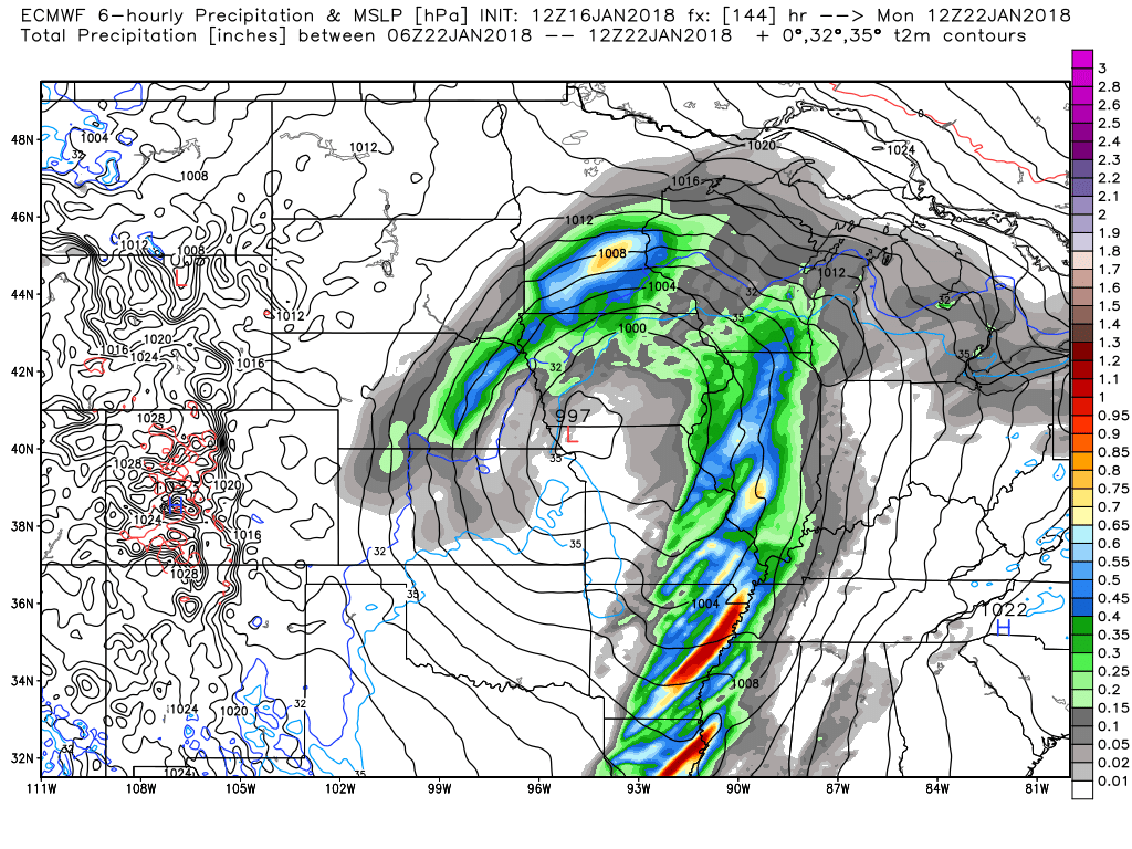
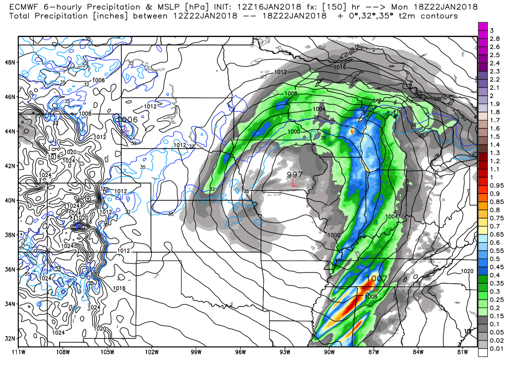
Here is the EC. Colors represent precipitation. This is rain for our region. Brighter colors would be heavier showers and perhaps thunderstorms.
This is the 6 hour rainfall totals map from 12 AM Monday to 6 AM Monday
The low is centered near Kansas City and is 997 mb.
.
.
This next graphic is 6 AM to 12 PM Monday
.
.
Monitor updates.
.
.
Beau’s Winter Weather Outlook
.
.
I am currently not tracking any winter weather concerns.
I will be monitoring a system towards the middle/end of next week. Long way out. Monitor updates
.


We offer regional radars and local city radars – if a radar does not update then try another one. Occasional browsers need their cache cleared. You may also try restarting your browser. This will usually fix any problems.
During the winter you can track snow and ice by clicking the winterize button on the local city view interactive radars.
You may email me at beaudodson@usawx.com
Interactive Weather Radar Page. Choose the city nearest your location: Click this link
National interactive radar: Click this link.