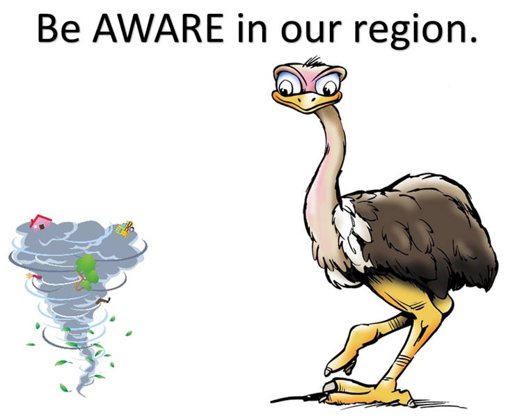
Part two of my series “what is available to you” for tracking weather.
Did you know that during high impact weather events I send out a “heads up” email? (this is separate for the signing up for the blog updates)
Thousands of you have already signed up for these emails. But, many of you may not even be aware of them.
You can sign up for these emails at the link below
Now, read the next paragraph carefully, please
You MUST reply back to the confirmation email.
Once you sign up for the email list you will receive an email asking you to confirm. If you do not respond to the confirmation email then the system will not add you.
So, if you sign up for the AWARE emails then check your email inbox and then reply to the email sent to you. 🙂
I use a company called Vertical Response to send out my emails. I sign in – I write the emails – I send the emails.
Here is the link to sign up for the AWARE emails…
Click here – SIGN UP FOR THE AWARE EMAILS
The link above will take you to a screen that will look like this image below
Simply click on the
Weather Updates
Sign Up Here!

I usually send out the emails before high impact weather events. Typically several days in advance. When I send them out does vary from one event to the next. When I send them out usually depends on how confident I am in the event occurring. Note that I will always tell you my confidence level within the email (see samples from actual events below).
When I send them out also depends on the type of weather event. If a major ice storm is forecast to impact our region, then I will try to give you several days advance notice. Same with tornado outbreaks. Occasionally, I will send out emails three or four days in advance and then one email per day leading up to the day of the event.
The emails are to be used as a “heads up” for impending inclement weather. I do NOT send out watches and warnings. You should own a NOAA Weather Radio to receive your watches and warnings. You should also have a weather APP on your cell phone. I recommend having three or four ways of receiving severe weather watches and warnings.
What information will these emails give you and your family?
Here are two examples from past events
December 3, 2013:
Update…
This email is valid for Thursday, December 5th through Monday, December 9th
This forecast covers parts of southern Illinois, southwest Indiana, southeast Missouri, western Kentucky, and northwest Tennessee.
For more frequent updates visit the Beau Dodson Weather Facebook page.
Confidence in this forecast: Medium confidence.
Remember that potential does not always make reality. Winter storms are notoriously tricky to forecast. Expect a wide range of weather conditions across our region. Some areas will remain rain longer than other areas.
Subject: Rain will spread into the area on Thursday afternoon. Rain will change to freezing rain, sleet, and snow on Thursday afternoon and Thursday night. Precipitation will continue into Friday. Another winter weather system is possible Saturday night and Sunday.
Significant accumulations of ice may occur over portions of the Tennessee and/or Ohio Valleys. The exact placement of the front will determine where precipitation falls and the amounts.
Forecasters are struggling with where to place the 32 degree line. That 32 degree line will obviously make all the difference in who ends up with the greatest amount of freezing rain.
I do believe that a damaging ice storm is possible later this week. Moderate to heavy ice accumulation could bring down tree limbs and power lines.
Bitterly cold air will mean lows in the teens both Saturday and Sunday morning. Single digits are possible in areas that have snow on the ground. Monday morning will also be bitterly cold.
Now is the time to make preparations for this possible winter storm.
This system is still several days out. Monitor the latest updates from the National Weather Service and local meteorologists.
Call to action: Make preparations for the possibility of short term power outages.
Find your local National Weather Service Office here – http://www.nws.noaa.gov/organization.php#maps – for the latest warnings and other information.
———————————–
Your Storm Tracking Tools:
1. Radars to track precipitation (I added eastern Kentucky and Nashville) – click here
2. Latest watches/warnings (click your area) – click here
4. Weather Observatory Main web-site – click here
———————————-
– Beau Dodson
Meteorologist for McCracken County Emergency Management
Meteorological Adviser Transportation Cabinet

The November 17, 2013 Tornado Outbreak –
You would have read the
Who
What
When
Where
and confidence level
November 17, 2013:
A chance for severe thunderstorms and tornadoes in the region later today and this evening…
This email covers Sunday, November 17th
This forecast covers parts of southern Illinois, southwest Indiana, southeast Missouri, western Kentucky, and northwest Tennessee.
For more frequent updates please visit the daily weather blog (see links below) or the Beau Dodson Weather Facebook page for current forecast threads.
———————————–
Your Storm Tracking Tools:
1. Radars to track storms (I added eastern Kentucky and Nashville) – click here
2. Latest watches/warnings (click your area) – click here
3. Storm Prediction Center Outlooks – click here
4. Weather Observatory Main web-site – click here
———————————-
Confidence in this forecast: Medium confidence to high confidence that some severe weather will occur today in the region.
There is the potential for a few strong tornadoes
There is the potential for a few reports of winds gusts over 70 mph
A regional severe weather outbreak is expected today across parts of the Ohio Valley. The Storm Prediction Center has outlined a significant risk area that covers parts or all of our area. The highest risk area is over parts of southeast and eastern Illinois into southern and western Indiana. The entire region, however, is in a risk for some severe storms.
The time-frame for the most concern would be 12 pm through early evening hours.
The current forecast projections indicate that a line of thunderstorms and/or super-cells will form later this afternoon over parts of Indiana and Illinois (perhaps as far southwest as eastern Missouri). These storms then would continue to develop and eventually form a line of thunderstorms.
Some questions remain as to how far south and west this line will develop. Certainty is higher over Indiana and Illinois vs far southeast Missouri and far western Kentucky. Confidence rises as you move further east in west Kentucky (say Kentucky Lake to Evansville, Indiana and then eastward.
Bottom line – pay attention to severe weather watches and warnings today. The atmosphere is unusually primed for tornadoes. The potential exists for a few tornadoes to become strong and long lived.