LONG RANGE OUTLOOKS/Videos/Graphics
A general spring and summer outlook has been posted. More details will be posted over time.
Bonus maps and videos have been updated.
Link to the long range outlooks (Scroll down to the 2nd post at this link for the latest long range outlook) and videos (for subscribers) – Click here
You haven’t subscribed? Subscribe at www.beaudodsonweather.com
Monthly operating costs for Weather Talk can top $2000.00. Your $3 subscription helps pay for those costs. I work for you.
.

.
Thursday Night Forecast Details:
Forecast: Mostly clear. Chilly.
Temperatures: MO ~ 26 to 32 IL ~ 26 to 32 KY ~ 26 to 32
What is the chance of precipitation? MO ~ 0% IL ~ 0% KY ~ 0% TN ~ 0%
Coverage of precipitation: None
Wind chill values: 20 to 30
Accumulating snow or ice: No
Winds: South at 5 to 10 mph.
What impacts are anticipated from the weather? None
My confidence in the forecast verifying: High
Is severe weather expected? No
The NWS defines severe weather as 58 mph wind or great, 1″ hail or larger, and/or tornadoes
Should I cancel my outdoor plans: No
.
February 9, 2018
Friday Forecast Details
Forecast: Partly to mostly sunny. A few more clouds over the northern quarter of the region.
Temperatures: MO ~ 52 to 58 IL ~ 50 to 55 KY ~ 54 to 58
What is the chance of precipitation? MO ~ 0% IL ~ 0% KY ~ 0% TN ~ 0%
Coverage of precipitation: None
Wind chill values: N/A
Accumulating snow or ice: No
Winds: South winds 8 to 16 mph with gusts above 20 mph
What impacts are anticipated from the weather? None
My confidence in the forecast verifying: High
Is severe weather expected? No
The NWS defines severe weather as 58 mph wind or great, 1″ hail or larger, and/or tornadoes
Should I cancel my outdoor plans? No
.
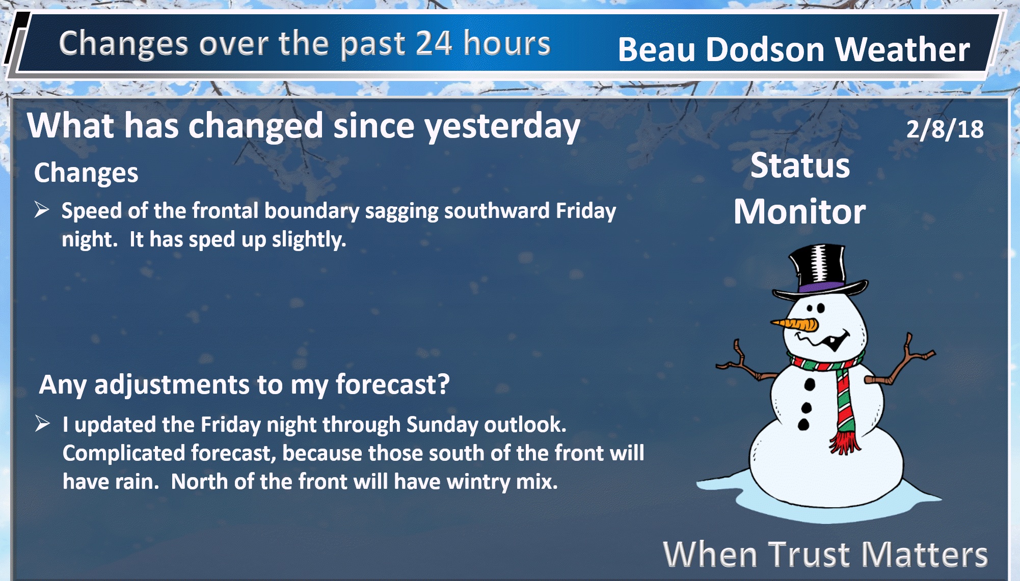
Uncertainty increases in the overall forecast as we enter Friday night. The placement of a cold front will be key to each counties forecast. Monitor updates. A wintry mix of freezing rain, sleet, and snow will be possible this weekend. Winter weather advisories may have to be issued for some of my forecast counties.
Friday Night Forecast Details:
Forecast: Increasing clouds. A chance of rain showers or light drizzle. I will be monitoring our extreme northern counties from Farmington, Missouri to Mt Vernon, Illinois. If the front sags a bit further southward then freezing rain or freezing drizzle may need to be added to the forecast.
Temperatures: MO ~ 30 to 36 IL ~ 30 to 35 KY ~ 32 to 35
What is the chance of precipitation? MO ~ 40% IL ~ 40% KY ~ 40% TN ~ 40%
Coverage of precipitation: Scattered
Wind chill values: 20 to 30
Accumulating snow or ice: Monitor updates. A light wintry mix may cause issues over our northern counties.
Winds: South at 8 to 16 mph south of the cold front. North winds at 8 to 16 mph north of the cold front. Again, the placement of the front is key to wind direction.
What impacts are anticipated from the weather? Monitor updates
My confidence in the forecast verifying: Medium.
Is severe weather expected? No
The NWS defines severe weather as 58 mph wind or great, 1″ hail or larger, and/or tornadoes
Should I cancel my outdoor plans: Monitor updates.
.
February 10, 2018
Saturday Forecast Details
Forecast: Cloudy. A chance of rain showers. A chance of a wintry mix early in the morning (northern counties). Wintry mix changing to rain as temperatures rise.
Temperatures: MO ~ 37 to 44 IL ~ 36 to 44 KY ~ 42 to 46
What is the chance of precipitation? MO ~ 40% IL ~ 40% KY ~ 60% TN ~ 60%
Coverage of precipitation: Scattered
Wind chill values: 30 to 40
Accumulating snow or ice: Monitor updates.
Winds: East and northeast winds 5 to 10 mph with gusts to 20 mph
What impacts are anticipated from the weather? Wet roadways. Monitor the potential for icy roads before 8 AM. Low confidence.
My confidence in the forecast verifying: Medium
Is severe weather expected? No
The NWS defines severe weather as 58 mph wind or great, 1″ hail or larger, and/or tornadoes
Should I cancel my outdoor plans? Have a plan B and monitor updates
.
Saturday Night Forecast Details:
Forecast: Cloudy. Turning colder. Light rain showers. Light rain changing to light freezing rain and sleet across portions of the area. What portion of the region will need to be monitored. It will depend on how fast the front moves southward.
Temperatures: MO ~ 26 to 32 IL ~ 26 to 32 KY ~ 28 to 32
What is the chance of precipitation? MO ~ 60% IL ~ 60% KY ~ 60% TN ~ 60%
Coverage of precipitation: Scattered to perhaps widespread.
Wind chill values: 18 to 28
Accumulating snow or ice: A light accumulation of freezing rain and sleet will be possible. Monitor updates.
Winds: North and northeast winds 6 to 12 mph with gusts to 16 mph
What impacts are anticipated from the weather? Wet roadways. Monitor for icy conditions, as well.
My confidence in the forecast verifying: Medium
Is severe weather expected? No
The NWS defines severe weather as 58 mph wind or great, 1″ hail or larger, and/or tornadoes
Should I cancel my outdoor plans: Have a plan B and monitor updates.
.
February 11, 2018
Sunday Forecast Details
Forecast: Cloudy. Colder. A chance of rain, freezing rain, and sleet.
Temperatures: MO ~ 32 to 36 IL ~ 32 to 36 KY ~ 32 to 36
What is the chance of precipitation? MO ~ 30% IL ~ 30% KY ~ 30% TN ~ 30%
Coverage of precipitation: Scattered
Wind chill values: 30 to 40
Accumulating snow or ice: Monitor updates
Winds: North and northeast winds 7 to 14 mph with gusts to 20 mph
What impacts are anticipated from the weather? Wet roadways. Monitor the potential for icy roads.
My confidence in the forecast verifying: LOW
Is severe weather expected? No
The NWS defines severe weather as 58 mph wind or great, 1″ hail or larger, and/or tornadoes
Should I cancel my outdoor plans? Have a plan B and monitor updates
.
Sunday Night Forecast Details:
Forecast: Mostly cloudy. Colder. A chance of freezing rain, sleet, and snow.
Temperatures: MO ~ 16 to 24 IL ~ 16 to 24 KY ~ 18 to 24
What is the chance of precipitation? MO ~ 30% IL ~ 30% KY ~ 30% TN ~ 30%
Coverage of precipitation: Monitor updates
Wind chill values: 10 to 20
Accumulating snow or ice: Monitor updates
Winds: North and northeast winds 6 to 12 mph with gusts to 16 mph
What impacts are anticipated from the weather? Icy roadways are possible.
My confidence in the forecast verifying: LOW
Is severe weather expected? No
The NWS defines severe weather as 58 mph wind or great, 1″ hail or larger, and/or tornadoes
Should I cancel my outdoor plans: Have a plan B and monitor updates
.
February 12, 2018
Monday Forecast Details
Forecast: A mix of sun and clouds. Cool.
Temperatures: MO ~ 42 to 46 IL ~ 42 to 46 KY ~ 42 to 46
What is the chance of precipitation? MO ~ 0% IL ~ 0% KY ~ 0% TN ~ 0%
Coverage of precipitation: None
Wind chill values: 35 to 45
Accumulating snow or ice: No
Winds: East and northeast winds 6 to 12 mph
What impacts are anticipated from the weather? None
My confidence in the forecast verifying: Medium
Is severe weather expected? No
The NWS defines severe weather as 58 mph wind or great, 1″ hail or larger, and/or tornadoes
Should I cancel my outdoor plans? No
.
Monday Night Forecast Details:
Forecast: Increasing clouds. Chilly.
Temperatures: MO ~ 30 to 35 IL ~ 30 to 35 KY ~ 30 to 35
What is the chance of precipitation? MO ~ 0% IL ~ 0% KY ~ 0% TN ~ 0%
Coverage of precipitation:
Wind chill values: 25 to 30
Accumulating snow or ice:
Winds: East and northeast winds 5 to 10 mph
What impacts are anticipated from the weather?
My confidence in the forecast verifying: LOW
Is severe weather expected? No
The NWS defines severe weather as 58 mph wind or great, 1″ hail or larger, and/or tornadoes
Should I cancel my outdoor plans:
.
Interactive Weather Radar Page. Choose the city nearest your location: Click this link.
.

.
Friday night into Saturday: Frozen precipitation is unlikely. I will be monitoring our extreme northern counties for rain showers changing to freezing rain or sleet. That would include areas from Farmington, Missouri to Mt Vernon, Illinois.
Saturday late afternoon into Sunday night: A wintry mix is possible. Monitor updates. The best chance of freezing rain and sleet will be Saturday night and Sunday morning. Another round possible Sunday night, but confidence is low. Not sure about snow chances. The upper levels of the atmosphere might be too warm. I will keep an eye on that part of the forecast.
.

.
The National Weather Service definition of a severe thunderstorm is one that produces quarter size hail or larger, 58 mph winds or greater, and/or a tornado.
Now through Tuesday: Severe weather is not in the forecast.
.

.
.
.
.
.
.
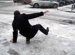
What may look wet could actually be ice. Black ice. Black ice looks like wet payment.
.
Forecast:
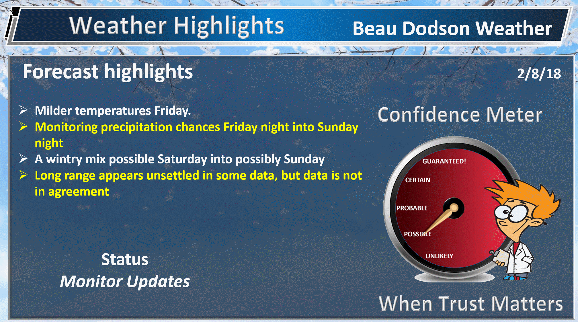
HIGHLIGHTS
- Quite day for the region
- Milder on Friday. Might feel a little like spring (after our recent cold spell)
- Precipitation chances increase Friday night and should linger into Sunday
- Another light winter weather event is on tap for the region. Location will again be key to precipitation type
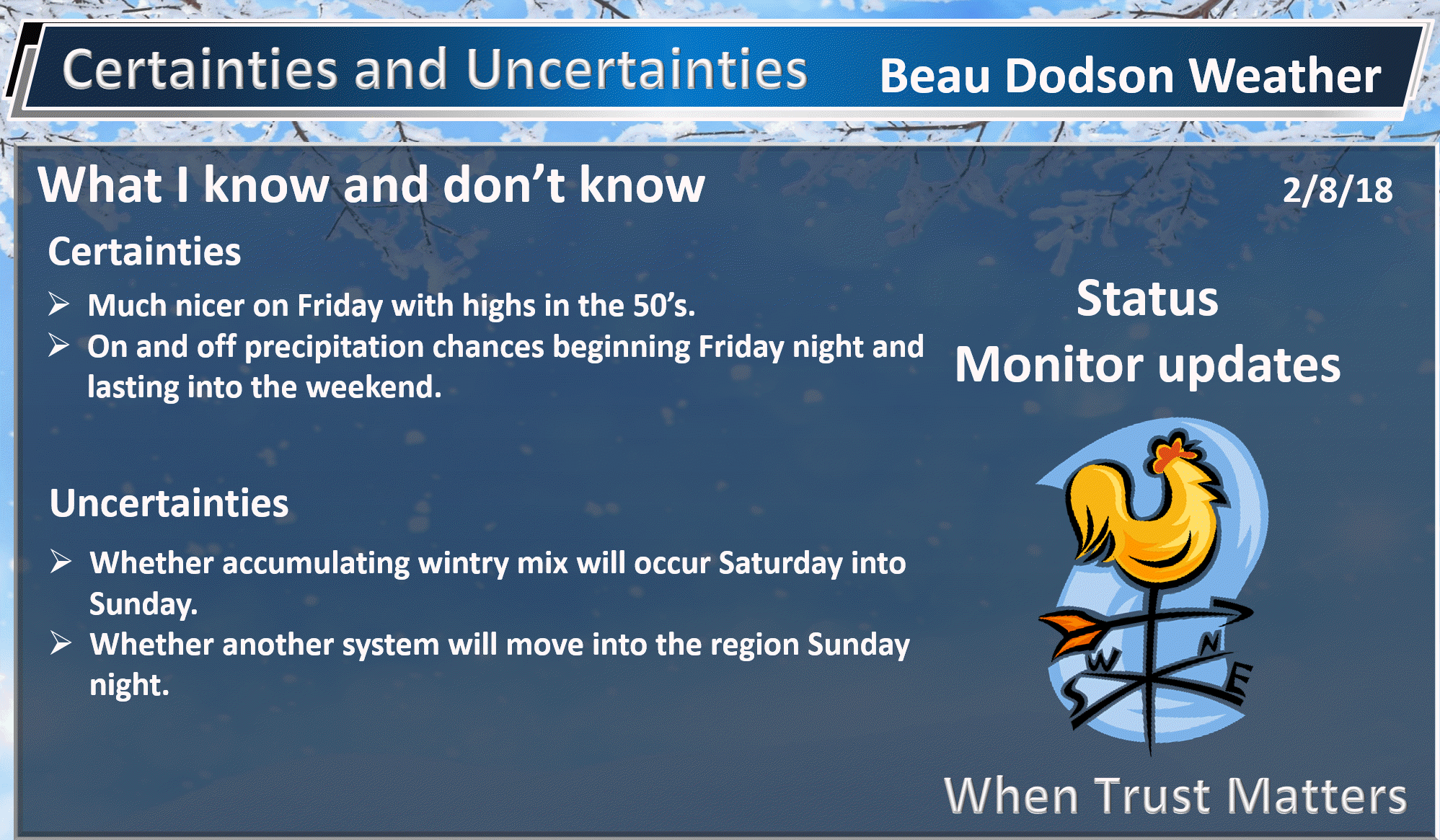
High confidence today through Friday.
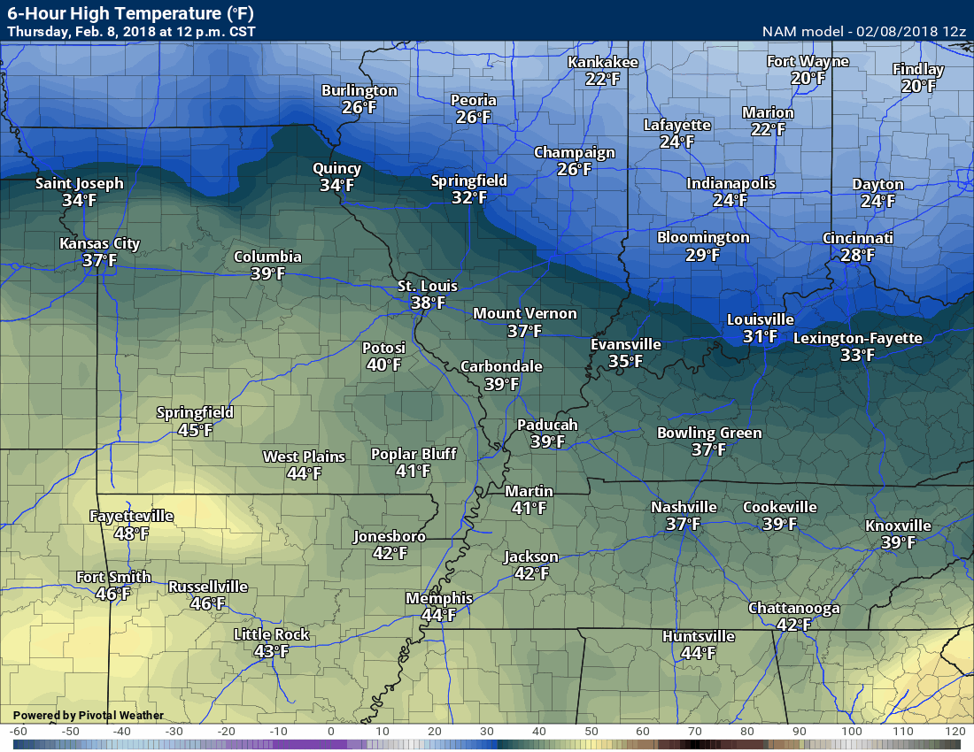
A quiet day is on tap for the region. We did have some morning clouds over our northern counties. A few snow flurries were noted on radar just to our north. Northern Illinois is experiencing quite a bit of snow. Anyone traveling north over the coming days should check road conditions.
Temperatures today will be cool, but not too bad (it is February, after all). Highs will top out in the upper 30’s to lower 40’s. That is colder than normal.
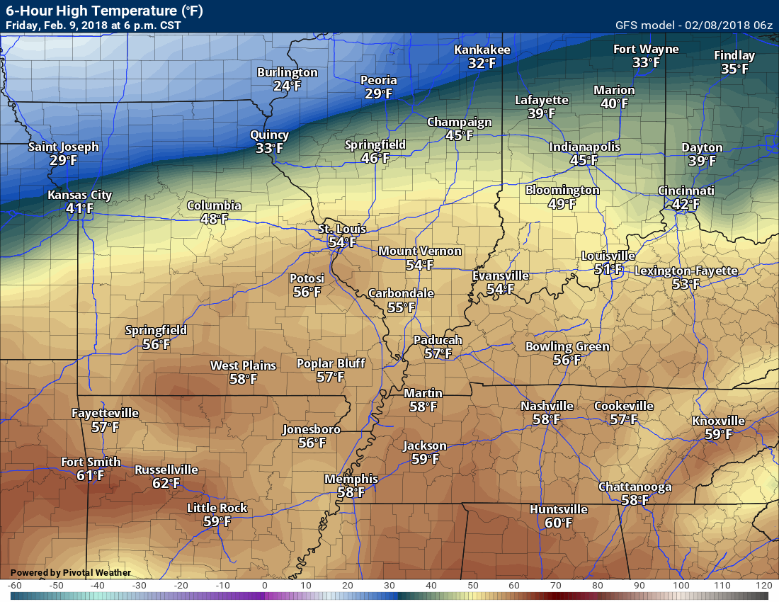
The big story, temperature wise, will arrive on Friday. Many of you will experience temperatures in the 50’s! Yes, 50’s! How wonderful is that?
Here is the Friday high temperature map. Look what is lurking to the north. Another sharp cold front. That is the front that will return wintry weather to our region.
.
.
Enjoy those temperatures, because they won’t last. The front will begin tracking southward Friday morning and afternoon. Here is a temperature animation. Time stamp upper left.
.
.
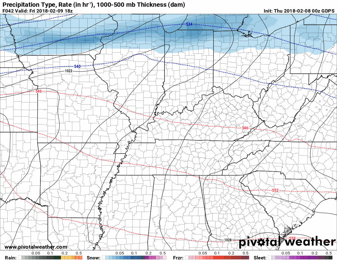
A light wintry mix of snow, sleet, and freezing rain will develop behind the cold front. Some showers possible ahead of it, as well.
The models diverge as you move into the weekend. This lowers the confidence level in the specific forecast for each county.
I am confident there will be precipitation in the region this weekend. The finer details will need to be worked out.
I believe most of our region will remain rain Friday night into Saturday. The front may stay just far enough north to keep us out of the winter weather zone. We will need to monitor our extreme northern counties.
The further north you travel the greater the risk of wintry precipitation and icy road conditions.
REMEMBER: Models are for guidance. They are not gospel. Models are non-human algorithms spit out by computers. Meteorologists produce forecasts based off a blend of models. No single model will be correct.
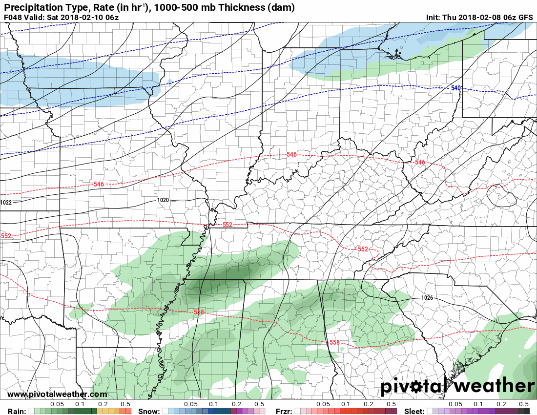
Let’s take a look at some future-cast radar animations. What I want you to note are the difference in the placement of the rain vs the wintry mix.
Green is rain. Dark green is heavier rain. Yellow is heavy rain. Blue is snow. Purple is sleet. Pink is freezing rain. The darker the shading the heavier the precipitation.
GFS model future-cast radar animation
.
.
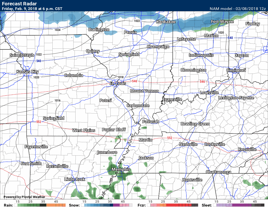
NAM model future-cast radar animation
Green is rain. Dark green is heavier rain. Yellow is heavy rain. Blue is snow. Purple is sleet. Pink/red is freezing rain. The darker the shading the heavier the precipitation.
.
.
GEM model future-cast radar animation
.
.
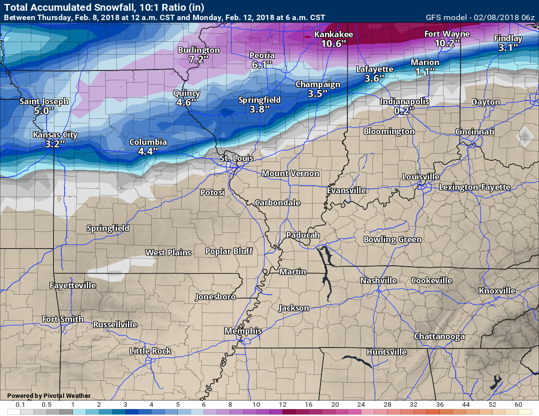
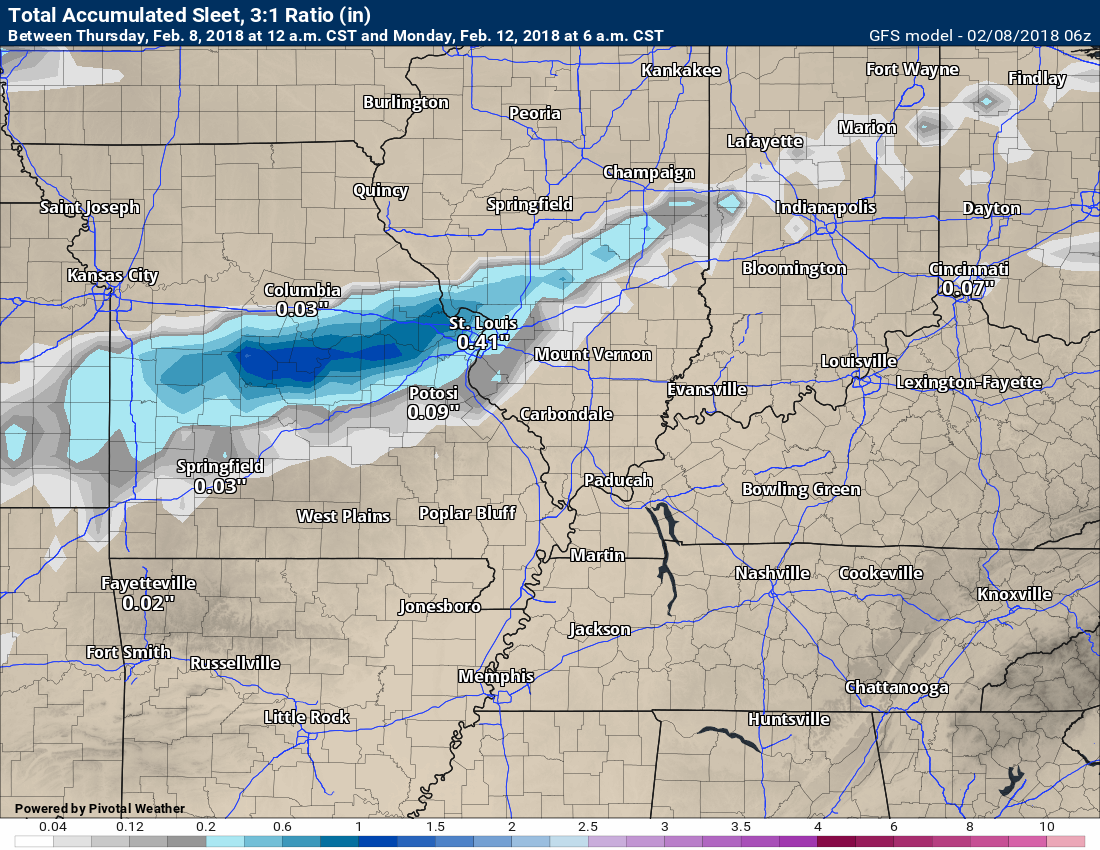
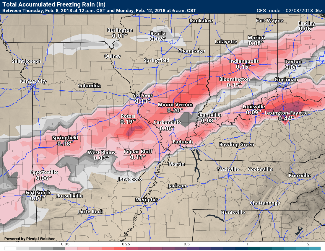
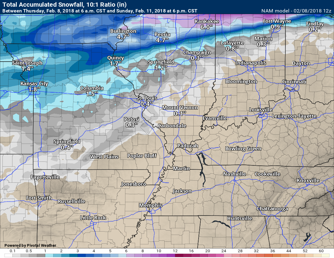
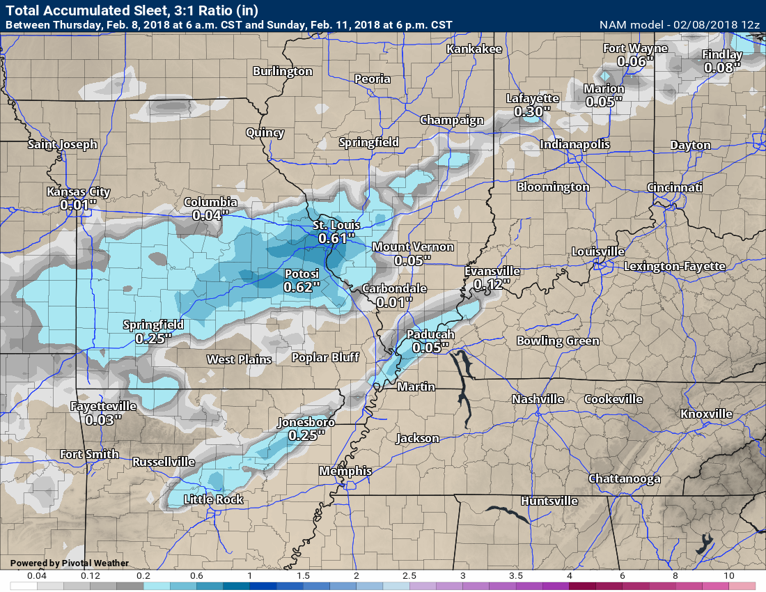
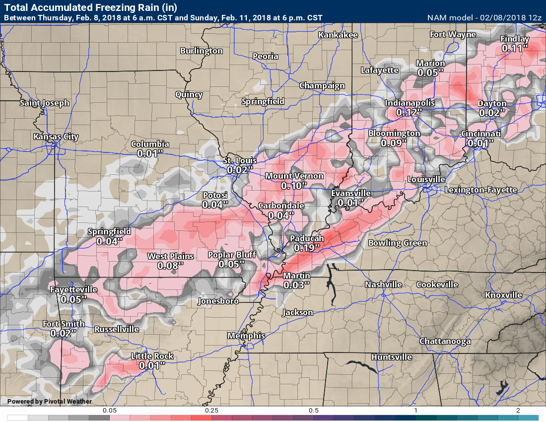
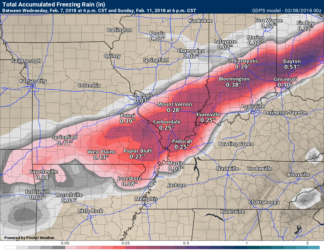
Let’s look at some totals. Take these with a grain of salt. I am showing you these so you get the general idea that some wintry mix is possible this weekend. Most of the guidance is showing light totals. Of course, it only takes a little bit of freezing rain to cause problems. Ice is ice.
GFS model snow totals
.
.
GFS model sleet totals
.
.
GFS model freezing rain totals
Remember, with freezing rain you can usually cut the model totals in half.
.
.
NAM model snow totals
.
.
NAM model sleet totals
.
.
NAM models freezing rain totals
Remember, with freezing rain you can usually cut the model totals in half.
.
.
GEM model snow totals
.
.
GEM model freezing rain and sleet totals
Remember, with freezing rain you can usually cut the model totals in half.
These are fairly light totals. Cut the number in half and you end up with 0.05″ to perhaps 0.15″ of freezing rain. Of course, it only takes a little bit of freezing rain to cause travel problems.
.
.
Bottom line:
Monitor updates concerning the Friday night through Sunday night time-frame. Portions of the region will likely receive a light wintry mix of precipitation. Icy roads and surfaces will be the main concern.
The greatest chance of frozen precipitation will be Saturday night into Sunday morning.
.


We offer regional radars and local city radars – if a radar does not update then try another one. Occasional browsers need their cache cleared. You may also try restarting your browser. This will usually fix any problems.
During the winter you can track snow and ice by clicking the winterize button on the local city view interactive radars.
You may email me at beaudodson@usawx.com
Interactive Weather Radar Page. Choose the city nearest your location: Click this link
National interactive radar: Click this link.