LONG RANGE OUTLOOKS/Videos/Graphics
February and March outlooks have been updated.
Bonus maps and videos have been updated.
Link to the long range outlooks (Scroll down to the 2nd post at this link for the latest long range outlook) and videos (for subscribers) – Click here
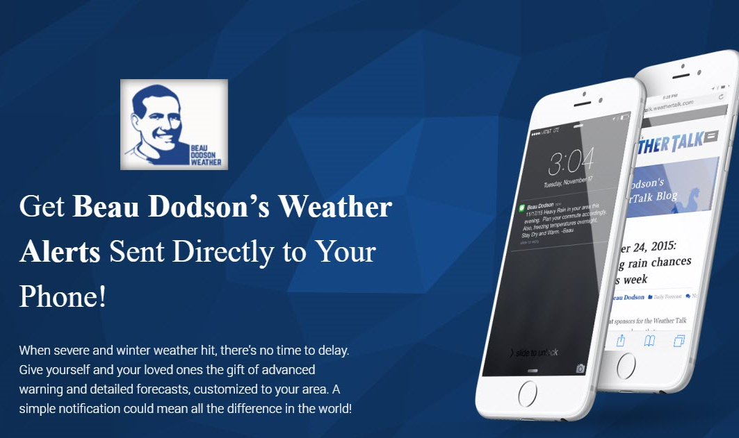
Subscribe at www.beaudodsonweather.com
Monthly costs to run Weather Talk can top $2000.00
Please consider subscribing!
Here are my monthly out of pocket costs to deliver you the weather.
.

.
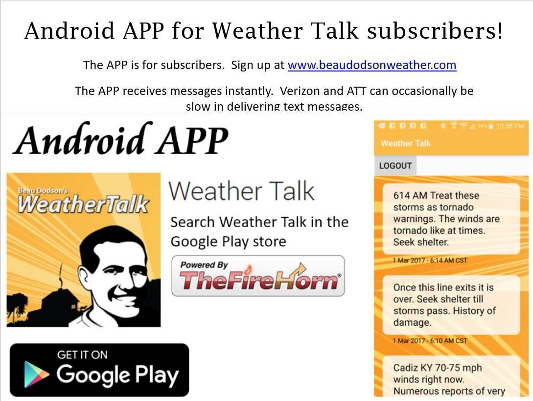
Do you want more? How about short and long range outlooks, videos, and more detailed analysis!
Subscribe at www.beaudodsonweather.com
Once subscribed you can choose from four different app/text messages!
.
.
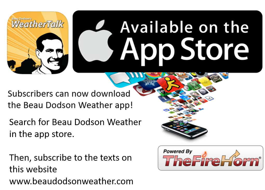
Be sure and download the app (subscribers). The app receives the messages much faster than regular text messaging (same messages, but faster).
.
.

.
February 4, 2018
Sunday Forecast Details
Forecast: Partly sunny this morning. Becoming cloudy. A 50% to 60% of snow showers re-developing. Some light accumulation possible. Becoming windy. Falling temperatures. Low wind chill values.
Temperatures: MO ~ 36 to 44 IL ~ 36 to 44 KY ~ 40 to 46
What is the chance of precipitation? MO ~ 60% IL ~ 60% KY ~ 50% – 60% TN ~ 60%
Coverage of precipitation: Snow showers, light snow, and flurries redeveloping during the afternoon hours.
Wind chill values: 10 to 20
Accumulating snow or ice: 0″ to 1″ of snow possible
Winds: Southwest winds becoming north and northwest at 6 to 12 mph with gusts to 35 mph
What impacts are anticipated from the weather? Strong winds. Monitor afternoon snow chances.
My confidence in the forecast verifying: High
Is severe weather expected? No
The NWS defines severe weather as 58 mph wind or great, 1″ hail or larger, and/or tornadoes
Should I cancel my outdoor plans? No, but it will be turning colder and snow showers are possible.
.
Sunday Night Forecast Details:
Forecast: Partly cloudy. Evening snow showers. Snow ending. Bitterly cold. Low wind chill values.
Temperatures: MO ~ 10 to 15 IL ~ 10 to 15 KY ~ 12 to 16
What is the chance of precipitation? MO ~ 30% IL ~ 30% KY ~ 30% TN ~ 30%
Coverage of precipitation: Scattered early. Ending.
Wind chill values: -5 to 15 above
Accumulating snow or ice: Light dusting or so possible.
Winds: North 7 to 14 mph with gusts to 30 mph (esp early)
What impacts are anticipated from the weather? Some slick spots if the snow showers linger.
My confidence in the forecast verifying: Medium
Is severe weather expected? No
The NWS defines severe weather as 58 mph wind or great, 1″ hail or larger, and/or tornadoes
Should I cancel my outdoor plans: No, but check radars and current conditions.
.
February 5, 2018
Monday Forecast Details
Forecast: Mostly sunny with passing clouds. Chilly.
Temperatures: MO ~ 35 to 40 IL ~ 34 to 38 KY ~ 35 to 40
What is the chance of precipitation? MO ~ 0% IL ~ 0% KY ~ 0% TN ~ 0%
Coverage of precipitation: None
Wind chill values: 0 to 15 before 11 AM and then 20 to 35 during the afternoon hours
Accumulating snow or ice: No
Winds: Winds becoming east and southeast at 5 to 10 mph with gusts to 12 mph
What impacts are anticipated from the weather? If snow lingers Sunday night, then watch for slick spots
My confidence in the forecast verifying: High
Is severe weather expected? No
The NWS defines severe weather as 58 mph wind or great, 1″ hail or larger, and/or tornadoes
Should I cancel my outdoor plans? No.
.
Monday Night Forecast Details:
Forecast: Increasing clouds. A chance of snow over the northern parts of southeast Missouri and northern parts of southern Illinois.
Temperatures: MO ~ 26 to 32 IL ~ 25 to 30 KY ~ 26 to 32
What is the chance of precipitation? MO ~ 30% IL ~ 30% KY ~ 10% TN ~ 10%
Coverage of precipitation: Isolated to scattered (mainly north)
Wind chill values: 18 to 25
Accumulating snow or ice: Unlikely, but monitor updates.
Winds: Winds south becoming southwest and perhaps west at 6 to 12 mph
What impacts are anticipated from the weather? Monitor updates
My confidence in the forecast verifying: Medium
Is severe weather expected? No
The NWS defines severe weather as 58 mph wind or great, 1″ hail or larger, and/or tornadoes
Should I cancel my outdoor plans: Monitor updates
.
February 6, 2018
Tuesday Forecast Details
Forecast: Cloudy. Freezing rain, sleet, snow, and rain developing during the late morning or afternoon. Some accumulation of wintry precipitation is possible. The track of the area of low pressure will determine who receives frozen precipitation and who receives rain.
Temperatures: MO ~ 32 to 44 IL ~ 32 to 44 KY ~ 35 to 40
What is the chance of precipitation? MO ~ 60% IL ~ 50% KY ~ 50% TN ~ 50%
Coverage of precipitation: Perhaps widespread. There are some questions above timing of precipitation.
Wind chill values: 24 to 32
Accumulating snow or ice: Monitor updates. Some accumulation of snow and ice is possible.
Winds: Northeast and east winds at 7 to 14 mph
What impacts are anticipated from the weather? Monitor updates.
My confidence in the forecast verifying: LOW
Is severe weather expected? No
The NWS defines severe weather as 58 mph wind or great, 1″ hail or larger, and/or tornadoes
Should I cancel my outdoor plans? Have a plan B.
.
Tuesday Night Forecast Details:
Forecast: Cloudy. Freezing rain, sleet, snow, and rain likely. Monitor updates. It appears that all types of precipitation will be possible in the region.
Temperatures: MO ~ 25 to 30 IL ~ 25 to 30 KY ~ 28 to 34
What is the chance of precipitation? MO ~ 60% IL ~ 60% KY ~ 70% TN ~ 70%
Coverage of precipitation: Widespread
Wind chill values: 20 to 30
Accumulating snow or ice: Yes. Some accumulation of ice and snow possible. Monitor updates.
Winds: East wind becoming north at 7 to 14 mph and gusty
What impacts are anticipated from the weather? Icy roads possible. Monitor the ice potential for spotty power outages.
My confidence in the forecast verifying: LOW
Is severe weather expected? No
The NWS defines severe weather as 58 mph wind or great, 1″ hail or larger, and/or tornadoes
Should I cancel my outdoor plans: Have a plan B
.
February 7, 2018
Wednesday Forecast Details
Forecast: Morning clouds. Freezing rain, sleet, snow, and rain possible before 2 PM. Timing of the precipitation ending will need to be fine tuned.
Temperatures: MO ~ 30 to 35 IL ~ 30 to 35 KY ~ 33 to 36
What is the chance of precipitation? MO ~ 40% IL ~ 40% KY ~ 50% TN ~ 50%
Coverage of precipitation: Scattered
Wind chill values: 20 to 30
Accumulating snow or ice: Monitor updates
Winds: North at 6 to 12 mph with gusts to 18 mph
What impacts are anticipated from the weather? Monitor for icy road conditions across portions of the region
My confidence in the forecast verifying: Medium
Is severe weather expected? No
The NWS defines severe weather as 58 mph wind or great, 1″ hail or larger, and/or tornadoes
Should I cancel my outdoor plans? Monitor updates.
.
Wednesday Night Forecast Details:
Forecast: Mostly clear. Chilly.
Temperatures: MO ~ 18 to 22 IL ~ 18 to 22 KY ~ 18 to 22
What is the chance of precipitation? MO ~ 0% IL ~ 0% KY ~ 0% TN ~ 0%
Coverage of precipitation: None
Wind chill values: 12 to 20
Accumulating snow or ice: No
Winds: North and northeast at 5 to 10 mph with gusts to 16 mph
What impacts are anticipated from the weather? None
My confidence in the forecast verifying: Medium
Is severe weather expected? No
The NWS defines severe weather as 58 mph wind or great, 1″ hail or larger, and/or tornadoes
Should I cancel my outdoor plans: No
.
February 8, 2018
Thursday Forecast Details
Forecast: Mostly sunny.
Temperatures: MO ~ 36 to 42 IL ~ 36 to 42 KY ~ 38 to 44
What is the chance of precipitation? MO ~ 0% IL ~ 0% KY ~ 0% TN ~ 0%
Coverage of precipitation: None
Wind chill values: 30 to 40
Accumulating snow or ice: No
Winds: South and southwest at 5 to 10 mph
What impacts are anticipated from the weather? None
My confidence in the forecast verifying: Medium
Is severe weather expected? No
The NWS defines severe weather as 58 mph wind or great, 1″ hail or larger, and/or tornadoes
Should I cancel my outdoor plans? No
.
Thursday Night Forecast Details:
Forecast: Mostly clear. Chilly.
Temperatures: MO ~ 25 to 30 IL ~ 25 to 30 KY ~ 25 to 30
What is the chance of precipitation? MO ~ 0% IL ~ 0% KY ~ 0% TN ~ 0%
Coverage of precipitation: None
Wind chill values: 18 to 24
Accumulating snow or ice: No
Winds: Variable at 5 to 10 mph
What impacts are anticipated from the weather? None
My confidence in the forecast verifying: Medium
Is severe weather expected? No
The NWS defines severe weather as 58 mph wind or great, 1″ hail or larger, and/or tornadoes
Should I cancel my outdoor plans: No
.

.
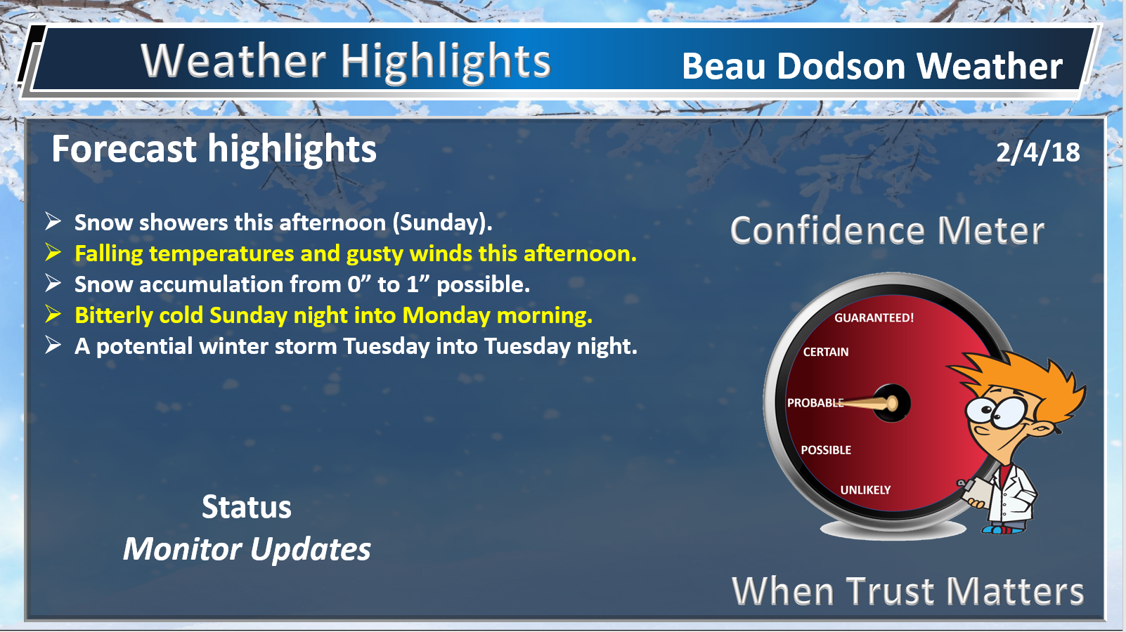
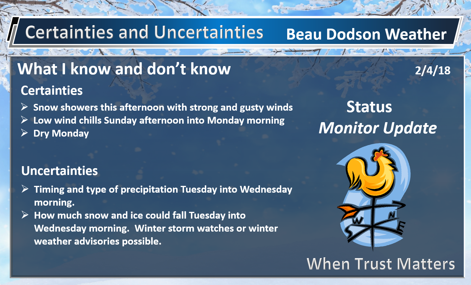
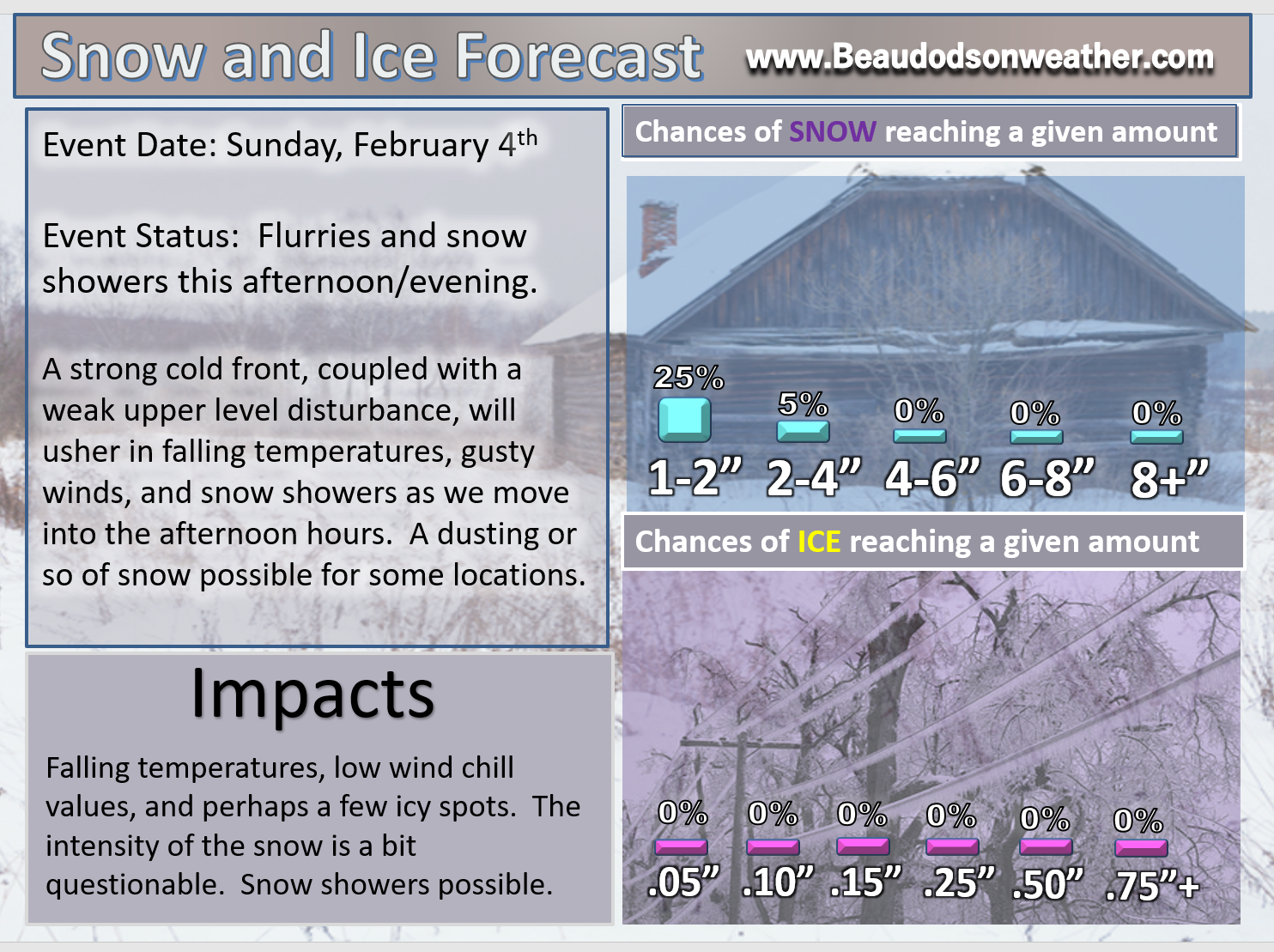
Sunday afternoon and Monday night: A fast moving system will deliver flurries and snow showers to the area. Falling temperatures and gusty winds will push wind chill values into the teens. A dusting to an inch of snow possible.
Tuesday into Wednesday: A winter storm is anticipated to deliver freezing rain, sleet, snow, and rain to the region. The track of the area of low pressure will be key to where the rain/ice/snow line sets up. Monitor updates concerning this winter storm.
.

.
The National Weather Service definition of a severe thunderstorm is one that produces quarter size hail or larger, 58 mph winds or greater, and/or a tornado.
Now through next Friday A few thunderstorms are possible on Tuesday/Tuesday night. The best chance of lightning would be across the Missouri Bootheel and northwest Tennessee. This is highly dependent on the track of the area of low pressure and placement of the warm front. Monitor updates.
.

.
February 4, 2018
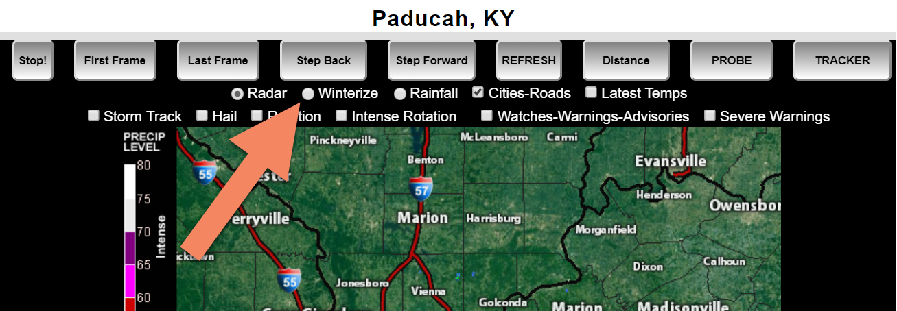
Interactive Weather Radar Page. Choose the city nearest your location: Click this link.
Click WINTERIZE on the local city view radars.
Example of the winterize button. This will show you rain vs snow vs ice. It is an algorithm, so it isn’t perfect.
.
.
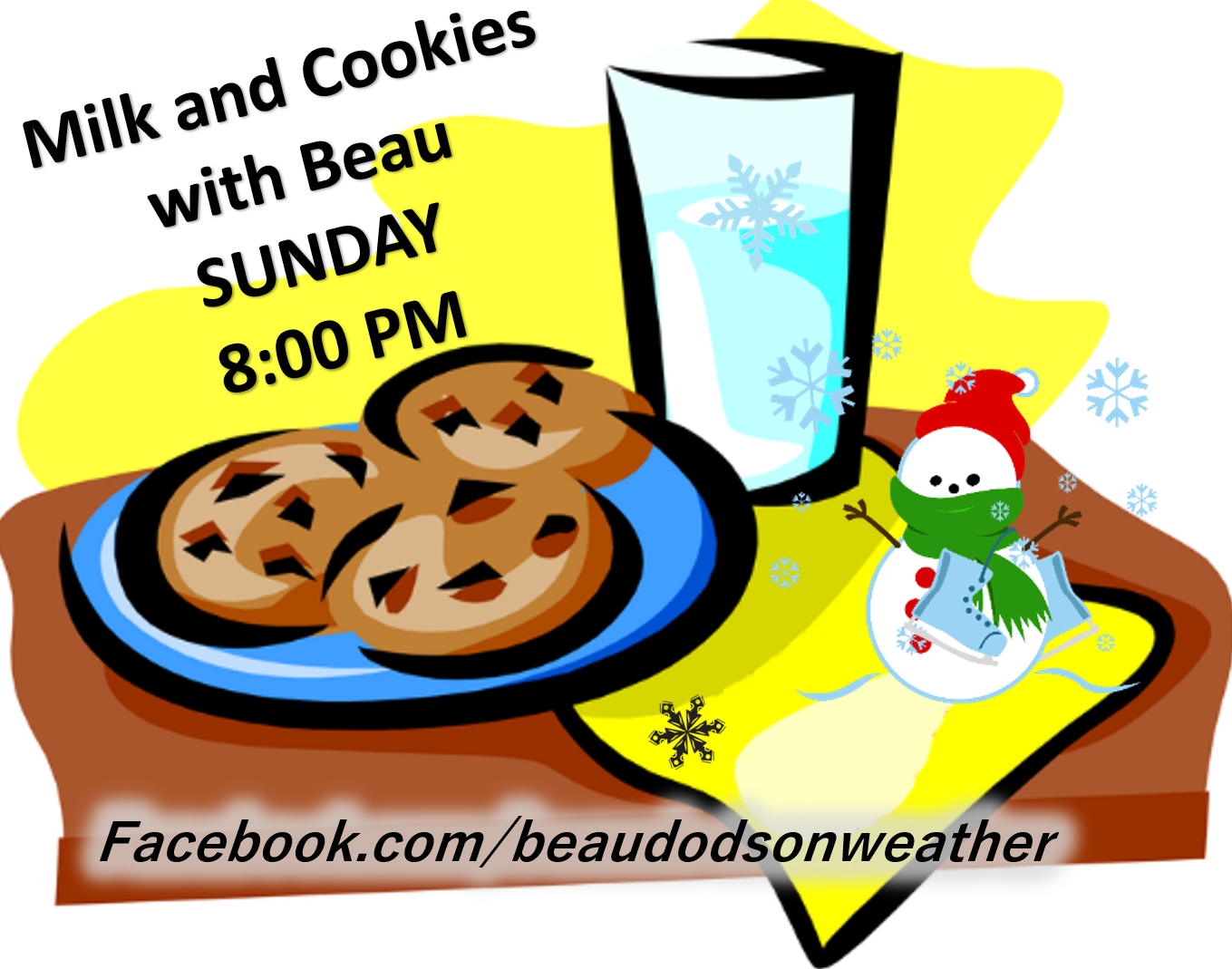
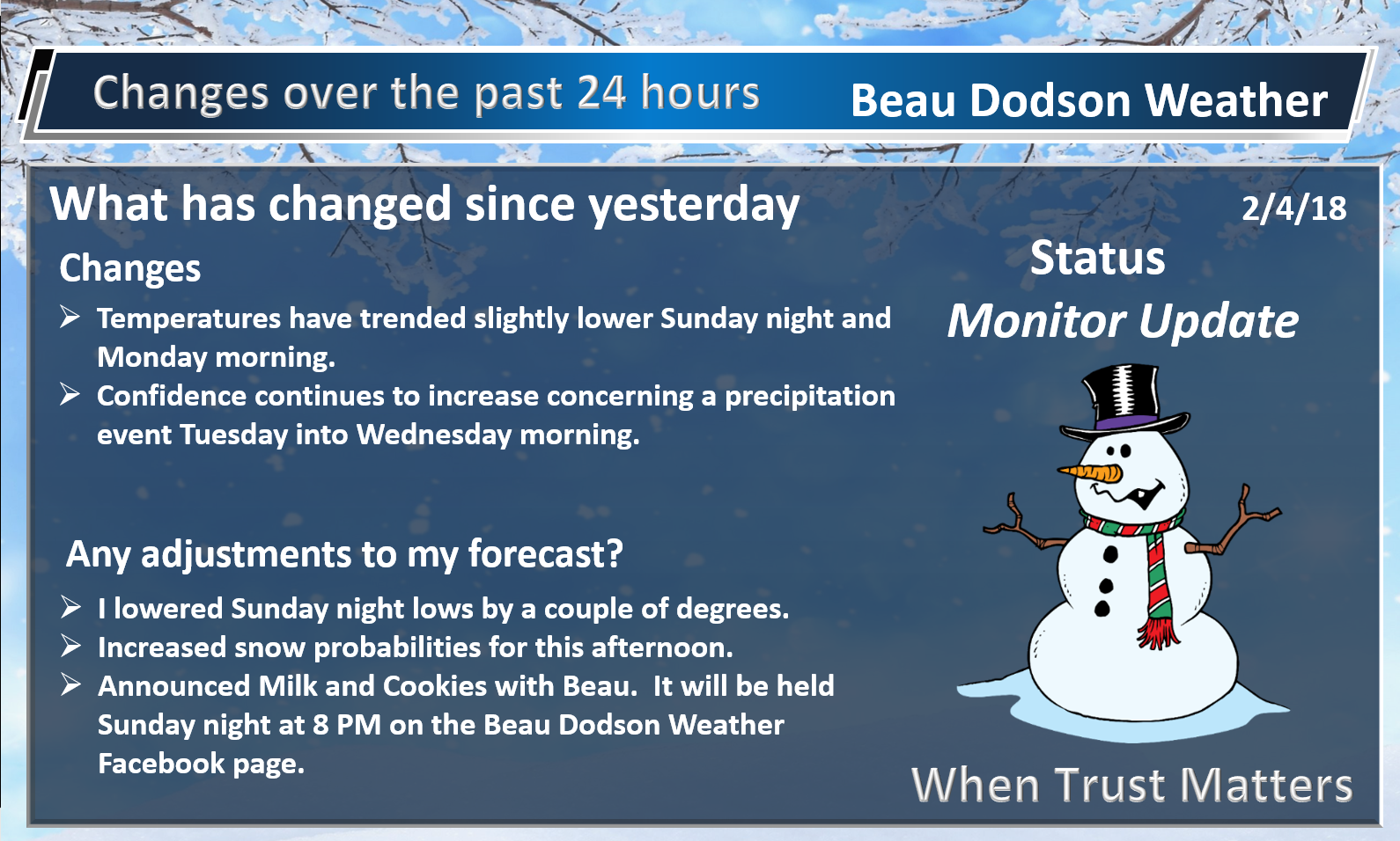
I will be holding a Milk and Cookies with Beau Sunday night at 8 PM. I will be discussing a possible winter weather event Tuesday and Tuesday night. Freezing rain, sleet, and snow will be possible across PORTIONS of our region. Others may end up with mostly rain.
You can join in on the discussion on my weather Facebook page. Here is the link ~ Beau Dodson Weather Facebook Page
I will start a thread around 8 PM Sunday. I will text everyone the thread to their text/app from www.beaudodsonweather.com Weather Talk. Be sure and subscribe. Make sure you have activated the social media alerts for winter storm days. That would be app/text option number two.
.
.
Here are the latest weather highlights.
.
.
.
.
Forecast:
Winter Weather Radar
Be sure and turn on the winterize button above the local city view radars
Interactive Weather Radar Page. Choose the city nearest your location: Click this link.
Sunday:
HIGHLIGHTS
- Turning colder today. Gusty winds. Low wind chills.
- Snow showers and snow flurries this afternoon and evening.
- Snow accumulation of 0″ to 1″ this afternoon and evening.
High confidence in the forecast through tonight.
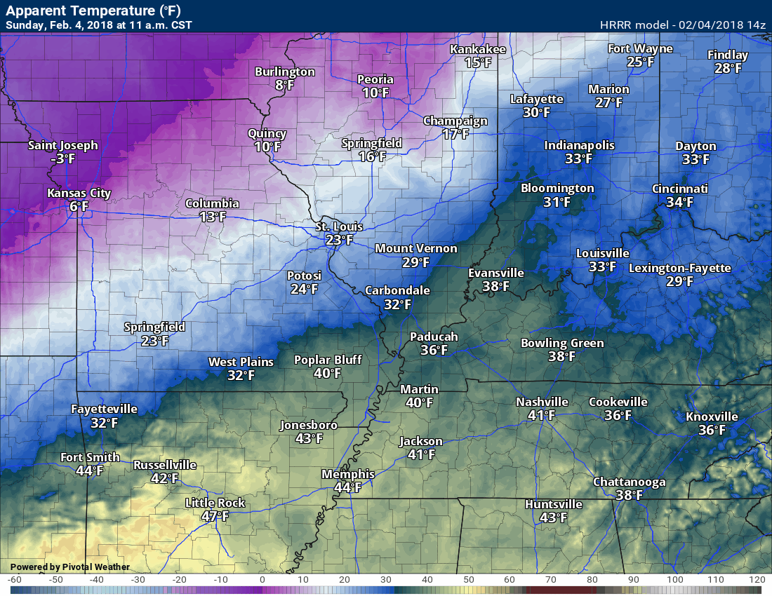
Our overnight rain rain/snow/sleet event has ended and colder air is moving into the region from the west/north.
Temperatures will fall today as the colder air wraps around the storm system (see graphic below).
Here is the wind chill forecast for today into Monday morning. Brrr
Wind chill is what the temperature feels like to your skin.
.


.
.
.
A fast moving disturbance will produce flurries and wind driven snow showers Sunday afternoon and evening. Light accumulation can’t be ruled out.
.
Future-cast radar for today and this evening. What radar might look like as we move into this afternoon and evening.
Time stamp upper left part of the animation.
Blue represents snow.
.

.
Here is my latest snow probability forecast map for this afternoon into Sunday night
.
.
Click image to enlarge.
You can see how temperatures fall during the day on Sunday. Time stamp upper left.
.
.
Monday night into Friday:
HIGHLIGHTS
- Another in a series of storm systems will spread precipitation back into our region. High confidence.
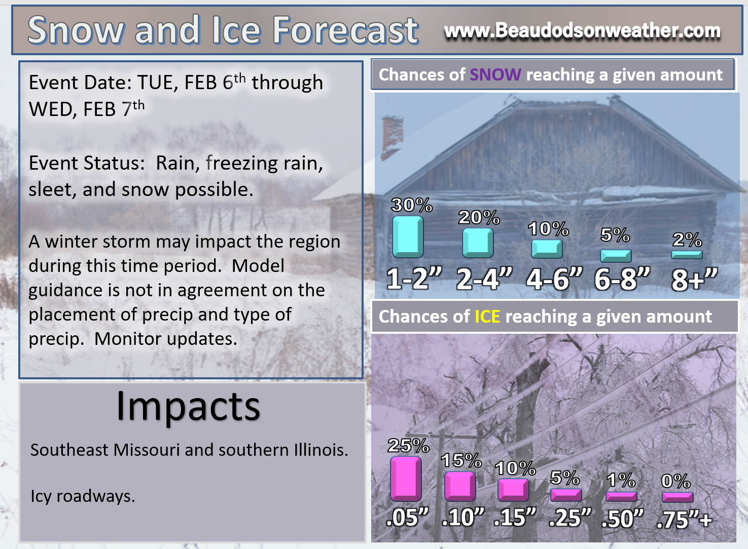
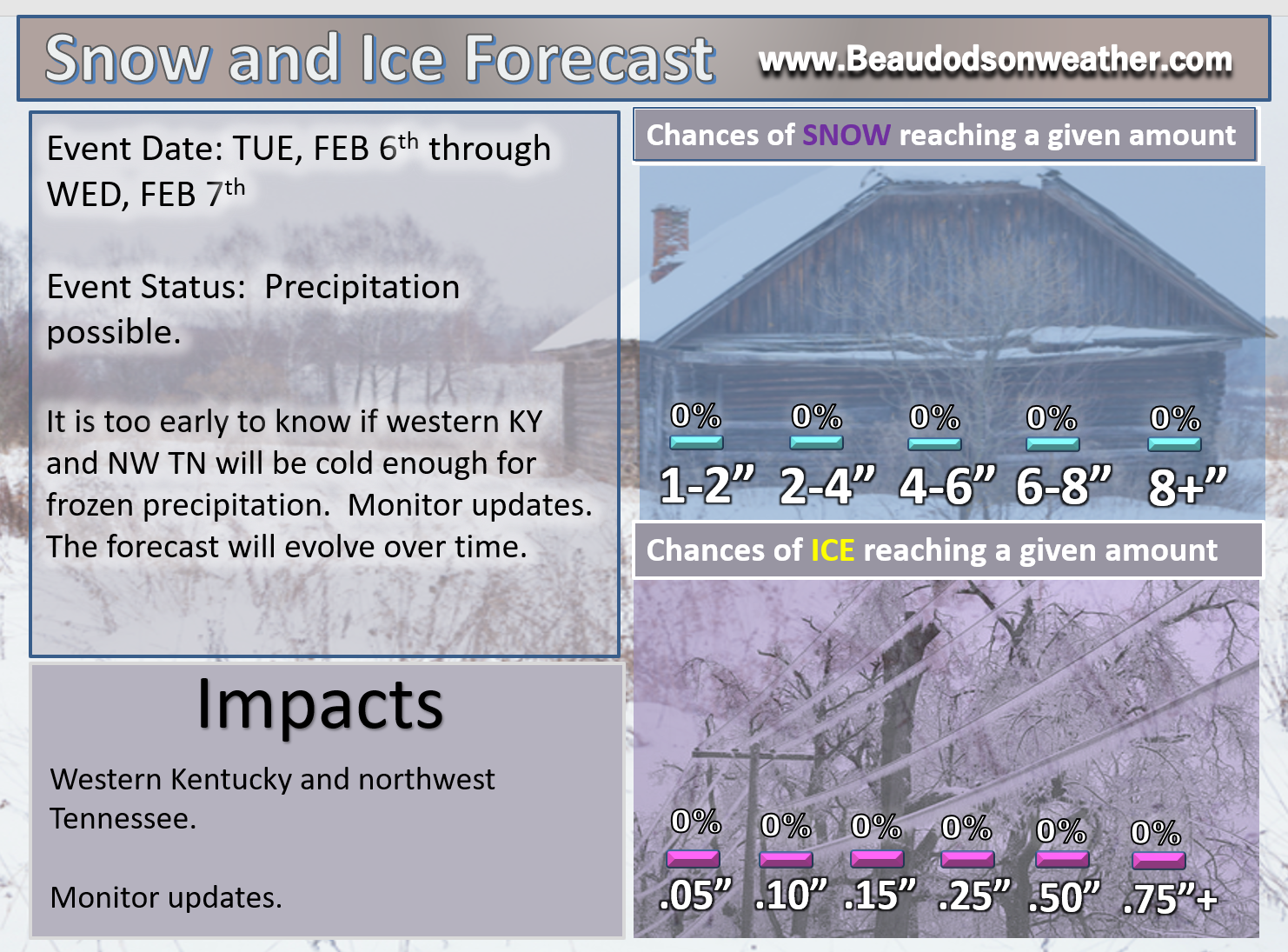
- Freezing rain, sleet, snow, and rain likely Tuesday into Wednesday morning. Some debate on when precipitation begins. Bulk of precipitation may end up being Tuesday/Tuesday night.
- Some accumulation of ice and snow will be possible. Winter weather advisories and/or winter storm watches may be necessary.
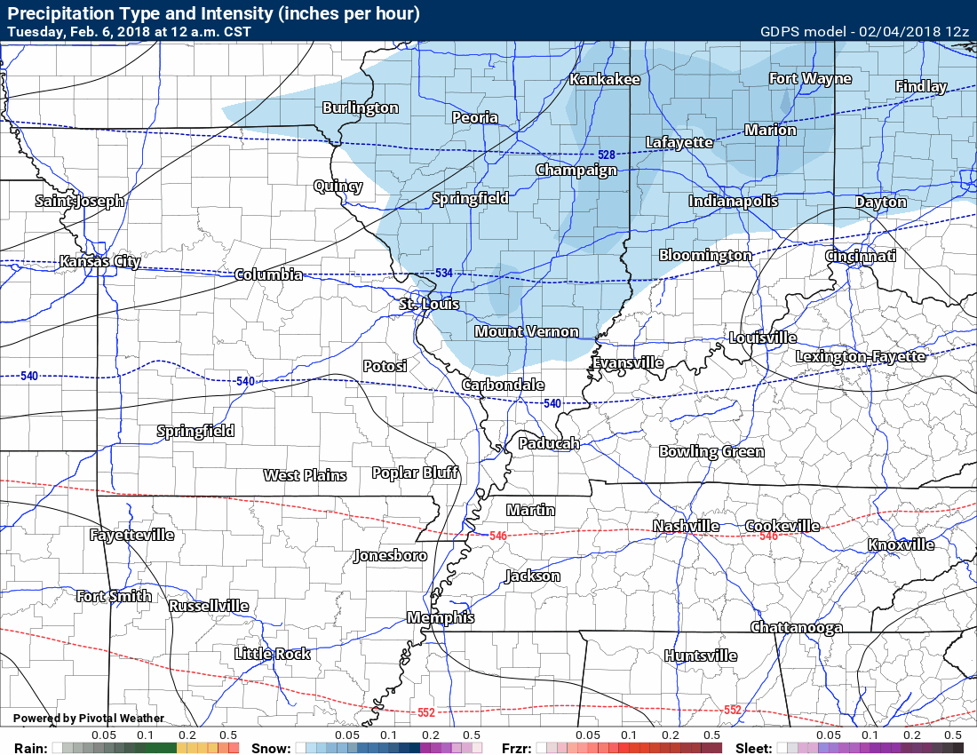
Yet another storm system will spread precipitation back into the region Tuesday. Cold air will be in place at the start of the event. That could mean a wintry mix of sleet, freezing rain, and snow. Temperatures may warm enough for all rain across portions of the area. This will need to be monitored.
Confidence on the exact type of precipitation and timing of change-over is low. Monitor updates, as always.
The track and intensity of the system is key to precipitation type.
Here is the GEM model guidance future-cast radar for late Tuesday into Wednesday morning.
Green is rain. Yellow is moderate rain. Blue is snow. Pink/red/purple is sleet and freezing rain.
This system should produce all types of precipitation. There is a signal for freezing rain. This will need to be monitored.
Still a bit early for certainties. If the track of the system shifts further north then that would cut down on the frozen precipitation potential. If it tracks further south then the frozen precipitation would impact more of the region.
Time stamp upper left.
.
.
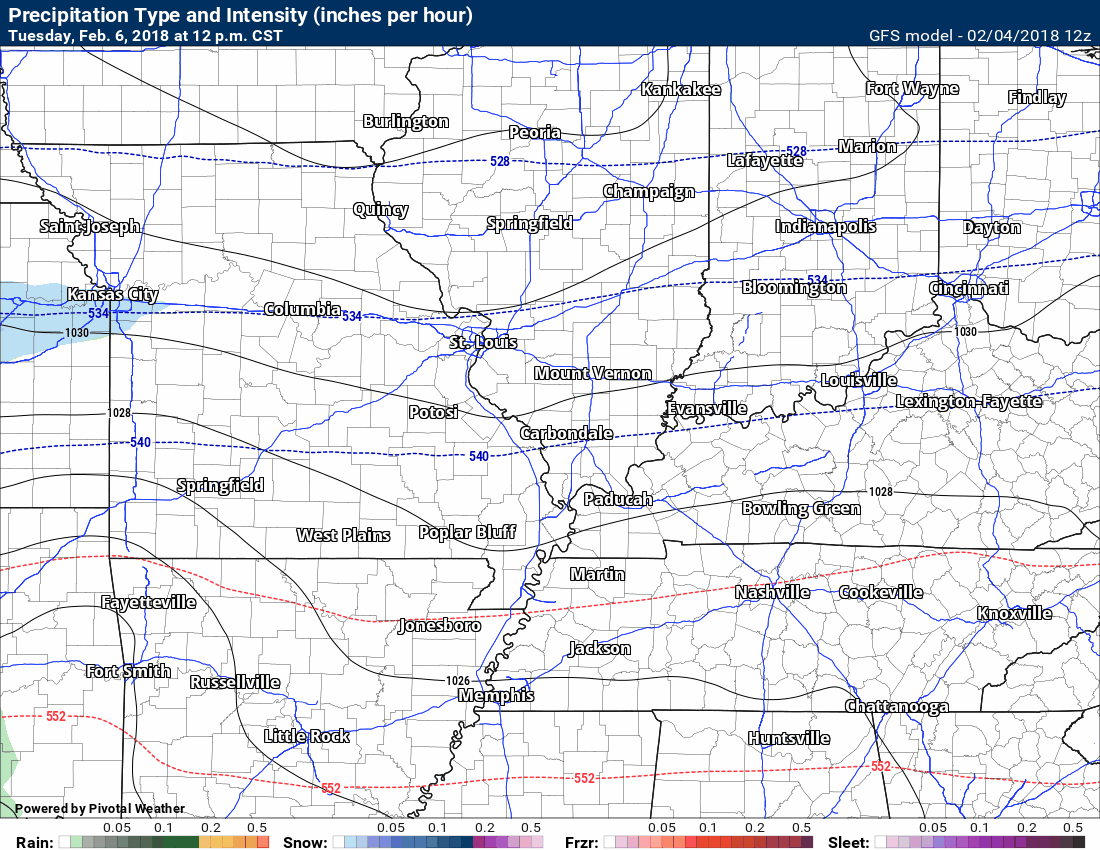
Here is the GFS model guidance future-cast radar. Another model’s opinion. You can see that it also has the rain/snow/ice line across our area.
Green is rain. Yellow is moderate rain. Blue is snow. Pink/red/purple is sleet and freezing rain.
Time stamp upper left.
.
.
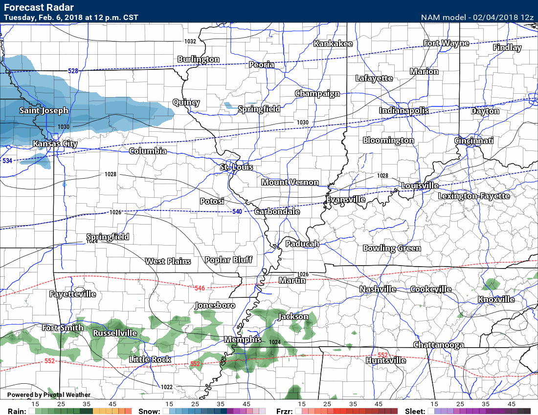
Here is the NAM model guidance. Another model’s opinion.
Green is rain. Yellow is moderate rain. Blue is snow. Pink/red/purple is sleet and freezing rain.
Time stamp upper left.
.
.
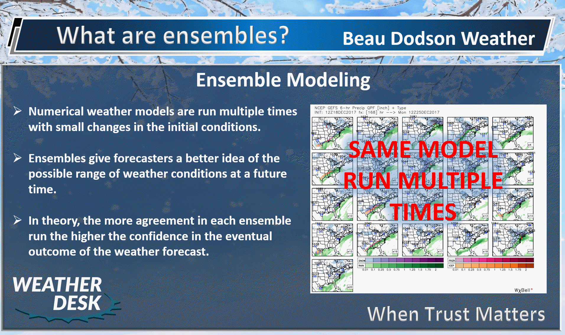
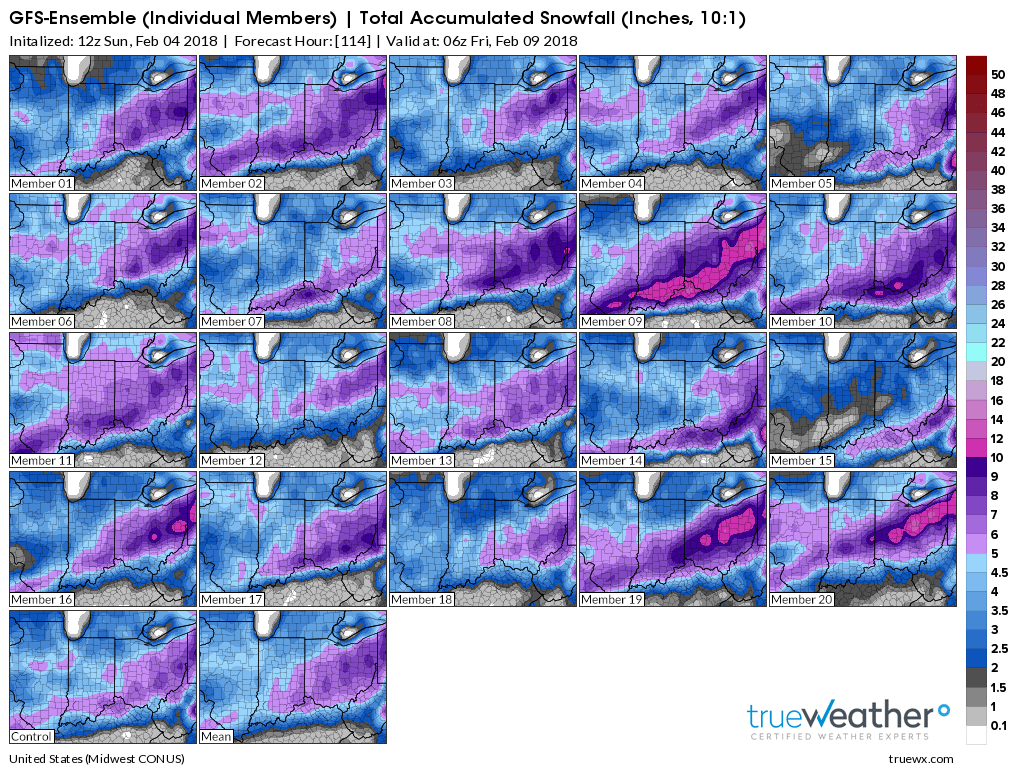
What are ensembles?
.
.
Here is the EC model guidance ensemble forecast for snow. This is the mean of all the model runs. You can see it does have a signal for frozen precipitation in our local area.
This is just the models opinion. Other models show different solutions.
You can see that the EC model guidance favors our northern counties for snow and ice.
Don’t get caught up in exact numbers. Just take the general idea that some frozen precipitation is possible.
.
.
Here is the GFS model guidance ensemble snow and ice outlook. A lot of the squares indicate the potential for frozen precipitation in our local area. This does add some confidence to the forecast.
I know these are hard to read. Click to enlarge.
This company does not have a sector that lines up right over our region.
Bottom line is that the GFS does paint snow over at least the northern half of our local area.
Click images to enlarge them.
.

.
.

.
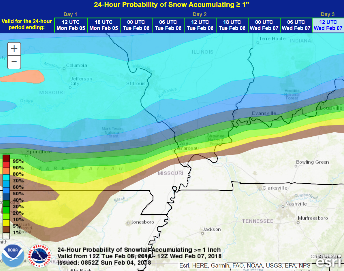
The WPC/NOAA snow forecast. This is the probability of at least one inch of snow.
This is the Tuesday into Wednesday morning event. Perhaps centered on Tuesday afternoon and Tuesday night.
Still some questions and debate about the track of the area if low pressure.
I suggest you check back frequently for updates. The forecast will evolve with time.
.
.
Here is the WPC freezing rain forecast. We may have to deal with ice.
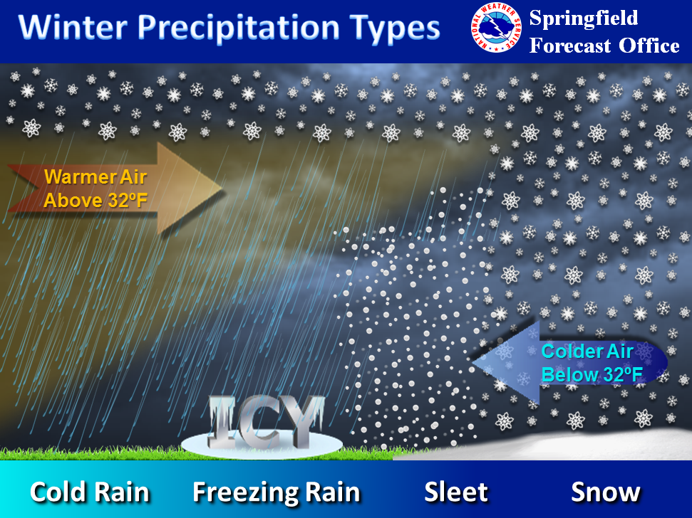
What is freezing rain?
.
.
This is the % chance of at least 0.10″ of freezing rain accumulating on exposed objects. Trees, power lines, and other.
.

.
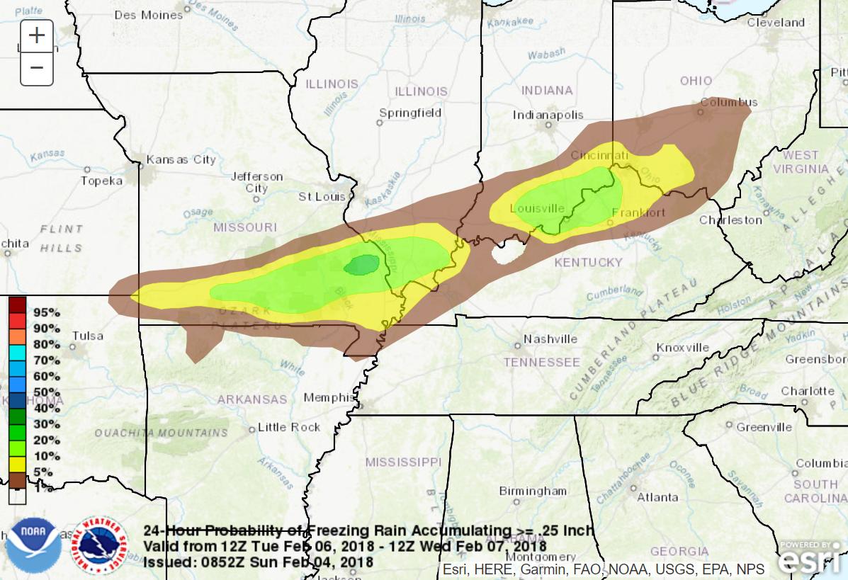
Here is the probability % chance of at least 0.25″ of freezing rain accumulating on exposed objects.
.
. .
.
.
What determines whether freezing rain, sleet, or snow falls? The depth of a warm layer of air aloft determines that.
.

.
.
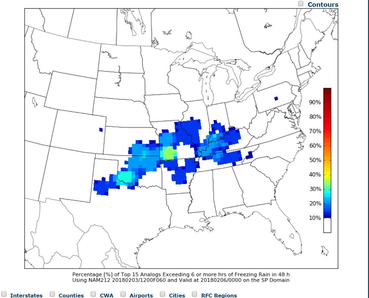
CIPS analogs (looking back at previous events and comparing then to the current state of the atmosphere) is showing a signal for freezing rain.
These colors represent the probability of freezing rain lasting six or more hours. The general idea is that the CIPS analogs are picking up a signal for freezing rain.
.
.
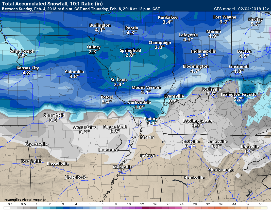
Here is the GFS model snowfall forecast. Remember, this is just one model of many. These graphics will likely change over the coming days. Check back frequently for updates.
.
.
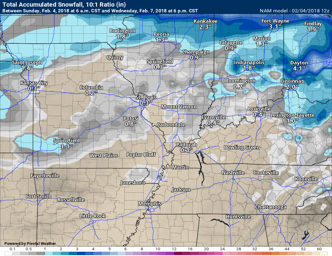
Here is the NAM models opinion on snow totals. Again, just one model. One opinion. It will likely change over the coming days.
.
.
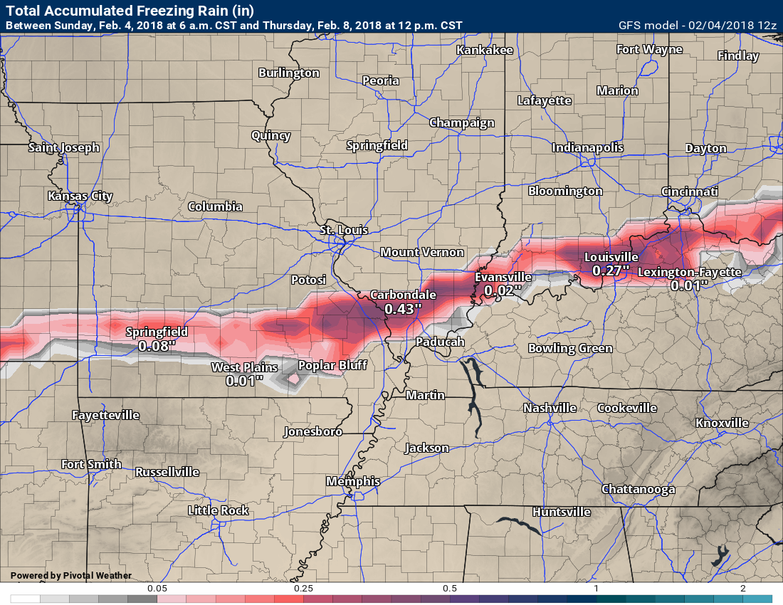
Here is the GEM model freezing rain forecast.
.
.
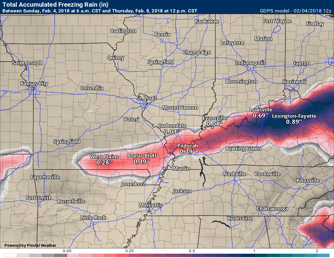
Here is the GFS model freezing rain forecast.
You can usually cut these numbers in half. Accretion does not always equal accumulating. In other words, if 0.50″ of rain falls from the sky and freezes upon impact, there would be some dripping and loss of accretion totals. Perhaps you would end up with 0.20″ to 0.30″ of ice accumulation.
It would be less than what actually falls.
.
.
You get the general idea. There is the potential of some snow and ice in the region Tuesday into Wednesday morning. The main focus will likely be Tuesday late morning into Tuesday night.
Monitor updates.
Here is my latest snow probability forecast map for Tuesday into Wednesday morning.
These numbers will need adjusting. First jab at the system.
This is for Missouri and Illinois. The second graphic is for Kentucky and Tennessee.
.
.
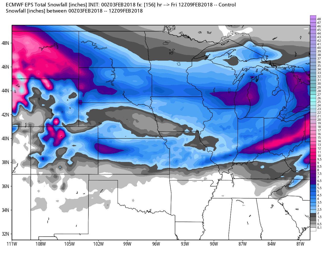
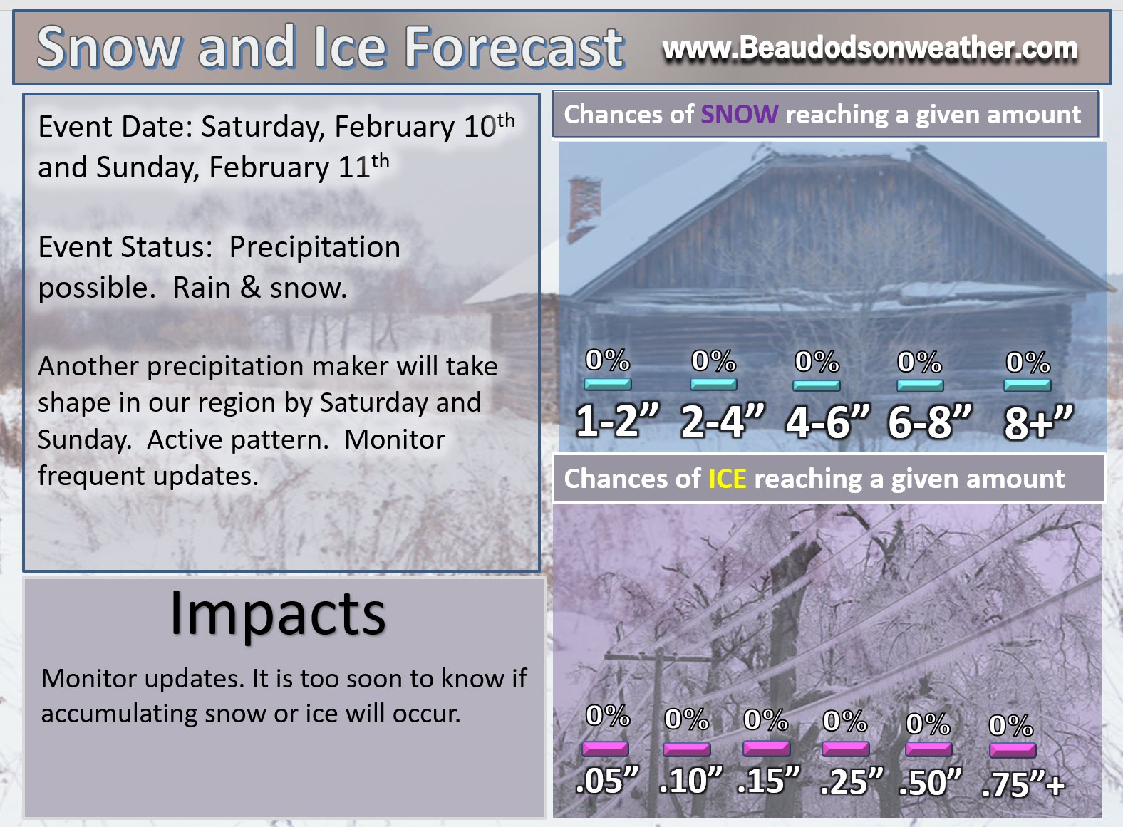
Friday night into Sunday (February 9th through the 11th)
HIGHLIGHTS
- Another in a series of storm systems may spread precipitation back into our region late next week. Low confidence.
- It is too early to know what type of precipitation. Monitor updates
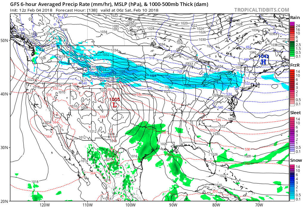
Here is the GFS model guidance. Lot of rain on the GFS. Green is rain.
This is for Friday night into Sunday (mainly SAT/SUN)
Click to enlarge all the graphics on this page.
.
. .
.
.
I will initiate a graphic on next weekends system. Still early to know the details on this one.
.
.


We offer regional radars and local city radars – if a radar does not update then try another one. Occasional browsers need their cache cleared. You may also try restarting your browser. This will usually fix any problems.
During the winter you can track snow and ice by clicking the winterize button on the local city view interactive radars.
You may email me at beaudodson@usawx.com
Interactive Weather Radar Page. Choose the city nearest your location: Click this link
National interactive radar: Click this link.