
I will keep this page updated throughout the day and into tonight.
I will also have question and answer sessions on Facebook. You can find the current thread at this link: Click here.
Be sure and sign up for the app/text messages (if you have not already done so). Turn on WeatherOne app/text option. That is the one for severe storms and tornadoes. Scroll down for more information and samples.
4:45 PM Video Update
.
.
4 PM Update
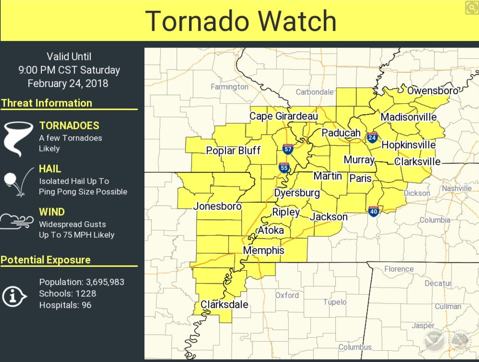
Tornado watch now covers a good chunk of the area. The main concern continues to be flash flooding. Damaging winds will be a concern, as well. I can not rule out tornadoes, but that threat is a bit more uncertain.
Here is the tornado watch issued by NOAA (as of 4 PM – counties will be shaved once storms move east)
.
.
Here is the latest Facebook question and answer thread. Click here.
Storm tracking links further down in this update.
2 PM Video Update
.
.
12 PM Update (next update will be posted at 2 PM)
See storm tracking links further down in the blog.
Showers and thunderstorms have rapidly developed across Arkansas, the Missouri Bootheel, and western Tennessee. These showers and storms are moving northeast at 30 to 40 mph.
Locally heavy rain is the main concern in our area over the coming hours.
The risk of severe thunderstorms may increase towards mid-afternoon into the evening hours.
Avoid flooded roadways. This is a particularly dangerous flash flood event.
Video update
.
.
10 AM Update (next update will be posted at 12 PM)
** High risk of flash flooding this afternoon into tonight **
** A few reports of wind damage possible later this afternoon and tonight **
We have an active day of weather ahead of us.
Dense fog, scattered showers, and some thunderstorms are the morning problem. A few downpours possible.
The heaviest rain will occur later this afternoon into tonight.
There is a high risk of flash flooding in areas that are already soaked. I can not emphasize enough how important it is to not drive through flood waters. This flash flood event has the potential to cause widespread road issues.
It only takes a few inches of fast-moving flood waters to sweep a car into a ditch or stream. Flash flooding typically kills more people in our region than tornadoes.
There is also the risk of a few reports of damaging winds between 3 PM and 12 AM. I can’t rule out isolated tornadoes. We may be placed under a severe thunderstorm or tornado watch later this afternoon and tonight.
Remember, a watch means to keep an eye on updates. A warning means to seek shelter.
Storms will be moving at 50 to 60 mph. That will not give you much time to take action. I will do my best to give you plenty of heads up via the app and text messages.
If we do have tornadoes then they would likely be QLCS tornadoes. What are QLCS tornadoes? They are short-lived tornadoes that occur embedded in rain. They normally occur on the leading edge of a line of thunderstorms. They can last seconds to minutes. They are difficult to issue warnings on. By the time a warning is issued the tornado has lifted.
If you feel threatened by the weather then seek shelter till the storm passes. You don’t need a warning.
Rainfall totals today will likely range from one to two inches. Locally higher amounts are possible.
My biggest concern is that thunderstorms could produce torrential downpours later today and tonight. If this does occur then flash flooding will be a problem. The soil can’t handle additional rain.
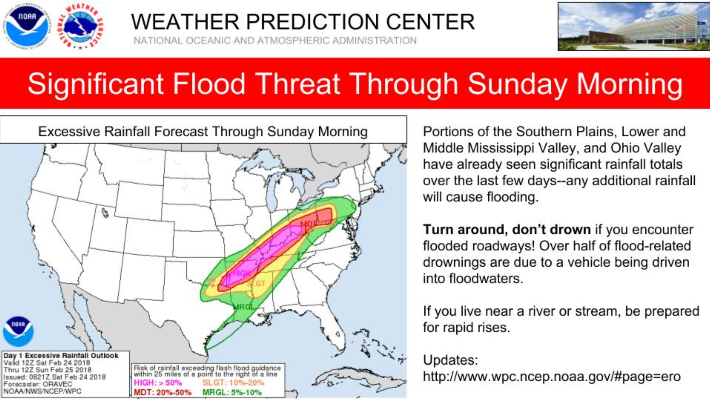
The WPC has placed us under a high risk. This is for flooding.
The main time frame of concern will be 3 PM today through 3 AM Sunday morning.
.
.
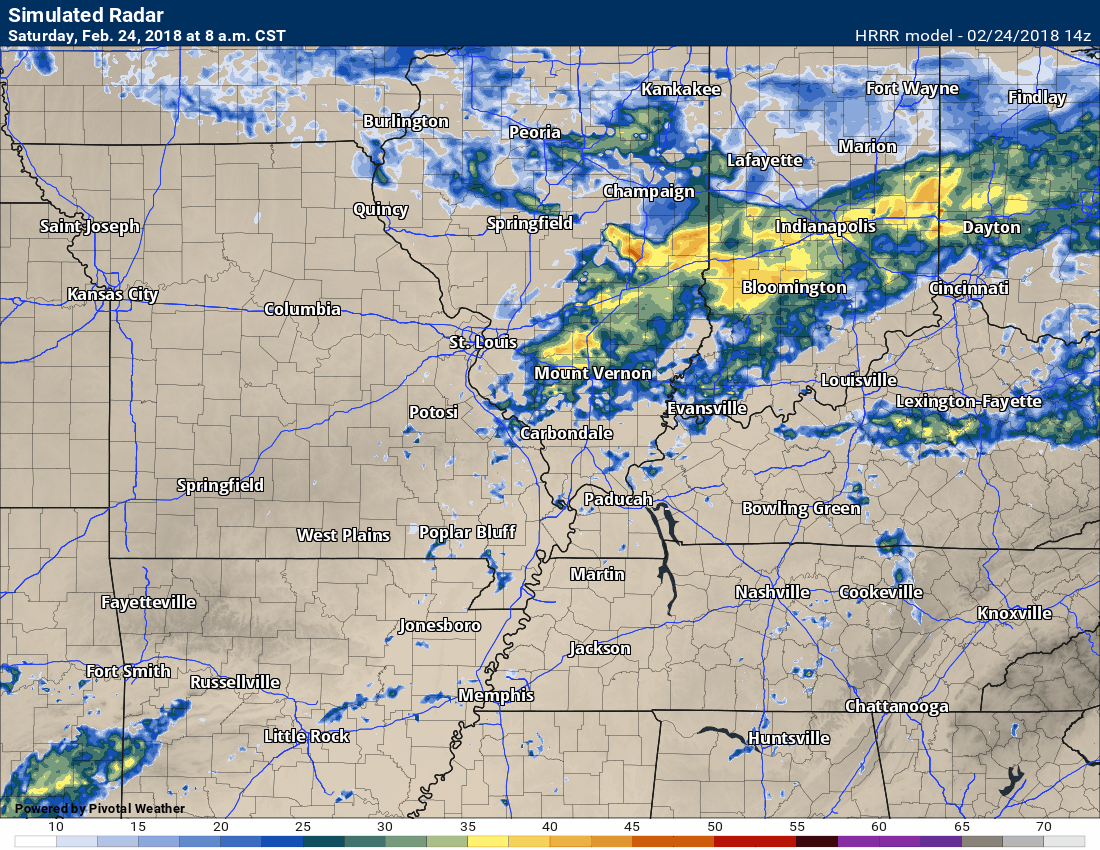
Here is the Hrrr model guidance future-cast radar. What radar might look like today. The time stamp can be found in the upper left portion of the image.
.
.
Check the latest river stage forecast.
https://water.weather.gov/ahps/forecasts.php

We offer regional radars and local city radars – if a radar does not update then try another one. Occasional browsers need their cache cleared. You may also try restarting your browser. This will usually fix any problems.
During the winter you can track snow and ice by clicking the winterize button on the local city view interactive radars.
You may email me at beaudodson@usawx.com
Interactive Weather Radar Page. Choose the city nearest your location: Click this link
.

.
Live lightning data ~ click here
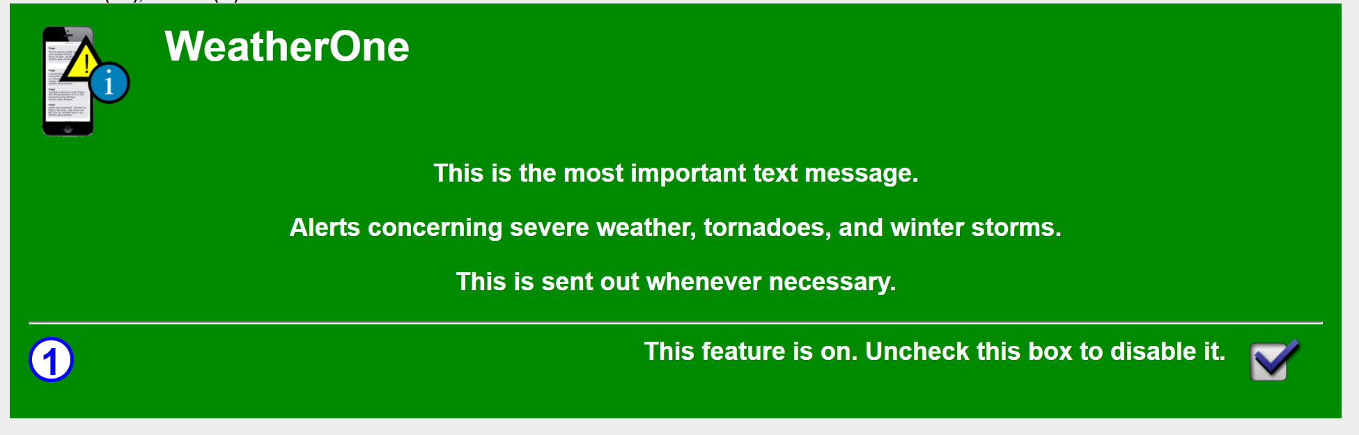
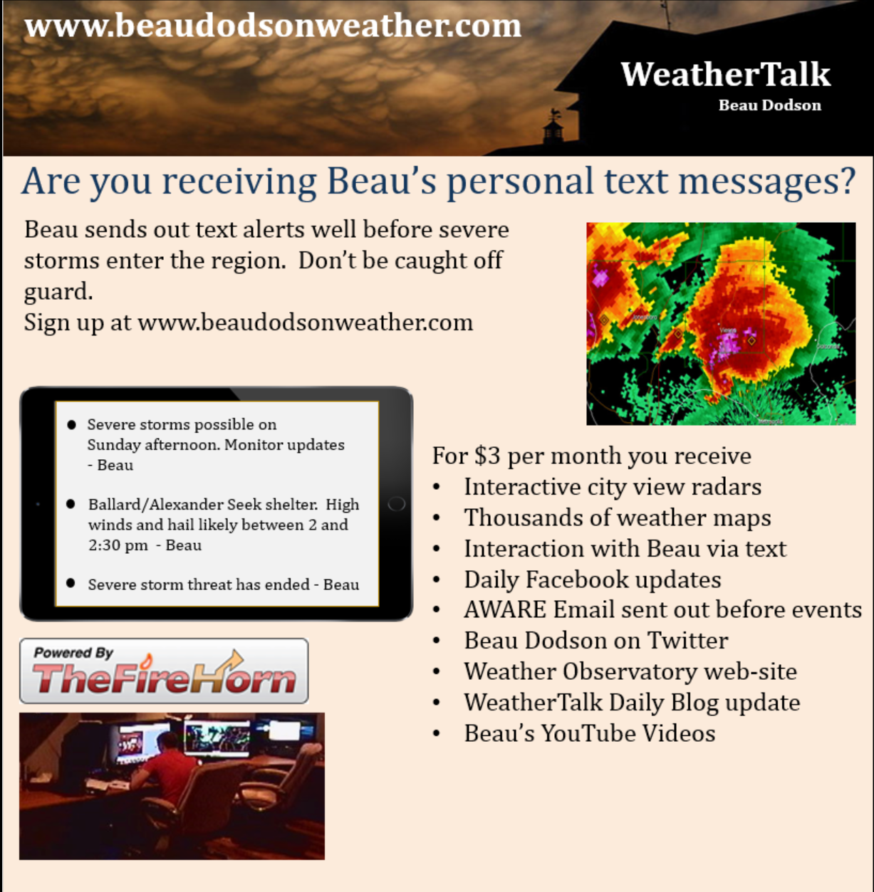
Subscribers, make sure you have turned on WeatherOne. This is the app/text option for severe storms and tornadoes. You can find this under your personal notification settings in your www.weathertalk.com account.
It will look like this (green means that it is on)
.
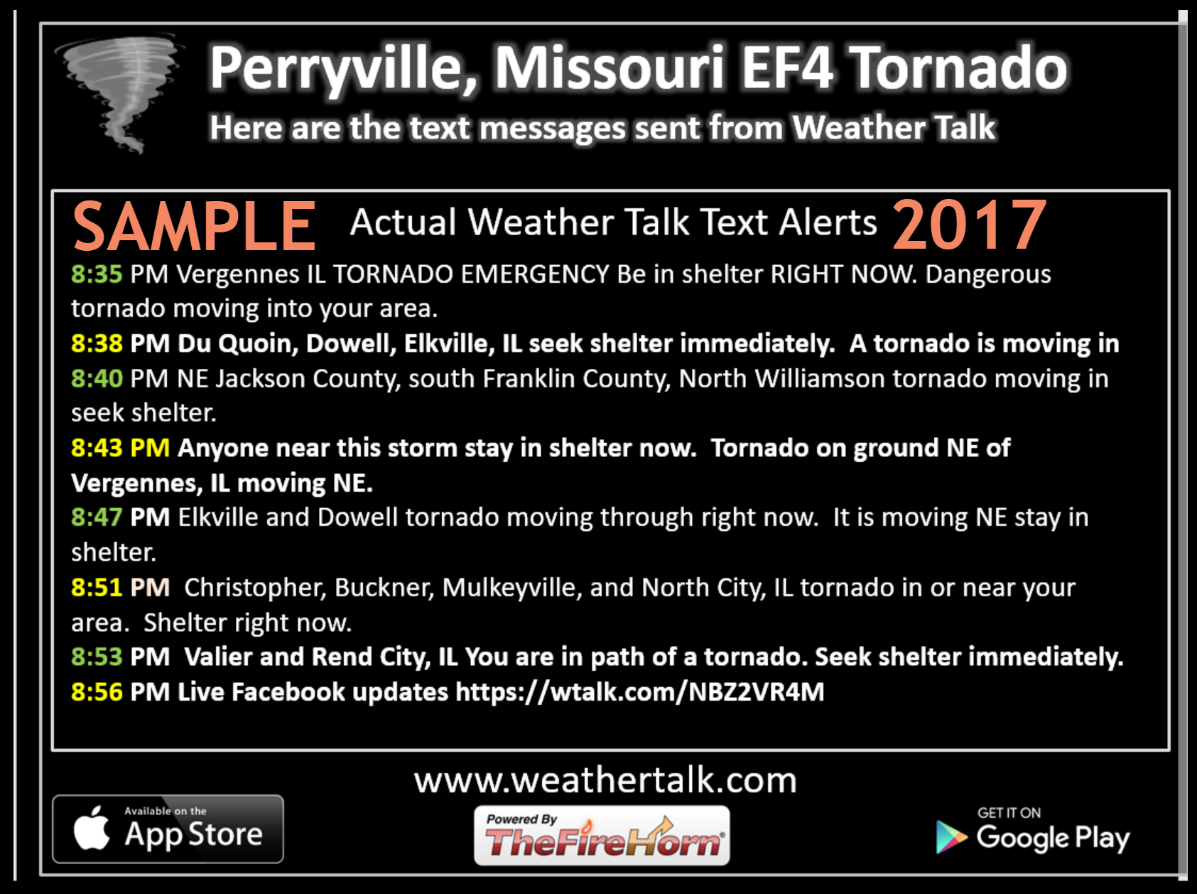
Here is a sample of the tornado texts that I send out. These are from 2017.
Again, this is the WeatherOne app/text option one product. Find this under your personal notification settings within your WeatherTalk account.
.
.
This is what you are missing out on if you are not a $3 a month subscriber!
- Daily forecast texts from my computer to your app/cell phone
- Severe weather app/text alerts from my keyboard to your app/cell phone
- Social media links sent directly to your app/cell phone. When I update the blog, videos, or Facebook you will receive the link.
- Missouri Valley centered video updates
- Ohio Valley centered video updates
- Long-range video updates
- Week one temperature and precipitation outlook
- Week two temperature and precipitation outlook
- Week three and four temperature and precipitation outlook
- Monthly outlooks
Monthly operating costs for Weather Talk can top $2000.00. Your $3 subscription helps pay for those costs. I work for you.
.

.
Your $3 per month also helps support these local charity projects.
.

.
.
We offer regional radars and local city radars – if a radar does not update then try another one. Occasional browsers need their cache cleared. You may also try restarting your browser. This will usually fix any problems.
During the winter you can track snow and ice by clicking the winterize button on the local city view interactive radars.
You may email me at beaudodson@usawx.com
Interactive Weather Radar Page. Choose the city nearest your location: Click this link
National interactive radar: Click this link.