We have some great sponsors for the Weather Talk Blog. Please let our sponsors know that you appreciate their support for the Weather Talk Blog.

Are you in need of new eye glasses? New contacts? Perhaps you need an eye exam. Then be sure and visit the Eye Care Associates of western Kentucky (the Paducah location). For all of your families eye care needs.
Visit their web-site here. Or, you can also visit their Facebook page.

Best at Enabling Body Shop Profitability since 1996. Located In Paducah Kentucky and Evansville Indiana; serving all customers in between. They provide Customer Service, along with all the tools necessary for body shops to remain educated and competitive. Click the logo above for their main web-site.
You can find McClintock Preferred Finishes on Facebook, as well

Expressway Carwash and Express Lube are a locally owned and operated full-service Carwash and Lube established in 1987.
They have been proudly serving the community for 29 years now at their Park Avenue location and 20 years at their Southside location. They have been lucky enough to partner with Sidecar Deli in 2015, which allows them to provide their customers with not only quality service, but quality food as well.
If you haven’t already, be sure to make Expressway your one-stop shop, with their carwash, lube and deli. For hours of operation and pricing visit www.expresswashlube.com or Expressway Carwash on Facebook.
.
.
Looking for some tasty holiday treats? Fluff Cupcakes has what you and your family need. Located in Benton, Kentucky. They even deliver!

**** VALENTINE’S DAY SPECIAL **** $25 dollar special includes ~ 4 assorted Valentine fluff cupcakes in a fabulous box! 18″ Mylar Happy Valentine Day cupcake balloon tied to the box! Valentine’s Day enclosure card! Free delivery in Marshall County! Free delivery to businesses in Paducah, Murray, and Mayfield! Payment is required at time of order. To place an order you can message Tracy on the fluff cupcake page, email, text, or call. Tracy will invoice thru PayPal, & also accepts credit/debit cards, cash, and/or checks. 270-205-2552 tracyd@dcelectricinc.com
I have used Fluff Cupcakes, during Thanksgiving and Christmas, for the last couple of years. I can tell you that the cupcakes are delicious. Be sure and contact Tracy and place your order. Birthdays, holidays, or just because! Visit them on Facebook at this link – click here

The quad states area source for Precision Ag Technology. Locally owned and operated, specializing in planting, harvesting, fertilizer application and drainage. Visit them on their website and on Facebook. You can also find them on Twitter. They are located in Almo, Kentucky. Phone 270-718-0245
..
Charity fund raiser for Guardian Family Services. Shane Parker, aka The Bear On The Air, Bear-B-Que Catering Co., will be selling Rib’s for $20 a slab. Preorder by calling 618-524-4357 or 618-645-6444. Pickup Saturday, February 4th at Metropolis Big John’s between 11 am and 2 pm.
Folks, we need to sell every slab, because the money that The Bear On The Air raises, will be matched! That means every $20 becomes $40!!!
All proceeds going to Guardian Family Services, a shelter for domestic violence victims & their children, service six+ southern Illinois counties.
Funds raised matched by the Shadow Angel Foundation in partnership with Beau Dodson Weather.

———————————————–
The Beau Dodson Weather APP is ready for Apple users. The purpose of this APP is for me to deliver your text messages instantly. ATT and Verizon have not always been reliable when it comes to speed. The APP allows instant delivery. You can keep your test messages on and use the APP. You can set the APP to turn off your text messages and just receive them through the APP.
We are working on the Android APP. Hopefully, it will be available in a week or so.
The APP is for subscribers.
The direct download can be viewed here
https://itunes.apple.com/us/app/id1190136514
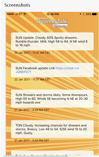
If you have not signed up for the texting service then you may do so at www.beaudodsonweather.com

This forecast update covers far southern Illinois, far southeast Missouri, and far western Kentucky. See the coverage map on the right side of the blog
February 1, 2017
Wednesday Night Forecast Details:
Forecast: Some clouds. Chilly with near normal to above normal temperatures.
What impacts are anticipated from the weather? None
Is severe weather expected? No
The NWS defines severe weather as 58 mph winds or great, 1″ hail or larger, and/or tornadoes
What is the chance of precipitation? MO ~ 10% IL ~ 10% KY ~ 10% TN ~ 10%
Coverage of precipitation: None to isolated
Should I cancel my outdoor plans? No
My confidence in the forecast verifying: High. This forecast should verify.
Temperatures: MO ~ 26 to 34 IL ~ 26 to 34 KY ~ 26 to 34 TN ~ 26 to 34
Winds: North and northeast at 7 to 14 mph with gusts to 20 mph.
Wind Chill when applicable:
Will there be a chance for wintry precipitation? Most likely, no. A flurry possible over Illinois and Kentucky.
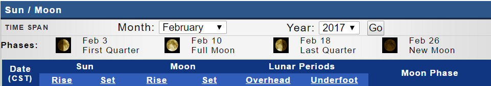
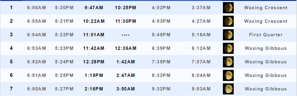
Moonrise will be at 9:47 a.m. and moonset will be at 10:25 p.m. Waxing Crescent
.
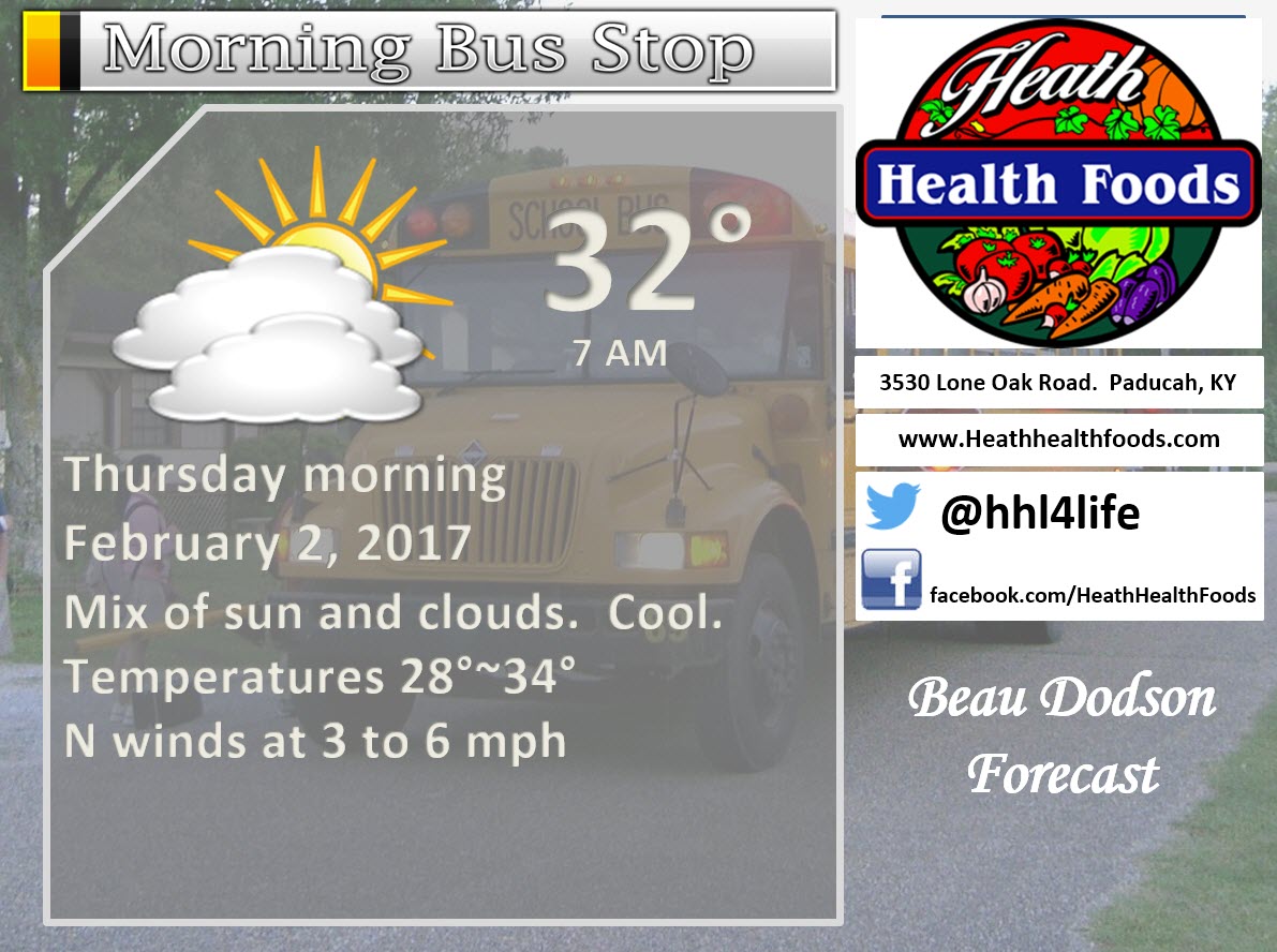
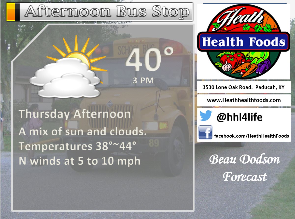
Thursday Forecast Details
Forecast: Quite a bit of sun with passing clouds. Cooler. Below normal temperatures.
What impacts are anticipated from the weather? None
Is severe weather expected? No
The NWS defines severe weather as 58 mph winds or great, 1″ hail or larger, and/or tornadoes
What is the chance of precipitation? MO ~ 10% IL ~ 10% KY ~ 10% TN ~ 10%
Coverage of precipitation: None to isolated
Should I cancel my outdoor plans? No
My confidence in the forecast verifying: High. This forecast should verify.
Temperatures: MO ~ 36 to 44 IL ~ 36 to 42 KY ~ 38 to 44 TN ~ 40 to 45
Winds: North winds at 5 to 10 mph
Wind Chill when applicable:
Will there be a chance for wintry precipitation? Unlikely
Sunrise will be at 6:55 a.m. and sunset will be at 5:21 p.m.
UV Index: 1 to 3
Moonrise will be at 10:22 a.m. and moonset will be at 11:30 p.m. Waxing Crescent
Thursday Night Forecast Details:
Forecast: Partly to mostly cloudy. A 10% for a flurry. Chilly temperatures. Near normal to slightly above normal temperatures.
What impacts are anticipated from the weather? None
Is severe weather expected? No
The NWS defines severe weather as 58 mph winds or great, 1″ hail or larger, and/or tornadoes
What is the chance of precipitation? MO ~ 10% IL ~ 10% KY ~ 10% TN ~ 10%
Coverage of precipitation: Most likely none.
Should I cancel my outdoor plans? No
My confidence in the forecast verifying: High. This forecast should verify.
Temperatures: MO ~ 24 to 28 IL ~ 24 to 28 KY ~ 24 to 28 TN ~ 26 to 30
Winds: North and northeast winds at 5 to 10 mph
Wind Chill when applicable: 24 to 28 degrees
Will there be a chance for wintry precipitation? Unlikely and nothing of significance.
Moonrise will be at 10:22 a.m. and moonset will be at 11:30 p.m. Waxing Crescent
The weekend system should be mostly a rain event. It is possible that a rain/snow mix occurs. Accumulation appears unlikely. I will continue to monitor our far northern and northeastern counties. This looks to be a light precipitation event.
Models are trending drier and drier for SAT night and SUN morning.
GFS model shows no measurable rain
Graphic cast for Friday into Monday
.
More information on the UV index. Click here
The School Bus Stop Forecast is sponsored by Heath Health and Wellness.
Located next to Crowell Pools in Lone Oak, Kentucky.
Visit their website here. Visit Heath Health Foods on Facebook!

Heath Health Foods is a locally owned and operated retail health and wellness store. Since opening in February 2006; the store has continued to grow as a ministry with an expanding inventory which also offers wellness appointments and services along with educational opportunities.
Visit their web-site here. And. visit Heath Health Foods on Facebook!.

Don’t forget to check out the Southern Illinois Weather Observatory web-site for weather maps, tower cams, scanner feeds, radars, and much more! Click here

An explanation of what is happening in the atmosphere over the coming day
- Cooler temperatures
- Weekend precipitation
- Larger system early next week (storms?)
Winter weather outlooks will be posted on the www.weathertalk.com website. Look under the Winter Weather Outlook tab. These are updated at least twice each week.
The winter weather outlook was updated on Tuesday, January 31st
If you would like to receive a text notification, when the winter weather outlooks are updated, then make sure you have opted into text option three. The text options are found under the Personal Notification Settings tab on the weathertalk.com website.
I am looking for weather watchers. You will need to fill out the form.
Form link https://weathertalk.com/weatherwatcher
Wednesday night into Friday
Confidence: High
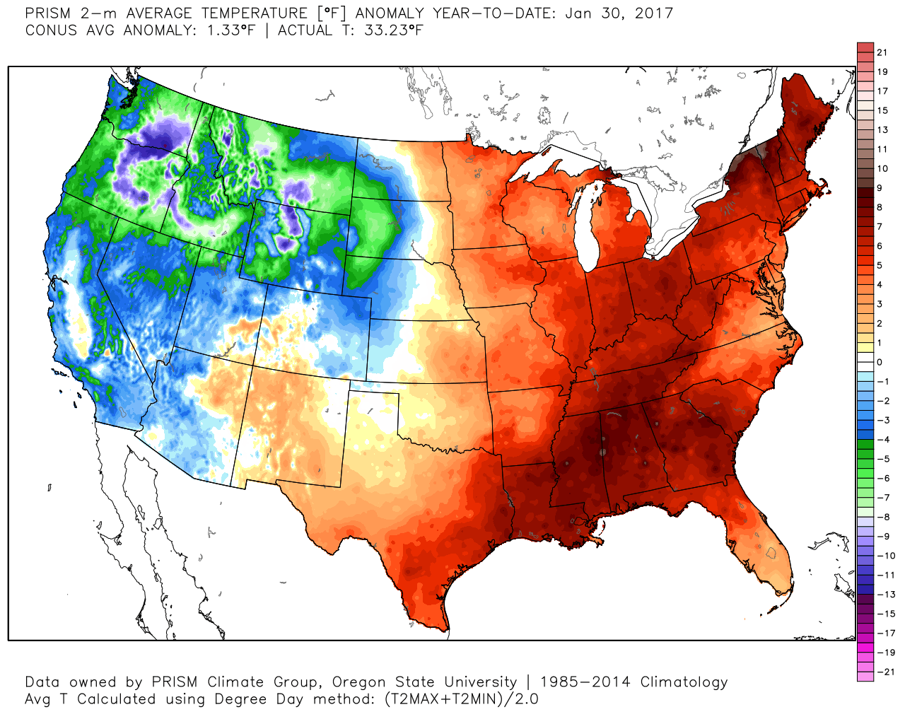
Welcome to February. January was a crazy month for temperatures. WAY WAY above normal. One of the warmer January’s that I can remember. It was supposed to be colder than normal. It did not take long for that balloon to pop.
Here are the temperature anomalies for January. Incredible numbers.
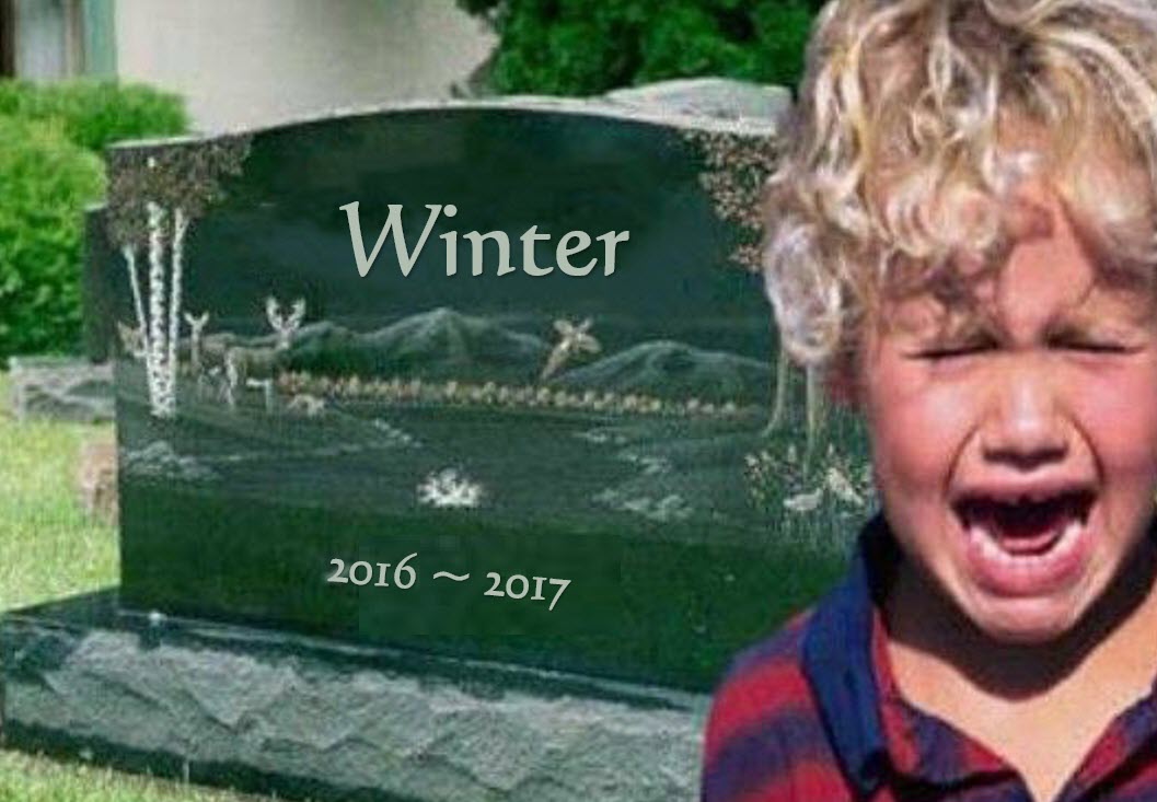
Remember this?
Snow fans much feel like this
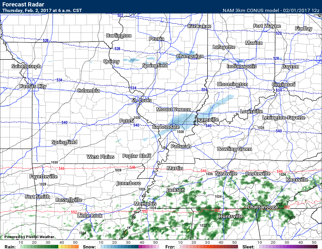
Meanwhile, the anti-snow crowd must be loving this.

Wednesday night into Friday will deliver some clouds. Small chance for a light sprinkle or flurry on Wednesday night and Thursday night. It appears the atmosphere is dry at lower levels. Thus, if something falls it would likely evaporate.
The NAM guidance does show a few flurries on Thursday morning. Again, the air at the surface is dry. Anything that falls should evaporate.
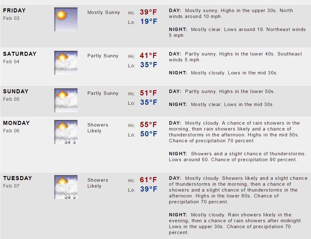
Temperatures will average near normal to above normal. Normal high temperatures, for this time of the year, are around 44 degrees. Normal low temperatures are around 24 degrees. Overnight lows on Wednesday, Thursday, and Friday night will average above normal, with the exception of Friday night. Friday night might see temps fall slightly below freezing. This will depend on clouds. High temperatures will average near normal to slightly below normal.
Friday night will likely end up the coldest night. Lows into the lower to middle 20’s.
Saturday and Sunday
Confidence: Low to medium
Dramatic changes in today’s data. Almost every guidance package shows less rainfall on Saturday night and Sunday.
The GFS guidance now shows no rain or snow on Saturday night and early Sunday morning. NAM guidance shows scattered rain and rain/snow showers. GEM guidance shows a few rain and snow showers.
The models are trending drier. This raises questions as to how much rain will fall on Saturday night and early Sunday.
I am going to lean drier than NOAA.
It now appears rainfall totals will likely be less 0.10″ Many areas may remain dry.
Sunday might actually end up a decent day.
Gusty winds on Saturday night and early Sunday morning.
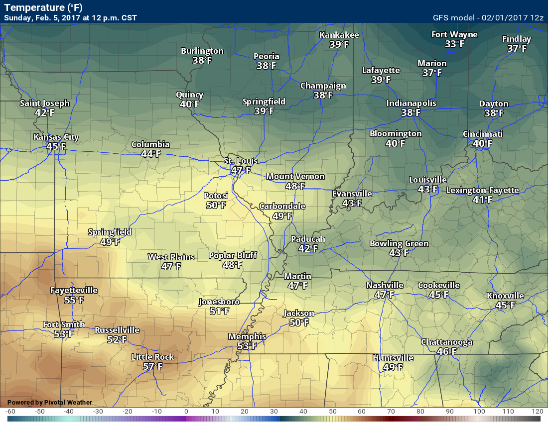
Temperatures will rise on Saturday night into Sunday. Sunday will deliver above normal temperatures. How many degrees above normal?
Actual air temperatures won’t be all that impressive. Still, above normal.
Monday into Friday (next week)
Confidence: Low to medium
- Questions remain on the strength of an area of low pressure on Monday into Wednesday
- Models show the potential for one low to move into the Great Lakes and one to move through central and southern Illinois
- Thunderstorms possible. I can’t rule out strong storms on Tuesday/Wednesday.
Winter is not to be found in the short or long range charts. There could be some cooler air from time to time. A high-pressure center is forecast to push into our region Thursday or Friday. This would deliver colder temperatures, but nothing extreme.
You can see that high on the GFS (the H is the center of the high)
This map is for Thursday night
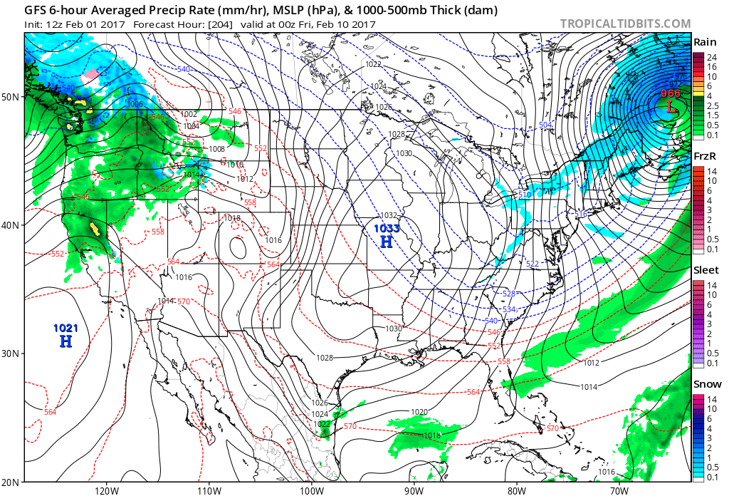
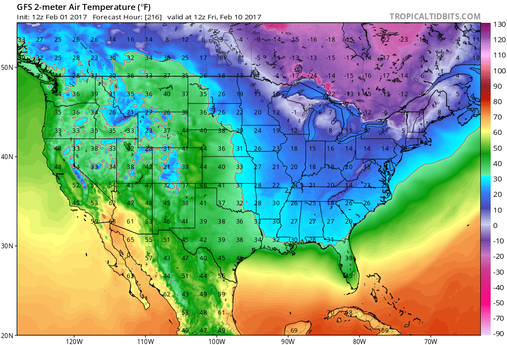
Here is the temperature forecast for Friday, February 10th. Chilly, but nothing extreme.
Click to enlarge any of these maps
The big story for Monday into Wednesday will be an area of low pressure that develops to our north and west. It should pass to our north. That places us in the warm sector. Showers and thunderstorms will be the end result. This will need to be monitored.
Some of the model guidance is showing two low-pressure centers. One of those low-pressure centers tracks into the Great Lakes and another one tracks over central and southern Illinois. I don’t think models have a handle on the set-up, just yet. Let’s monitor trends.
Either way, we are on the warm side of the system. It would take a MAJOR shift southward to place us in the cold sector.
CAPE numbers (energy for storms) will pop ahead of the cold front. There remain some questions as to just how high CAPE numbers will rise. Wind fields will be strong. There will also be plenty of wind shear. We will need to monitor the severe weather potential on Tuesday and Tuesday night/Wednesday morning.
The strength and eventual track of the low will need to be monitored. The EC guidance shows the low tracking further south and weaker. The GFS has been the strongest and farthest north.
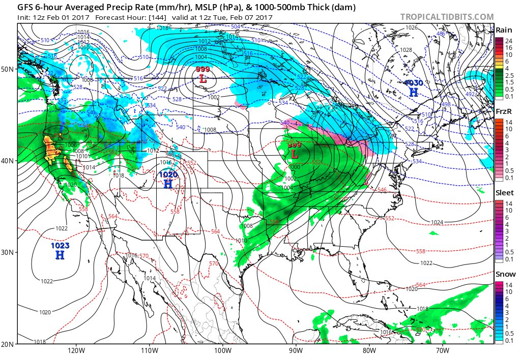
Here is the GFS depiction of the MON/TUE system. An area of low pressure moving into Illinois and Tuesday morning. A cold front trails back into our region. Showers and thunderstorms ahead of the front. Snow well to our north.
Tight pressure gradient. Strong and gusty winds possible.
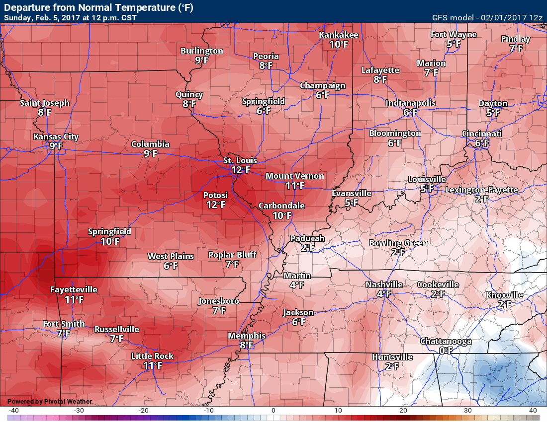
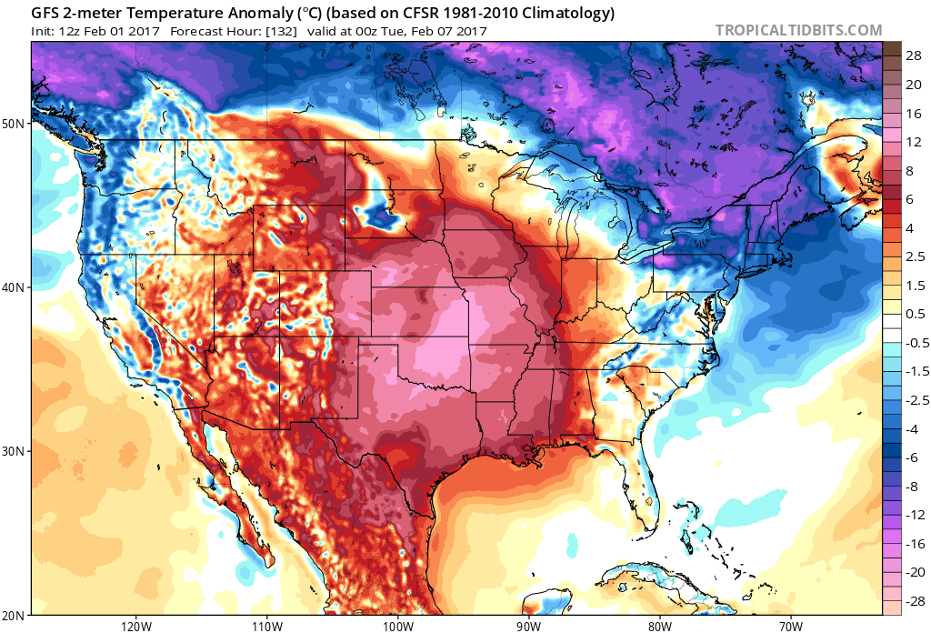
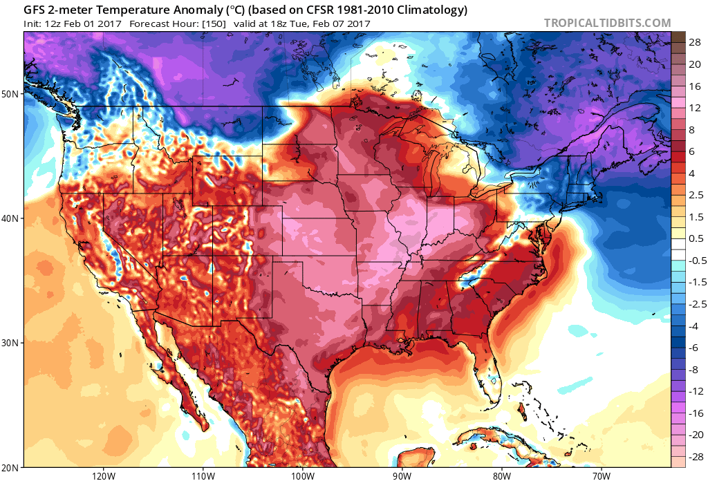
Temperatures ahead of the system will be well above normal. This is the Monday evening temperature anomaly map. Mild for February. What else is new! How many degrees above normal will temperatures be? Scale is on the right side of the image.
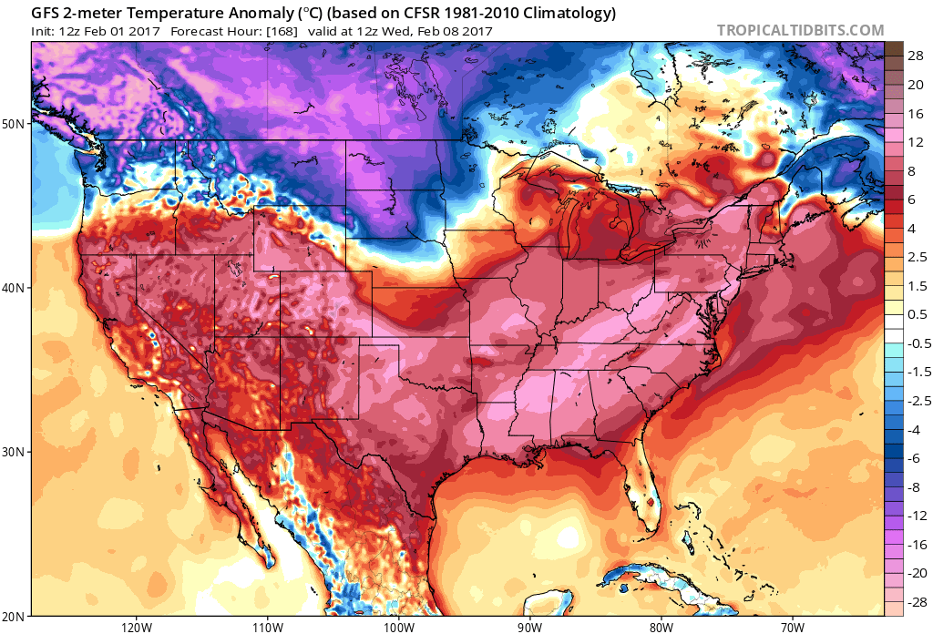
Temperature anomaly map for Tuesday at 12 pm.
Temperature anomaly map for Wednesday morning. Well above normal.
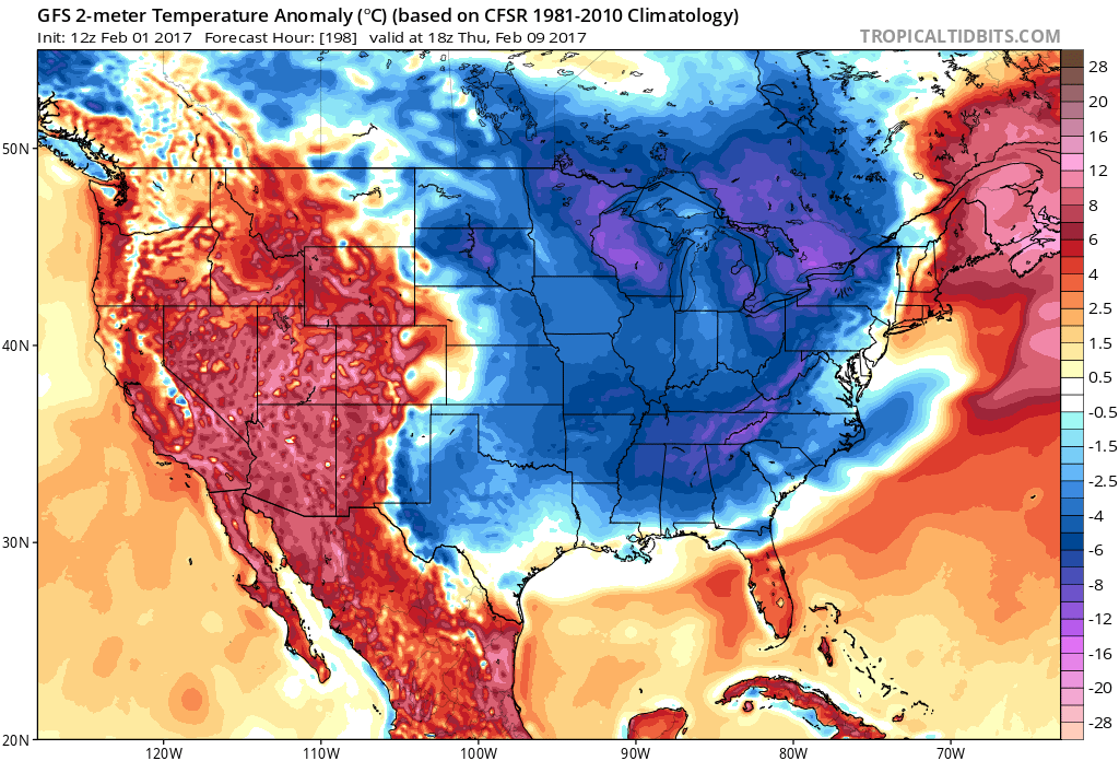
Temperature anomaly map for Thursday afternoon. Cooler air arrives behind the cold front. Nothing extreme, but cooler.

Find me on Twitter

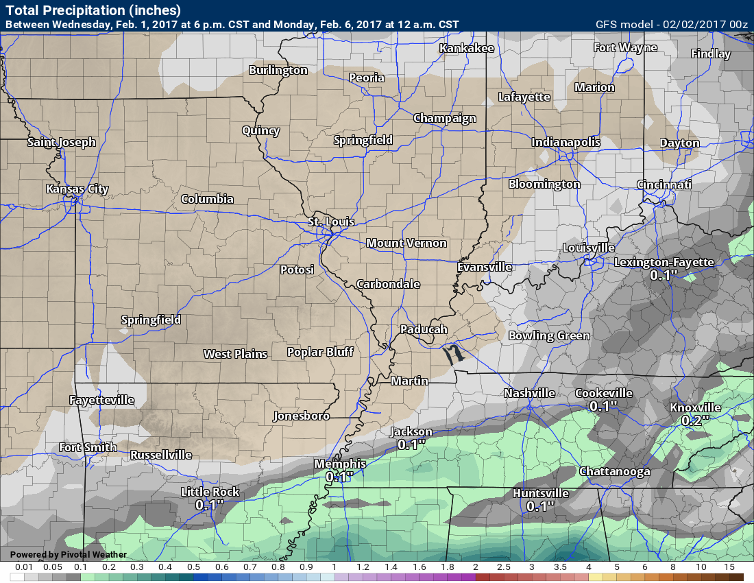
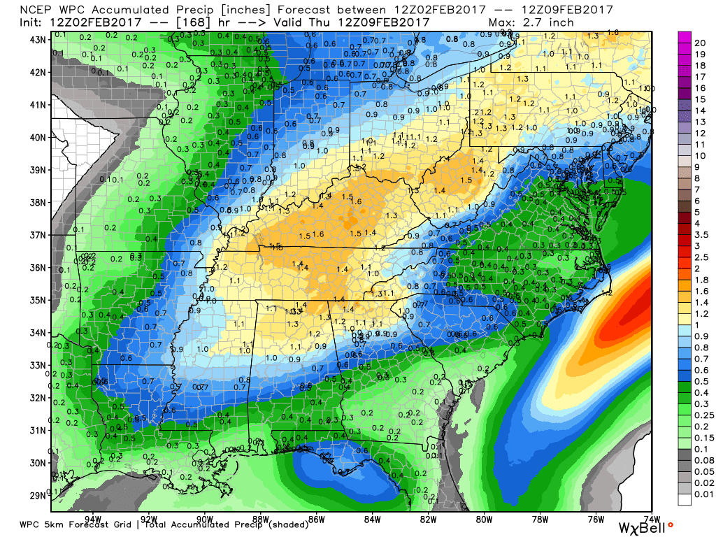
How much rain is expected over the coming days?
The official NOAA rainfall total forecast is below.
Click image to enlarge
Most of this falls on Monday into Wednesday
High and Low-Temperature Outlook
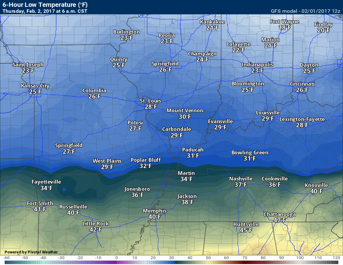
Thursday morning low temperatures
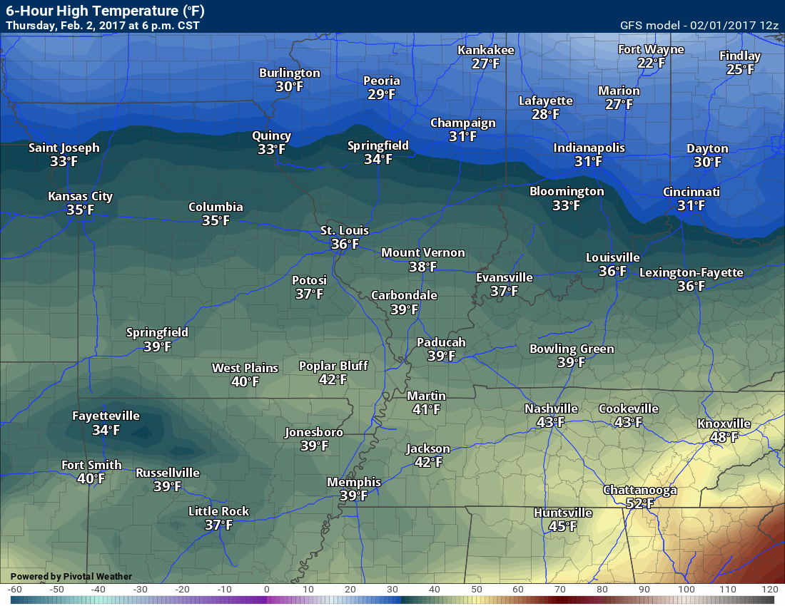
Thursday afternoon high temperatures
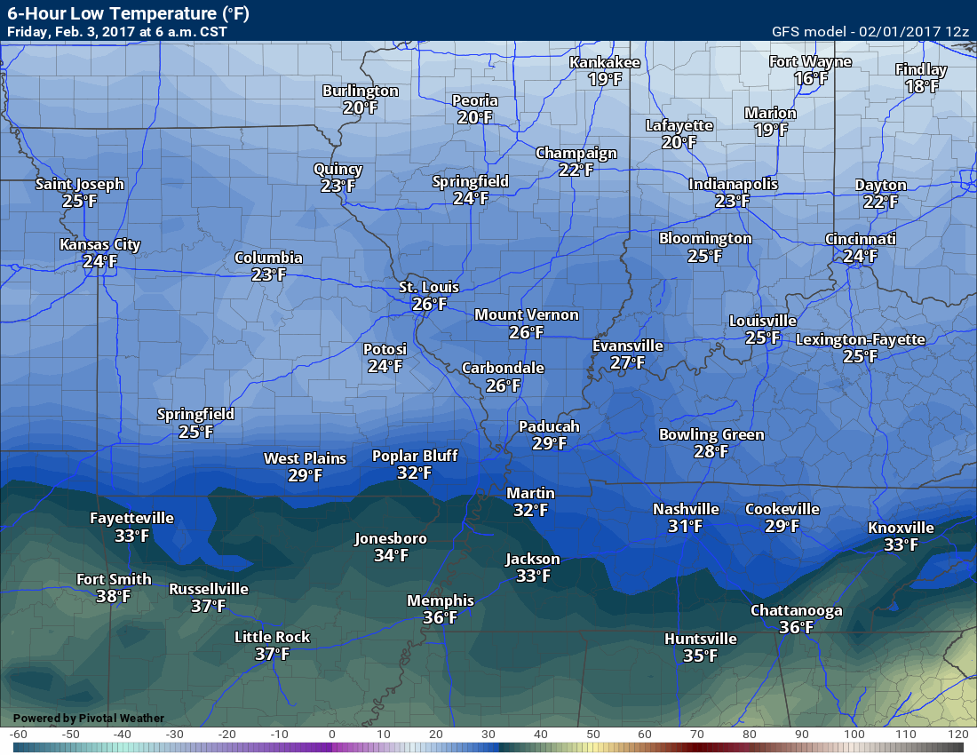
Friday morning low temperatures
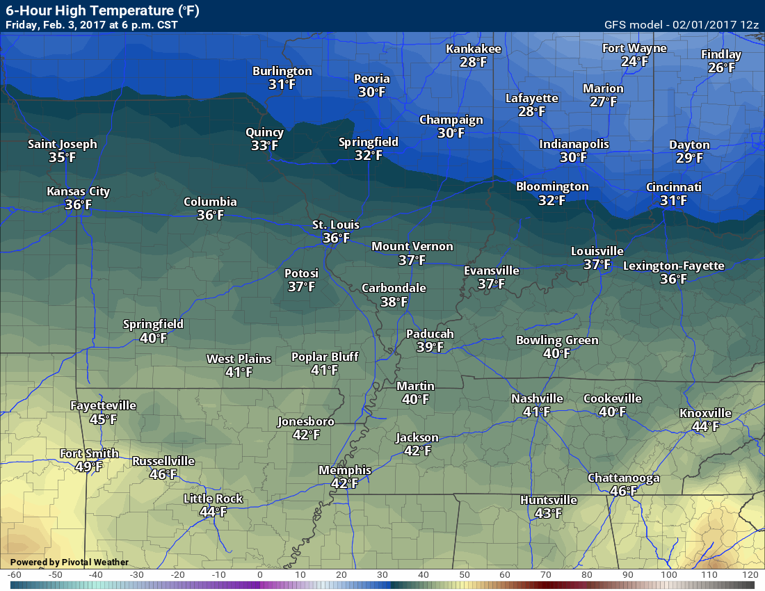
Friday Afternoon high temperatures

Guidance is trending drier and drier for Saturday night and Sunday morning.

No major concerns, at this time

Severe thunderstorm outlook.
Remember that a severe thunderstorm is defined as a thunderstorm that produces 58 mph winds or higher, quarter size hail or larger, and/or a tornado.
Wednesday night through Saturday: No severe weather concerns.
Monday night through next Friday: Monitor updates. Some storms are possible Monday into Wednesday. Timing of the system will need to be monitored. I can’t rule out strong storms, but confidence this far out is low.

We have regional radars and local city radars – if a radar does not update then try another one. Occasional browsers need their cache cleared. You may also try restarting your browser. That usually fixes the problem. Occasionally we do have a radar go down. That is why I have duplicates. Thus, if one fails then try another one.
During the winter you can track snow and ice by clicking the winterize button on the local city view interactive radars.
If you have any problems then please send me an email beaudodson@usawx.com
Interactive Weather Radar Page. Choose the city nearest your location: Click this link—
National interactive radar: Click this link.
Local interactive city radars include St Louis, Mt Vernon, Evansville, Poplar Bluff, Cape Girardeau, Marion, Paducah, Hopkinsville, Memphis, Nashville, Dyersburg, and all of eastern Kentucky. These are interactive radars. Local city radars – click here
Regional Radar


Here are the current river stage forecasts. You can click your state and then the dot for your location. It will bring up the full forecast and hydrograph.
..

The official 6-10 day and 8-14 day temperature and precipitation outlook. Check the date stamp at the top of each image (so you understand the time frame).
The forecast maps below are issued by the Weather Prediction Center (NOAA)


The latest 8-14 day temperature and precipitation outlook. Note the dates are at the top of the image. These maps DO NOT tell you how high or low temperatures or precipitation will be. They simply give you the probability as to whether temperatures or precipitation will be above or below normal.


Who do you trust for your weather information and who holds them accountable?
I have studied weather in our region since the late 1970’s. I have 39 years of experience in observing our regions weather patterns. My degree is in Broadcast Meteorology and a Bachelor’s of Science.
My resume includes:
Member of the American Meteorological Society.
NOAA Weather-Ready Nation Ambassador.
Meteorologist for McCracken County Emergency Management. I served from 2005 through 2015.
Meteorologist for McCracken County Rescue. 2015 through current
I own and operate the Southern Illinois Weather Observatory.
I am the chief meteorologist for Weather Talk LLC. I am the owner of Weather Talk LLC.
I am also a business owner in western Kentucky.
Recipient of the Mark Trail Award, WPSD Six Who Make A Difference Award, Kentucky Colonel, and the Caesar J. Fiamma” Award from the American Red Cross.
In 2005 I helped open the largest American Cross shelter in U.S. history in Houston, Texas. I was deployed to help after Hurricane Katrina and Hurricane Rita. I was a shelter manager of one of the Houston, Texas shelter divisions.
In 2009 I was presented with the Kentucky Office of Highway Safety Award.
Recognized by the Kentucky House of Representatives for my service to the State of Kentucky leading up to several winter storms and severe weather outbreaks.
If you click on the image below you can read the Kentucky House of Representatives Resolution.

I am also President of the Shadow Angel Foundation which serves portions of western Kentucky and southern Illinois.
There is a lot of noise on the internet. A lot of weather maps are posted without explanation. Over time you should learn who to trust for your weather information.
My forecast philosophy is simple and straight forward.
- Communicate in simple terms
- To be as accurate as possible within a reasonable time frame before an event
- Interact with you on Twitter, Facebook, email, texts, and this blog
- Minimize the “hype” that you might see on some television stations or through other weather sources
- Push you towards utilizing wall-to-wall LOCAL TV coverage during severe weather events
Many of the graphics on this page are from www.weatherbell.com
WeatherBell is a great resource for weather model guidance.


You can sign up for my AWARE email by clicking here I typically send out AWARE emails before severe weather, winter storms, or other active weather situations. I do not email watches or warnings. The emails are a basic “heads up” concerning incoming weather conditions