Good evening
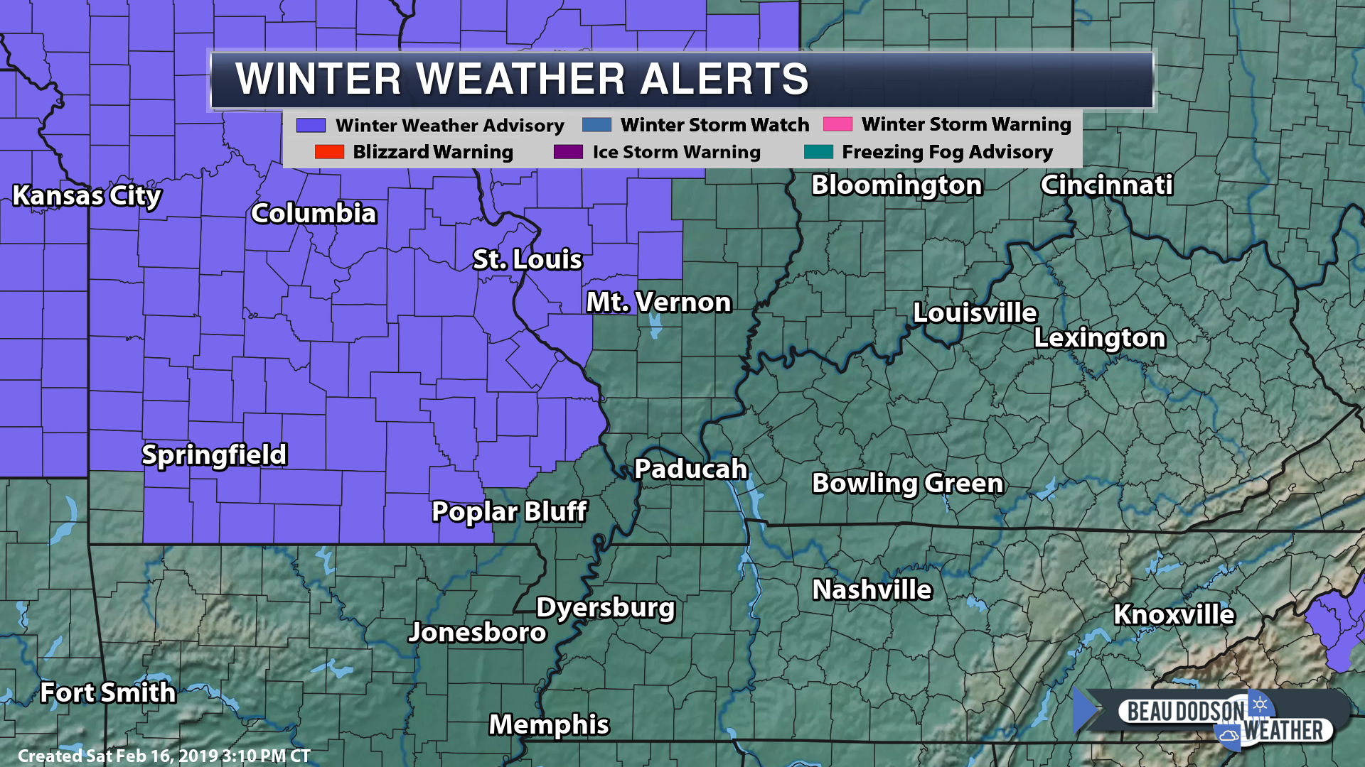
We have a winter weather advisory for portions of the area tonight. Wintry precipitation could also occur outside the advisory zone.
Temperatures today have struggled to move above freezing. The amount of snow and ice is the reason.
We have widespread 30 to 34-degree readings. The thinking was we would move into the 33 to 36-degree range. Locally higher. That is not happening.
A fast moving system will spread freezing rain, sleet, and snow into the region tonight. It will be a light event.
The problem is that it does not take much freezing rain or freezing drizzle to cause issues. That is the reason for the advisory.
Again, other areas may also have issues.
Use care if you much be out tonight and early tomorrow morning.
Other roads remain ice covered from last nights event.
Thank you for all the ice storm photos. I posted many of them on my Twitter feed.
Radars are up and running (see below).

Click here for your interactive local city-view radars & regional radars.
During winter weather be sure and click the winterize button above each city-view radar. This will show you the precipitation type.
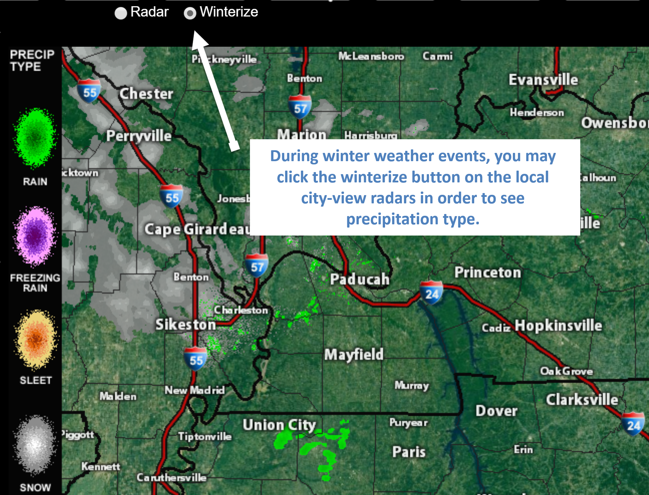
Click the image above to enlarge the example of how to winterize your city-view radar.
You will also find clickable warning and advisory buttons on the local city-view radars.
If the radar is not updating then try another one. If a radar does not appear to be refreshing then hit Ctrl F5. You may also try restarting your browser.
Broken links? Something not working? Email me at beaudodson@usawx.com
Find me on Facebook!

Find me on Twitter!

Did you know that a portion of your monthly subscription helps support local charity projects?
You can learn more about those projects by visiting the Shadow Angel Foundation website and the Beau Dodson News website.
