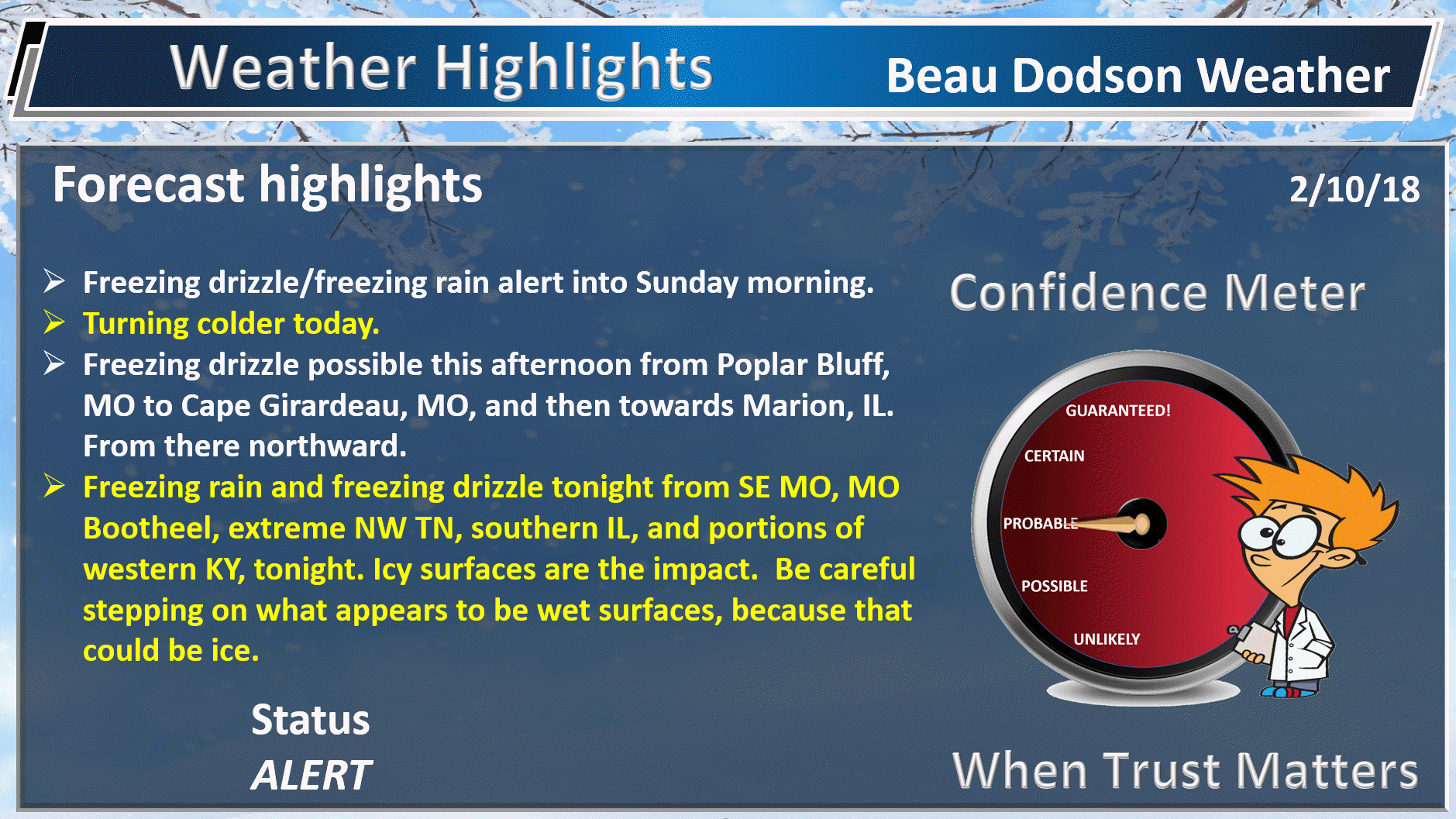
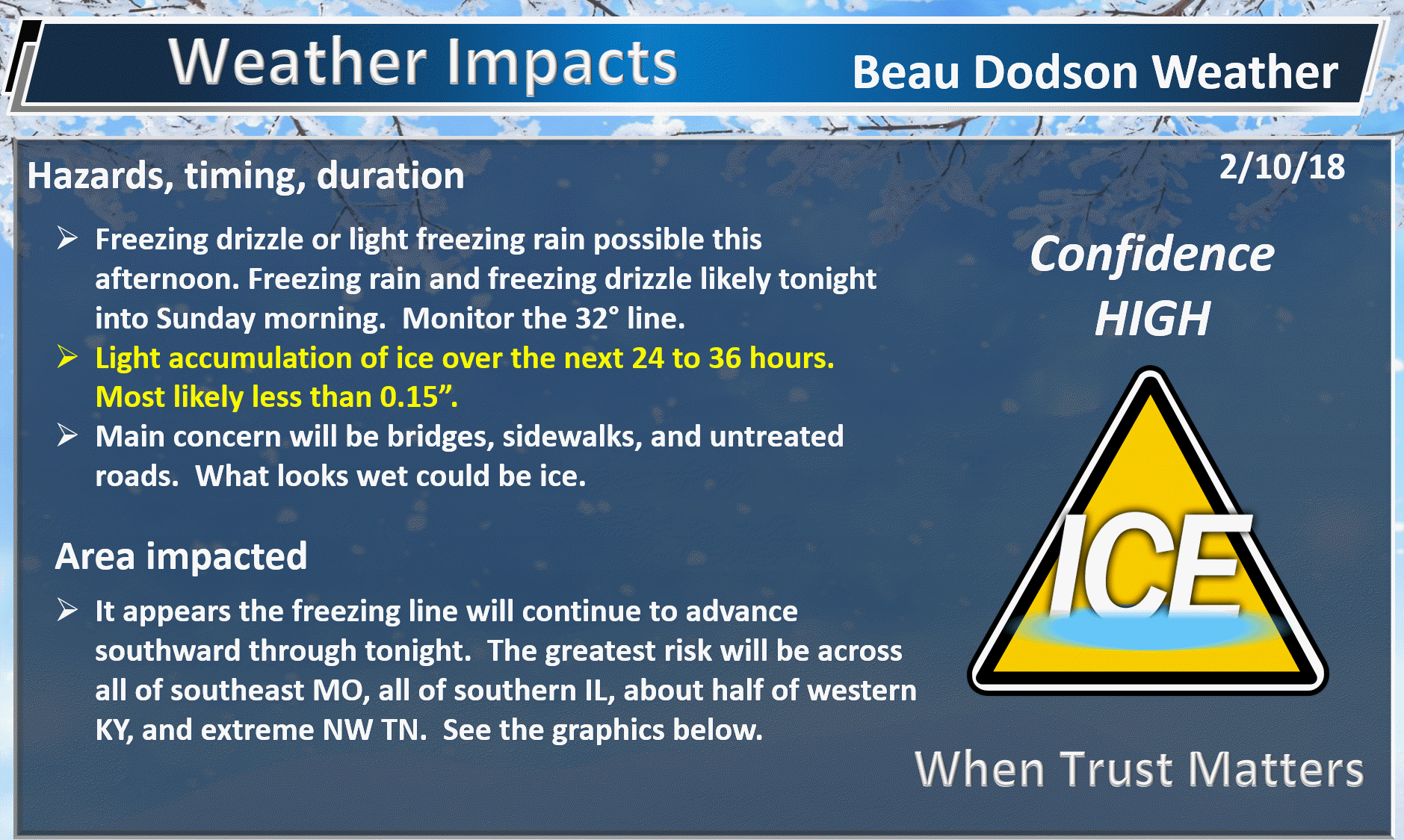
** Freezing rain and freezing drizzle alert for portions of the area **
Freezing drizzle could begin as early as late this afternoon and chances increase into tonight (see graphics in this update)
.
.
.
Red zone greatest risk of ice.
Middle zone is questionable. Monitor temperatures. You will be near freezing late tonight.
The southeast zone will likely remain above freezing tonight.

.
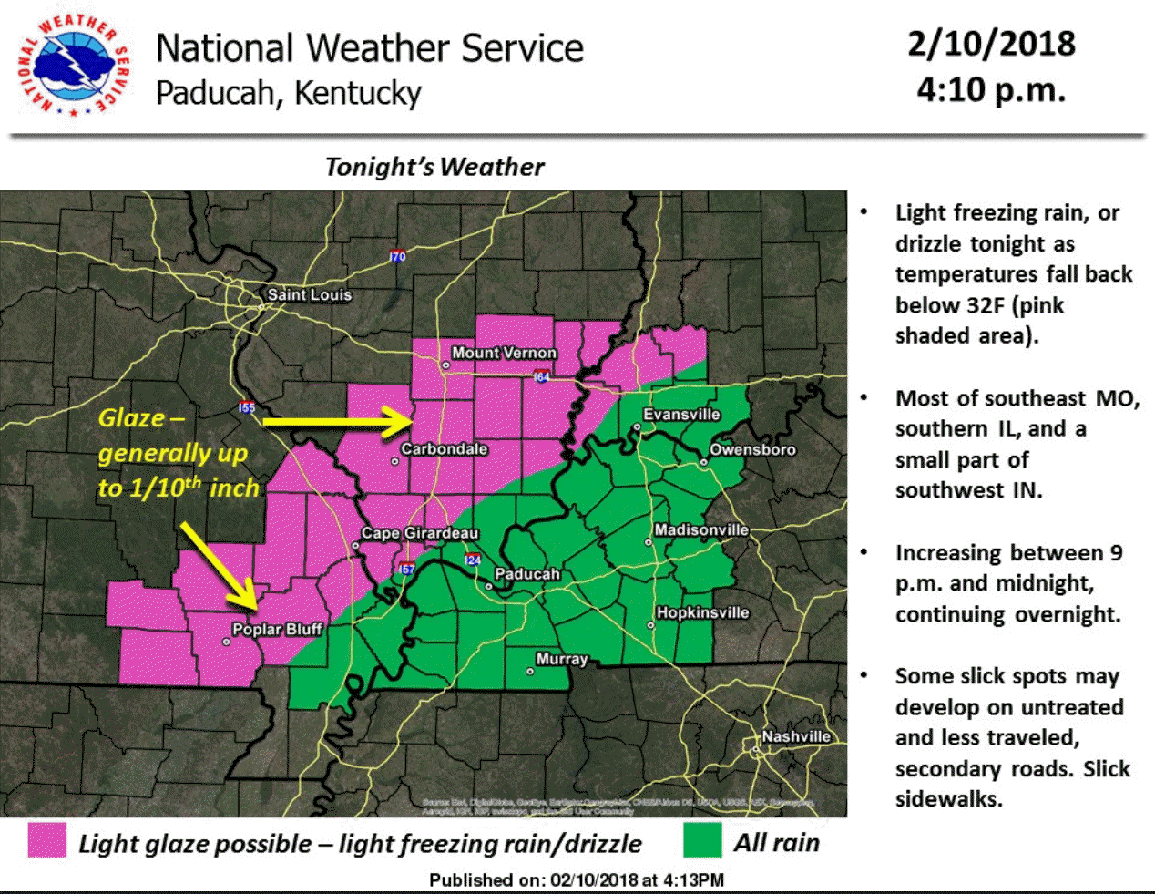
Here is the Paducah, KY NWS graphic. Western portions of that green zone may go below freezing and should monitor updates.
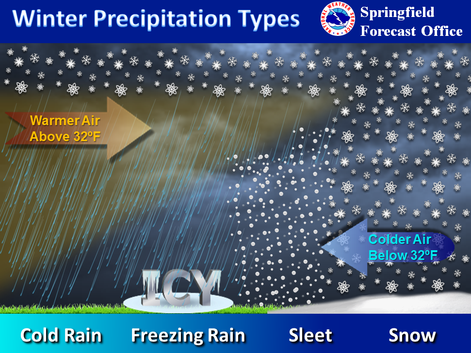
The exact placement of the freezing line is key to what type of precipitation you will have.
.
.
LONG RANGE OUTLOOKS/Videos/Graphics
A general spring and summer outlook has been posted. More details will be posted over time.
Bonus maps and videos have been updated.
Link to the long range outlooks (Scroll down to the 2nd post at this link for the latest long range outlook) and videos (for subscribers) – Click here
You haven’t subscribed? Subscribe at www.beaudodsonweather.com
Monthly operating costs for Weather Talk can top $2000.00. Your $3 subscription helps pay for those costs. I work for you.
.

.
February 10, 2018
Saturday Forecast Details
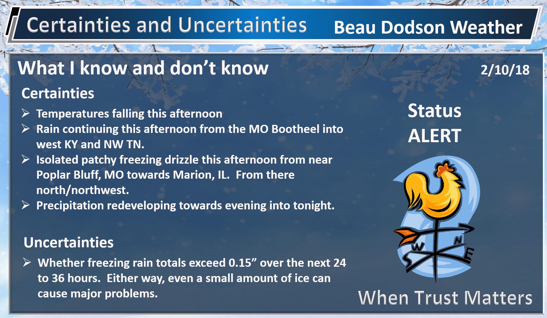
Forecast: Cloudy. Patchy freezing drizzle possible across portions of southeast Missouri and southern Illinois. Rain showers across the Missouri Bootheel into western Kentucky and NW Tennessee. Temperatures steady or slowly falling. The best chance of freezing drizzle this afternoon will be along a line from Poplar Bluff, MO to near Cape Girardeau, MO to near Vienna, IL and then north northeast into the Carmi, IL area. Keep In mind the freezing line will slowly sag southward today. Monitor your temperatures. Freezing drizzle can cause decks, porches, sidewalks, and other surfaces to become ice covered. A thin layer of ice. Bridges will freeze first.
Temperatures: Temperatures steady or slowly falling through the afternoon hours. MO ~ 28 to 36 (warmest over the Bootheel of MO) IL ~ 28 to 38 KY ~ 36 to 42 (mildest towards Hopkinsville)
What is the chance of precipitation? MO ~ 40% IL ~ 40% KY ~ 70% TN ~ 80%
Coverage of precipitation: Isolated to patchy/scattered north and more widespread from the Bootheel into western Kentucky and northwest Tennessee.
Wind chill values: 20 to 30
Accumulating snow or ice: Light freezing drizzle is possible. This could cause a thin glaze of ice on surfaces.
Winds: East and northeast winds 5 to 10 mph with gusts to 14 mph
What impacts are anticipated from the weather? Wet roadways. Icy surfaces where freezing drizzle develops.
My confidence in the forecast verifying: High
Is severe weather expected? No
The NWS defines severe weather as 58 mph wind or great, 1″ hail or larger, and/or tornadoes
Should I cancel my outdoor plans? Have a plan B and monitor updates
.
Saturday Night Forecast Details:
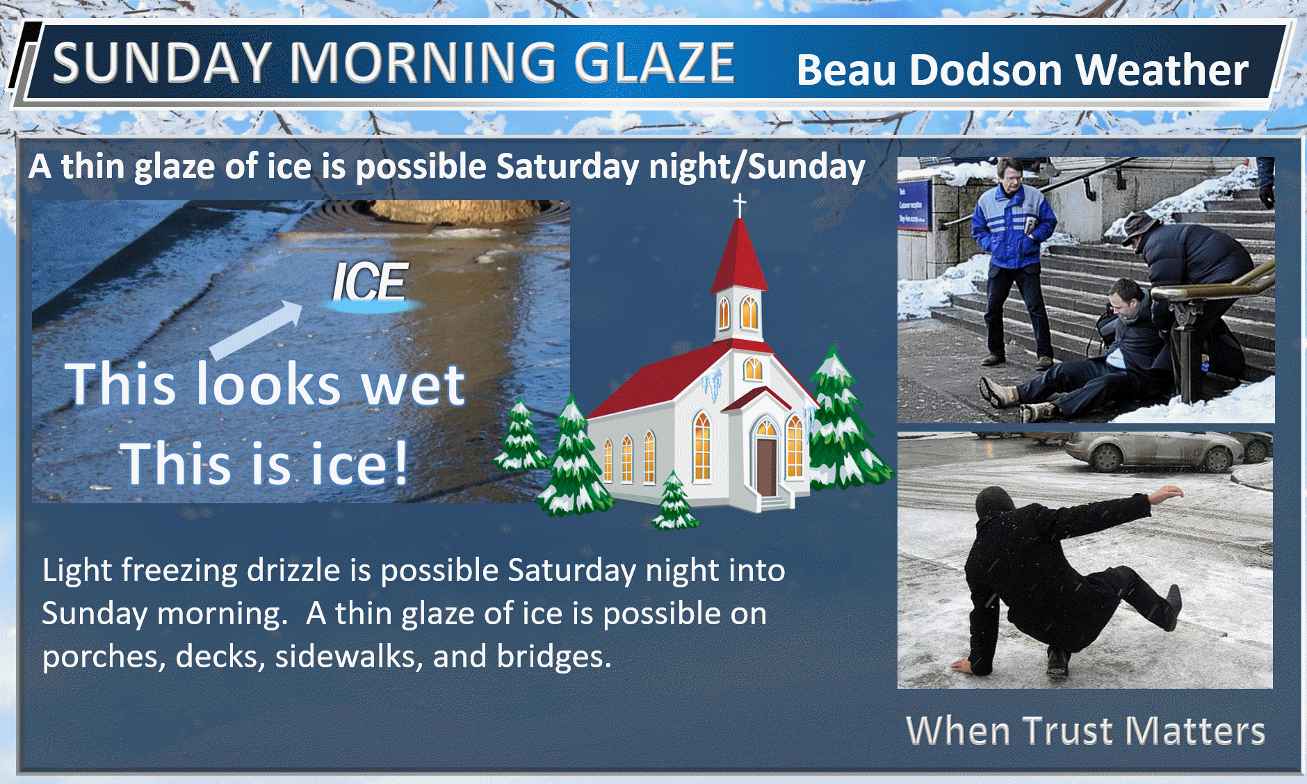
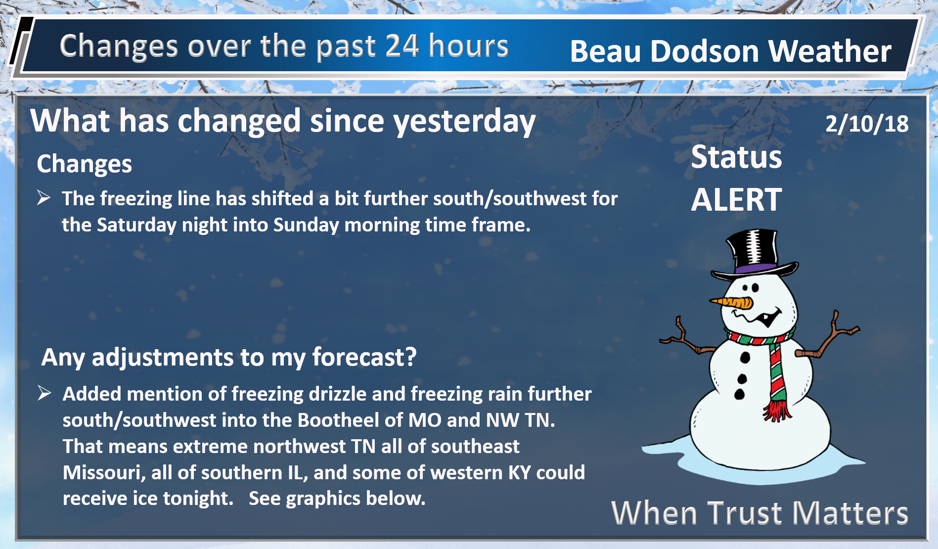
Forecast: ** Freezing Drizzle/freezing rain Alert ** Monitor where the freezing line is tonight. Cloudy. Colder. Rain and drizzle changing to freezing rain and freezing drizzle. Small chance of sleet. The freezing line will determine who receives plain rain and those who receive freezing rain that will ice surfaces. At this time it appears the freezing line may make it as far south as the Missouri Bootheel and northwest Tennessee. From there the freezing line will extend towards Mayfield, KY and then towards Owensboro. Counties along and north of that line should be at or below freezing. There is a margin of error of 20 miles. The main concern will be a thin layer of ice on surfaces. Please watch the first step in the morning. What looks wet could be ice.
Temperatures: MO ~ 25 to 30 IL ~ 25 to 30 KY ~ 28 to 34 (warmest near Hopkinsville and coolest as you move towards Ohio River)
What is the chance of precipitation? MO ~ 70% IL ~ 70% KY ~ 80% TN ~ 80%
Coverage of precipitation: Widespread light freezing rain and freezing drizzle. Rain showers where temperatures remain above freezing.
Wind chill values: 18 to 28
Accumulating snow or ice: A thin layer of ice may cover surfaces. Monitor updates. Temperatures will vary across the region.
Winds: North and northeast winds 6 to 12 mph with gusts to 16 mph
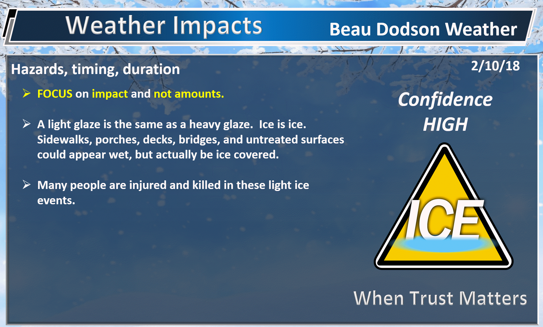
What impacts are anticipated from the weather? Wet roadways. A thin layer of ice on bridges, porches, decks, sidewalks, and perhaps untreated roadways. Use care.
My confidence in the forecast verifying: High
Is severe weather expected? No
The NWS defines severe weather as 58 mph wind or great, 1″ hail or larger, and/or tornadoes
Should I cancel my outdoor plans: Have a plan B and monitor updates.
.
Interactive Weather Radar Page. Choose the city nearest your location: Click this link.
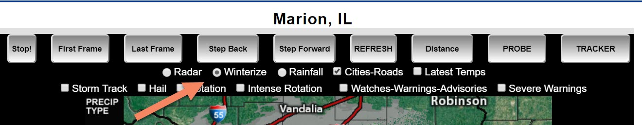
Don’t forget, on the city-view local radars, to click the winterize button. That will show you where freezing rain, sleet, snow, and rain is occurring.
.
Example
.
February 11, 2018
Sunday Forecast Details
Forecast: ** Freezing Drizzle/freezing rain Alert ** Cloudy. Cold. A chance of light freezing drizzle or freezing rain during the morning hours. Rain will occur where temperatures remain above freezing. Temperatures may rise above freezing during the mid to late morning hours. The freezing drizzle would then turn to light rain. Another surge of moisture is forecast to move out of Arkansas into the Missouri Bootheel, western Kentucky, extreme southern Illinois, and northwest Tennessee during the late afternoon and evening hours. This would be a mixture of rain and freezing rain. Snow will be possible, as well. Monitor updates.
Temperatures: MO ~ 32 to 36 IL ~ 32 to 36 KY ~ 32 to 36
What is the chance of precipitation? MO ~ 40% IL ~ 40% KY ~ 60% TN ~ 60%
Coverage of precipitation: Scattered early. A lull. Precipitation may redevelop during late in the day. This precipitation would spread into the region from Arkansas. This second surface may confine itself to the southern half of the region. Monitor updates.
Wind chill values: 25 to 35
Accumulating snow or ice: Thin layer of ice is possible.
Winds: North and northeast winds 7 to 14 mph with gusts to 20 mph
What impacts are anticipated from the weather? Wet roadways. Icy surfaces.
My confidence in the forecast verifying: Medium
Is severe weather expected? No
The NWS defines severe weather as 58 mph wind or great, 1″ hail or larger, and/or tornadoes
Should I cancel my outdoor plans? Have a plan B and monitor updates
.
Sunday Night Forecast Details:
Forecast: Monitor updates concerning another round of freezing rain and snow. Mostly cloudy. Colder. A period of rain and freezing rain during the first half of the night. Freezing rain may become mixed with or change to snow. Best chances will be from the Missouri Bootheel towards Paducah and then northeast towards Madisonville. From there southward. North of there could have scattered light freezing rain or freezing drizzle, as well, but coverage won’t be as great.
Temperatures: MO ~ 18 to 24 IL ~ 18 to 24 KY ~ 20 to 25
What is the chance of precipitation? MO ~ 40% IL ~ 40% KY ~ 50% TN ~ 60%
Coverage of precipitation: Isolated to scattered north. A bit more widespread as you move towards the MO Bootheel and along the Ohio River in KY/IL from there eastward.
Wind chill values: 12 to 22
Accumulating snow or ice: Icy surfaces are possible
Winds: North and northeast winds 6 to 12 mph with gusts to 16 mph
What impacts are anticipated from the weather? Icy roadways are possible. Some snow may mix in with the freezing rain.
My confidence in the forecast verifying: Medium
Is severe weather expected? No
The NWS defines severe weather as 58 mph wind or great, 1″ hail or larger, and/or tornadoes
Should I cancel my outdoor plans: Have a plan B and monitor updates
.
February 12, 2018
Monday Forecast Details
Forecast: A mix of sun and clouds. Cool.
Temperatures: MO ~ 38 to 44 IL ~ 38 to 44 KY ~ 40 to 45
What is the chance of precipitation? MO ~ 0% IL ~ 0% KY ~ 0% TN ~ 0%
Coverage of precipitation: None
Wind chill values: 30 to 35
Accumulating snow or ice: No
Winds: North and northeast winds 6 to 12 mph with gusts to 18 mph
What impacts are anticipated from the weather? None
My confidence in the forecast verifying: High
Is severe weather expected? No
The NWS defines severe weather as 58 mph wind or great, 1″ hail or larger, and/or tornadoes
Should I cancel my outdoor plans? No
.
Monday Night Forecast Details:
Forecast: A few clouds. Chilly.
Temperatures: MO ~ 28 to 34 IL ~ 28 to 34 KY ~ 30 to 35
What is the chance of precipitation? MO ~ 0% IL ~ 0% KY ~ 0% TN ~ 0%
Coverage of precipitation: None
Wind chill values: 22 to 30
Accumulating snow or ice: No
Winds: East and northeast winds 5 to 10 mph
What impacts are anticipated from the weather? None
My confidence in the forecast verifying: Medium
Is severe weather expected? No
The NWS defines severe weather as 58 mph wind or great, 1″ hail or larger, and/or tornadoes
Should I cancel my outdoor plans: No
.
February 13, 2018
Tuesday Forecast Details
Forecast: A mix of sun and clouds. Milder.
Temperatures: MO ~ 48 to 54 IL ~ 48 to 54 KY ~ 48 to 54
What is the chance of precipitation? MO ~ 10% IL ~ 10% KY ~ 10% TN ~ 10%
Coverage of precipitation: Most likely none, but monitor updates.
Wind chill values: N/A
Accumulating snow or ice: No
Winds: Winds becoming variable at 4 to 8 mph. Winds become south as the day wears on.
What impacts are anticipated from the weather? None.
My confidence in the forecast verifying: Medium
Is severe weather expected? No
The NWS defines severe weather as 58 mph wind or great, 1″ hail or larger, and/or tornadoes
Should I cancel my outdoor plans? No
.
Tuesday Night Forecast Details:
Forecast: Mostly cloudy. A chance of isolated showers.
Temperatures: MO ~ 35 to 40 IL ~ 35 to 40 KY ~ 35 to 40
What is the chance of precipitation? MO ~ 0% IL ~ 0% KY ~ 0% TN ~ 0%
Coverage of precipitation: Isolated
Wind chill values: 30 to 35
Accumulating snow or ice: No
Winds: South and southwest at 5 to 10 mph
What impacts are anticipated from the weather? Perhaps some scattered wet roadways
My confidence in the forecast verifying: Medium
Is severe weather expected? No
The NWS defines severe weather as 58 mph wind or great, 1″ hail or larger, and/or tornadoes
Should I cancel my outdoor plans: No
.
February 14, 2018
Wednesday Forecast Details
Forecast: Mostly cloudy. A chance of showers. Mild.
Temperatures: MO ~ 55 to 60 IL ~ 55 to 60 KY ~ 55 to 60
What is the chance of precipitation? MO ~ 30% IL ~ 30% KY ~ 30% TN ~ 30%
Coverage of precipitation: Isolated showers
Wind chill values: N/A
Accumulating snow or ice: No
Winds: South and southwest at 5 to 10 mph with gusts to 14
What impacts are anticipated from the weather? Isolated wet roadways.
My confidence in the forecast verifying: Medium
Is severe weather expected? No
The NWS defines severe weather as 58 mph wind or great, 1″ hail or larger, and/or tornadoes
Should I cancel my outdoor plans? No, but monitor updates
.
Wednesday Night Forecast Details:
Forecast: Mostly cloudy. A chance of a few showers.
Temperatures: MO ~ 46 to 52 IL ~ 46 to 52 KY ~ 46 to 54
What is the chance of precipitation? MO ~ 20% IL ~ 20% KY ~ 20% TN ~ 20%
Coverage of precipitation: Isolated
Wind chill values: N/A
Accumulating snow or ice: No
Winds: South and southwest at 5 to 10 mph
What impacts are anticipated from the weather? Perhaps some scattered wet roadways
My confidence in the forecast verifying: Medium
Is severe weather expected? No
The NWS defines severe weather as 58 mph wind or great, 1″ hail or larger, and/or tornadoes
Should I cancel my outdoor plans: No, but monitor updates
.
Interactive Weather Radar Page. Choose the city nearest your location: Click this link.
.

.
Saturday afternoon: Light freezing drizzle is possible from Poplar Bluff towards Cape Girardeau and then towards Marion, IL. From there north and northeast into the Carmi, IL area. The freezing line will slowly sag southward with time. Once the freezing line arrives any pockets of light precipitation could produce icy surfaces. Monitor you local surface temperatures.
Saturday night into Sunday: Saturday afternoon: Light freezing drizzle is possible from Poplar Bluff towards Cape Girardeau and then towards Marion, IL. From there north and northeast into the Carmi, IL area. The freezing line will slowly sag southward with time. Once the freezing line arrives any pockets of light precipitation could produce icy surfaces. Monitor you local surface temperatures.
Widespread freezing drizzle is anticipated. Pockets of freezing rain, as well. This will cause surfaces to have a thin layer of ice. Please use care on porches, stairs, sidewalks, bridges, and other untreated surfaces. That first step could be one that causes you to slip and fall. What looks wet could be ice
Sunday night: Another round of freezing drizzle and freezing rain will move out of the Missouri Bootheel into portions of western Kentucky and northwest Tennessee. It could reach into far southern Illinois, as well. Temperatures will likely be in the lower to middle 30’s at the beginning of the precipitation. Some areas will once again have to deal with icy surfaces. Use care.
.

.
The National Weather Service definition of a severe thunderstorm is one that produces quarter size hail or larger, 58 mph winds or greater, and/or a tornado.
Now through Wednesday: Severe weather is not in the forecast.
.

.
Interactive Weather Radar Page. Choose the city nearest your location: Click this link.
Good afternoon and evening.
I am running behind a bit. Let’s keep this fairly simple and concentrate on the next 36 hours.
There are three time frames to monitor.
- This afternoon some light freezing drizzle could occur from near Poplar Bluff, MO towards Marion, IL and then towards Carmi, IL. Widespread precipitation is not anticipated in those areas, but a few patches of freezing drizzle possible.
. - Precipitation coverage increases area-wide tonight. Freezing drizzle and freezing rain is a concern. The impact will be icy surfaces. What looks wet could be ice. Use care.
. - Another round of precipitation may impact our southern counties Sunday evening and night. This could be in the form of rain and freezing rain. The most likely area of concern, during that time frame, will be from the Missouri Bootheel into northwest Tennessee and then into western Kentucky. Not sure about extreme southern Illinois. Monitor updates.
Here are the highlights.
.
.
.
.
.
.
.
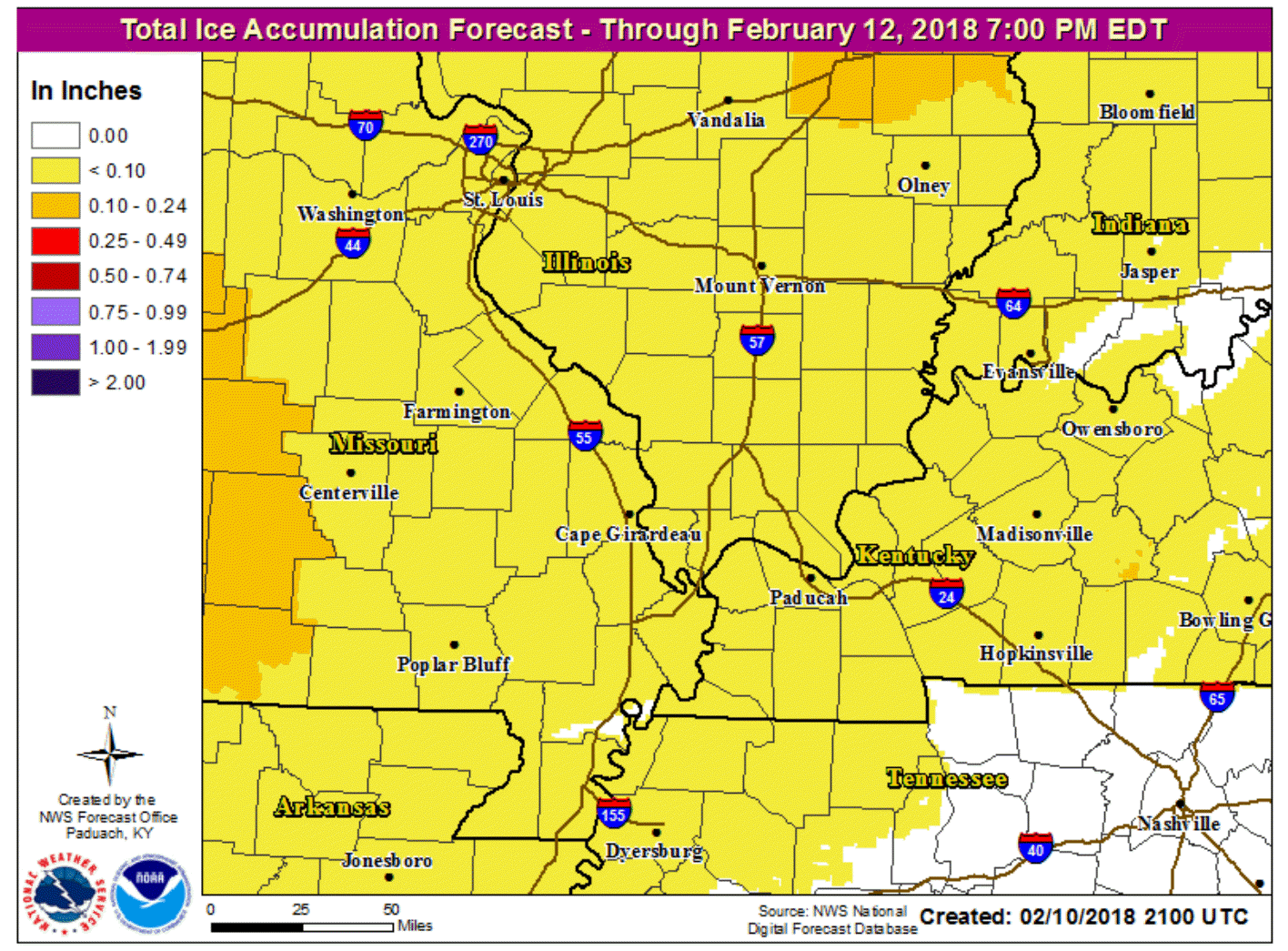
Here is the latest freezing rain accumulation forecast. This could change, but use it as a general guide.
Remember, bridges freeze first. Decks and porches freeze first. Elevated surfaces free first.
Why isn’t this a snow event? The reason is a warm wedge of air aloft. This warm air aloft will melt the snowflakes. The liquid drops will then fall to the Earth’s surface (your backyard). Temperatures at the surface will be below freezing. The liquid will then freeze upon contact.
.
.
.
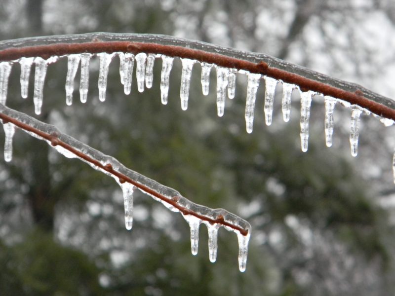
What is freezing rain? This is freezing rain.
.
.
As you move closer to Murray and then towards Madisonville along and south of that line could remain above freezing tonight. Again, this is questionable. Keep it in mind.
Monitor updates and monitor your local surface temperatures.
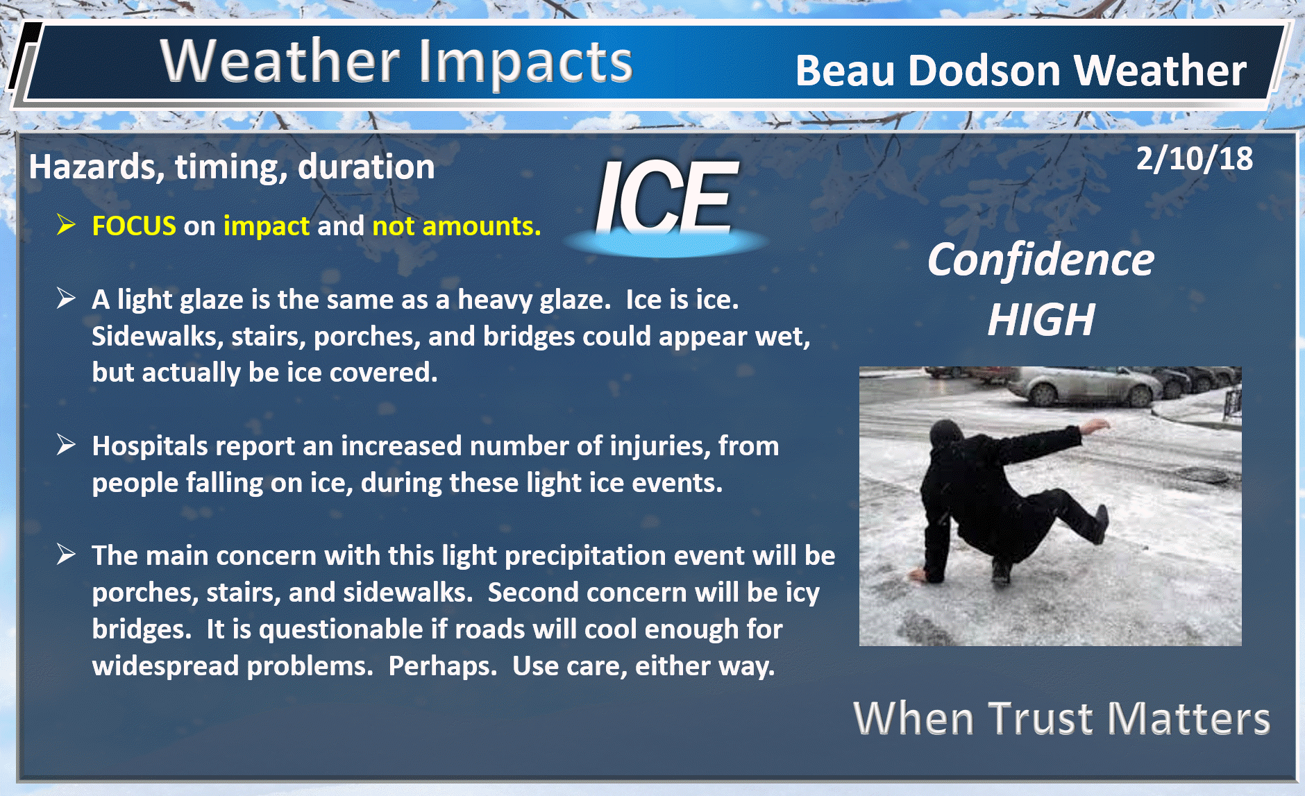
Overall this is anticipated to be a light event. Ice totals of 0.01 to 0.15″ is anticipated. Don’t focus on the amount of ice. Focus on the impact.
Again, remember, it only takes a hint of freezing rain to cause surfaces to becoming ice covered.
.
.
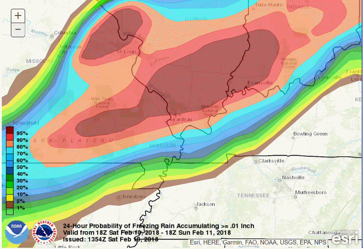
Here is the WPC/NOAA freezing rain probability chart. What is the chance of at least 0.01″ of freezing rain accumulating tonight into Sunday morning.
.
.
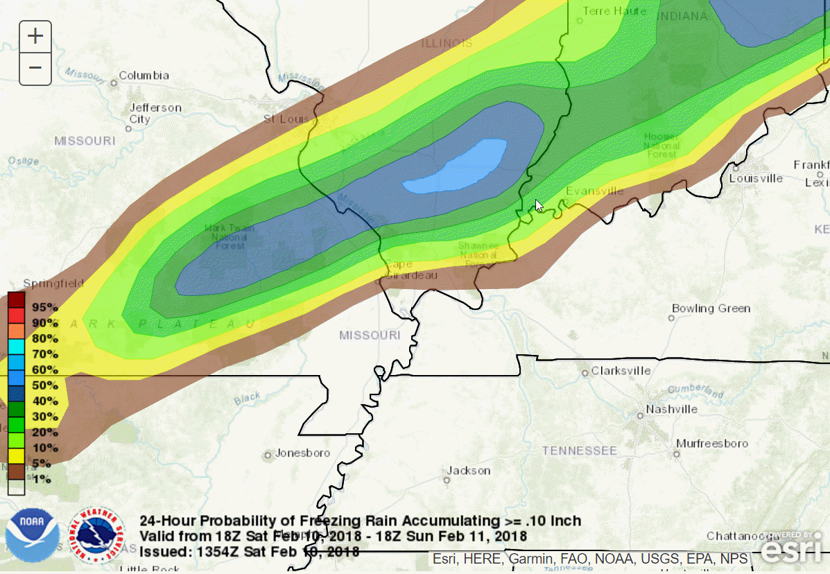
What is the chance of 0.10″ of freezing rain accumulation tonight into Sunday morning.
(NOTE: areas outside this zone could also have ice. This is JUST the % chance of 0.10″ or greater amounts).
.
.
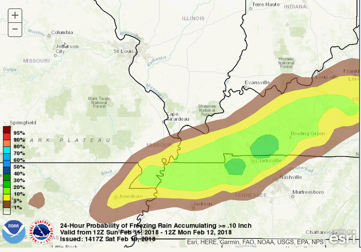
This next graphic is the chance of 0.10″ of freezing rain Sunday night into Monday morning. This is that second system that I mentioned above.
.
.
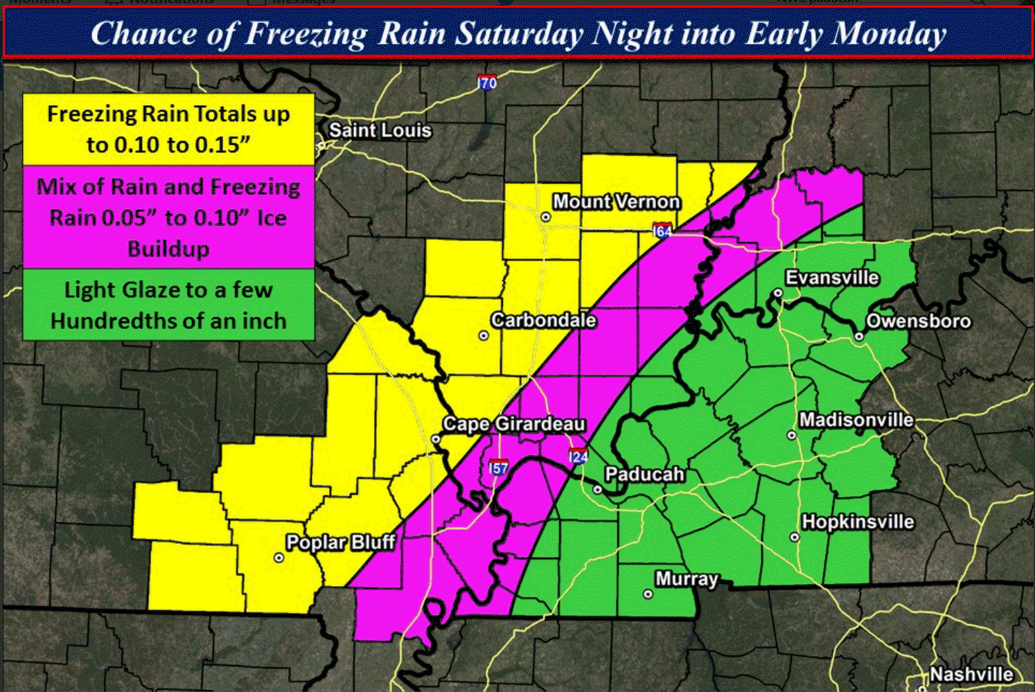
Here is a rough idea of where freezing rain is MOST likely tonight into Sunday morning (this does NOT include the Sunday night event). The yellow and purple areas are the most likely zones for ice.
The green zone may receive some ice, as well. The green zone is where confidence is less.
This graphic may need updating as we move into tonight. Confidence on the exact placement of the freezing line is medium. There is a margin of error of about 20 miles.
Monitor your local surface temperatures. Use care as you step out onto stairs, porches, and decks. What looks like a wet surface could be ice. This graphic was made by the Paducah, KY NWS.
.
.
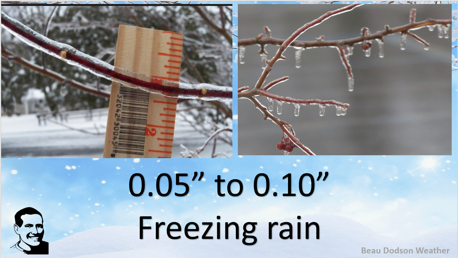
What does 0.05 to 0.10″ of freezing rain look like?
.
.
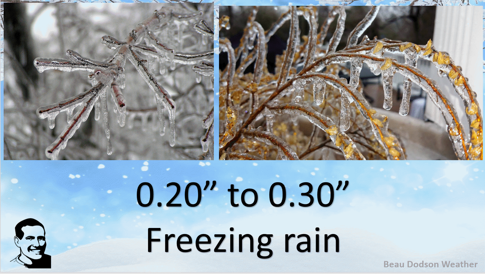
What about 0.20″ to 0.30″
.
.
Use care this weekend.
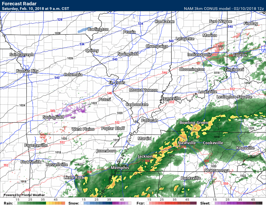
Here is the future-cast radar from the NAM model guidance. Green is rain. Pink and purple/orange is sleet and freezing rain. Blue is snow.
Notice how patchy freezing drizzle and patchy freezing drizzle moves across the region over the next 12 to 18 hours.
.
 n.
n.
.
.

.


We offer regional radars and local city radars – if a radar does not update then try another one. Occasional browsers need their cache cleared. You may also try restarting your browser. This will usually fix any problems.
During the winter you can track snow and ice by clicking the winterize button on the local city view interactive radars.
You may email me at beaudodson@usawx.com
Interactive Weather Radar Page. Choose the city nearest your location: Click this link
National interactive radar: Click this link.