
Stop what you are doing and do me a favor!
A couple of housekeeping items. I need your assistance with these.
We still have a number of www.weathertalk.comaccounts that have expired cards/PayPal accounts. You would still receive messages because I have to turn those off manually.
Can you sign into your www.weathertalk.comaccount and make sure your payment is active? If it is not active then click the MY ACCOUNT tab and then the yellow button that says make a payment/update payment info.
Thank you
Did you know that your WeatherTalk subscription helps support numerous local charity events?
Check them out at these links
The Justin Croach Memorial Scholarship

Daily WeatherTalk schedule


We offer interactive local city view radars and regional radars.
If a radar does not update then try another one. If a radar does not appear to be refreshing then hit Ctrl F5. You may also try restarting your browser.

Interactive Radars:
Interactive live weather radar page. Choose the city nearest your location. If one of the city radars won’t load then try a nearby one. Click here.
Live satellite views. Click here
ANY shift in this storm systems track will completely change our local forecast. Monitor updates.
December 8, 2018
Saturday forecast: Mostly cloudy. Cold. A chance of a wintry mix changing along the MO/AR and KY/TN State line. Temperatures may rise enough to change everything over to plain rain for a period of time. Monitor updates concerning this topic. Any shift in the storm track would change the going forecast. Use care during the AM hours. Remember, bridges freeze first.
My confidence in the forecast verifying: Medium (50% confidence)
Temperature range: MO ~ 32 to 34 IL ~32 to 34 KY ~ 32 to 34 TN ~ 32 to 34
Wind chill (feels like) temperature forecast: 15 to 25
What is the chance/probability of precipitation? MO ~ 90% in the Missouri Bootheel. 50% (near Poplar Bluff and 10% near Farmington, MO IL ~ 20% KY ~ 10% near Owensboro to 60% near Fulton, KY (far southwest part of KY) TN ~ 90%
Coverage of precipitation: None for most of us to numerous near the Bootheel into western Tennessee.
Is flooding anticipated? No
Is accumulating snow or ice anticipated? Yes. There is the potential of freezing rain, sleet, and snow during the AM hours. It could change to rain during the PM hours.
Is non-accumulating snow or ice anticipated?
Are icy road conditions anticipated? At this time, the greater concerns appear to be Saturday PM into Sunday. Monitor updates.
Wind direction and speed: North and northeast at 10 to 20 mph
What impacts are anticipated from the weather? Scattered wet roadways. Scattered icy roads possible near Poplar Bluff, Missouri and then east into the Bootheel and west Tennessee Monitor the KY/TN border counties.
Is severe weather expected? No
The NWS officially defines severe weather as 58 mph wind or great, 1″ hail or larger, and/or tornadoes
Will lightning be possible? No
Should I cancel my outdoor plans? For most of us, no. For areas along the MO/AR and KY/TN border you should monitor radars and updates.
Will the weather impact my outdoor plans? For most of the area, no. The above-mentioned areas should monitor radars.
UV Index: 1 to 2 Low
Sunrise: 6:57 AM
ANY shift in this storm systems track will completely change our local forecast. Monitor updates.
Saturday Night Forecast Details:
** Winter Storm Alert **
Forecast: A chance of rain or ice/snow changing to freezing rain, sleet, and snow along the MO/AR and KY/TN border southward. Some icy roads possible. Temperatures may be marginal for icy roads and this needs to be monitored.
My confidence in the forecast verifying: Medium (60% confidence)
Temperature range: MO ~ 25 to 30 IL ~ 25 to 30 KY ~ 25 to 30 TN ~ 26 to 30
Wind chill (feels like) temperature forecast: 10 to 20
What is the chance/probability of precipitation? MO ~ 90% near the MO/AR state line to 30% near Farmington, MO IL ~ 30% KY ~ 20% along the KY/IN State line to 80% along the KY/TN State line TN ~ 100%
Coverage of precipitation: None north to widespread far southern counties in the region.
Is flooding anticipated? No
Is accumulating snow or ice anticipated? Yes. That will be a possibility along the MO/AR and KY/TN State line.
Is non-accumulating snow or ice anticipated?
Are icy road conditions anticipated? Yes. Icy roads are likely in areas I mentioned.
Wind direction and speed: Northeast at 8 to 16 mph with gusts to 30 mph
What impacts are anticipated from the weather? Wet roadways. Icy roadways.
Is severe weather expected? No
The NWS officially defines severe weather as 58 mph wind or great, 1″ hail or larger, and/or tornadoes
Will lightning be possible? No
Should I cancel my outdoor plans? Have a plan B along the MO/AR and KY/TN State line. Monitor updates.
Will the weather impact my outdoor plans? Yes. Precipitation could cause problems with travel in the area with wintry precipitation.
Sunset: 4:37 PM
Moonrise: 7:58 AM Waxing Crescent
Moonset: 6:00 PM
December 9, 2018
Sunday forecast: Cloudy. Dry for most of the region. Precipitation should come to an end as the morning wears on.
My confidence in the forecast verifying: Medium (60% confidence)
Temperature range: MO ~ 36 to 40 IL ~ 35 to 40 KY ~ 36 to 40 TN ~ 34 to 38
Wind chill (feels like) temperature forecast: 25 to 35
What is the chance/probability of precipitation? MO ~ 30% IL ~ 20% KY ~ 60% mainly along the KY/TN border and perhaps our southeast counties near Hopkinsville TN ~ 70%
Coverage of precipitation: Most of the area may remain dry. Areas from the Bootheel and then east along the KY/TN State line will need to be monitored.
Is flooding anticipated? No
Is accumulating snow or ice anticipated? It is possible during the AM hours.
Is non-accumulating snow or ice anticipated?
Are icy road conditions anticipated? Some icy roads are possible from the MO/AR to KY/TN State line southward.
Wind direction and speed: North at 10 to 20 mph
What impacts are anticipated from the weather? Wet and/or icy roads are possible.
Is severe weather expected? No
The NWS officially defines severe weather as 58 mph wind or great, 1″ hail or larger, and/or tornadoes
Will lightning be possible? No
Should I cancel my outdoor plans? No, for most. Areas from the MO/AR to KY/TN State line should monitor updates.
Will the weather impact my outdoor plans? The region could have some icy road conditions. If you have travel plans then monitor regional updates.
UV Index: 3 Medium
Sunrise: 6:58 AM
Sunday Night Forecast Details:
Forecast: Some clouds. Cold. Patchy fog.
My confidence in the forecast verifying: Medium (40% confidence)
Temperature range: MO ~ 24 to 28 IL ~ 22 to 26 KY ~ 24 to 28 TN ~ 24 to 28
Wind chill (feels like) temperature forecast: 10 to 15
What is the chance/probability of precipitation? MO ~ 0% IL ~ 0% KY ~ 20% TN ~ 20%
Coverage of precipitation: Most likely none, but monitor updates. There is a small disturbance near the region.
Is flooding anticipated? No
Is accumulating snow or ice anticipated? Most likely no, but monitor updates.
Is non-accumulating snow or ice anticipated?
Are icy road conditions anticipated? Yes. Some icy roads will be possible in the region.
Wind direction and speed: North at 7 to 14 mph with gusts to 20 mph
What impacts are anticipated from the weather? Monitor road conditions. Icy roads are possible if the winter storm does materialize.
Is severe weather expected? No
The NWS officially defines severe weather as 58 mph wind or great, 1″ hail or larger, and/or tornadoes
Will lightning be possible? No
Should I cancel my outdoor plans? There could still be icy roads remaining in the region. This will be dependent on the track of the weekend winter storm.
Will the weather impact my outdoor plans? Remaining impacts from the winter storm are possible.
Sunset: 4:37 PM
Moonrise: 8:49 AM Waxing Crescent
Moonset: 6:50 PM
December 10, 2018
Monday forecast: Mostly sunny. Not quite as cold.
My confidence in the forecast verifying: High (90% confidence)
Temperature range: MO ~ 40 to 45 IL ~40 to 45 KY ~ 40 to 45 TN ~ 40 to 45
Wind chill (feels like) temperature forecast: 35 to 45
What is the chance/probability of precipitation? MO ~ 0% IL ~ 0% KY ~ 0% TN ~ 0%
Coverage of precipitation: None
Is flooding anticipated? No
Is accumulating snow or ice anticipated? No
Is non-accumulating snow or ice anticipated? No
Are icy road conditions anticipated? No
Wind direction and speed: North at 5 to 10 mph
What impacts are anticipated from the weather? No
Is severe weather expected? No
The NWS officially defines severe weather as 58 mph wind or great, 1″ hail or larger, and/or tornadoes
Will lightning be possible? No
Should I cancel my outdoor plans? No
Will the weather impact my outdoor plans? No
UV Index: 4 Medium
Sunrise: 6:59 AM
Monday Night Forecast Details:
Forecast: Mostly clear and cold.
My confidence in the forecast verifying: High (90% confidence)
Temperature range: MO ~ 20 to 25 IL ~ 20 to 25 KY ~ 22 to 26 TN ~ 22 to 26
Wind chill (feels like) temperature forecast: 15 to 20
What is the chance/probability of precipitation? MO ~ 0% IL ~ 0% KY ~ 0% TN ~ 0%
Coverage of precipitation: None
Is flooding anticipated? No
Is accumulating snow or ice anticipated? No
Is non-accumulating snow or ice anticipated? No
Are icy road conditions anticipated? No
Wind direction and speed: Light and variable wind conditions.
What impacts are anticipated from the weather? None
Is severe weather expected? No
The NWS officially defines severe weather as 58 mph wind or great, 1″ hail or larger, and/or tornadoes
Will lightning be possible? No
Should I cancel my outdoor plans? No
Will the weather impact my outdoor plans? No
Sunset: 4:37 PM
Moonrise: 9:38 AM Waxing Crescent
Moonset: 7:43 PM
December 11, 2018
Tuesday forecast: Mostly sunny. Not quite as cold.
My confidence in the forecast verifying: High (80%)
Temperature range: MO ~ 43 to 46 IL ~43 to 46 KY ~ 43 to 46 TN ~ 44 to 48
Wind chill (feels like) temperature forecast: 38 to 44
What is the chance/probability of precipitation? MO ~ 0% IL ~ 0% KY ~ 0% TN ~ 0%
Coverage of precipitation: None
Is flooding anticipated? No
Is accumulating snow or ice anticipated? No
Is non-accumulating snow or ice anticipated? No
Are icy road conditions anticipated? No
Wind direction and speed: Southwest at 5 to 10 mph
What impacts are anticipated from the weather? No
Is severe weather expected? No
The NWS officially defines severe weather as 58 mph wind or great, 1″ hail or larger, and/or tornadoes
Will lightning be possible? No
Should I cancel my outdoor plans? No
Will the weather impact my outdoor plans? No
UV Index: 3 Low to medium
Sunrise: 6:59 AM
Tuesday Night Forecast Details:
Forecast: Partly to mostly clear sky conditions. Chilly.
My confidence in the forecast verifying: Medium (50%)
Temperature range: MO ~28 to 32 IL ~ 26 to 30 KY ~ 28 to 34 TN ~ 32 to 34
Wind chill (feels like) temperature forecast: 25 to 30
What is the chance/probability of precipitation? MO ~ 0% IL ~ 0% KY ~ 0% TN ~ 0%
Coverage of precipitation: None
Is flooding anticipated? No
Is accumulating snow or ice anticipated? No
Is non-accumulating snow or ice anticipated? No
Are icy road conditions anticipated? No
Wind direction and speed: South and southwest at 4 to 8 mph
What impacts are anticipated from the weather? None
Is severe weather expected? No
The NWS officially defines severe weather as 58 mph wind or great, 1″ hail or larger, and/or tornadoes
Will lightning be possible? No
Should I cancel my outdoor plans? No
Will the weather impact my outdoor plans? No
Sunset: 4:37 PM
Moonrise: 10:19 AM Waxing Crescent
Moonset: 8:37 PM
December 12, 2018
Wednesday forecast: Increasing clouds. A chance of a shower.
My confidence in the forecast verifying: Medium (50%)
Temperature range: MO ~ 44 to 48 IL ~43 to 46 KY ~ 44 to 48 TN ~ 45 to 50
Wind chill (feels like) temperature forecast:
What is the chance/probability of precipitation? MO ~ 30% IL ~ 30% KY ~ 30% TN ~ 30%
Coverage of precipitation: Scattered
Is flooding anticipated? No
Is accumulating snow or ice anticipated? No
Is non-accumulating snow or ice anticipated? No
Are icy road conditions anticipated? Most likely no
Wind direction and speed: Southwest at 8 to 16 mph and gusty
What impacts are anticipated from the weather? Some wet roadways.
Is severe weather expected? No
The NWS officially defines severe weather as 58 mph wind or great, 1″ hail or larger, and/or tornadoes
Will lightning be possible? No
Should I cancel my outdoor plans? No, but monitor updates
Will the weather impact my outdoor plans? Some rain showers could be an issue.
UV Index: 2 Low
Sunrise: 7:00 AM
Wednesday Night Forecast Details:
Forecast: Cloudy. A rain shower possible.
My confidence in the forecast verifying: Medium (50%)
Temperature range: MO ~ 35 to 40 IL ~ 35 to 40 KY ~ 35 to 40 TN ~ 35 to 40
Wind chill (feels like) temperature forecast:
What is the chance/probability of precipitation? MO ~ 30% IL ~ 30% KY ~ 30% TN ~ 30%
Coverage of precipitation: Scattered
Is flooding anticipated? No
Is accumulating snow or ice anticipated? No
Is non-accumulating snow or ice anticipated? No
Are icy road conditions anticipated? No
Wind direction and speed: South at 4 to 8 mph
What impacts are anticipated from the weather? Wet roadways.
Is severe weather expected? No
The NWS officially defines severe weather as 58 mph wind or great, 1″ hail or larger, and/or tornadoes
Will lightning be possible? No
Should I cancel my outdoor plans? No, but monitor radars
Will the weather impact my outdoor plans? Rain showers could be an issue.
Sunset: 4:37 PM
Moonrise: 10:57 AM Waxing Crescent
Moonset: 9:33 PM
December 13, 2018
Thursday forecast: Increasing clouds.
My confidence in the forecast verifying: Medium (50%)
Temperature range: MO ~ 48 to 54 IL ~48 to 54 KY ~ 48 to 54 TN ~ 48 to 54
Wind chill (feels like) temperature forecast:
What is the chance/probability of precipitation? MO ~ 40% IL ~ 40% KY ~ 40% TN ~ 40%
Coverage of precipitation: Scattered
Is flooding anticipated? No
Is accumulating snow or ice anticipated? No
Is non-accumulating snow or ice anticipated? No
Are icy road conditions anticipated? Most likely no
Wind direction and speed: South at 6 to 12 mph
What impacts are anticipated from the weather? Wet roadways.
Is severe weather expected? No
The NWS officially defines severe weather as 58 mph wind or great, 1″ hail or larger, and/or tornadoes
Will lightning be possible? No
Should I cancel my outdoor plans? Have a plan B and monitor updates
Will the weather impact my outdoor plans? Yes. Rain showers could be an issue for any outdoor activities.
UV Index: 2 Low
Sunrise: 7:01 AM
Thursday Night Forecast Details:
Forecast: Cloudy. Rain showers likely.
My confidence in the forecast verifying: Medium (50%)
Temperature range: MO ~ 38 to 44 IL ~ 38 to 44 KY ~ 38 to 44 TN ~ 38 to 44
Wind chill (feels like) temperature forecast:
What is the chance/probability of precipitation? MO ~ 50% IL ~ 50% KY ~ 50% TN ~ 50%
Coverage of precipitation: Scattered to numerous
Is flooding anticipated? No
Is accumulating snow or ice anticipated? No
Is non-accumulating snow or ice anticipated? No
Are icy road conditions anticipated? No
Wind direction and speed: Variable at 8 to 16 mph
What impacts are anticipated from the weather? Wet roadways.
Is severe weather expected? No
The NWS officially defines severe weather as 58 mph wind or great, 1″ hail or larger, and/or tornadoes
Will lightning be possible? No
Should I cancel my outdoor plans? Have a plan B. Monitor radars.
Will the weather impact my outdoor plans? Rain will likely impact any outdoor events.
Sunset: 4:38 PM
Moonrise: 11:31 AM Waxing Crescent
Moonset: 10:29 PM
December 14, 2018
Friday forecast: Cloudy. Rain showers likely. Gusty winds.
My confidence in the forecast verifying: Medium (50%)
Temperature range: MO ~ 44 to 48 IL ~44 to 48 KY ~ 44 to 48 TN ~ 44 to 48
Wind chill (feels like) temperature forecast:
What is the chance/probability of precipitation? MO ~ 60% IL ~ 60% KY ~ 60% TN ~ 60%
Coverage of precipitation: Numerous
Is flooding anticipated? No
Is accumulating snow or ice anticipated? No
Is non-accumulating snow or ice anticipated? No
Are icy road conditions anticipated? Most likely no
Wind direction and speed: Variable wind at 10 to 20 mph and gusty
What impacts are anticipated from the weather? Wet roadways.
Is severe weather expected? No
The NWS officially defines severe weather as 58 mph wind or great, 1″ hail or larger, and/or tornadoes
Will lightning be possible? No
Should I cancel my outdoor plans? Have a plan B and monitor updates.
Will the weather impact my outdoor plans? Wet and windy conditions could impact outdoor activities. Rain is the concern.
UV Index: 2 Low
Sunrise: 7:02 AM
Friday Night Forecast Details:
Forecast: Cloudy. Rain showers possible. Windy.
My confidence in the forecast verifying: Medium (40%)
Temperature range: MO ~ 35 to 40 IL ~ 35 to 40 KY ~ 35 to 40 TN ~ 35 to 40
Wind chill (feels like) temperature forecast:
What is the chance/probability of precipitation? MO ~ 50% IL ~ 50% KY ~ 50% TN ~ 50%
Coverage of precipitation: Perhaps numerous
Is flooding anticipated? No
Is accumulating snow or ice anticipated? Unlikely
Is non-accumulating snow or ice anticipated? Unlikely
Are icy road conditions anticipated? Unlikely
Wind direction and speed: North and northwest at 10 to 20 mph and gusty.
What impacts are anticipated from the weather? Wet roadways.
Is severe weather expected? No
The NWS officially defines severe weather as 58 mph wind or great, 1″ hail or larger, and/or tornadoes
Will lightning be possible? No
Should I cancel my outdoor plans? Have a plan B and monitor updates.
Will the weather impact my outdoor plans? Some remaining rain showers could make for wet conditions. Gusty winds are a concern for outdoor activities, as well.
Sunset: 4:38 PM
Moonrise: 12:01 PM Waxing Crescent
Moonset: 11:26 PM
December 15, 2018
Saturday forecast: Mostly sunny. Cool. Breezy.
My confidence in the forecast verifying: Medium (50%)
Temperature range: MO ~ 40 to 45 IL ~40 to 45 KY ~ 40 to 45 TN ~ 40 to 45
Wind chill (feels like) temperature forecast: 30 to 40
What is the chance/probability of precipitation? MO ~ 0% IL ~ 0% KY ~ 0% TN ~ 0%
Coverage of precipitation: None
Is flooding anticipated? No
Is accumulating snow or ice anticipated? Unlikely
Is non-accumulating snow or ice anticipated? Unlikely
Are icy road conditions anticipated? Unlikely
Wind direction and speed: Northwest at 10 to 20 mph
What impacts are anticipated from the weather? None
Is severe weather expected? No
The NWS officially defines severe weather as 58 mph wind or great, 1″ hail or larger, and/or tornadoes
Will lightning be possible? No
Should I cancel my outdoor plans? No
Will the weather impact my outdoor plans? None
UV Index: 3 Medium
Sunrise: 7:02 AM
Saturday Night Forecast Details:
Forecast: Partly cloudy.
My confidence in the forecast verifying: Medium (50%)
Temperature range: MO ~ 33 to 36 IL ~33 to 36 KY ~ 33 to 36 TN ~ 33 to 36
Wind chill (feels like) temperature forecast:
What is the chance/probability of precipitation? MO ~ 0% IL ~ 0% KY ~ 0% TN ~ 0%
Coverage of precipitation: None
Is flooding anticipated? No
Is accumulating snow or ice anticipated? No
Is non-accumulating snow or ice anticipated? No
Are icy road conditions anticipated? No
Wind direction and speed: Northwest at 5 to 10 mph
What impacts are anticipated from the weather? None
Is severe weather expected? No
The NWS officially defines severe weather as 58 mph wind or great, 1″ hail or larger, and/or tornadoes
Will lightning be possible? No
Should I cancel my outdoor plans? No
Will the weather impact my outdoor plans? No
Sunset: 4:38 PM
Moonrise: 12:30 PM First Quarter
Moonset: 12:01 PM
December 16, 2018
Sunday forecast: Partly sunny.
My confidence in the forecast verifying: Medium (50%)
Temperature range: MO ~ 46 to 52 IL ~46 to 52 KY ~ 46 to 52 TN ~ 46 to 52
Wind chill (feels like) temperature forecast:
What is the chance/probability of precipitation? MO ~ 0% IL ~ 0% KY ~ 0% TN ~ 0%
Coverage of precipitation: None
Is flooding anticipated? No
Is accumulating snow or ice anticipated? No
Is non-accumulating snow or ice anticipated? No
Are icy road conditions anticipated? Most likely no
Wind direction and speed: Southwest at 5 to 10 mph
What impacts are anticipated from the weather? None
Is severe weather expected? No
The NWS officially defines severe weather as 58 mph wind or great, 1″ hail or larger, and/or tornadoes
Will lightning be possible? No
Should I cancel my outdoor plans? No
Will the weather impact my outdoor plans? No
UV Index: 3 Medium
Sunrise: 7:03 AM
Sunday Night Forecast Details:
Forecast: Mostly clear. Cool.
My confidence in the forecast verifying: Medium (50%)
Temperature range: MO ~ 35 to 40 IL ~ 35 to 40 KY ~ 35 to 40 TN ~ 35 to 40
Wind chill (feels like) temperature forecast:
What is the chance/probability of precipitation? MO ~ 20% IL ~ 20% KY ~ 20% TN ~ 20%
Coverage of precipitation: Scattered
Is flooding anticipated? No
Is accumulating snow or ice anticipated? No
Is non-accumulating snow or ice anticipated? No
Are icy road conditions anticipated?
Wind direction and speed:
What impacts are anticipated from the weather? Wet roadways.
Is severe weather expected? No
The NWS officially defines severe weather as 58 mph wind or great, 1″ hail or larger, and/or tornadoes
Will lightning be possible? No
Should I cancel my outdoor plans? No, but monitor updates
Will the weather impact my outdoor plans? Monitor updates
Sunset: 4:38 PM
Moonrise: 12:57 PM Waxing Gibbous
Moonset: 12:23 AM
December 17, 2018
Monday forecast: Increasing clouds.
My confidence in the forecast verifying: Medium (50%)
Temperature range: MO ~ 44 to 48 IL ~44 to 48 KY ~ 44 to 48 TN ~ 44 to 48
Wind chill (feels like) temperature forecast:
What is the chance/probability of precipitation? MO ~ 10% IL ~ 10% KY ~ 10% TN ~ 10%
Coverage of precipitation: None
Is flooding anticipated? No
Is accumulating snow or ice anticipated? No
Is non-accumulating snow or ice anticipated? No
Are icy road conditions anticipated? Most likely no
Wind direction and speed: Southeast at 5 to 10 mph
What impacts are anticipated from the weather?
Is severe weather expected? No
The NWS officially defines severe weather as 58 mph wind or great, 1″ hail or larger, and/or tornadoes
Will lightning be possible? No
Should I cancel my outdoor plans? No, but monitor updates
Will the weather impact my outdoor plans? Monitor updates
UV Index: 3 Medium
Sunrise: 7:04 AM
Monday Night Forecast Details:
Forecast: Cloudy. A rain shower possible.
My confidence in the forecast verifying: Medium (50%)
Temperature range: MO ~ 35 to 40 IL ~ 35 to 40 KY ~ 35 to 40 TN ~ 35 to 40
Wind chill (feels like) temperature forecast:
What is the chance/probability of precipitation? MO ~ 20% IL ~ 20% KY ~ 20% TN ~ 20%
Coverage of precipitation: Scattered
Is flooding anticipated? No
Is accumulating snow or ice anticipated? No
Is non-accumulating snow or ice anticipated? No
Are icy road conditions anticipated?
Wind direction and speed:
What impacts are anticipated from the weather? Wet roadways.
Is severe weather expected? No
The NWS officially defines severe weather as 58 mph wind or great, 1″ hail or larger, and/or tornadoes
Will lightning be possible? No
Should I cancel my outdoor plans? No, but monitor updates
Will the weather impact my outdoor plans? Monitor updates
Sunset: 4:30 PM
Moonrise: 1:29 PM Waxing Crescent
Moonset: 1:22 AM
December 18, 2018
Tuesday forecast: Cloudy with showers possible.
My confidence in the forecast verifying: Medium (50%)
Temperature range: MO ~ 40 to 45 IL ~40 to 45 KY ~ 40 to 45 TN ~ 40 to 45
Wind chill (feels like) temperature forecast:
What is the chance/probability of precipitation? MO ~ 30% IL ~ 30% KY ~ 30% TN ~ 30%
Coverage of precipitation:
Is flooding anticipated? No
Is accumulating snow or ice anticipated? No
Is non-accumulating snow or ice anticipated? No
Are icy road conditions anticipated? Most likely no
Wind direction and speed:
What impacts are anticipated from the weather? Wet roadways
Is severe weather expected? No
The NWS officially defines severe weather as 58 mph wind or great, 1″ hail or larger, and/or tornadoes
Will lightning be possible? No
Should I cancel my outdoor plans? No, but monitor updates
Will the weather impact my outdoor plans? Monitor updates
UV Index: 3 Medium
Sunrise: 7:04 AM
Tuesday Night Forecast Details:
Forecast: Cloudy. A rain shower possible.
My confidence in the forecast verifying: Medium (50%)
Temperature range: MO ~ 35 to 40 IL ~ 35 to 40 KY ~ 35 to 40 TN ~ 35 to 40
Wind chill (feels like) temperature forecast:
What is the chance/probability of precipitation? MO ~ 20% IL ~ 20% KY ~ 20% TN ~ 20%
Coverage of precipitation: Scattered
Is flooding anticipated? No
Is accumulating snow or ice anticipated? No
Is non-accumulating snow or ice anticipated? No
Are icy road conditions anticipated?
Wind direction and speed:
What impacts are anticipated from the weather? Wet roadways.
Is severe weather expected? No
The NWS officially defines severe weather as 58 mph wind or great, 1″ hail or larger, and/or tornadoes
Will lightning be possible? No
Should I cancel my outdoor plans? No, but monitor updates
Will the weather impact my outdoor plans? Monitor updates
Sunset: 4:39 PM
Moonrise: 2:00 PM Waxing Crescent
Moonset: 2:22 AM
I am monitoring next Thursday, Friday, and Saturday’s system.
Learn more about the UV index readings. Click here.
.

Today through Monday: A winter storm is sweeping across parts of the central and southern United States. This system may clip our region with a wintry mix. The main concern will be late tonight into Saturday morning and then Saturday night into Sunday morning.
Areas along the MO/AR border eastward into the Missouri Bootheel and then along the KY/TN border southward will need to monitor radars and updates. ANY shift in the storm track will change the forecast.
Temperatures will be cold enough tonight for some icy roads (if precip falls). Temperatures may rise to or above freezing on Saturday afternoon. Temperatures would then fall again Saturday night into Sunday morning before rising again Sunday afternoon.
Temperatures will obviously control what type of precipitation falls.
If you have travel plans in the region then monitor the latest forecast updates.
The rest of the region should remain ice
Next week: I am closely monitoring late next week. Another system could bring wintry weather to the region. Still early for details.
Subscribers, do you need a forecast for an outdoor event?


We offer interactive local city live radars and regional radars.
If a radar does not update then try another one. If a radar does not appear to be refreshing then hit Ctrl F5 on your keyboard.
You may also try restarting your browser. The local city view radars also have clickable warnings.
During the winter months, you can track snow and ice by clicking the winterize button on the local city view interactive radars.

Questions? Broken links? Other questions?
You may email me at beaudodson@usawx.com

The National Weather Service defines a severe thunderstorm as one that produces quarter size hail or larger, 58 mph winds or greater, and/or a tornado.
Thursday through next Wednesday: No severe weather.
Interactive live weather radar page. Choose the city nearest your location. If one of the cities does not work then try a nearby one. Click here.
National map of weather watches and warnings. Click here.
Storm Prediction Center. Click here.
Weather Prediction Center. Click here.

Live lightning data: Click here.

Interactive GOES R satellite. Track clouds. Click here.

Here are the latest local river stage forecast numbers Click Here.
Here are the latest lake stage forecast numbers for Kentucky Lake and Lake Barkley Click Here.

Quick update. Everything appears to be on track with the going forecast.
Freezing rain tonight could linger long enough to cause issues with power lines and tree limbs. Totals may exceed 0.20″ in some areas. Highest chance would be the Bootheel into the KY/TN border counties. Let’s hope it changes to sleet.
Areas just north of there may also have some light frozen precipitation.
![]()

A new weather podcast is now available! Weather Geeks (which you might remember is on The Weather Channel each Sunday)
To learn more visit their website. Click here.
![]()

WeatherBrains Episode 672
Tonight’s Guest WeatherBrain is the Branch Chief at NOAA’s Earth System Research Laboratory. He has his PhD from the University of Oklahoma. Curtis Alexander, welcome to WeatherBrains!
Tonight’s second Guest WeatherBrain is also a researcher at the Earth System Research Laboratory. He has his PhD from Penn State University. Stephen Weygandt, welcome to the show!
Other discussions in this weekly podcast include topics like:
- How weather models have changed over the years
- National weather round-up
- Astronomy Outlook with Tony Rice
- and more!
Link to their website https://weatherbrains.com/
Previous episodes can be viewed by clicking here.
We offer interactive local city live radars and regional radars. If a radar does not update then try another one. If a radar does not appear to be refreshing then hit Ctrl F5. You may also try restarting your browser.
The local city view radars also have clickable warnings.
During the winter months, you can track snow and ice by clicking the winterize button on the local city view interactive radars.
You may email me at beaudodson@usawx.com
Find me on Facebook!

Find me on Twitter!

Did you know that a portion of your monthly subscription helps support local charity projects?
You can learn more about those projects by visiting the Shadow Angel Foundation website and the Beau Dodson News website.

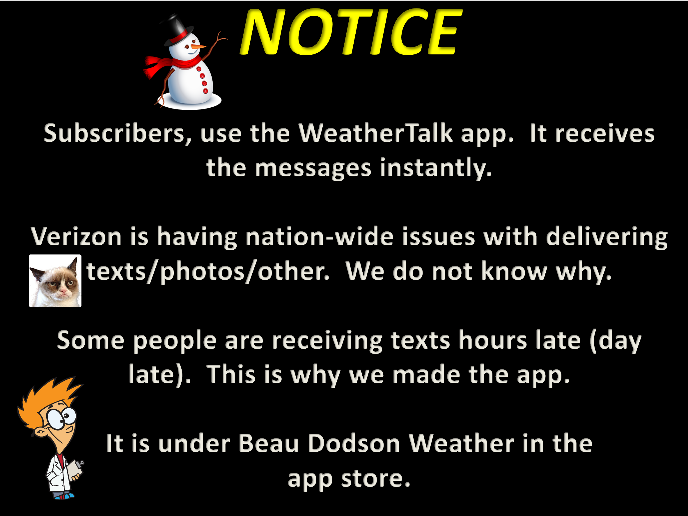
I encourage subscribers to use the app vs regular text messaging. We have found text messaging to be delayed during severe weather. The app typically will receive the messages instantly. I recommend people have three to four methods of receiving their severe weather information.
Remember, my app and text alerts are hand typed and not computer generated. You are being given personal attention during significant weather events.
