December 2, 2017
Morning and early afternoon update.
This is a reminder that if you don’t subscribe to WeatherTalk, please do so. Average monthly costs (from my pocket) are between $1000 and $2000.00. You can subscribe at www.beaudodsonweather.com. Your subscription will also get you app/text forecasts, alerts, social media posting alerts, and videos. It is only $3 per month. Also, please download the app (it receives the same text messages but ten times faster).
Three weather stories over the coming days.
- Widespread showers and thunderstorms late Monday afternoon into Tuesday morning. Bulk of the rain will fall Monday night/early Tuesday morning.
- Much colder air arrives Wednesday into the following week
- Light snow events possible over the coming twelve days, but questions remain on the track of each system.
A nice day on tap for the region. No issues today or Sunday. Temperatures will rise into the upper 50’s and lower 60’s today and in the lower to middle 60’s on Sunday. Enjoy!!
Light winds. Variable in direction today and tonight. Southerly winds on Sunday.
Monday and Tuesday
A strong cold front will push through our region on Monday and Tuesday. This front will be accompanied by widespread showers and thunderstorms.
The peak of the rain event will arrive on Monday night into the early morning hours on Tuesday.
Gusty winds will top 30 mph on Monday into Tuesday.
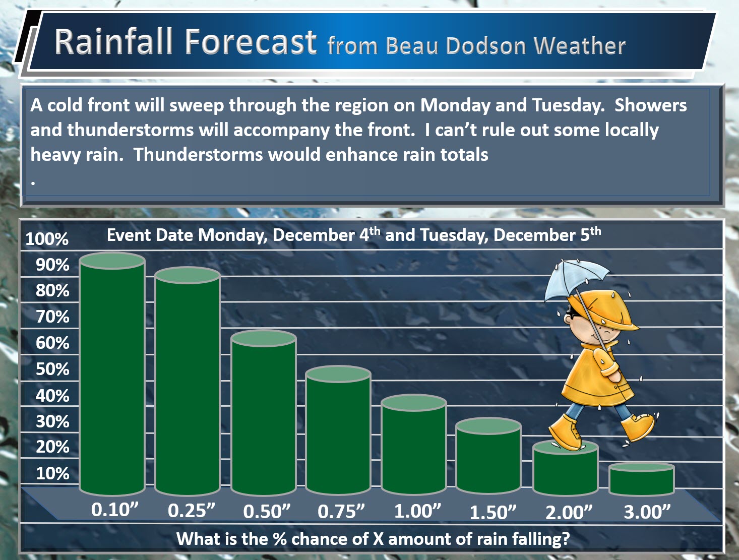
My rainfall forecast. What is the % chance of X amount of rain falling.
If thunderstorms develop then we should have some locally heavy rain.
I may need to bump these numbers up a bit.
.
.
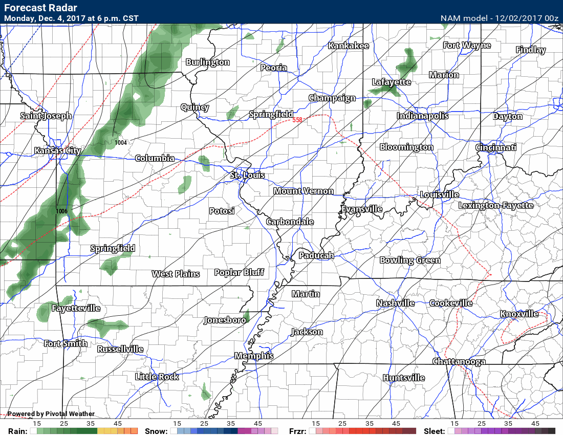
Here is the NAM future-cast radar for late Monday into early Tuesday. Time stamp upper left.
Click animation to enlarge
This runs from 6 PM on Monday through 6 AM on Tuesday. You can see the rain develop and advance over the region.
.
.
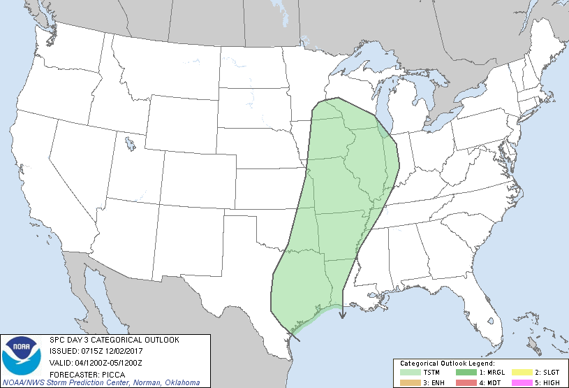
The Storm Prediction Center has outlined us for general thunderstorms on Monday night/Tuesday morning, but for now they are not forecasting severe thunderstorms. The green area represents thunderstorms, but below severe levels.
.
.
.
The atmosphere should dry out by Tuesday afternoon and evening. There is a 30% chance the rain changes to sleet and snow at the end of the precipitation event, but no accumulation anticipated (if it even occurs).
We then turn our attention to the colder air that will push into the region. Highs on Wednesday through Sunday will likely remain mostly in the 30’s and 40’s. There are some charts that show warmer temperatures on Wednesday. I will monitor that.
We will have to monitor several clippers over the next two weeks. Clippers are areas of low pressure that dive into our region from the northwest. They usually move southeast. They can produce light precipitation. The track of each clipper is key to our weather.
If the track is far enough south, then we will have snow. Questions remain on the eventual track of each system. Model guidance is of little use on forecasting these events past a few days. Thus, we just have to monitor the guidance and trends.
Here is one system on Thursday night and Friday. The models have shown this system in our region and north of our region. It keeps going back and forth.
Blue is snow
.
.
Here is another one on Saturday
.
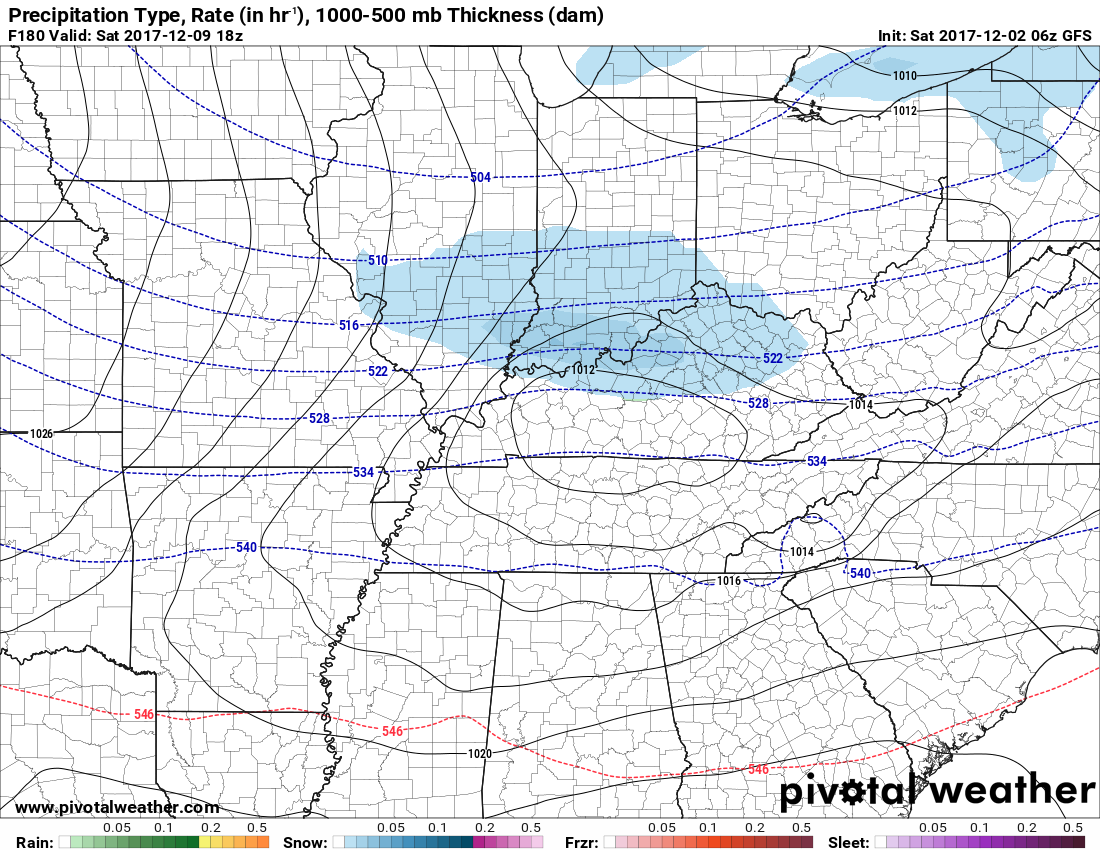
..
Last night the GFS shows this much snow for our region
.
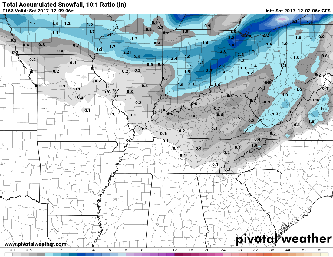
.
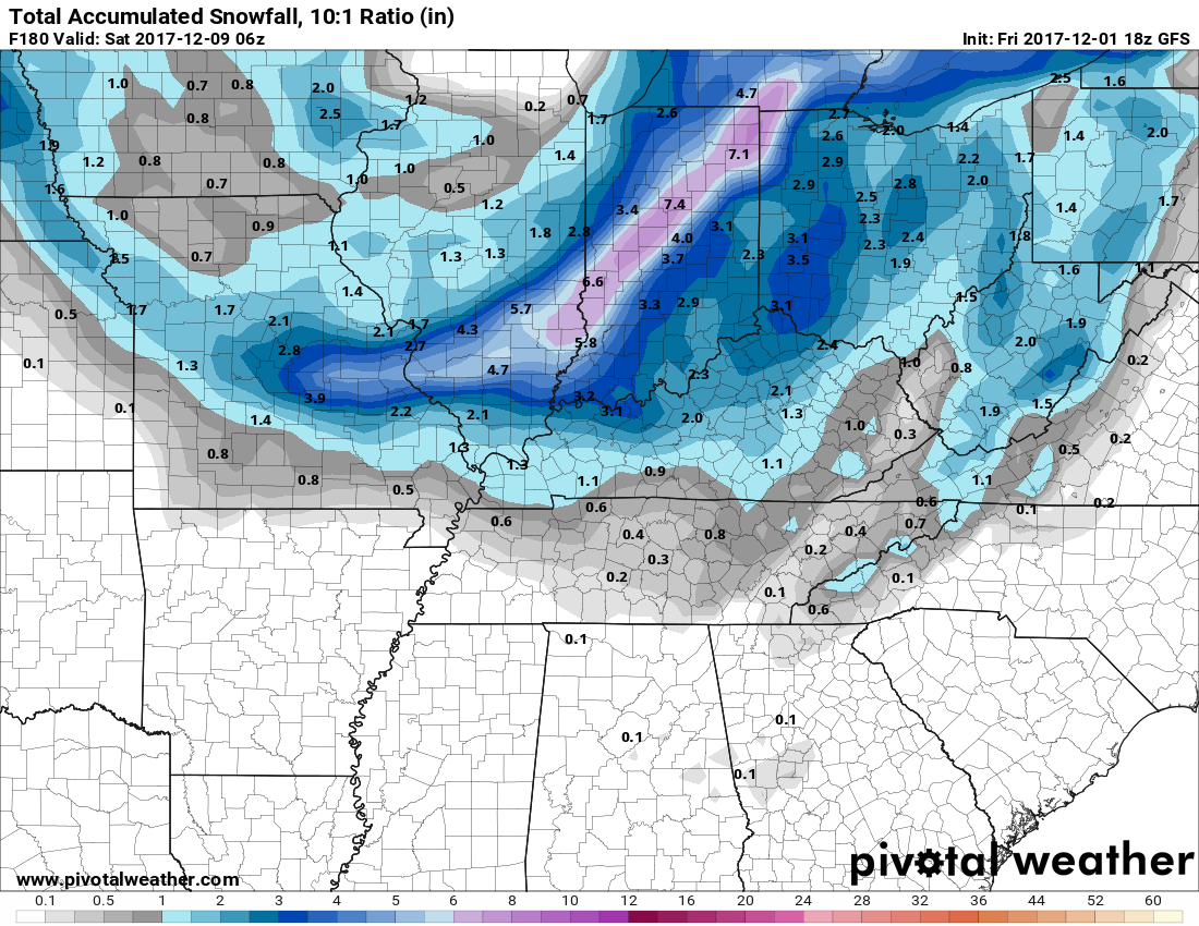
Look at the same model run twelve hours earlier. Notice the big change? This is why I tell people don’t trust model guidance past a few days. People who post ten day snow maps (without commentary) are not giving you accurate information.
.
.
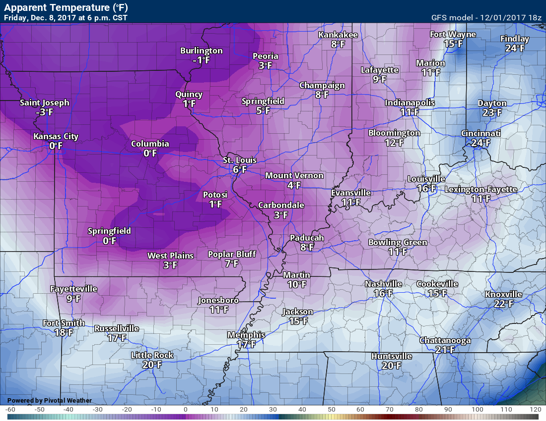
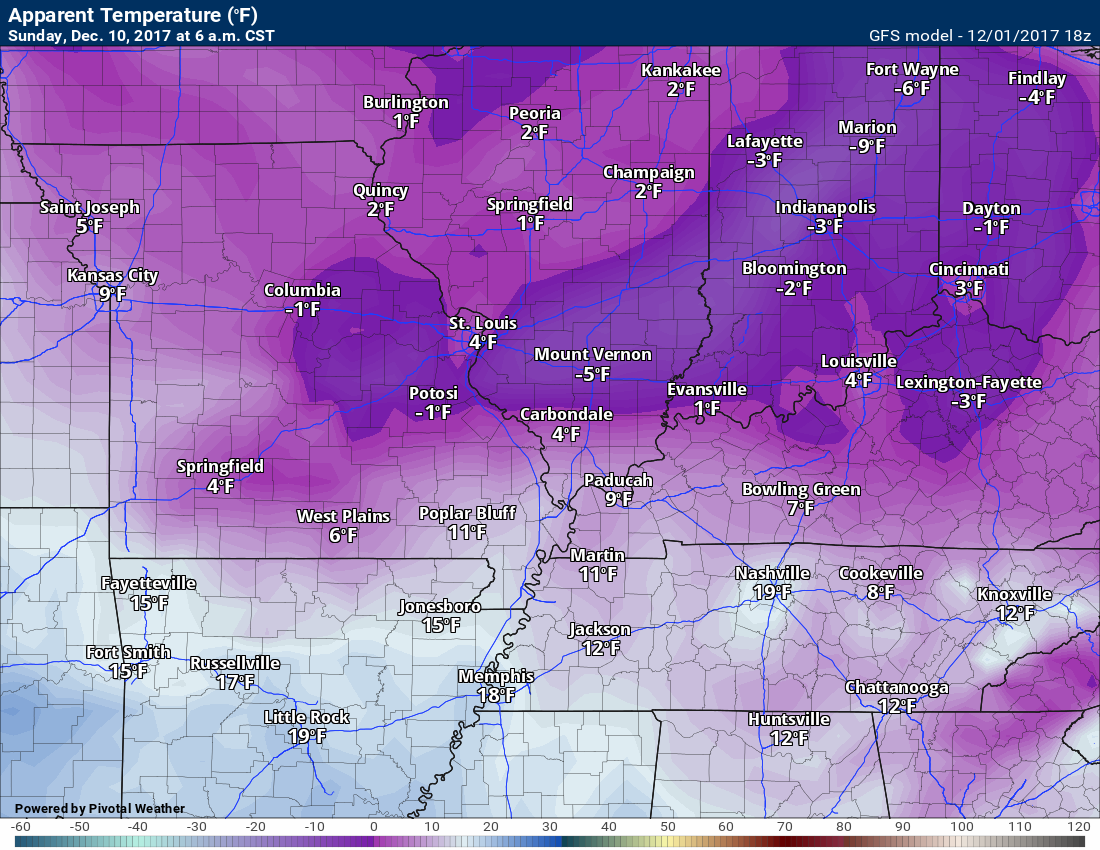
Wind chills next Friday afternoon into the weekend look awfully cold.
Friday 6 PM
.
.
Sunday
.
.
Much colder air is moving into our region next week and the week after. Prepare for winter cold. Heating bills will be higher. Budget for that.

Next update will be after 5 pm tonight
Previous update with the winter weather outlook can be viewed here http://talk.weathertalk.com/wp-admin/post.php?post=30174&action=edit