Did you know that your WeatherTalk subscription helps support numerous local charity events?
Check them out at these links
The Justin Croach Memorial Scholarship
Daily WeatherTalk schedule
Click schedule for a larger view. Keep in mind, during active weather this schedule will change. There will be additional updates outside of what has been posted here.


We offer interactive local city view radars and regional radars.
If a radar does not update then try another one. If a radar does not appear to be refreshing then hit Ctrl F5. You may also try restarting your browser.

Interactive Radars:
Interactive live weather radar page. Choose the city nearest your location. If one of the city radars won’t load then try a nearby one. Click here.
Live satellite views. Click here
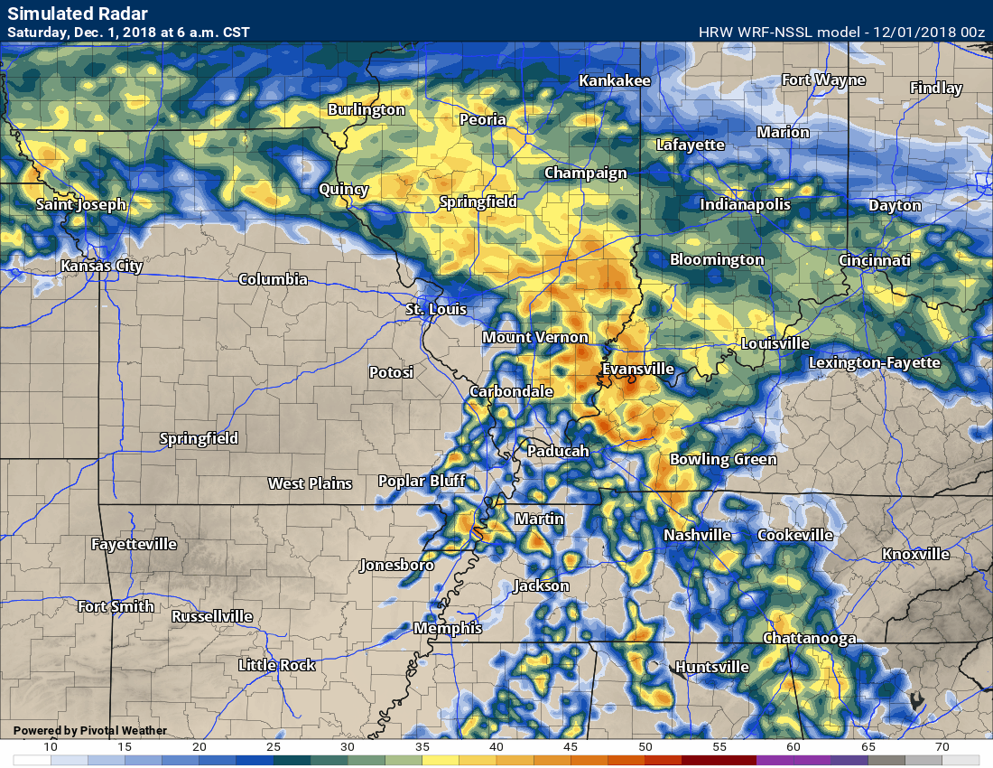
I am having the open house Saturday morning/Saturday afternoon. There could be some strong thunderstorms during the PM hours, but the confidence in that happening is not all that great. Thus, we will move forward with the open house.
December 1, 2018
Those going to Memphis for the charity run: It is possible that the showers will have just ended by 8 AM. It will be close. Plan on showers/storms and then hope for the best. The drying line will be near you at 8 AM. Windy conditions and mild.
Temperatures during race time will likely be in the 60’s and eventually will warm into the lower 70’s.
Saturday forecast: I will be carefully monitoring late Saturday late morning into the afternoon. If storms were to develop during that time period then they could be severe. For now, it appears most of the rain will have ended by then. Windy. Mostly cloudy early. Decreasing clouds through the day. Showers and thunderstorms likely before 10 AM. Diminishing precipitation coverage from southwest to northeast. Monitor the PM hours for additional thunderstorm development.
My confidence in the forecast verifying: Medium (60% confidence) during the morning. Low (3 0% confidence) during the afternoon.
Temperature range: MO ~ 66 to 72 IL ~ 66 to 72 KY ~ 66 to 72 TN ~ 68 to 74
Wind chill (feels like) temperature forecast: N/A
What is the chance/probability of precipitation? Rain chances early in the day (before 10 AM). MO ~ 60% IL ~ 70% KY ~ 50% TN ~ 50% Rain chances after 12 PM MO ~ 30% IL ~ 30% KY ~ 30% TN ~ 30%
Coverage of precipitation: Perhaps numerous early in the day. Uncertain about afternoon activity. Monitor updates and radars in case storms redevelop.
Is flooding anticipated? Some ditches and low-land flooding possible.
Is accumulating snow or ice anticipated? No
Is non-accumulating snow or ice anticipated? No
Are icy road conditions anticipated? No
Wind direction and speed: Southwest and south at 10 to 20 mph with gusts to 40 mph
What impacts are anticipated from the weather? Wet roadways and lightning during the morning hours. I will be closely monitoring clearing sky conditions that could set the stage for a few severe thunderstorms. The confidence in the severe weather part of the forecast is low. Strong and gusty wind conditions throughout the day. Gusts above 40 mph likely.
Is severe weather expected? Severe storms are possible.
The NWS officially defines severe weather as 58 mph wind or great, 1″ hail or larger, and/or tornadoes
Will lightning be possible? Yes
Should I cancel my outdoor plans? Early morning activities could need a plan B. The rain will be on the way out, but some areas will likely still have rain early tomorrow morning. Rain will continue into the morning hours and then end southwest to northeast.
Will the weather impact my outdoor plans? Wet outdoor conditions and strong winds will impact activities. Lightning is also a concern.
UV Index: 3 Moderate
Sunrise: 6:51 AM
Saturday Night Forecast Details:
Forecast: Any remaining thunderstorms will come to an end. Clearing. Colder. Breezy, at times.
My confidence in the forecast verifying: Medium (60% confidence)
Temperature range: MO ~ 44 to 48 IL ~ 44 to 48 KY ~ 44 to 48 TN ~ 44 to 48
Wind chill (feels like) temperature forecast: 30 to 40
What is the chance/probability of precipitation? MO ~ 10% IL ~ 30% (before 8 PM) KY ~ 30% (before 9 PM) TN ~ 20% (before 8 PM)
Coverage of precipitation: None to scattered
Is flooding anticipated? No
Is accumulating snow or ice anticipated? No
Is non-accumulating snow or ice anticipated? No
Are icy road conditions anticipated? No
Wind direction and speed: South to west at 10 to 20 mph and gusty
What impacts are anticipated from the weather? A few evening strong thunderstorms. This is questionable. Monitor updates. Storms may reform just ahead of an incoming cold front.
Is severe weather expected? Monitor updates.
The NWS officially defines severe weather as 58 mph wind or great, 1″ hail or larger, and/or tornadoes
Will lightning be possible? Possible early in the night.
Should I cancel my outdoor plans? No, but check radars and updates.
Will the weather impact my outdoor plans? Small chance of evening thunderstorms. Monitor the radars. Damp ground conditions.
Sunset: 4:37 PM
Moonrise: 12:47 AM Waning Crescent
Moonset: 1:39 PM
December 2, 2018
Sunday forecast: Partly sunny.
My confidence in the forecast verifying: Medium (60% confidence)
Temperature range: MO ~ 55 to 60 IL ~ 55 to 60 KY ~ 58 to 62 TN ~ 58 to 64
Wind chill (feels like) temperature forecast: N/A
What is the chance/probability of precipitation? MO ~ 0% IL ~ 10% KY ~ 10% TN ~ 0%
Coverage of precipitation: None
Is flooding anticipated? No
Is accumulating snow or ice anticipated? No
Is non-accumulating snow or ice anticipated? No
Are icy road conditions anticipated? No
Wind direction and speed: Southwest and west at 6 to 12 mph with gusts to 18 mph
What impacts are anticipated from the weather? None
Is severe weather expected? No
The NWS officially defines severe weather as 58 mph wind or great, 1″ hail or larger, and/or tornadoes
Will lightning be possible? No
Should I cancel my outdoor plans? No
Will the weather impact my outdoor plans? No major impacts.
UV Index: 3 Moderate
Sunrise: 6:52 AM
Sunday Night Forecast Details:
Forecast: Some increase in clouds.
My confidence in the forecast verifying: Medium (40% confidence)
Temperature range: MO ~ 35 to 40 IL ~ 35 to 40 KY ~ 38 to 42 TN ~ 38 to 44
Wind chill (feels like) temperature forecast: 30 to 35
What is the chance/probability of precipitation? MO ~ 20% IL ~ 20% KY ~ 20% TN ~ 20%
Coverage of precipitation: None to isolated
Is flooding anticipated? No
Is accumulating snow or ice anticipated? No
Is non-accumulating snow or ice anticipated? No
Are icy road conditions anticipated? No
Wind direction and speed: Northwest and north at 4 to 8 mph
What impacts are anticipated from the weather? None
Is severe weather expected? No
The NWS officially defines severe weather as 58 mph wind or great, 1″ hail or larger, and/or tornadoes
Will lightning be possible? No
Should I cancel my outdoor plans? No
Will the weather impact my outdoor plans? No major concerns.
Sunset: 4:37 PM
Moonrise: 1:53 AM Waning Gibbous
Moonset: 2:11 PM
December 3, 2018
Monday forecast: Cloudy. Cold. A slight chance of a sprinkle or flurry.
My confidence in the forecast verifying: Medium (50% confidence)
Temperature range: MO ~ 40 to 45 IL ~ 42 to 46 KY ~ 44 to 48 TN ~ 44 to 48
Wind chill (feels like) temperature forecast: N/A
What is the chance/probability of precipitation? MO ~ 20% IL ~ 20% KY ~ 30% TN ~ 30%
Coverage of precipitation: None to isolated
Is flooding anticipated? No
Is accumulating snow or ice anticipated? No
Is non-accumulating snow or ice anticipated? No
Are icy road conditions anticipated? No
Wind direction and speed: Southwest at 10 to 20 mph
What impacts are anticipated from the weather? Most likely none.
Is severe weather expected? No
The NWS officially defines severe weather as 58 mph wind or great, 1″ hail or larger, and/or tornadoes
Will lightning be possible? No
Should I cancel my outdoor plans? No
Will the weather impact my outdoor plans? Unlikely
UV Index: 2 Low
Sunrise: 6:53 AM
Monday Night Forecast Details:
Forecast: Mostly cloudy. Cold. A flurry possible.
My confidence in the forecast verifying: Low (30% confidence)
Temperature range: MO ~ 30 to 35 IL ~ 30 to 35 KY ~ 34 to 36 TN ~ 36 to 40
Wind chill (feels like) temperature forecast: 28 to 32
What is the chance/probability of precipitation? MO ~ 20% IL ~ 20% KY ~ 20% TN ~ 20%
Coverage of precipitation: None to isolated
Is flooding anticipated? No
Is accumulating snow or ice anticipated? No
Is non-accumulating snow or ice anticipated? Unlikely, but monitor updates
Are icy road conditions anticipated? No
Wind direction and speed: South at 5 to 10 mph
What impacts are anticipated from the weather? Most likely none.
Is severe weather expected? No
The NWS officially defines severe weather as 58 mph wind or great, 1″ hail or larger, and/or tornadoes
Will lightning be possible? No
Should I cancel my outdoor plans? No
Will the weather impact my outdoor plans? Most likely no
Sunset: 4:37 PM
Moonrise: 2:57 AM Waning Crescent
Moonset: 2:43 PM
December 4, 2018
Tuesday forecast: Partly cloudy. Colder.
My confidence in the forecast verifying: Medium (50% confidence)
Temperature range: MO ~ 35 to 40 IL ~35 to 40 KY ~ 36 to 42 TN ~ 38 to 44
Wind chill (feels like) temperature forecast: 20 to 30
What is the chance/probability of precipitation? MO ~ 0% IL ~ 0% KY ~ 0% TN ~ 0%
Coverage of precipitation: None
Is flooding anticipated? No
Is accumulating snow or ice anticipated? No
Is non-accumulating snow or ice anticipated? No
Are icy road conditions anticipated? No
Wind direction and speed: West and northwest at 6 to 12 mph with gusts to 18 mph
What impacts are anticipated from the weather? None
Is severe weather expected? No
The NWS officially defines severe weather as 58 mph wind or great, 1″ hail or larger, and/or tornadoes
Will lightning be possible? No
Should I cancel my outdoor plans? No
Will the weather impact my outdoor plans? No
UV Index: 3 Moderate
Sunrise: 6:53 AM
Tuesday Night Forecast Details:
Forecast: Mostly clear and cold.
My confidence in the forecast verifying: Medium (50% confidence)
Temperature range: MO ~ 24 to 26 IL ~ 24 to 26 KY ~ 24 to 28 TN ~ 24 to 28
Wind chill (feels like) temperature forecast: 18 to 24
What is the chance/probability of precipitation? MO ~ 0% IL ~ 0% KY ~ 0% TN ~ 0%
Coverage of precipitation: None
Is flooding anticipated? No
Is accumulating snow or ice anticipated? No
Is non-accumulating snow or ice anticipated? No
Are icy road conditions anticipated? No
Wind direction and speed: Northwest at 6 to 12 mph
What impacts are anticipated from the weather? None
Is severe weather expected? No
The NWS officially defines severe weather as 58 mph wind or great, 1″ hail or larger, and/or tornadoes
Will lightning be possible? No
Should I cancel my outdoor plans? No
Will the weather impact my outdoor plans? No
Sunset: 4:37 PM
Moonrise: 4:00 AM Waning Crescent
Moonset: 3:17 PM
I am monitoring a potential winter storm late next week.
Learn more about the UV index readings. Click here.

Today through Monday: No accumulating wintry precipitation anticipated.
I am watching Monday night/Tuesday. There could be a mix of rain and sleet developing. For now, this does not appear to be anything of consequence.
I am monitoring December 7th through the 9th for another precipitation event. It is possible this could be a winter storm in or near our region.
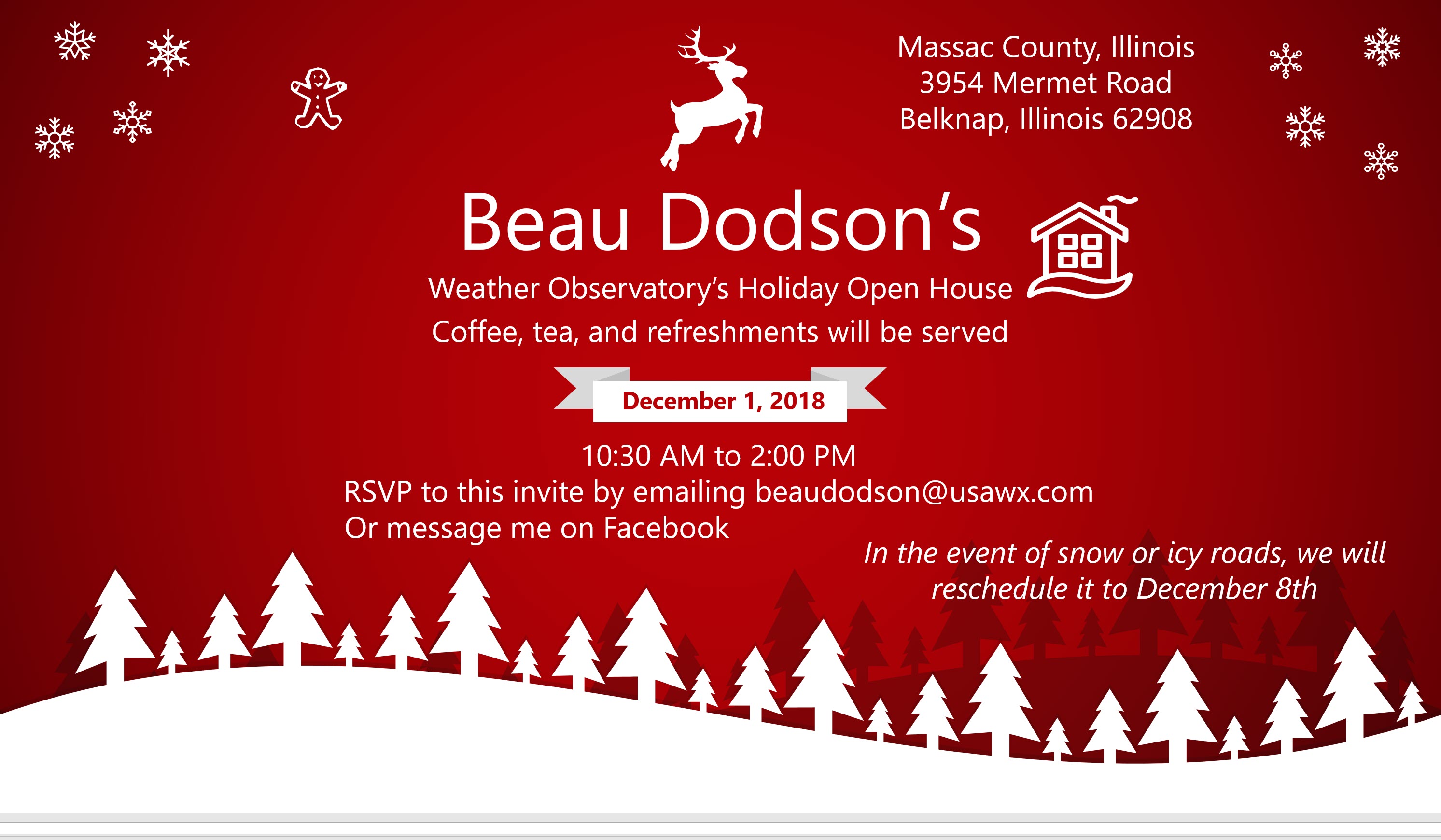
The Weather Observatory will be holding two open houses for adults and children. The open house will be Saturday, December 1st.
I am having the open house Saturday morning/Saturday afternoon. There could be some strong thunderstorms during the PM hours, but the confidence in that happening is not all that great. Thus, we will move forward with the open house.

Here is the WPC/NOAA rainfall outlook
Additional rain will be highly dependent on storms reforming later today. That is still questionable.
Did you know that you can find me on Twitter?

Subscribers, do you need a forecast for an outdoor event?


We offer interactive local city live radars and regional radars.
If a radar does not update then try another one. If a radar does not appear to be refreshing then hit Ctrl F5 on your keyboard.
You may also try restarting your browser. The local city view radars also have clickable warnings.
During the winter months, you can track snow and ice by clicking the winterize button on the local city view interactive radars.

Questions? Broken links? Other questions?
You may email me at beaudodson@usawx.com

The National Weather Service defines a severe thunderstorm as one that produces quarter size hail or larger, 58 mph winds or greater, and/or a tornado.
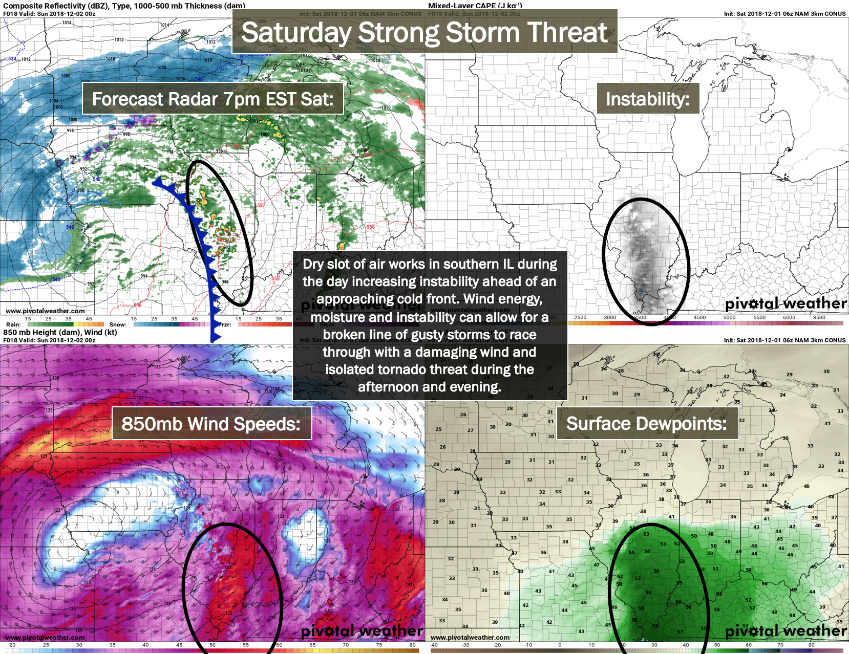
Saturday: Monitor updates. I am closely monitoring late Saturday morning into Saturday afternoon for additional thunderstorm development. There remain questions about there being enough lift to support thunderstorm development.
We do have several ingredients coming together for severe weather.
I would suggest you monitor weather updates from late morning into the afternoon hours. If thunderstorms do develop, they could certainly be severe.
The main concern would be damaging winds and tornadoes. There is plenty of shear with this system. Hail is also possible.
Interactive live weather radar page. Choose the city nearest your location. If one of the cities does not work then try a nearby one. Click here.
National map of weather watches and warnings. Click here.
Storm Prediction Center. Click here.
Weather Prediction Center. Click here.

Live lightning data: Click here.

Interactive GOES R satellite. Track clouds. Click here.

Here are the latest local river stage forecast numbers Click Here.
Here are the latest lake stage forecast numbers for Kentucky Lake and Lake Barkley Click Here.

- Saturday update concerning severe thunderstorms.
- Monitoring winter storm chances Thursday into Sunday. Perhaps centered on Friday/Saturday.
The WeatherTalk blog is free for everyone today.
We have a chance of showers and thunderstorms this morning. A line of storms will push through the region early in the AM hours. This line could produce pockets of high winds.
I am concerned about the redevelopment of thunderstorms during the late morning hours into the afternoon. There are a number of ingredients available for the development of severe thunderstorms. Damaging wind, tornadoes, and hail are possible.
If storms form then they could become severe.
Monitor updates today.
I will be sending out app/text messages.
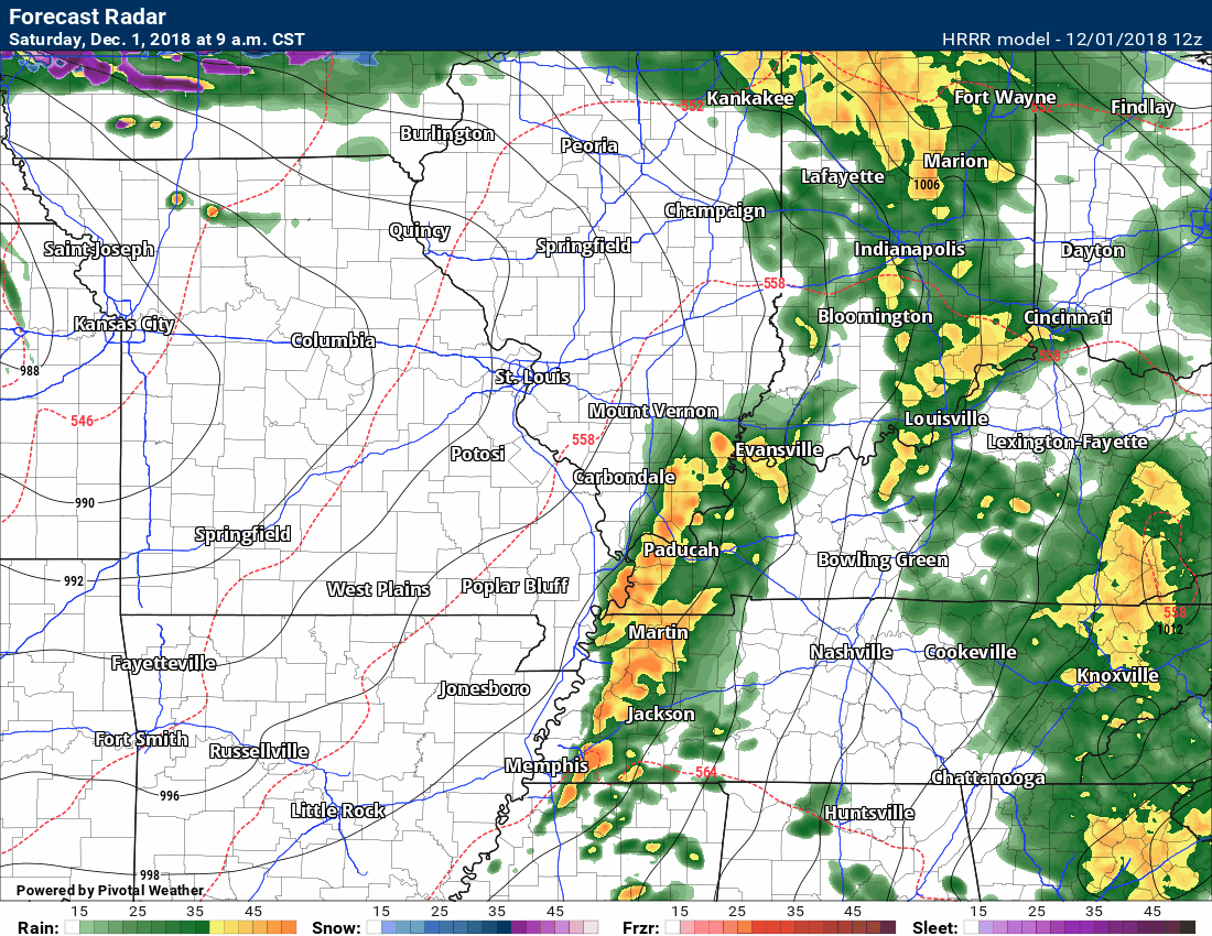
Another model, the SPC WRF, does show thunderstorms forming.
Obviously, there is disagreement on how today unfolds.
Monitor updates.
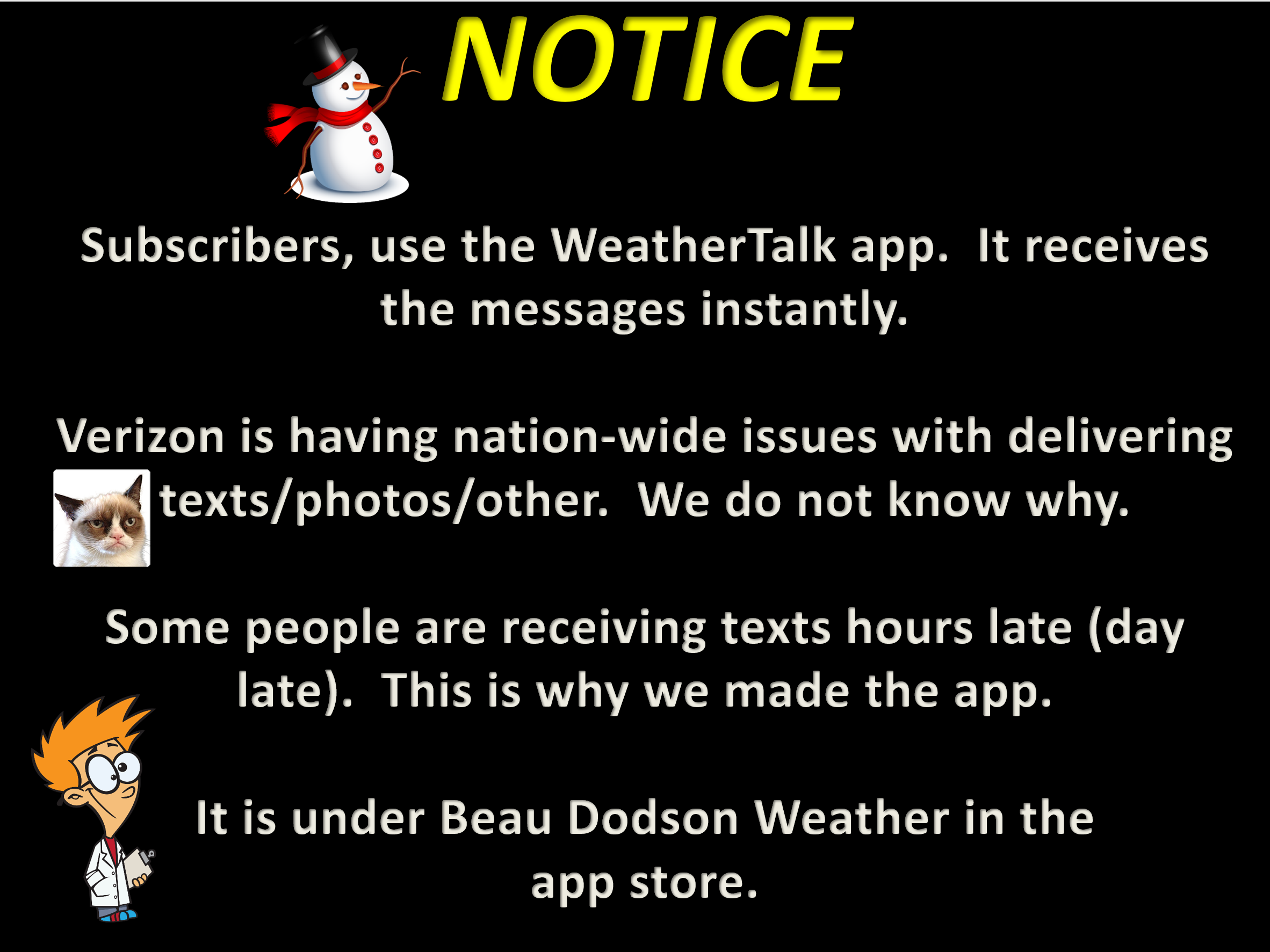
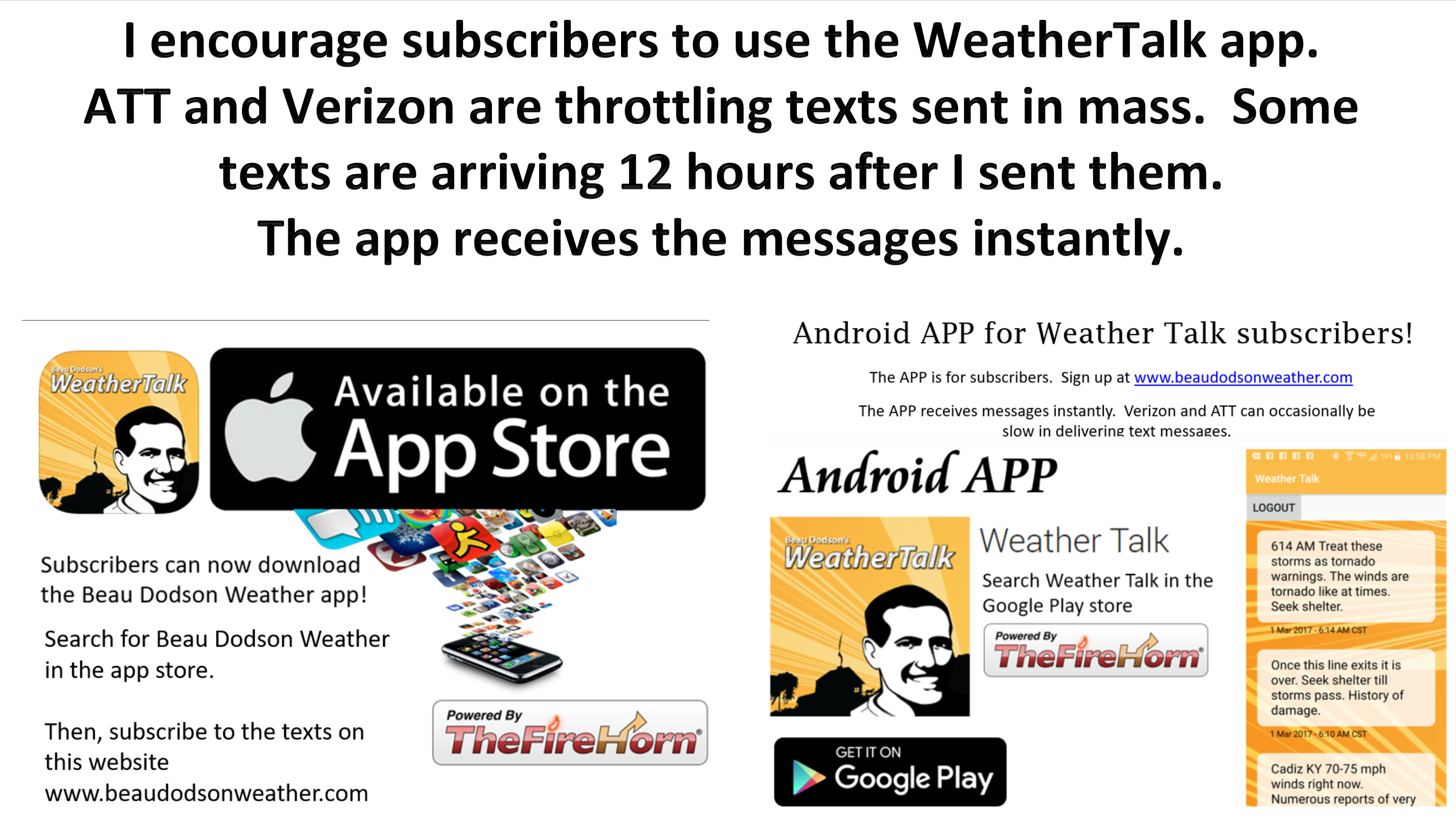
Please use the app for receiving your subscriber text messages. The app receives the messages faster.
![]()

A new weather podcast is now available! Weather Geeks (which you might remember is on The Weather Channel each Sunday)
To learn more visit their website. Click here.
![]()

WeatherBrains Episode 671
Tonight’s Guest WeatherBrain is the recipient of the 2018 National Weather Association Public Education Award. He received the award for his severe weather and climate outreach, organizing the Central Plains Severe Weather Symposium and Family Weatherfest (CPSWS) in Lincoln, NE year after year since 1999, and running a national weather camp program.
Dr. Ken Dewey, welcome to WeatherBrains!
onight, our Guest WB is joined by a special Panelist, who is a friend of the show and a friend the WB. He is a graduate of the Atmospheric Science at The Ohio State University. He is the owner of JRB Storm Photography with his wife. His mission is helping the public gain an understanding of the importance of weather. Jeremy Bower, welcome to the show!
Other discussions in this weekly podcast include topics like:
- More discussion on social media
- Winter weather outlook
- Astronomy Outlook with Tony Rice
- and more!
Link to their website https://weatherbrains.com/
Previous episodes can be viewed by clicking here.
We offer interactive local city live radars and regional radars. If a radar does not update then try another one. If a radar does not appear to be refreshing then hit Ctrl F5. You may also try restarting your browser.
The local city view radars also have clickable warnings.
During the winter months, you can track snow and ice by clicking the winterize button on the local city view interactive radars.
You may email me at beaudodson@usawx.com
Find me on Facebook!

Find me on Twitter!

Did you know that a portion of your monthly subscription helps support local charity projects?
You can learn more about those projects by visiting the Shadow Angel Foundation website and the Beau Dodson News website.

I encourage subscribers to use the app vs regular text messaging. We have found text messaging to be delayed during severe weather. The app typically will receive the messages instantly. I recommend people have three to four methods of receiving their severe weather information.
Remember, my app and text alerts are hand typed and not computer generated. You are being given personal attention during significant weather events.
