
This forecast update covers far southern Illinois, far southeast Missouri, and far western Kentucky. See the coverage map on the right side of the blog
.
Interactive Weather Radar Page. Choose the city nearest your location: Click this link
.
April 14, 2017
Friday Night Forecast Details:
Forecast: Partly cloudy. Isolated early evening showers or storms possible. Mild.
Temperatures: MO ~ 60 to 65 IL ~ 60 to 65 KY ~ 60 to 65 TN ~ 62 to 66
Winds: South winds at 6 mph with gusts to 10 mph.
My confidence in the forecast verifying: High. This forecast should verify.
What impacts are anticipated from the weather? Perhaps some early evening lightning and wet roadways.
Is severe weather expected? No.
The NWS defines severe weather as 58 mph winds or great, 1″ hail or larger, and/or tornadoes
What is the chance of precipitation? MO ~ 30% IL ~ 30% KY ~ 20% TN ~ 20%
Coverage of precipitation: Isolated before 7 pm.
Should I cancel my outdoor plans? No. Monitor radars for evening showers.
.
April 15, 2017
Saturday Forecast Details
Forecast: Pick day of the weekend. Patchy morning fog. Mostly sunny and warm.
Temperatures: MO ~ 78 to 84 IL ~ 78 to 84 KY ~ 80 to 84 TN ~ 80 to 84
Winds: South and southwest at 6 to 12 mph with gusts to 25 mph.
What impacts are anticipated from the weather? None
My confidence in the forecast verifying: High. This forecast should verify.
Is severe weather expected? No
The NWS defines severe weather as 58 mph winds or great, 1″ hail or larger, and/or tornadoes
What is the chance of precipitation? MO ~ 0% IL ~ 0% KY ~ 0% TN ~ 0%
Coverage of precipitation: None anticipated.
Should I cancel my outdoor plans? No
Sunrise will be at 6:18 a.m. and sunset will be at 7:30 p.m.
Saturday Night Forecast Details:
Forecast: Nice evening for outdoor activities. Increasing clouds through the evening. A chance for showers and thunderstorms developing late over our northern counties (Farmington, MO towards Mt Vernon, IL). Most areas should remain dry during the overnight hours.
Temperatures: MO ~ 60 to 65 IL ~ 60 to 65 KY ~ 60 to 65 TN ~ 60 to 65
Winds: South and southwest winds at 4 to 8 mph.
My confidence in the forecast verifying: High. This forecast should verify.
What impacts are anticipated from the weather? Wet roadways and lightning (late and far north)
Is severe weather expected? No
The NWS defines severe weather as 58 mph winds or great, 1″ hail or larger, and/or tornadoes
What is the chance of precipitation? AFTER 11 PM MO ~ 40% IL ~ 40% KY ~ 10% TN ~ 10%
Coverage of precipitation: Isolated. Perhaps becoming scattered after 2 am across our northern counties.
Should I cancel my outdoor plans? No.
.
April 16, 2017
Sunday Forecast Details
Those with outdoor events on Sunday should have a plan B. We should have some rain on radar. Doubt it will rain all day, but some rain. Plan for rain showers and then hope for the best.
NEW data suggests rain coverage won’t be nearly as great as it appeared a day or two ago. This raises doubts about the forecast. Low confidence.
Forecast: Mostly cloudy. Scattered showers and thunderstorms. Spreading from north to south. That means some areas will remain dry during the morning hours. That means northern counties may dry out during the afternoon hours. We will have to see how fast the front shifts southward.
Temperatures: MO ~ 74 to 76 IL ~ 74 to 76 KY ~ 74 to 78 TN ~ 74 to 78
Winds: West and southwest winds at 6 to 12 mph.
What impacts are anticipated from the weather? Lightning. Some downpours. Wet roadways. Severe weather risk is small.
My confidence in the forecast verifying: Low. Significant adjustments are possible.
Is severe weather expected? Small risk for severe weather.
The NWS defines severe weather as 58 mph winds or great, 1″ hail or larger, and/or tornadoes
What is the chance of precipitation? MO ~ 60% IL ~ 60% KY ~ 60% TN ~ 50%
Coverage of precipitation: Scattered to perhaps widespread. Low confidence.
Should I cancel my outdoor plans? Have a plan B in case it rains. Plan for rain and hope for the best.
Sunrise will be at 6:17 a.m. and sunset will be at 7:31 p.m.
Sunday Night Forecast Details:
Forecast: Showers and thunderstorms possible (esp southern half of the region).
Temperatures: MO ~ 55 to 60 IL ~ 55 to 60 KY ~ 55 to 60 TN ~ 55 to 60
Winds: Variable at 3 to 6 mph
My confidence in the forecast verifying: Medium. Some adjustments are possible.
What impacts are anticipated from the weather? Lightning. Wet roadways.
Is severe weather expected? Unlikely, but monitor updates.
The NWS defines severe weather as 58 mph winds or great, 1″ hail or larger, and/or tornadoes
What is the chance of precipitation? MO ~ 50% IL ~ 40% KY ~ 60% TN ~ 60%
Coverage of precipitation: Scattered northern portions of the area (perhaps ending north). Greater coverage as you move towards the KY/TN State line.
Should I cancel my outdoor plans? Have a plan B in case it rains.
.
April 17, 2017
Monday Forecast Details
Forecast: Mostly cloudy. A 60% for showers and perhaps a thunderstorm.
Temperatures: MO ~ 70 to 74 IL ~ 70 to 74 KY ~ 70 to 74 TN ~ 70 to 74
Winds: East at 5 mph.
What impacts are anticipated from the weather? Wet roadways. Lightning.
My confidence in the forecast verifying: Medium. Some adjustments are possible.
Is severe weather expected? Not at this time.
The NWS defines severe weather as 58 mph winds or great, 1″ hail or larger, and/or tornadoes
What is the chance of precipitation? MO ~ 60% IL ~ 60% KY ~ 60% TN ~ 60%
Coverage of precipitation: Scattered
Should I cancel my outdoor plans? I would monitor updates. Rain is a possibility.
Sunrise will be at 6:15 a.m. and sunset will be at 7:31 p.m.
Monday Night Forecast Details:
Forecast: Mostly cloudy. A 40% for showers. Perhaps a thunderstorm.
Temperatures: MO ~ 54 to 58 IL ~ 54 to 58 KY ~ 54 to 58 TN ~ 54 to 58
Winds: East at 5 mph.
My confidence in the forecast verifying: Medium. Some adjustments are possible.
What impacts are anticipated from the weather? Wet roadways. Perhaps lightning.
Is severe weather expected? Not at this time.
The NWS defines severe weather as 58 mph winds or great, 1″ hail or larger, and/or tornadoes
What is the chance of precipitation? MO ~ 40% IL ~ 40% KY ~ 40% TN ~ 40%
Coverage of precipitation: Scattered
Should I cancel my outdoor plans? No, but monitor updated forecasts.
.
April 18, 2017
Tuesday Forecast Details
Forecast: Mostly cloudy. A 40% for showers and perhaps a thunderstorm.
Temperatures: MO ~ 74 to 78 IL ~ 74 to 78 KY ~ 74 to 78 TN ~ 74 to 78
Winds: Variable at 5 mph.
What impacts are anticipated from the weather? Wet roadways. Lightning.
My confidence in the forecast verifying: Medium. Some adjustments are possible.
Is severe weather expected? Not at this time.
The NWS defines severe weather as 58 mph winds or great, 1″ hail or larger, and/or tornadoes
What is the chance of precipitation? MO ~ 40% IL ~ 40% KY ~ 40% TN ~ 40%
Coverage of precipitation: Scattered
Should I cancel my outdoor plans? I would monitor updates. Rain is a possibility.
Sunrise will be at 6:14 a.m. and sunset will be at 7:32 p.m.
Tuesday Night Forecast Details:
Forecast: Mostly cloudy. A 40% for showers. Perhaps a thunderstorm.
Temperatures: MO ~ 58 to 62 IL ~ 58 to 62 KY ~ 58 to 62 TN ~ 58 to 62
Winds: Variable at 5 mph.
My confidence in the forecast verifying: Medium. Some adjustments are possible.
What impacts are anticipated from the weather? Wet roadways. Perhaps lightning.
Is severe weather expected? Not at this time.
The NWS defines severe weather as 58 mph winds or great, 1″ hail or larger, and/or tornadoes
What is the chance of precipitation? MO ~ 40% IL ~ 40% KY ~ 40% TN ~ 40%
Coverage of precipitation: Scattered
Should I cancel my outdoor plans? No, but monitor updated forecasts.
.

Don’t forget to check out the Southern Illinois Weather Observatory web-site for weather maps, tower cams, scanner feeds, radars, and much more! Click here

An explanation of what is happening in the atmosphere over the coming day

Severe thunderstorm outlook.
Remember that a severe thunderstorm is defined as a thunderstorm that produces 60 mph winds or higher, quarter size hail or larger, and/or a tornado.
Friday night: Isolated evening storms could produce gusty winds, pea size hail, and lightning. Most areas will remain dry.
Saturday: Severe weather is not anticipated.
Saturday night into Monday: Thunderstorms are possible. Lightning and locally heavy downpours are the main concern. Small risk for severe weather on Sunday. It appears lightning may be the main concern.
Beyond Monday it does appear we will have a few chances for storms next week. Too early to know if one of those events will produce severe weather. Monitor updates.
———————————-
Your day by day analysis
Friday night:
A few evening thunderstorms are possible, but most areas will remain dry. A weak disturbance will push to our north. The rest of the night will deliver a few clouds with mild temperatures. Nice April evening.
Saturday:
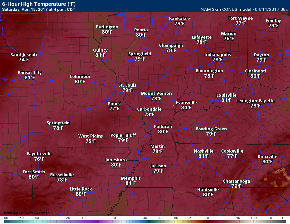
Saturday is the pick day of the weekend. Warm! Breezy! Quite a bit of sunshine. It will be a nice day (other than some gusty winds).
Temperatures will rise into the 80’s and this will be well above the normal high temperature of around 66 degrees. I think you will enjoy Saturday’s weather.
Winds may gust up to 20 ~ 25 mph from time to time. Keep that in mind.
Here is the 1 pm wind gust map.
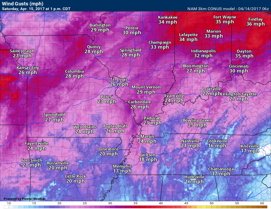
Temperatures on Saturday afternoon will pop into the 80’s across most of the area.
The NAM guidance keeps us in the upper 70’s, but I think it will be a few degrees warmer.
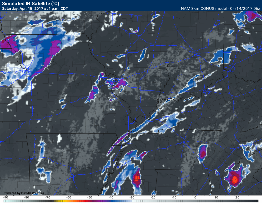
Future-cast satellite shows quite a bit of sunshine for the region on Saturday.
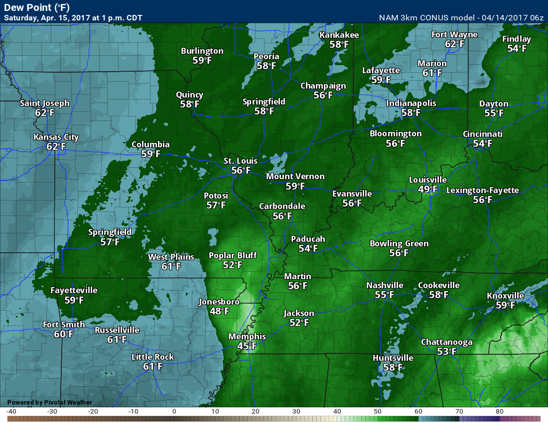
Dew points on Saturday will be pleasant. Expect them to top out in the 50’s. Nice air-mass.
Saturday night into Monday:
CHANGES FOR SUNDAY?
Clouds increase Saturday night. Late at night a few showers or storms may move into the Farmington, MO to Mt Vernon, IL area. The bulk of the night will remain dry over most of the region. A nice spring evening.
That takes us to Easter Sunday. Models today have backed off the rain coverage. The NAM shows very little in the way of rain. This raises questions concerning coverage.
It still appears there will be several hours of dry weather during the morning hours. Especially true over the southern half of the region. That would include areas from Poplar Bluff, Missouri towards Vienna, Illinois and then towards Madisonville, KY. North of that line rain chances will be on the increase during the morning hours.
Rain chances increase from there southward after 11 am on Sunday.
The whole system will be sliding from north to south. That will mean rain arrives first over our northern counties and then later over our southern counties.
I encourage you to have a plan B on Sunday. If it rains then you are prepared. If it doesn’t then no harm done.
I am not overly confident on rain coverage for Sunday.
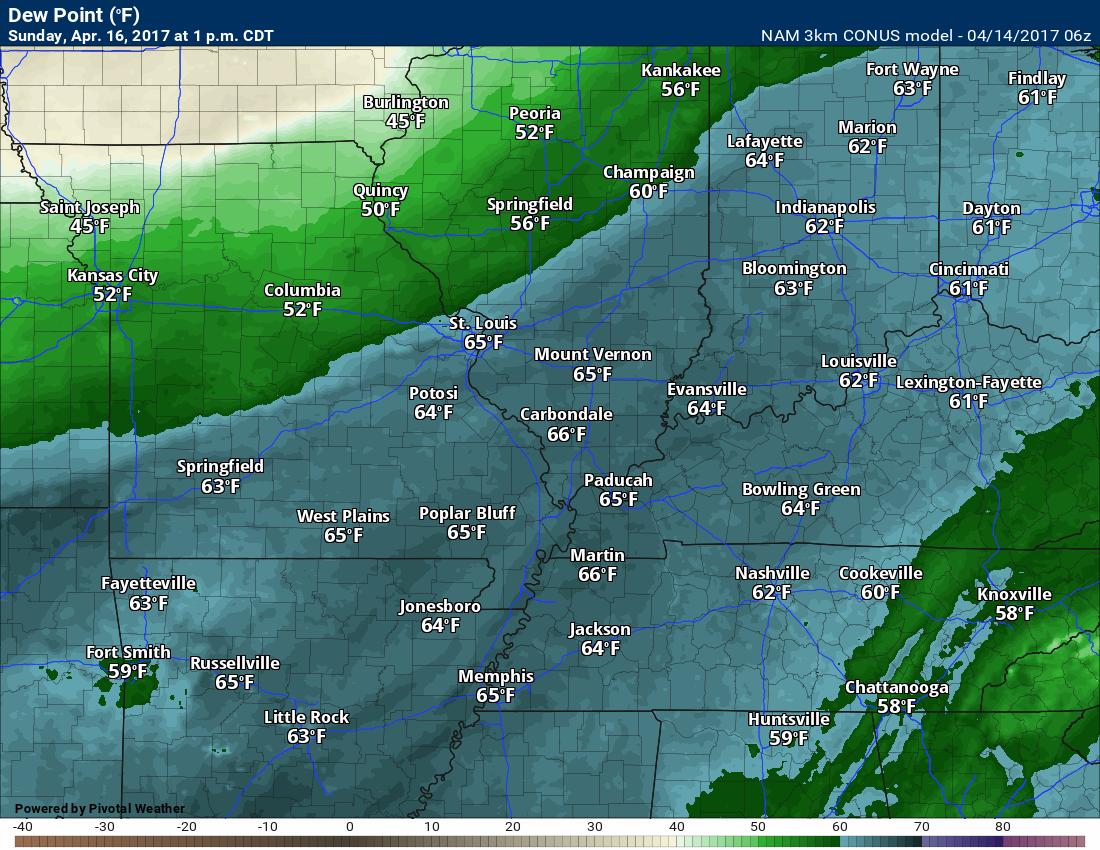
There is a small risk for a few strong storms on Sunday afternoon. CAPE values of 100 to 300 are anticipated. That is not a lot of energy for storms to work with. Dew points will rise into the lower 60’s. That is sufficient moisture for storms. Severe weather risk is small, but perhaps not zero.
Here is the Sunday dew point map. Once dew points rise above 60 degrees it begins to feel a bit more humid outside.
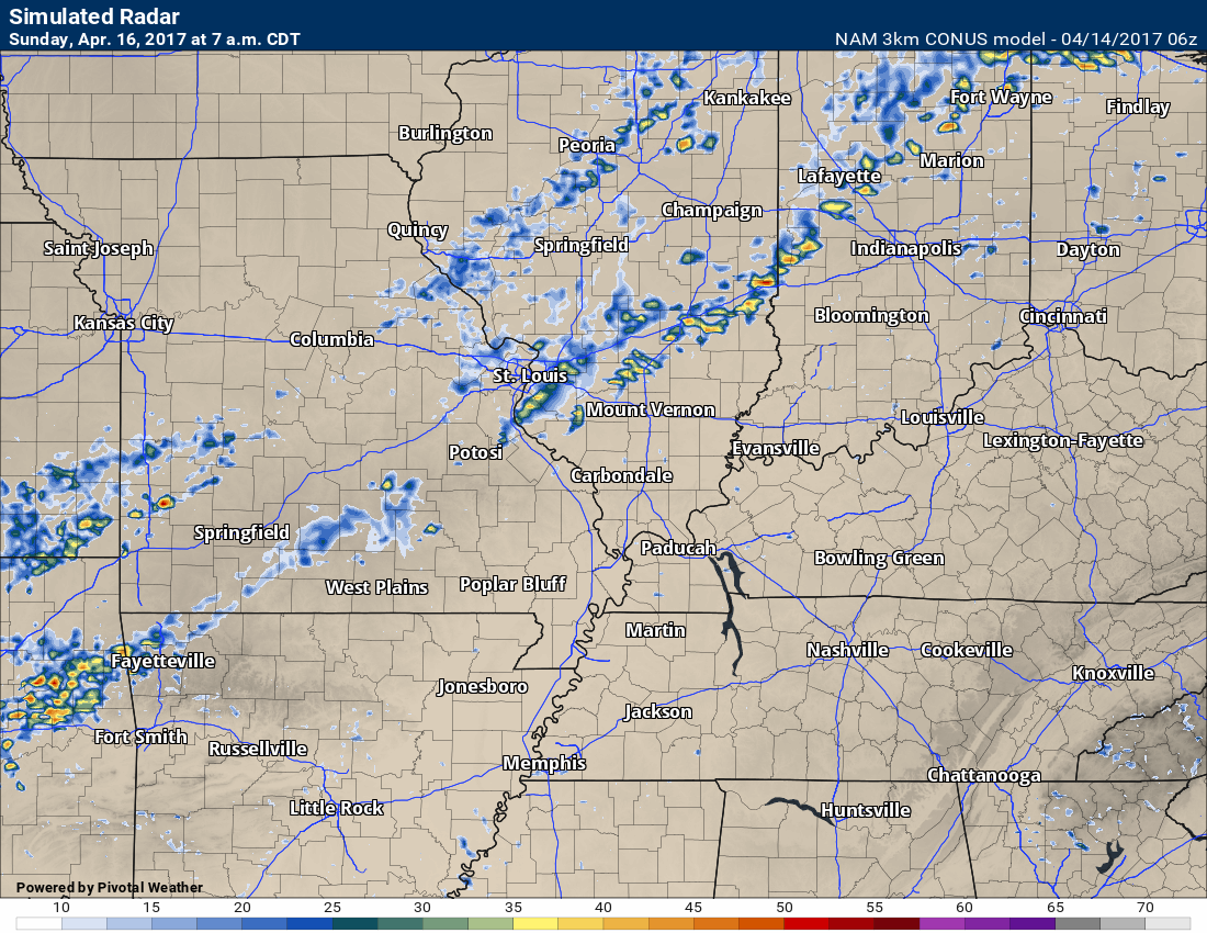
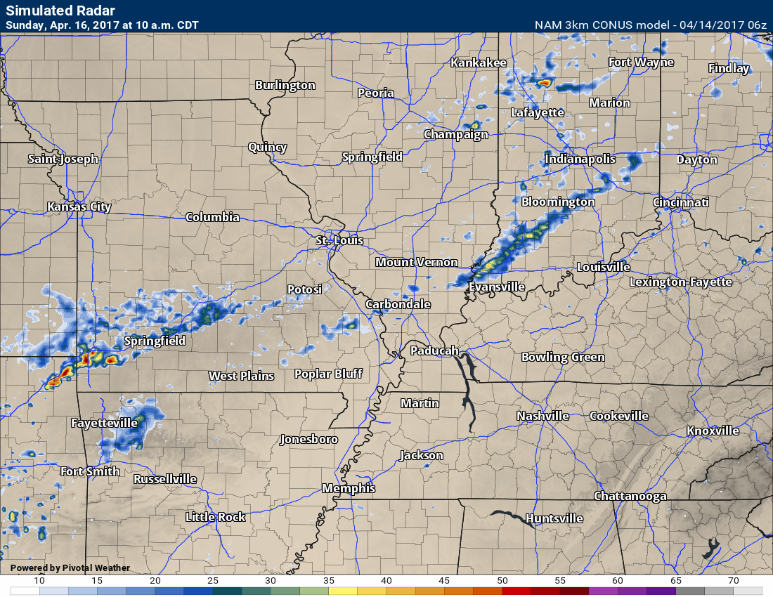
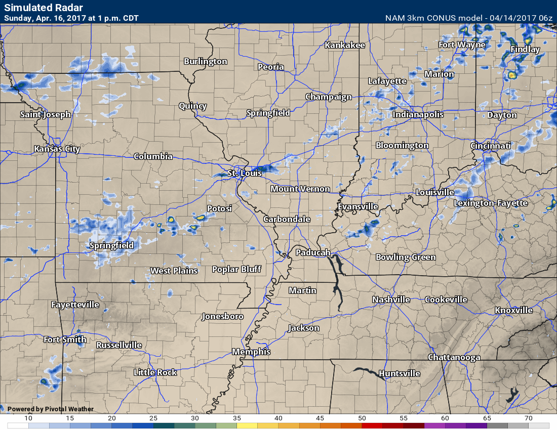
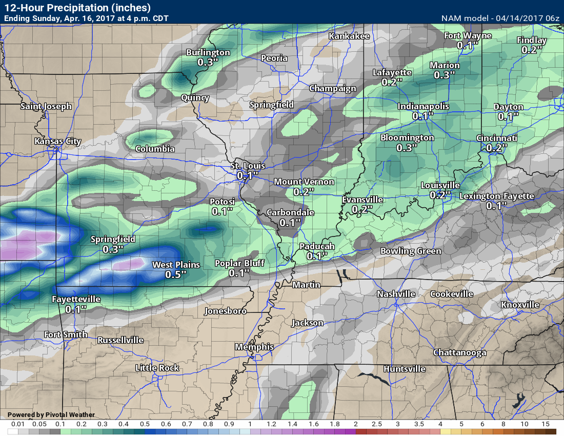
Let’s look at the NAM guidance future-cast radar for Sunday’s rain event.
I am not really sure, at least right now, what to make of how dry the NAM has become. I will monitor trends. Again, my suggestion is to have a plan B and then hope for the best.
Here is the future-cast radar from the NAM
This is one model’s opinion. A lot less rain coverage than earlier model runs. I will be watching trends.
7 AM
10 AM
1 PM
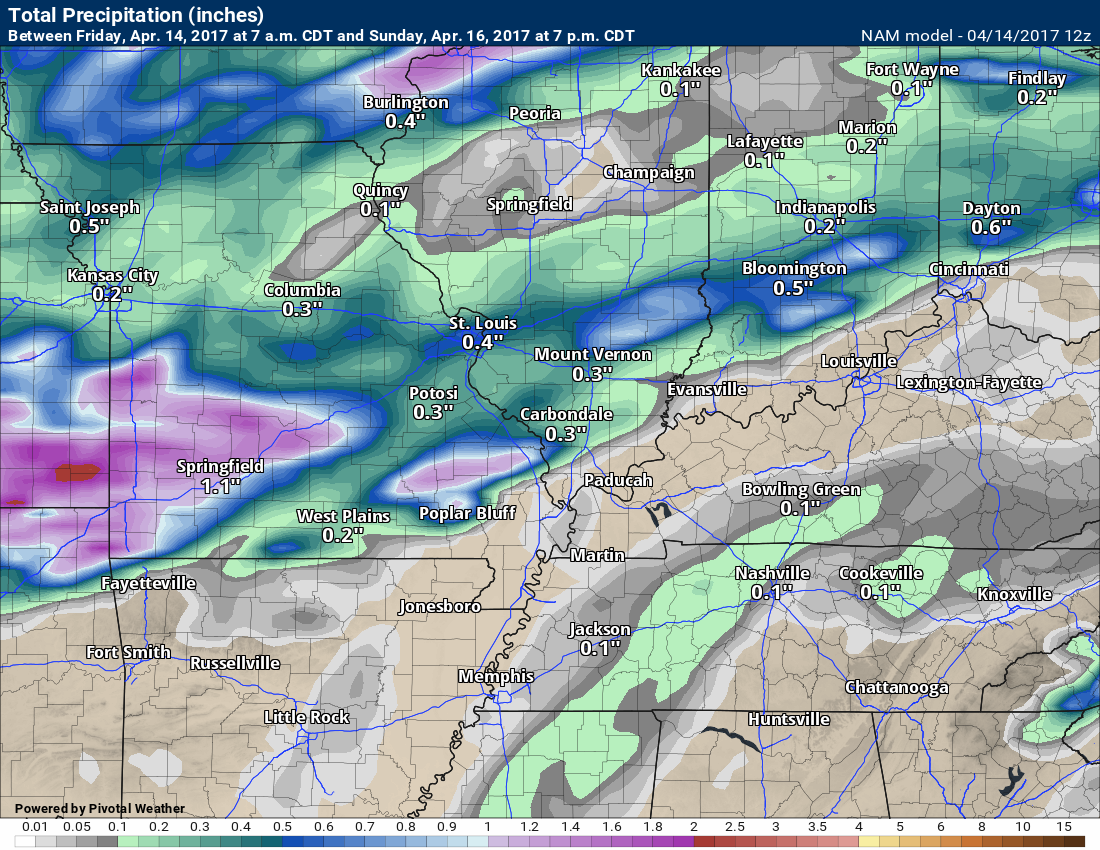
12 hour rain-fall totals from the NAM guidance. This would be from 7 AM SUN through 7 PM SUN.
Check this out.
The high res 3K NAM shows very little rainfall through 7 PM Sunday
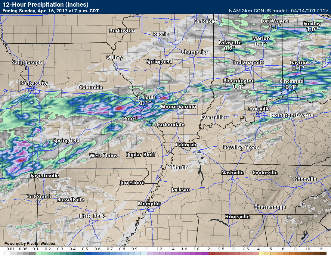
The lower resolution NAM shows more rain than the higher resolution one
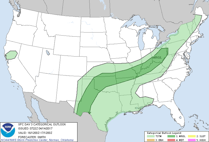
The Storm Prediction Center did outline us in a marginal/small risk for severe storms on Sunday.
The front will be slow to move south on Sunday night and Monday. Shower and thunderstorm chances will linger over the southern half of the region. That would include far southeast Missouri, western Kentucky and western Tennessee. Lesser chances further north.
Monday night through Wednesday:
It appears that on and off rain chances will be with us all week. An active pattern developing. We will need to monitor the severe thunderstorm risk through the week, as well.
If an organized low were to develop then the severe weather risk would increase.
The GFS model is busy busy with on and off rain chances.
7 AM Monday
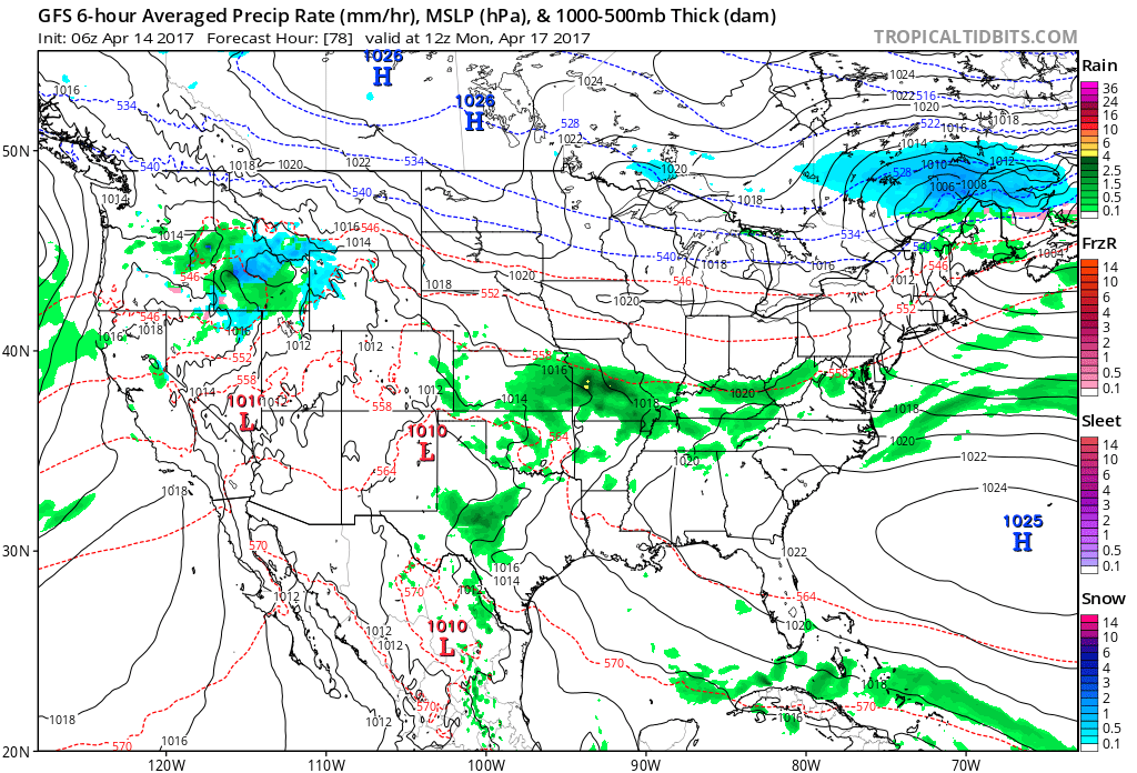
7 PM Monday
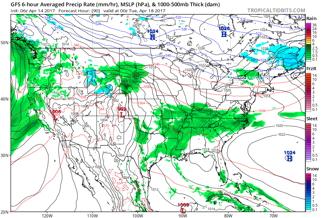
7 AM Tuesday
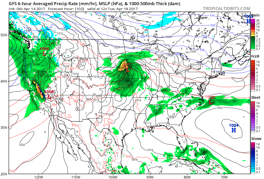
7 PM Tuesday
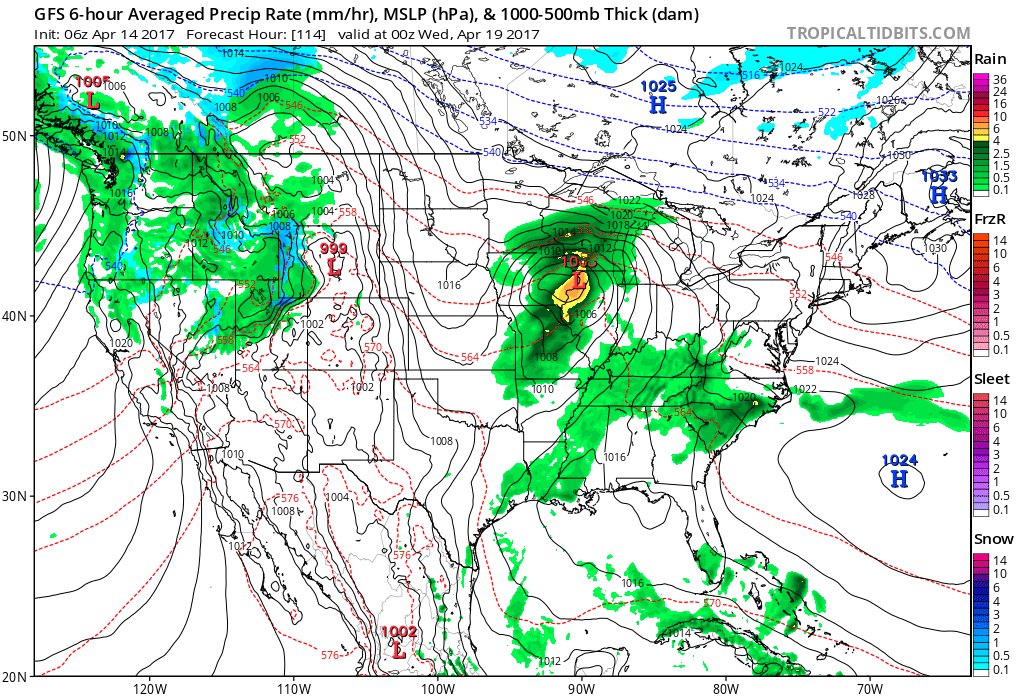
7 AM Wednesday
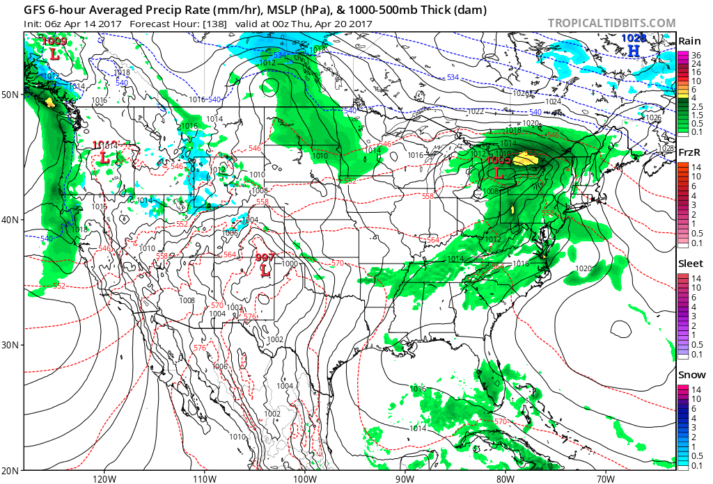
7 PM Wednesday
7 AM Thursday
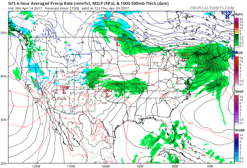
7 PM Thursday
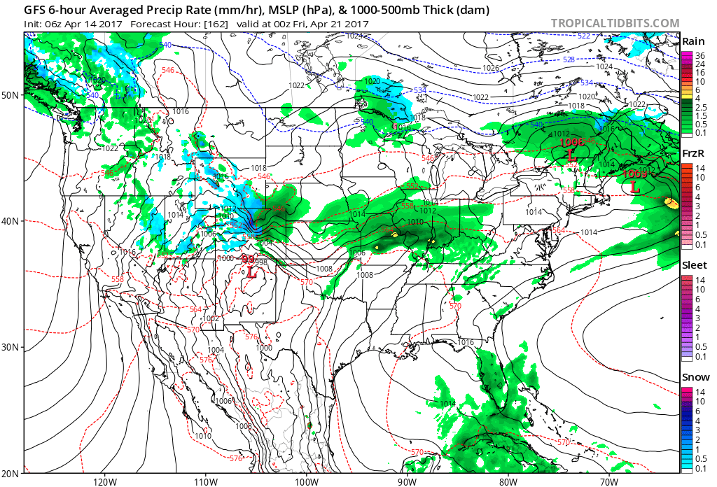
7 AM on Saturday
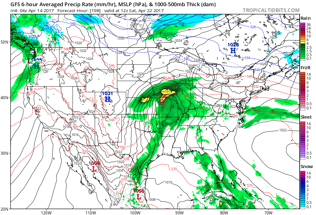
Needless to say, the GFS (one of many models) is showing an active pattern with multiple rain chances.
Find me on Twitter

We have regional radars and local city radars – if a radar does not update then try another one. Occasional browsers need their cache cleared. You may also try restarting your browser. That usually fixes the problem. Occasionally we do have a radar go down. That is why I have duplicates. Thus, if one fails then try another one.
During the winter you can track snow and ice by clicking the winterize button on the local city view interactive radars.
If you have any problems then please send me an email beaudodson@usawx.com
Interactive Weather Radar Page. Choose the city nearest your location: Click this link—
National interactive radar: Click this link.
Local interactive city radars include St Louis, Mt Vernon, Evansville, Poplar Bluff, Cape Girardeau, Marion, Paducah, Hopkinsville, Memphis, Nashville, Dyersburg, and all of eastern Kentucky. These are interactive radars. Local city radars – click here
Regional Radar


The official 6-10 day and 8-14 day temperature and precipitation outlook. Check the date stamp at the top of each image (so you understand the time frame).
The forecast maps below are issued by the Weather Prediction Center (NOAA)


The latest 8-14 day temperature and precipitation outlook. Note the dates are at the top of the image. These maps DO NOT tell you how high or low temperatures or precipitation will be. They simply give you the probability as to whether temperatures or precipitation will be above or below normal.


The Beau Dodson Weather APP is ready for Apple and Android users. The purpose of this app is for me to deliver your text messages instantly. ATT and Verizon have not always been reliable when it comes to speed. The app allows instant delivery.
Some of you have asked if you can keep receiving the texts on your phone and the app. The answer to that is, yes. The Android app will automatically allow that to happen. On the Apple app, however, you will need to go into your app and click settings. Make sure the green tab is OFF. Off means you will still receive the texts to your phone and the app. If you have any questions, then email me at beaudodson@usawx.com
The app is for text subscribers.
The direct download, for the Apple app, can be viewed here
https://itunes.apple.com/us/app/id1190136514
If you have not signed up for the texting service then you may do so at www.beaudodsonweather.com

The Android app is also ready.
Remember, the app’s are for www.weathertalk.com subscribers. The app allows your to receive the text messages faster than ATT and Verizon.
Here is the download link for the Android version Click Here

——————————————————–
If you have not signed up for the texts messages, then please do. Link www.beaudodsonweather.com
Your support helps with the following:

and


Who do you trust for your weather information and who holds them accountable?
I have studied weather in our region since the late 1970’s. I have 39 years of experience in observing our regions weather patterns. My degree is in Broadcast Meteorology and a Bachelor’s of Science.
My resume includes:
Member of the American Meteorological Society.
NOAA Weather-Ready Nation Ambassador.
Meteorologist for McCracken County Emergency Management. I served from 2005 through 2015.
Meteorologist for McCracken County Rescue. 2015 through current
I own and operate the Southern Illinois Weather Observatory.
I am the chief meteorologist for Weather Talk LLC. I am the owner of Weather Talk LLC.
I am also a business owner in western Kentucky.
Recipient of the Mark Trail Award, WPSD Six Who Make A Difference Award, Kentucky Colonel, and the Caesar J. Fiamma” Award from the American Red Cross.
In 2005 I helped open the largest American Cross shelter in U.S. history in Houston, Texas. I was deployed to help after Hurricane Katrina and Hurricane Rita. I was a shelter manager of one of the Houston, Texas shelter divisions.
In 2009 I was presented with the Kentucky Office of Highway Safety Award.
Recognized by the Kentucky House of Representatives for my service to the State of Kentucky leading up to several winter storms and severe weather outbreaks.
If you click on the image below you can read the Kentucky House of Representatives Resolution.

I am also President of the Shadow Angel Foundation which serves portions of western Kentucky and southern Illinois.
There is a lot of noise on the internet. A lot of weather maps are posted without explanation. Over time you should learn who to trust for your weather information.
My forecast philosophy is simple and straight forward.
- Communicate in simple terms
- To be as accurate as possible within a reasonable time frame before an event
- Interact with you on Twitter, Facebook, email, texts, and this blog
- Minimize the “hype” that you might see on some television stations or through other weather sources
- Push you towards utilizing wall-to-wall LOCAL TV coverage during severe weather events
Many of the graphics on this page are from www.weatherbell.com
WeatherBell is a great resource for weather model guidance.


You can sign up for my AWARE email by clicking here I typically send out AWARE emails before severe weather, winter storms, or other active weather situations. I do not email watches or warnings. The emails are a basic “heads up” concerning incoming weather conditions